Out of my collection of – prior to Golden Week last year – 129 unique IC cards from all around Japan, there was only one regularly available one I was missing: DESUCA, from Kochi Prefecture. Kochi’s one most out-of-the-way regions of Japan, but also one I’d been hearing for ages was stunning, wild, not to mention full of fantastic food… Despite this, it’s the third-least visited prefecture by inbound tourists, and in the bottom five for domestic tourism. It’s also time-consuming – annoying – to get to by train. After all, it’s not like the Shinkansen network even gets close to Shikoku, much less running to the southernmost part of it… COME ON SHIKOKU!!
So, with a little over a week free for the holidays, I set off for Kochi, and to explore the south of Shikoku as a whole, via a route I’d long wanted to travel: going southwest from Nagoya, traversing the Kii Peninsula along the coasts of Mie and Wakayama, and then hopping on the ferry across to Tokushima Prefecture, the other remaining prefecture in Shikoku that it’d be my first time visiting. My trip was eleven days total and dense, so in this post, I’m just covering the first half of it – in Wakayama, across the Seto Inland Sea to Tokushima, looping up through Kagawa, and then back down to the far south of Cape Muroto. As you can see on the map below, the areas outside of this are shaded out. I’ll write about the latter half in a month or two!
Friday, April 25, 2025
Today’s transit:
11:37 Nagoya / Rapid Mie 7 (JR Kansai + Ise Railway + JR Kisei Line) → 12:54 Taki
13:22 Taki / Kisei Line → 17:04 Shingū
17:09 Shingū / JR Kinokuni (Kisei) Line → 17:32 Nachi
Today’s plan was to head out and take conventional line trains down to about halfway around the Kii Peninsula, also Japan’s largest peninsula. I’d done some research online and it seemed like around Nachi Station, or possibly Kii-Katsuura, would be the best area for me to stay, and I was able to find a nice-looking, quite-affordable business hotel with rooms still available, probably due to actually having started figuring out lodging over a month ahead this time (rare!) I set off in the mid-morning and leisurely worked my way down, as the scenery changed from inland to coastal and urban to rural.
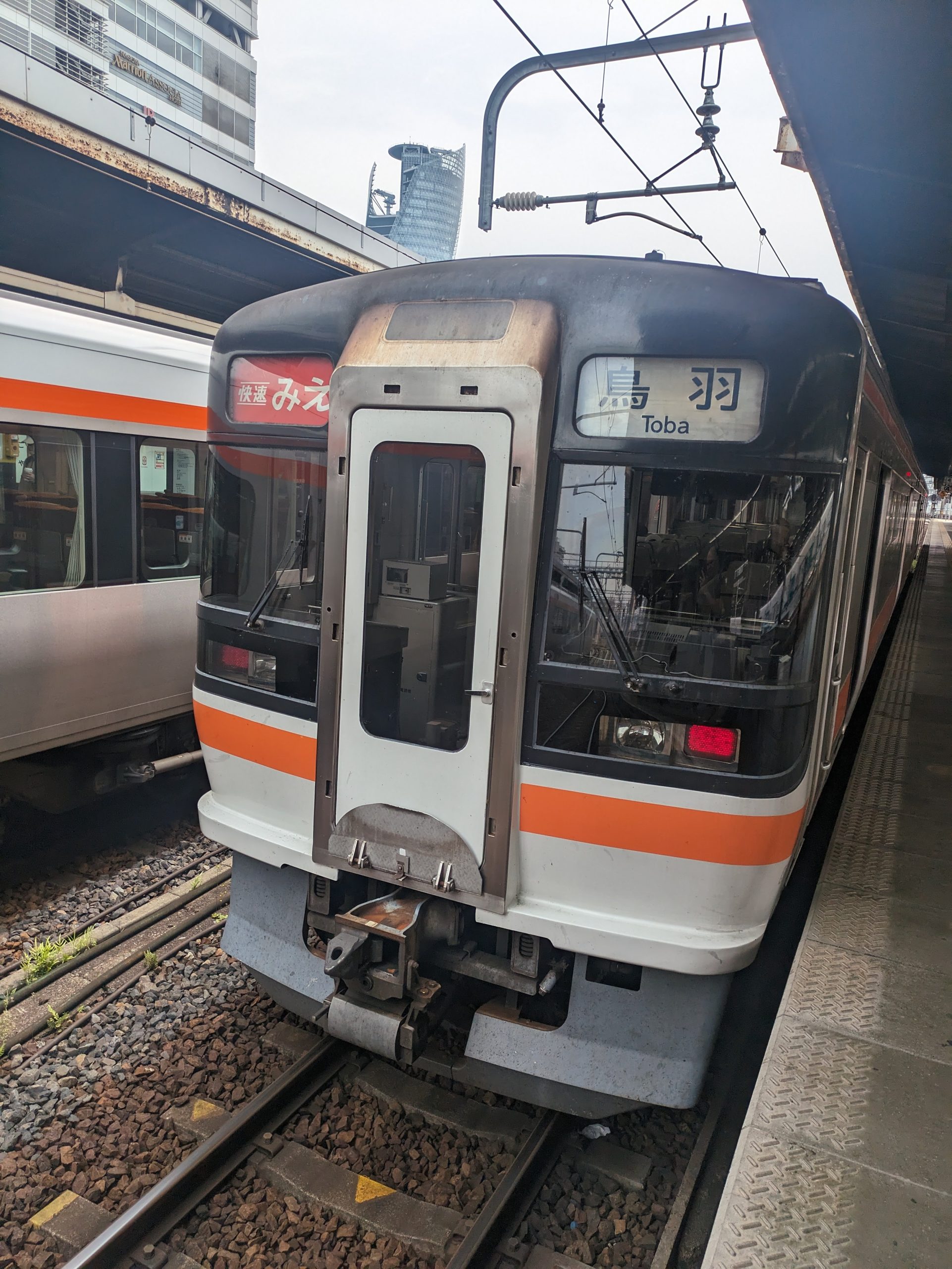
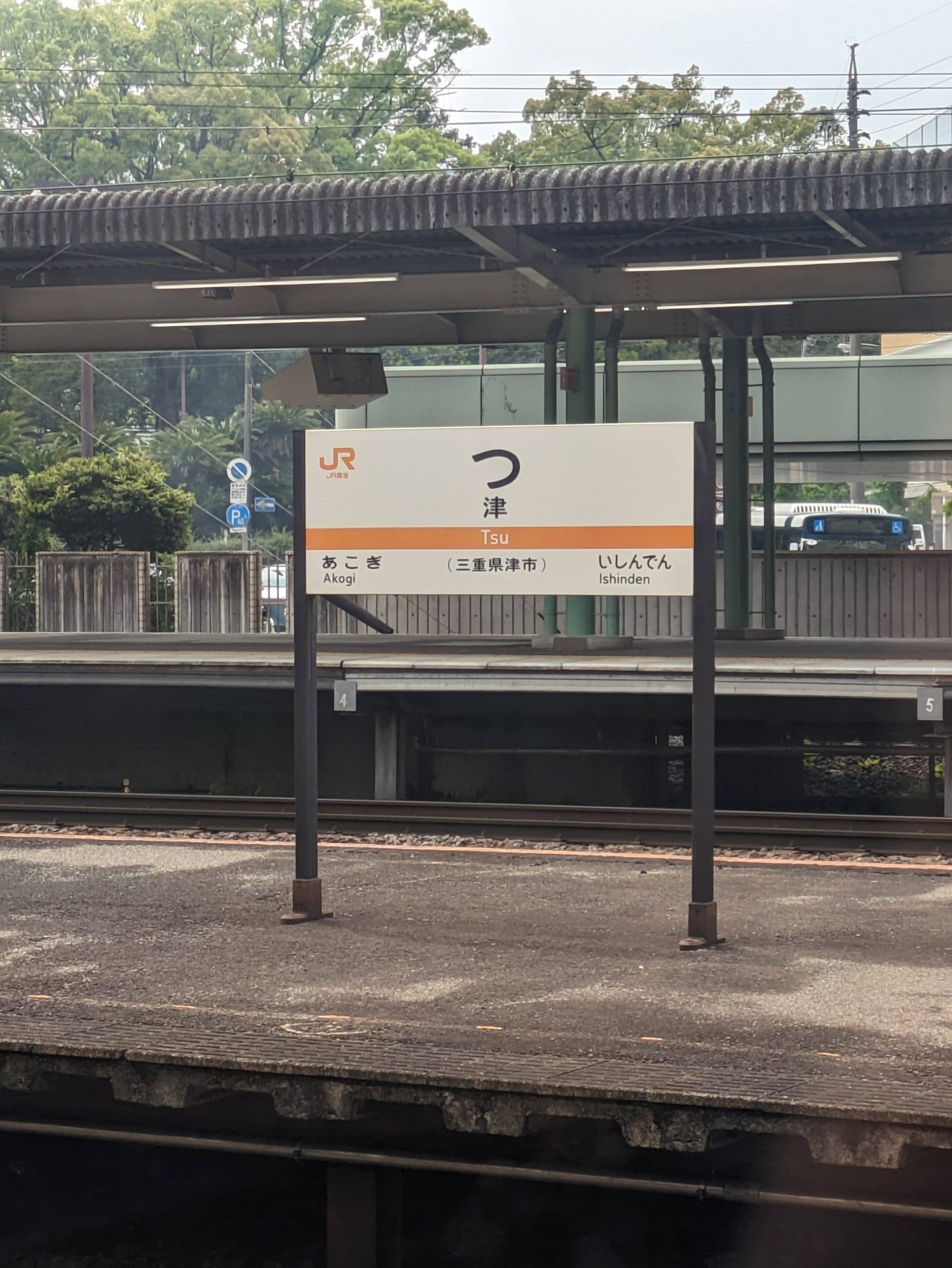
I left Nagoya on the Rapid Mie, a train operated by JR C*ntral that runs on both JR and briefly non-JR lines too, down to its namesake prefecture. (Of course, this means it stops the station with the shortest name in the country: Tsu!)
Going to southern Mie means that train service gets sparse. This is nothing compared to rural Shikoku, though!
All the “rules” you hear about Japan only apply to cities. In the countryside, on little used-trains, it’s quite a bit more chill.
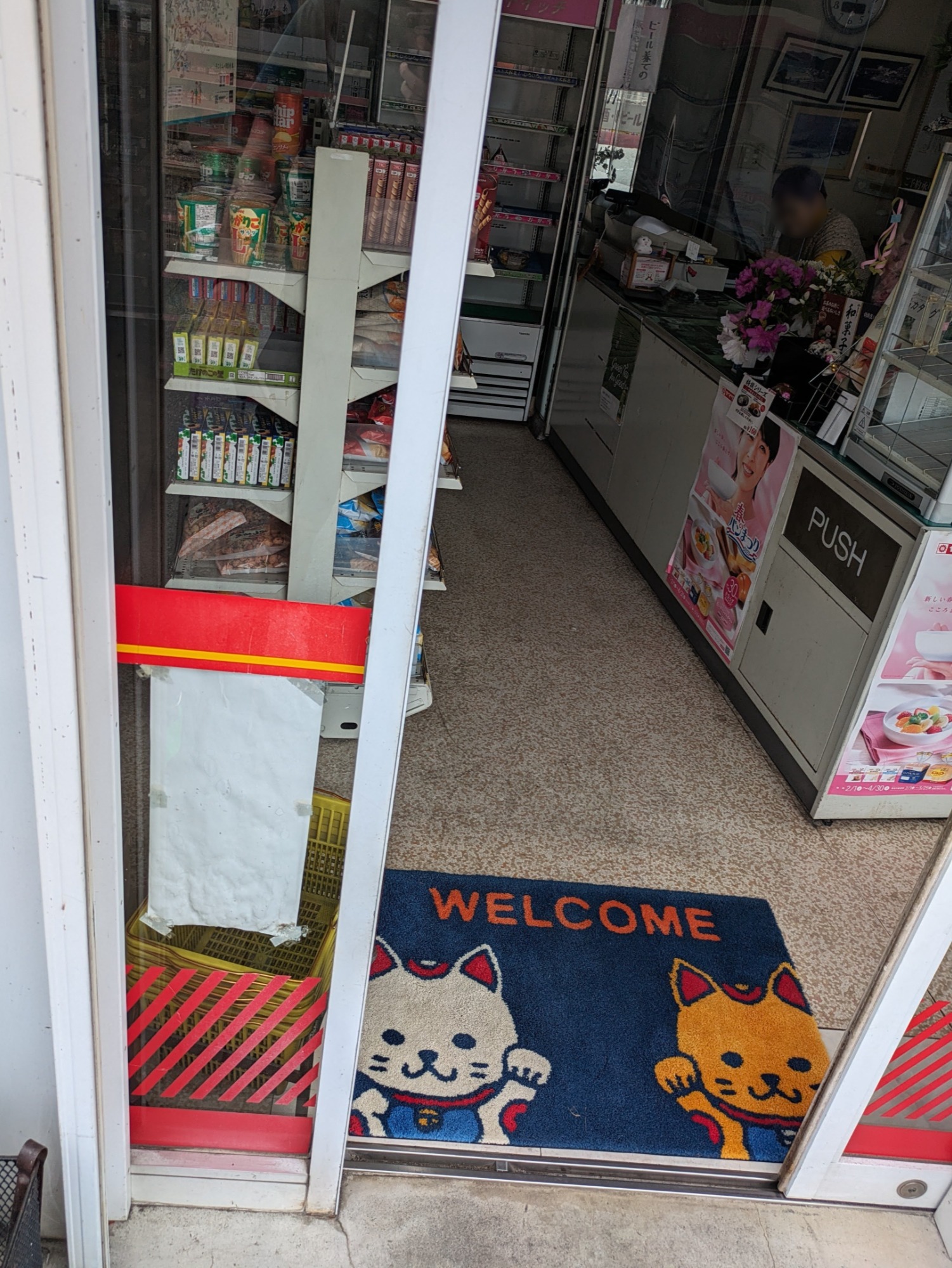
I stopped in this small, independent convenience store/food mart to grab some light lunch. Kimbap (they called it サラダ巻 or a “salad roll”, but I think it was more like kimbap) and some finger sandwiches – nothing fancy, but a decent enough snack.
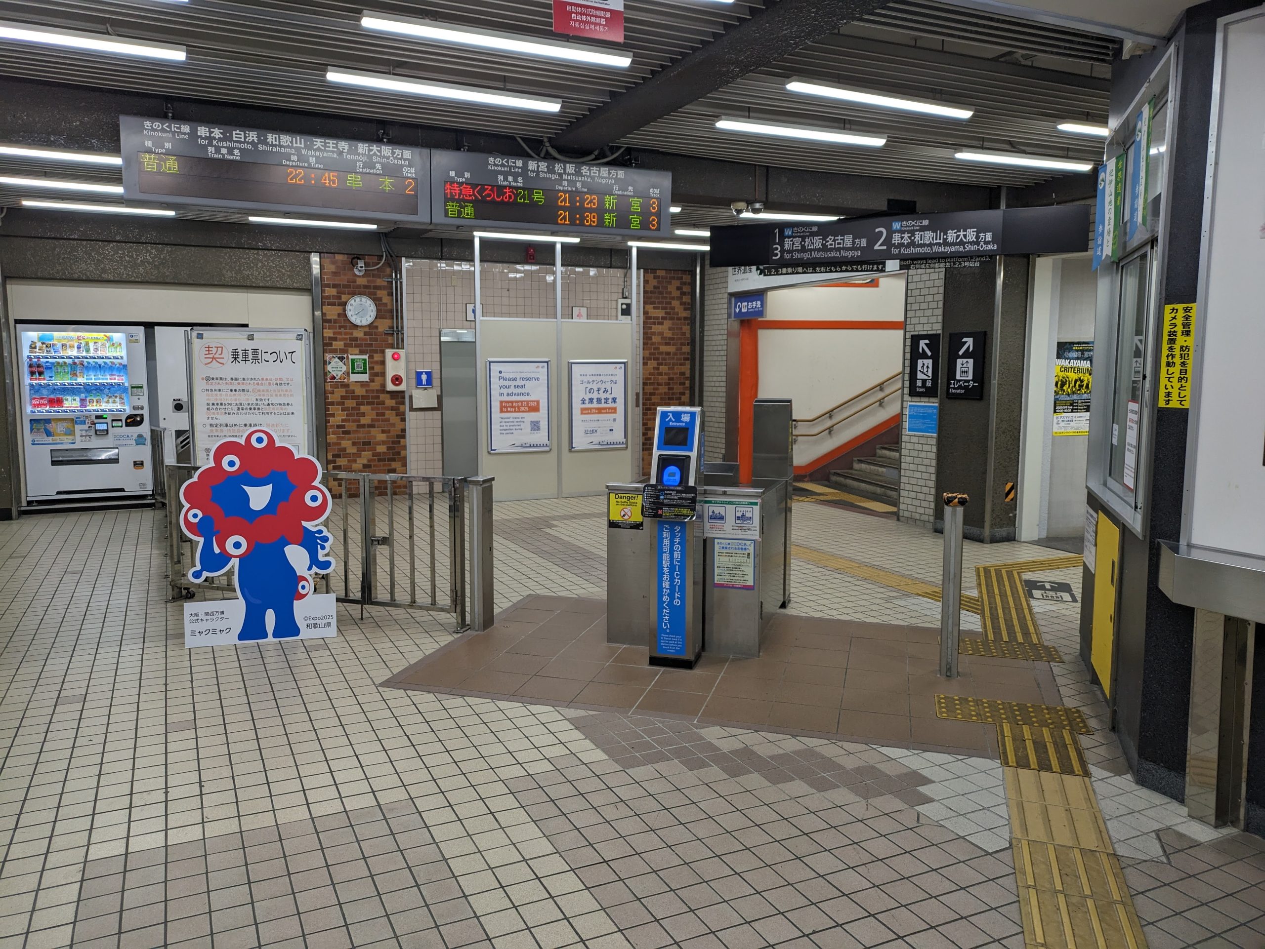
Below is the ticket I was using to get from Nagoya down to Wakayama, circumscribing the coast of the Kii Peninsula via the Kisei Main Line. JR West (they love these “official nicknames”) calls their section of the line the きのくに線 Kinokuni Line, referencing the former Kii Province, or “Kii no Kuni”, that comprised the area covered by the modern day prefectures of Wakayama and southern Mie. And yes, this is what the bookstore chain Kinokuniya is named after! In fact, this is not the only “international store ending with -ya that happens to be named after a place I’m visiting” on this trip, but more on that in the next post. :)
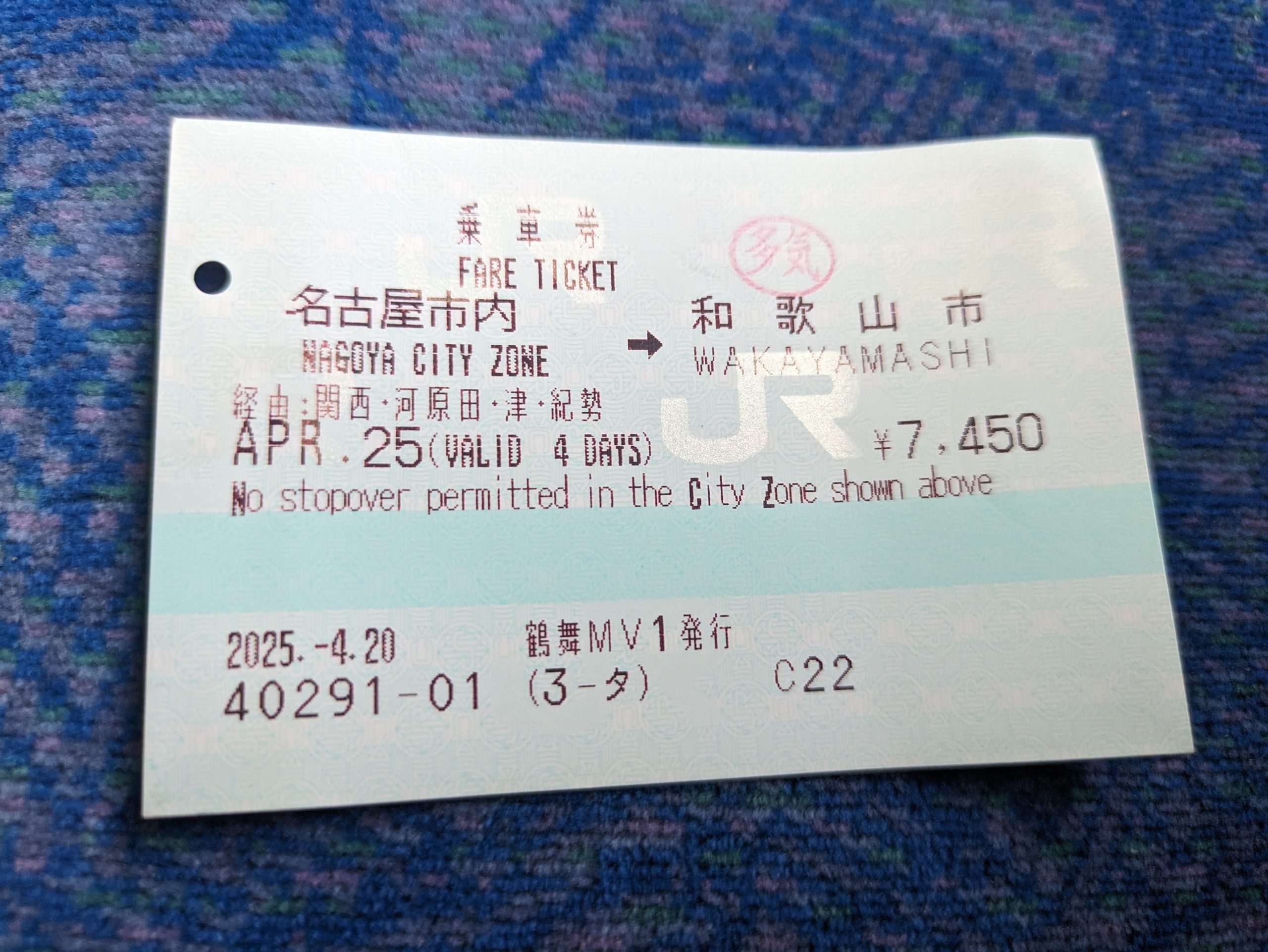
They turned on English printing on my ticket for some reason. I don’t mind either way and generally just let the employee toggle it if they so choose.
Walked around this quiet field at Taki Station while waiting for my next train. You can see the red 多気 Taki stopover stamp on my ticket in the left image, too.
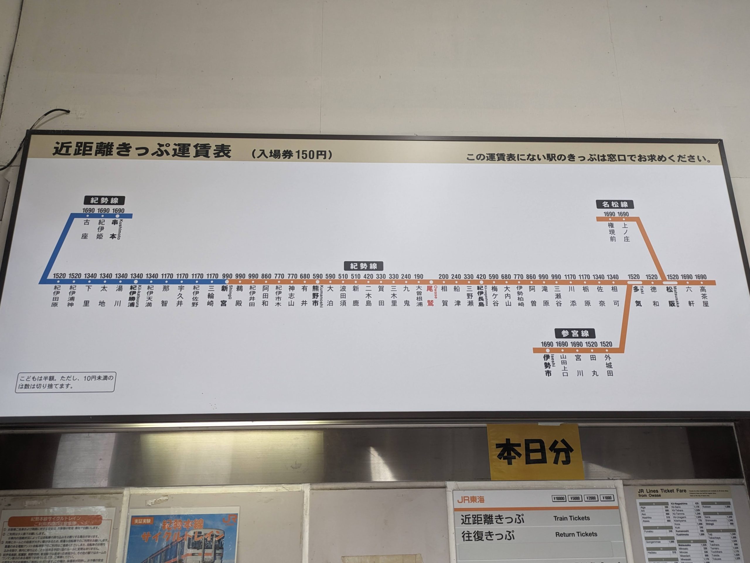
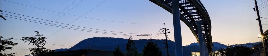
Since the Kisei Main Line is single-tracked in this section, we had about a 25 minute wait here at Owase until a train coming from the opposite direction passed us. Here’s the route diagram and fare board; I’m going right-to-left on the simple, horizontal line.
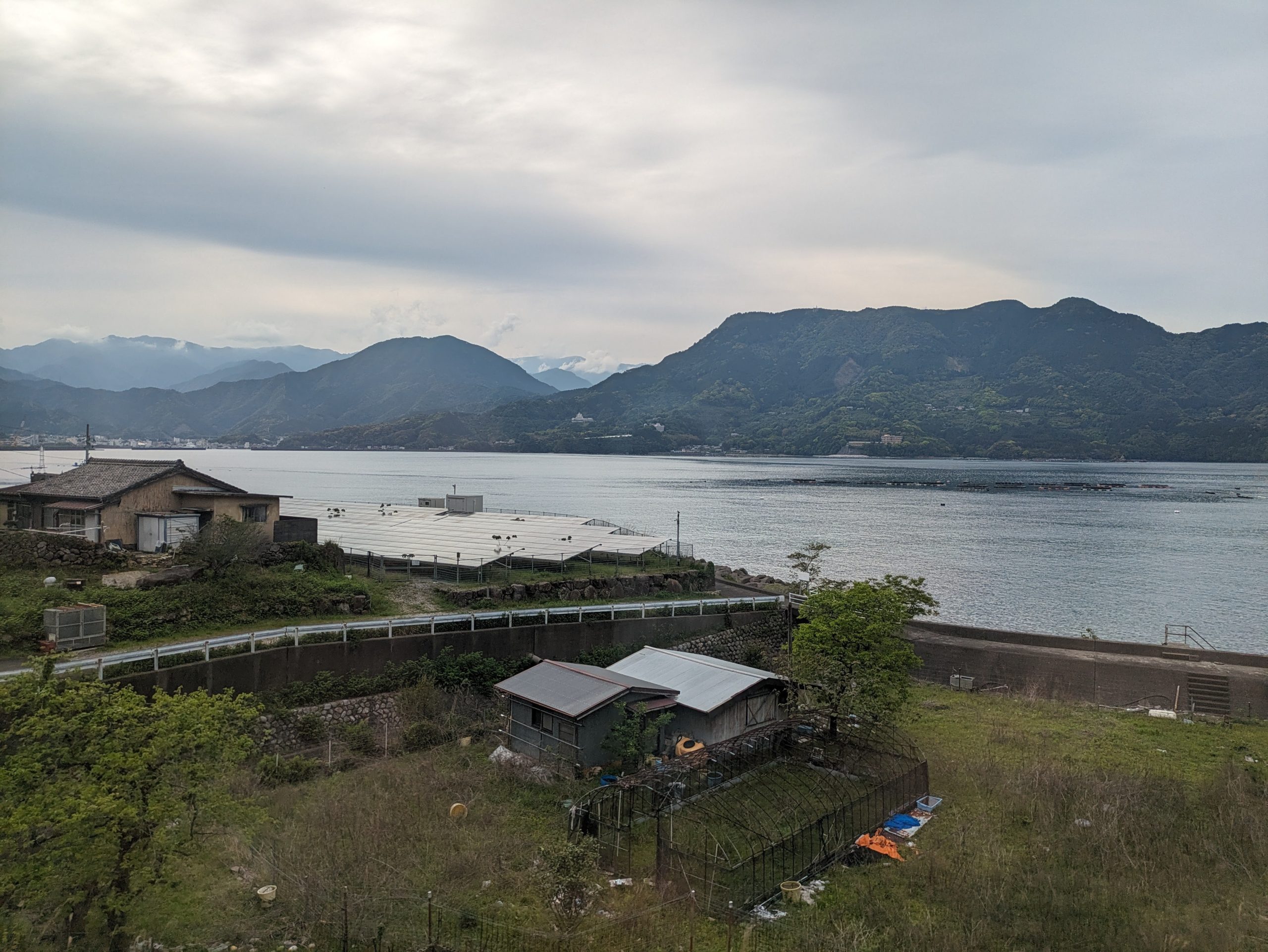
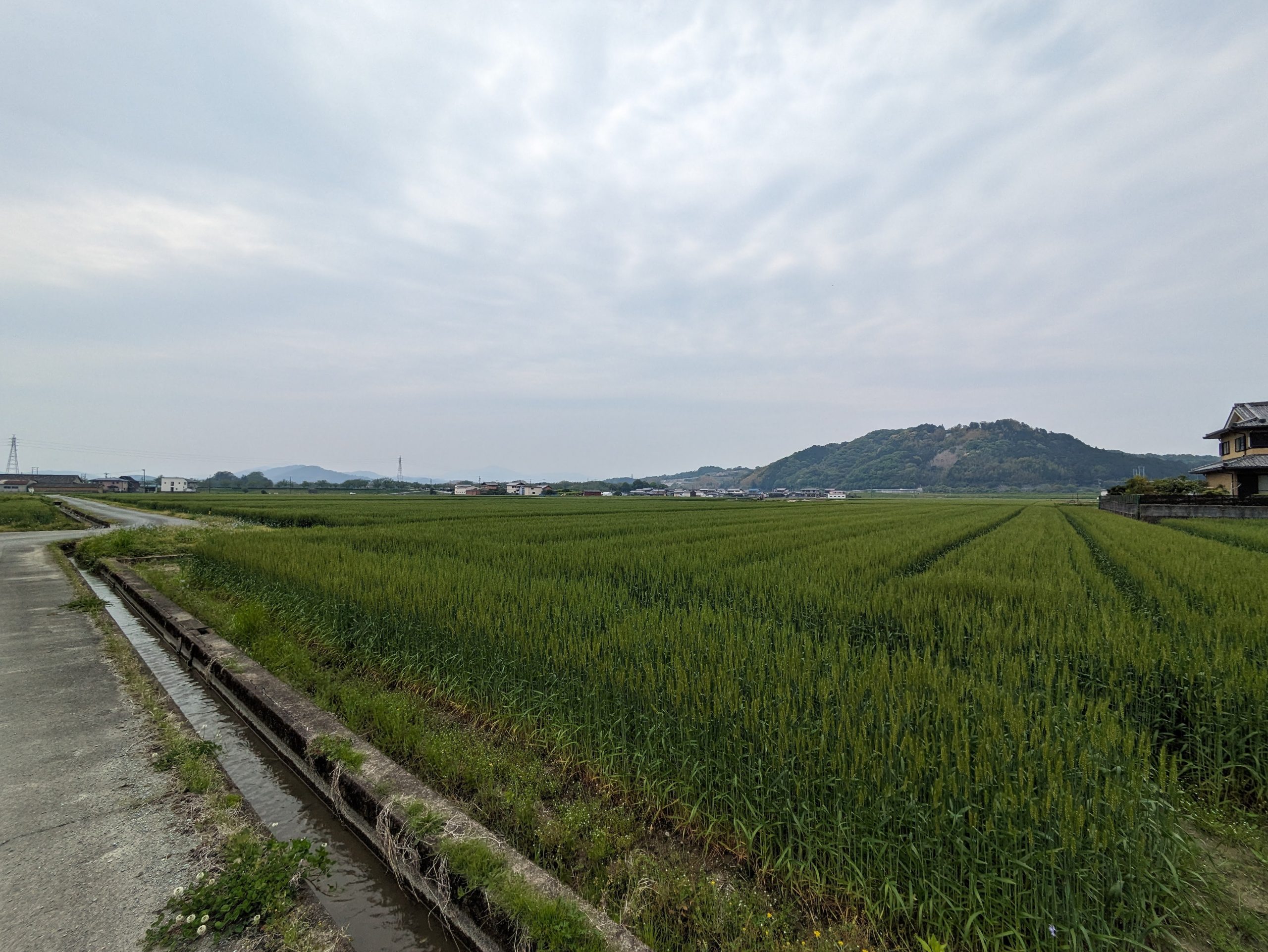
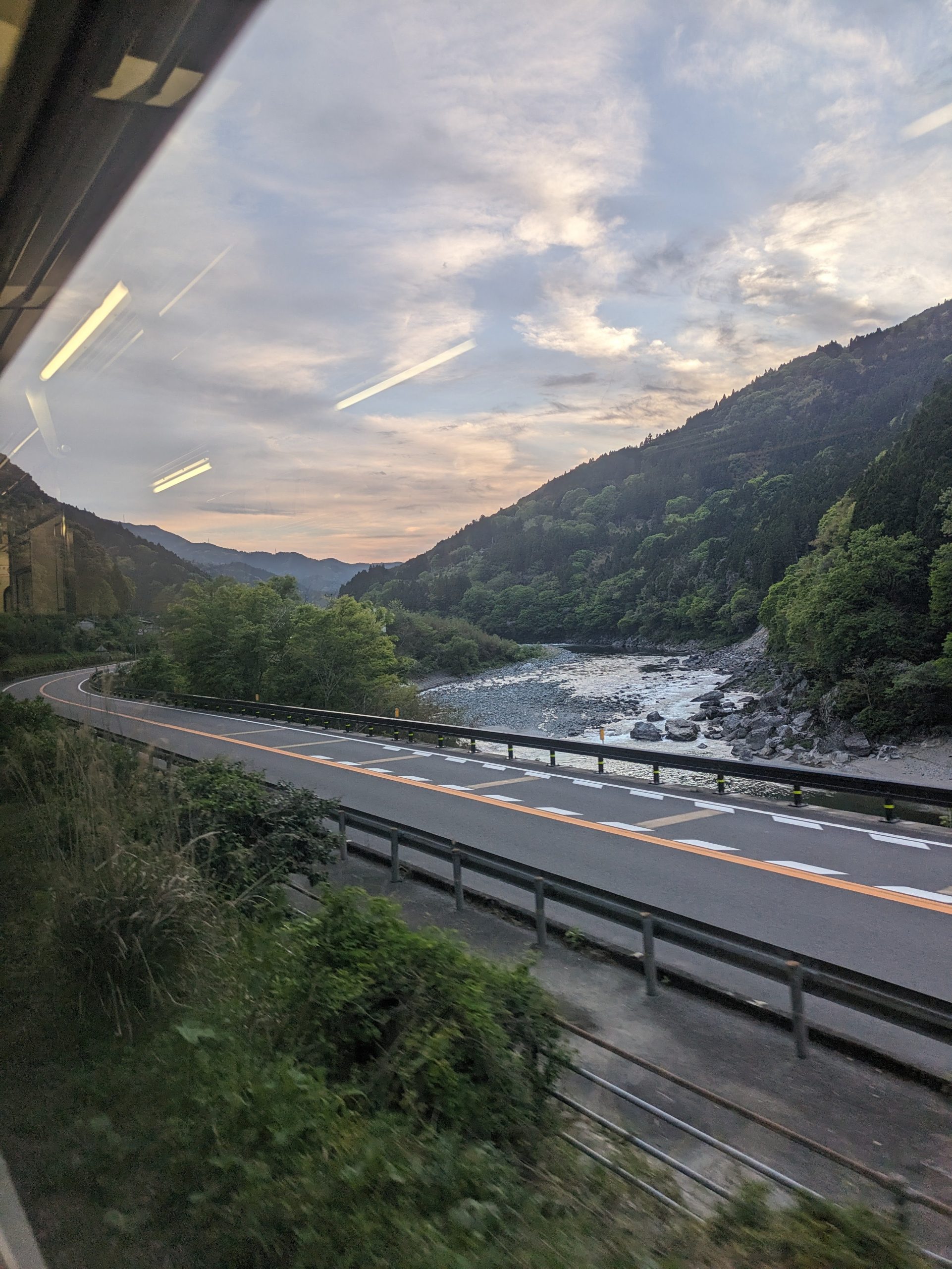
The section following this is where the line really starts to hug the coast, and it was pretty!
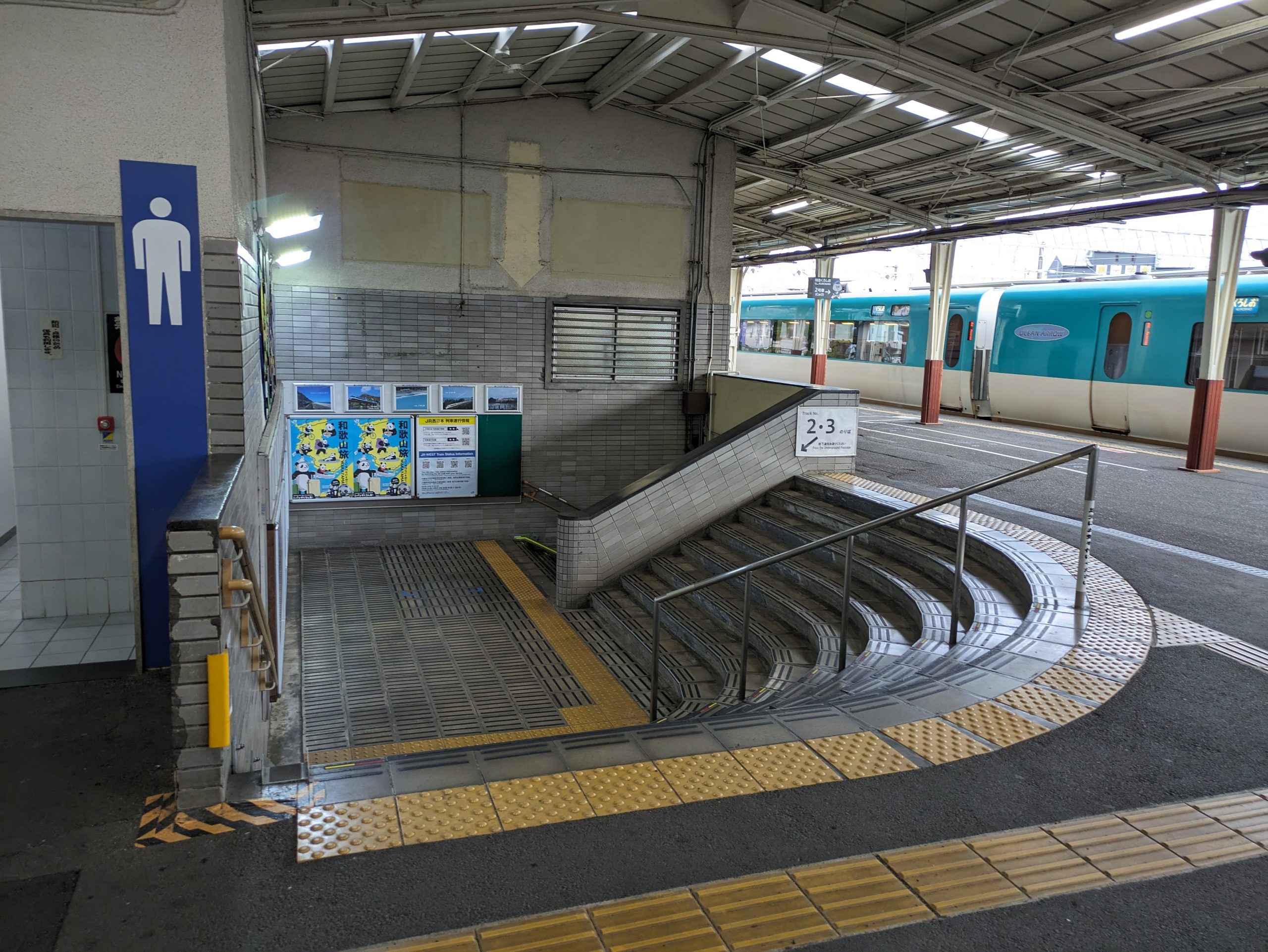
Shingū Station is the border station between JR Central and JR West. It also had this weird, small, curved staircase – haven’t seen much of this type of architecture or this sort of layout in stations, I feel?
A mysterious crow also adorned the walls of the station. He’ll be showing up more and more in this area. This art is by a local woodblock printmaker named Kyoko Bandome (also spelled “Kyoko Vendome”).
My next and final train for the day only took me four stations, from Shingū to Nachi, where I was staying for the night. It was my first overnight in Wakayama Prefecture (just barely, though, right across the 県境… you do remember that word which seems to come up in all my posts, right?!)
If you look closely, you can see the bicycle icon in the destination sign, since you can bring bikes on these trains!
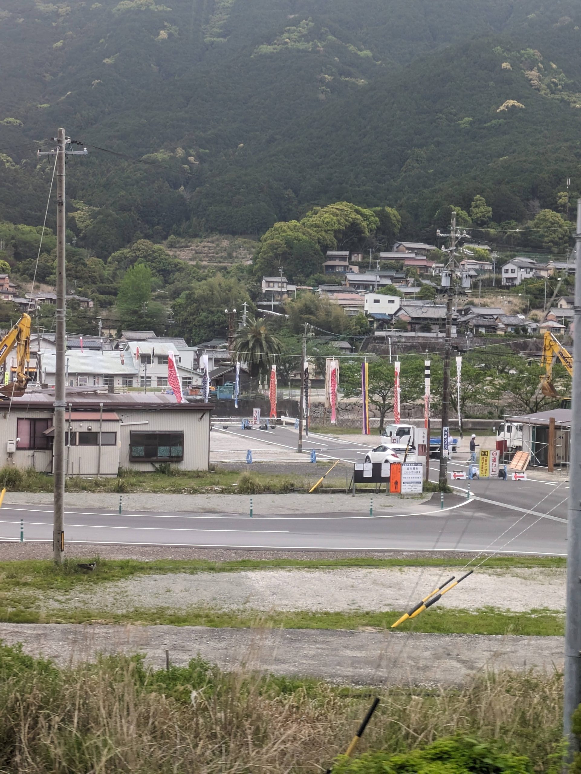
Koinobori hung in preparation for Children’s Day, an upcoming public holiday in May. Not the prettiest over a a drab concrete street with no wind blowing, but just wait until later on the trip!
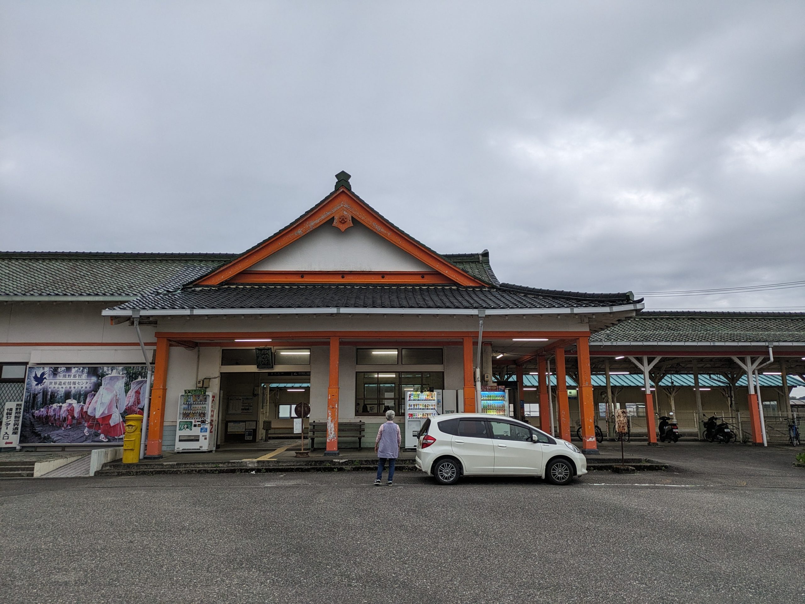
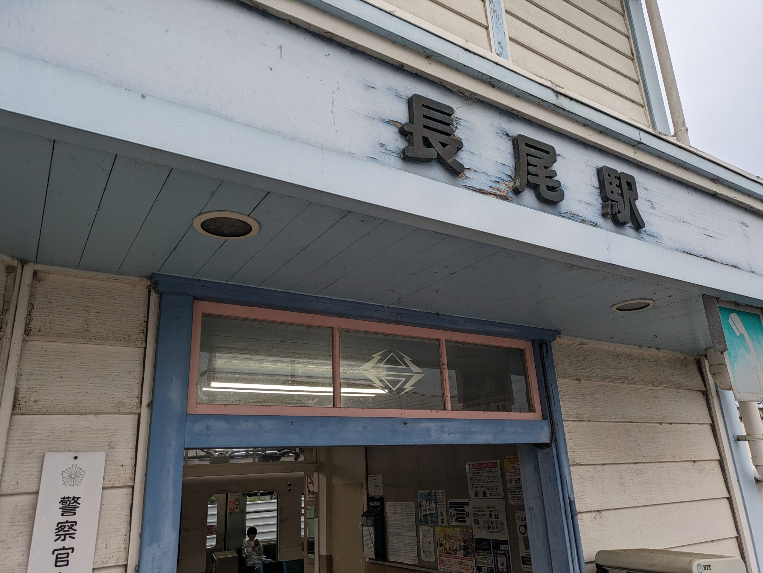
Nachi Station! The station building is modeled after the Kumano Nachi Taisha shrine, a UNESCO World Heritage site that’s not far from here, and which I’ll visit tomorrow morning.
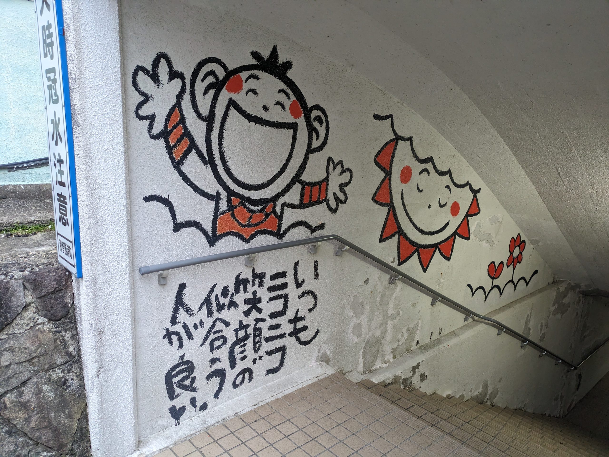
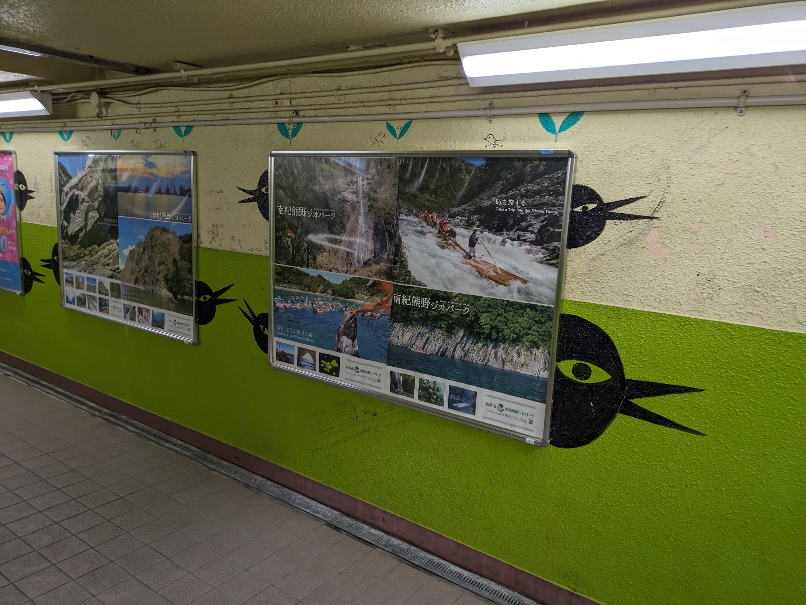
There was some very exuberantly happy art decorating the walls of the underpass that connects this station to…
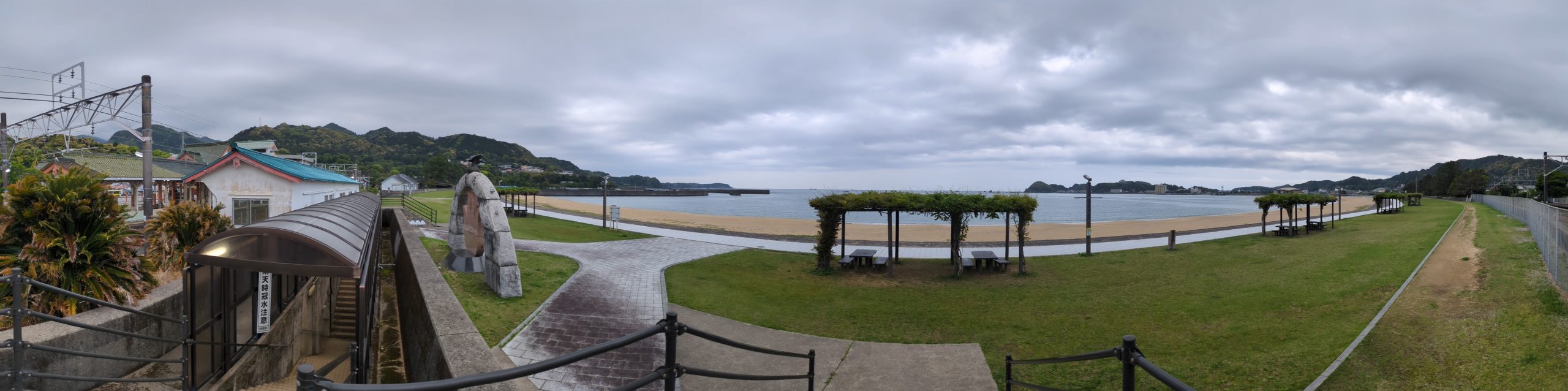
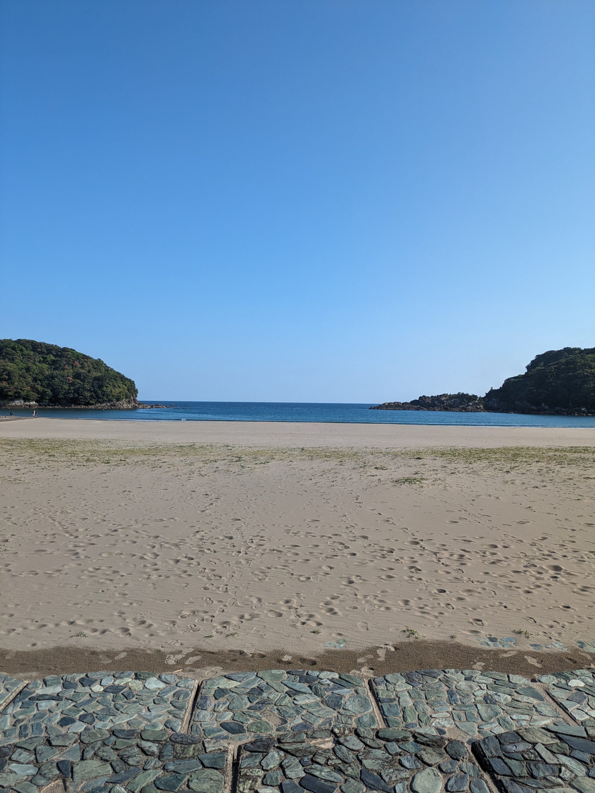
…the beach! On the other side of the tracks is this wonderful view.
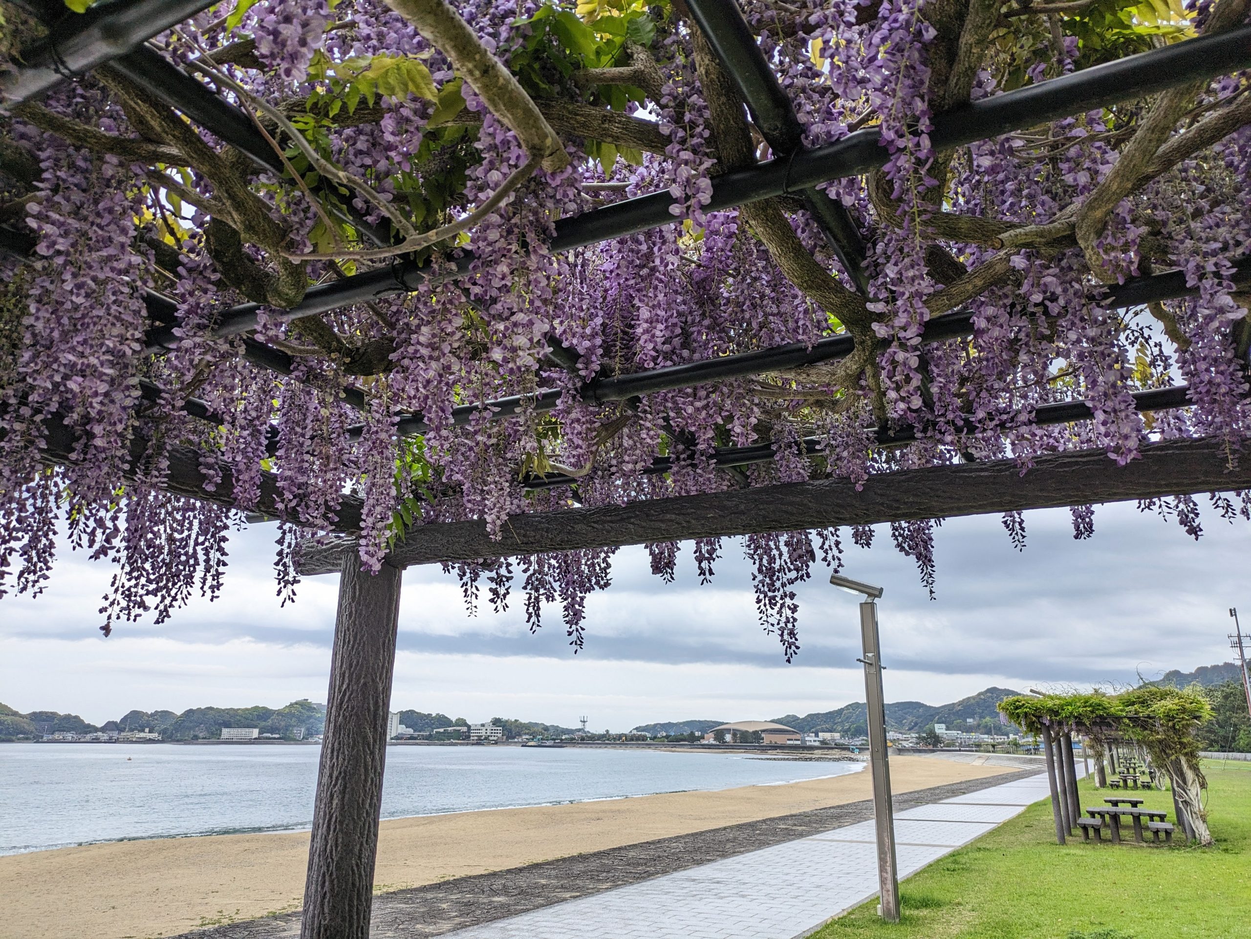
Ttrellises with beautiful, vibrant, purple wisteria and benches to relax underneath lined the beachfront walkway. April and May are the best times for wisteria in Japan.
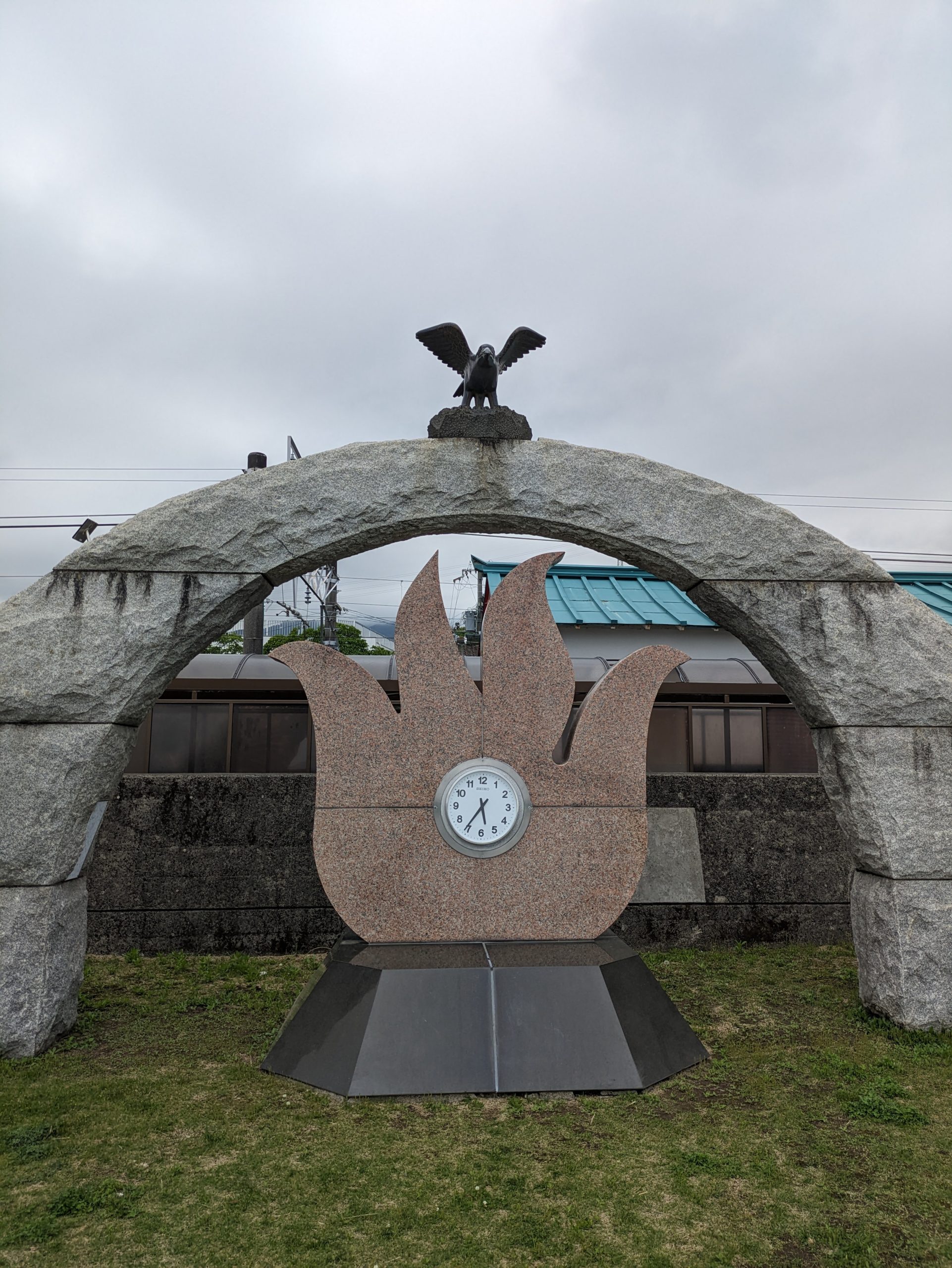
Here’s that crow again! Now look how many legs he has. Yes, this is Yatagarasu, the three-legged crow-god who is said to have aided the legendary Emperor Jimmu on his journey. What journey, you ask? Well, the one beginning from the Kumano region of the Kii Peninsula, of course – right where I am!
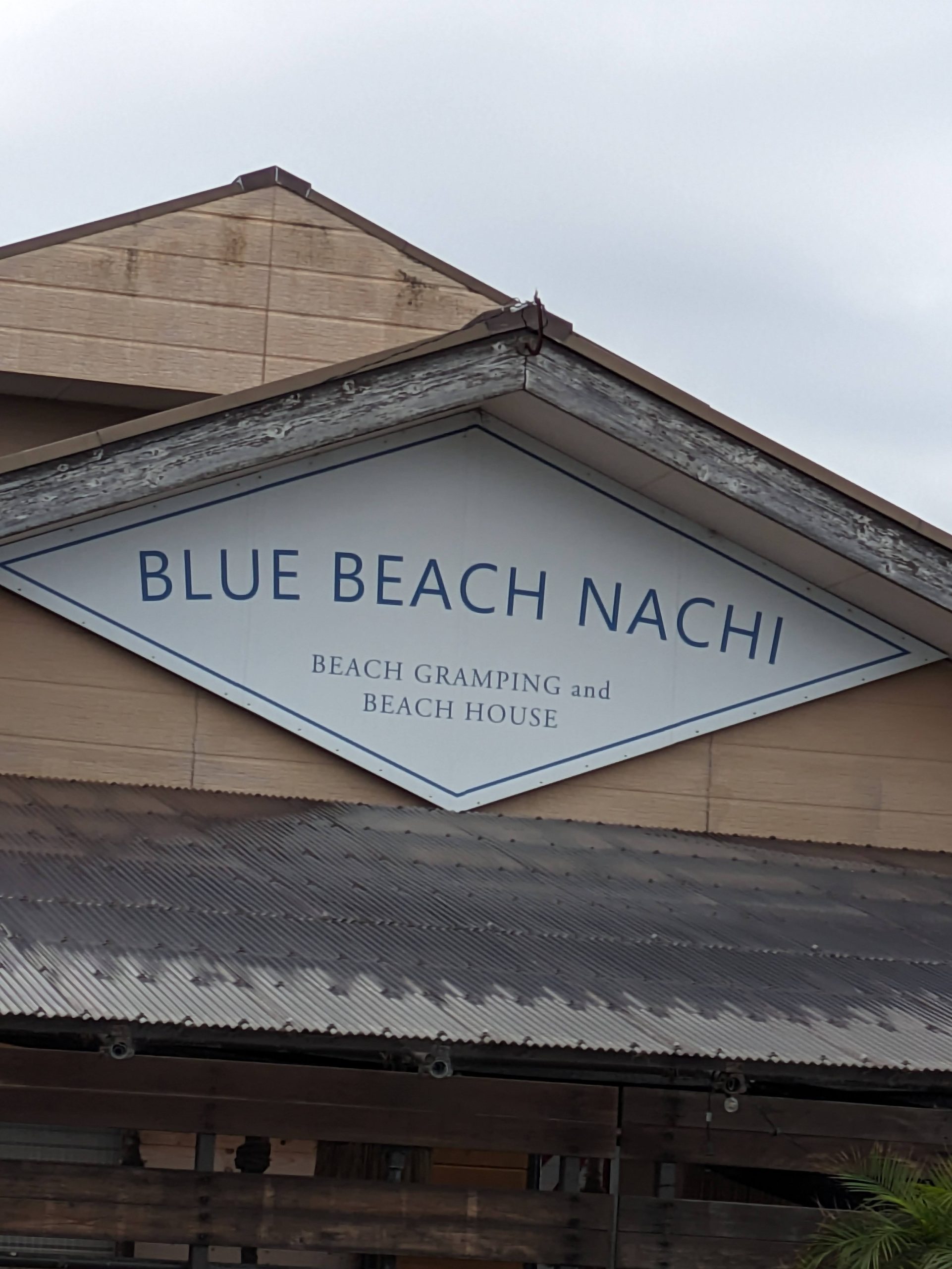
BEACH GRAMPING. I bet the Nagoya Grampus soccer team mascot comes here on the weekends.
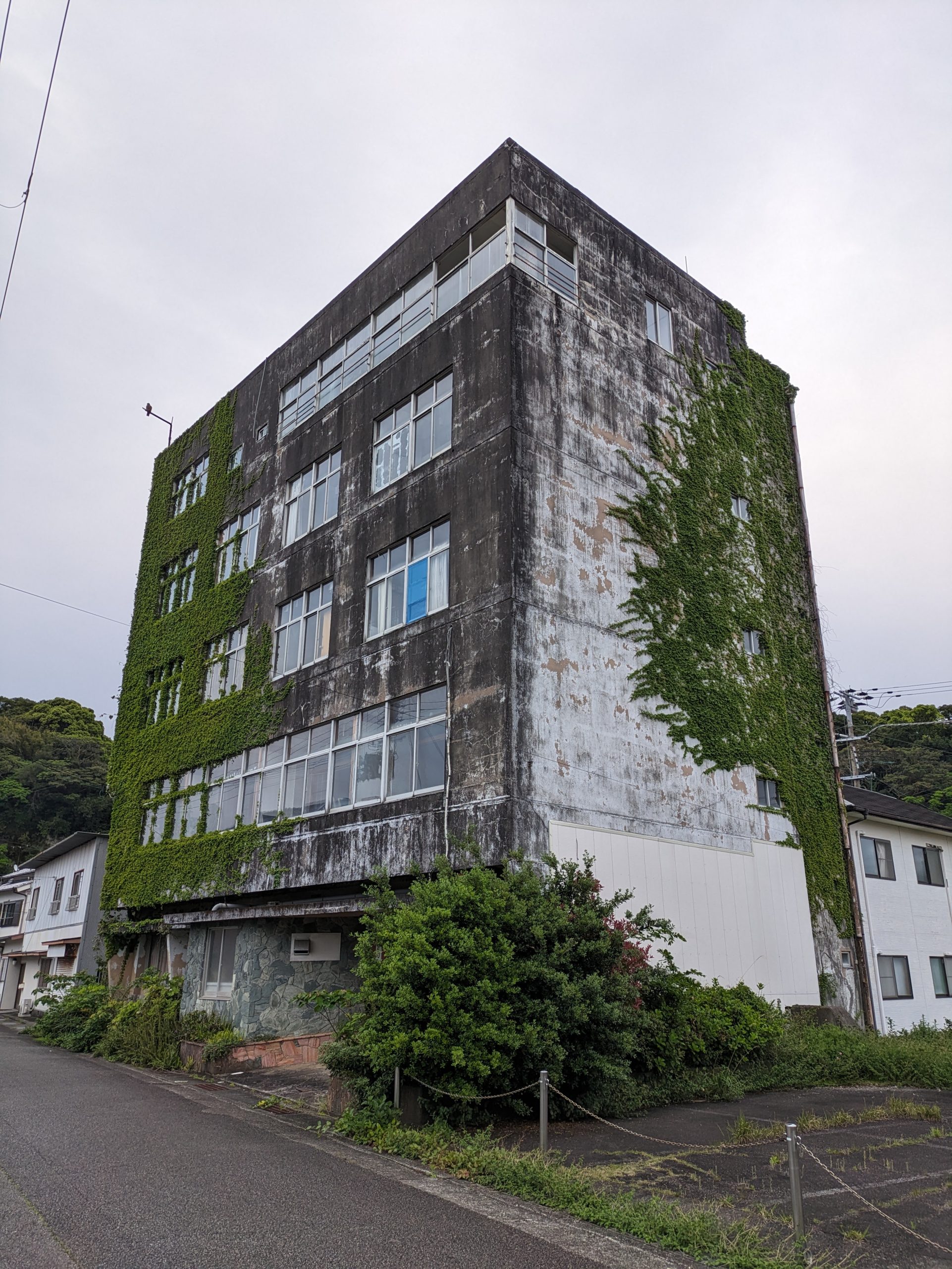
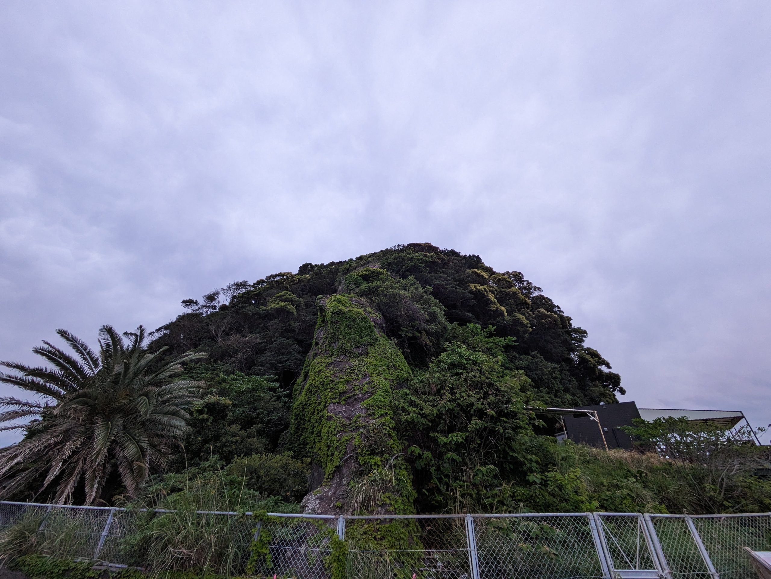
Some nice green ivy (or is it kudzu? I’m no botanist) on the side of this gray, weathered block of concrete. :D
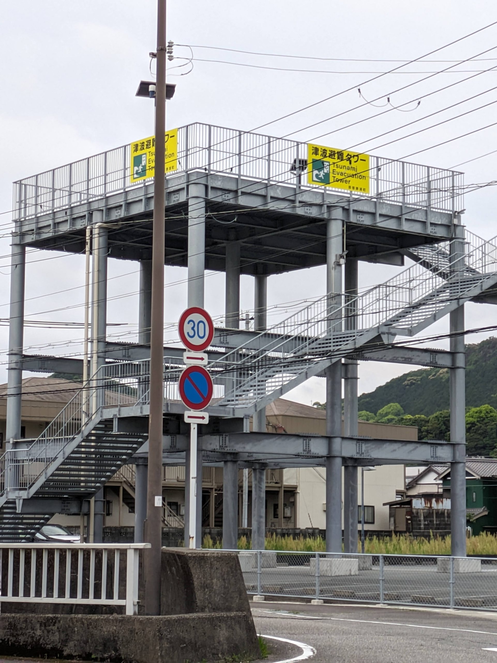
I was staying across from this structure. I guess I’d be safe in the event of a tsunami?
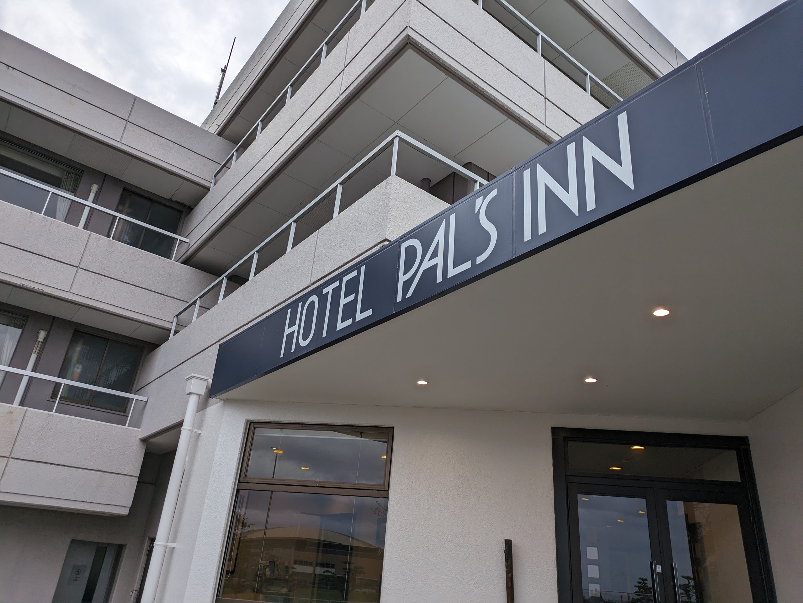
It’s me. I’m the pal. It’s my inn.
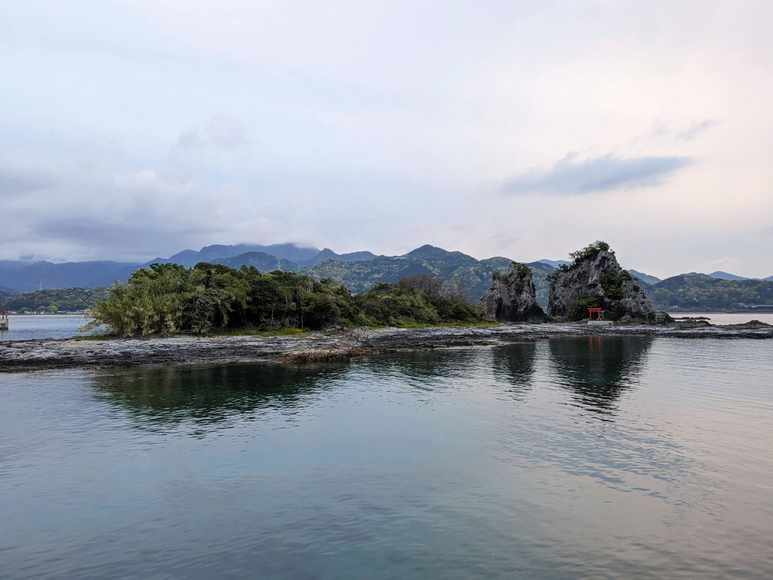
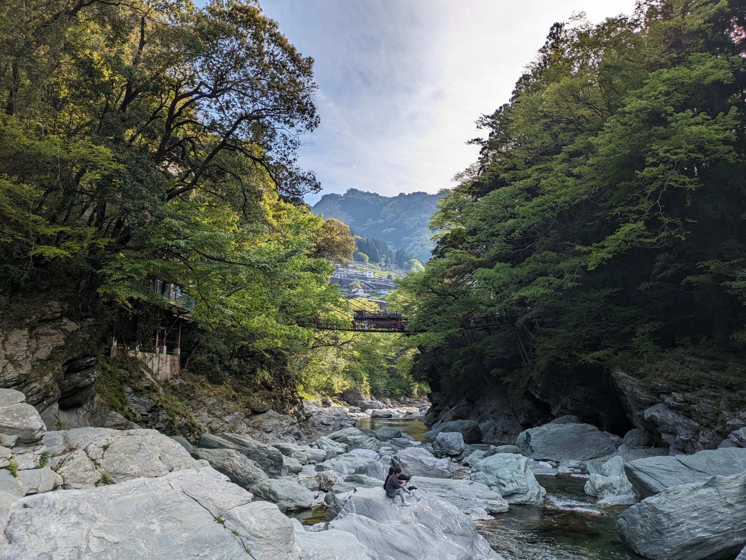
I walked down toward the main part of Nachikatsuura and along the craggy Ojaura Coast where there was this islet with a small shrine and torii on it.
The path along the coast came flush up against a lot of towering greenery!
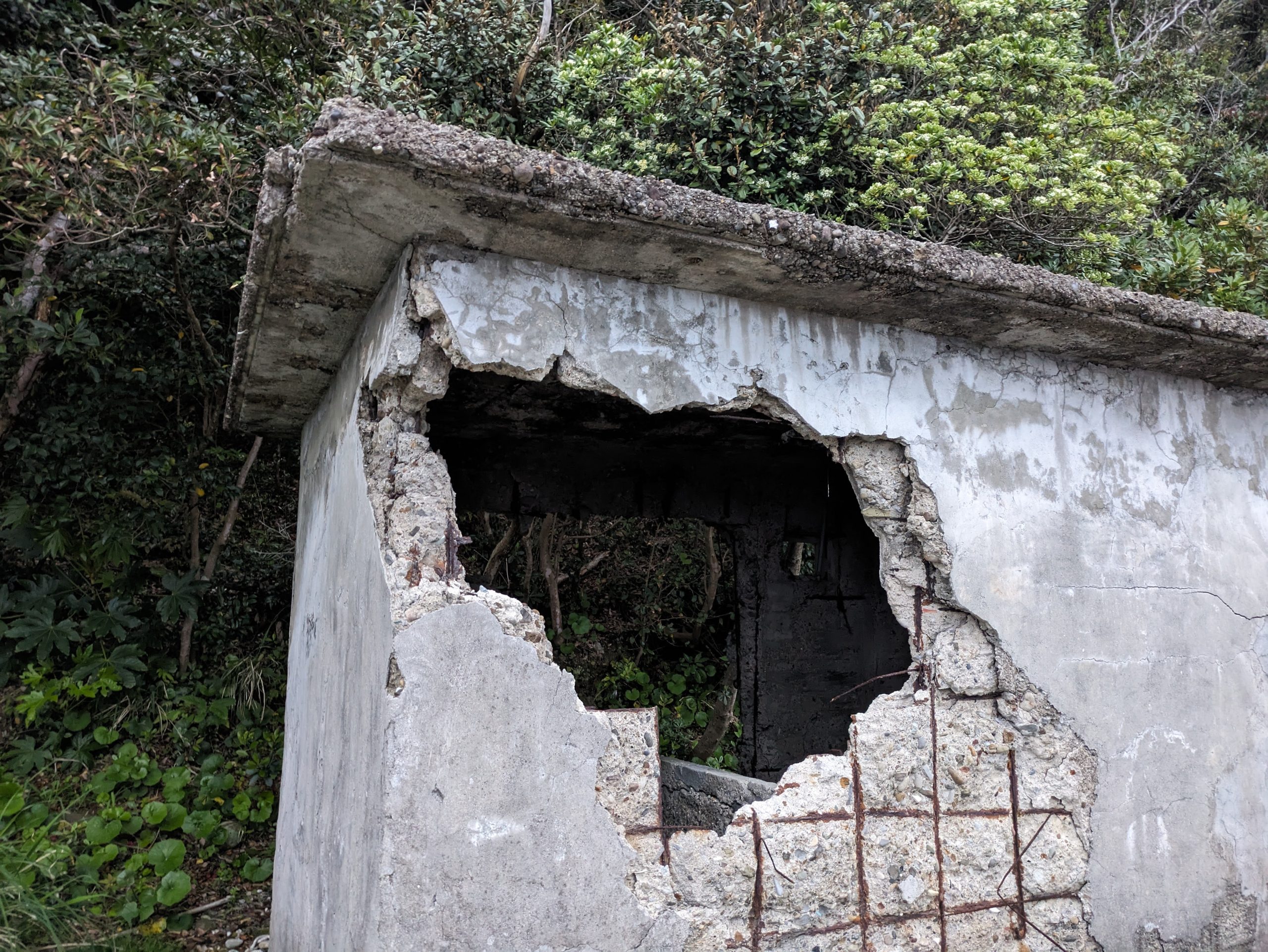
The whole route was dotted with many decaying, abandoned structures. I do wonder what these buildings were used for…
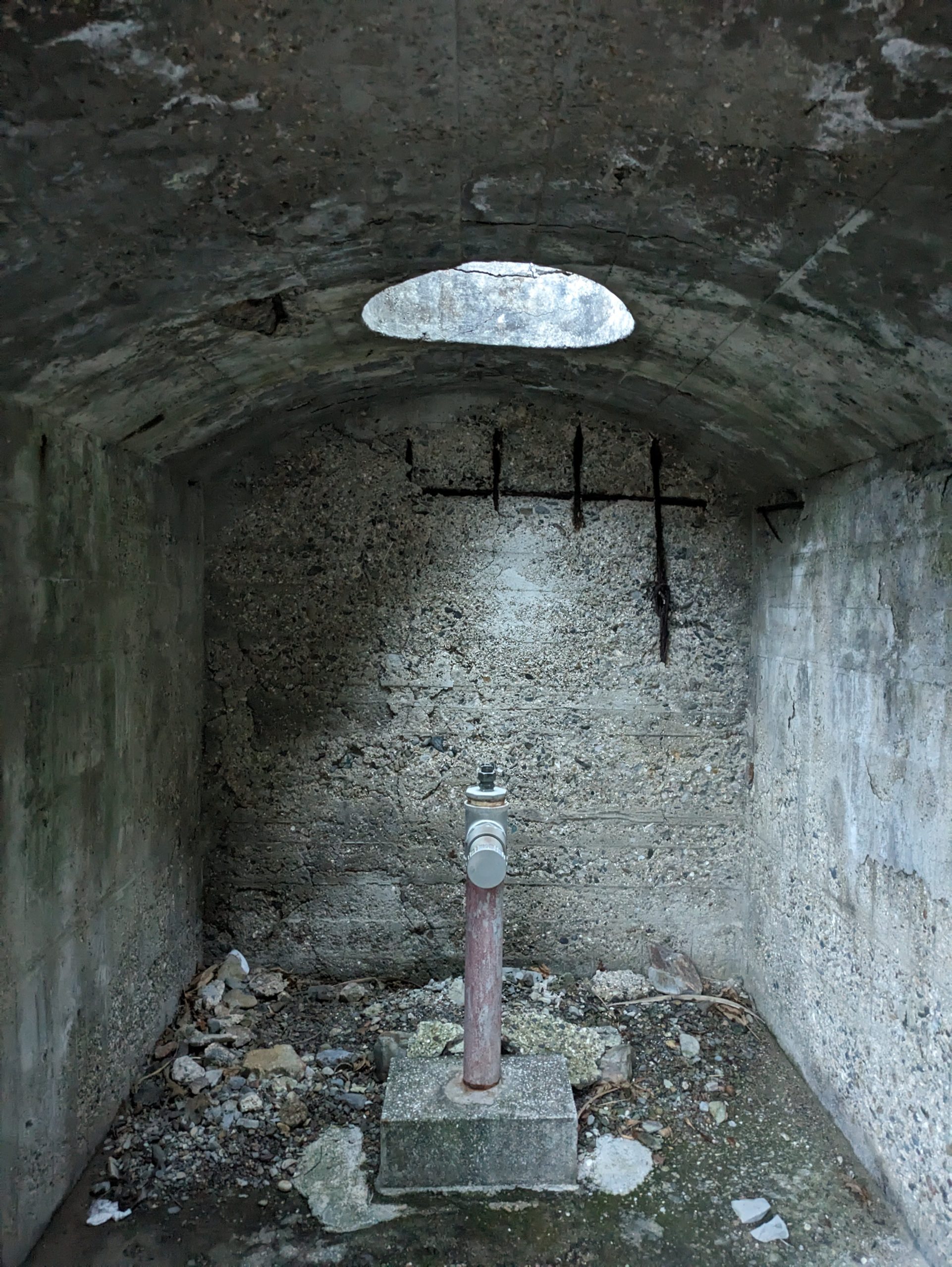
Some type of water pipe? Yet another structure I didn’t know the use for, or really what I was looking at…
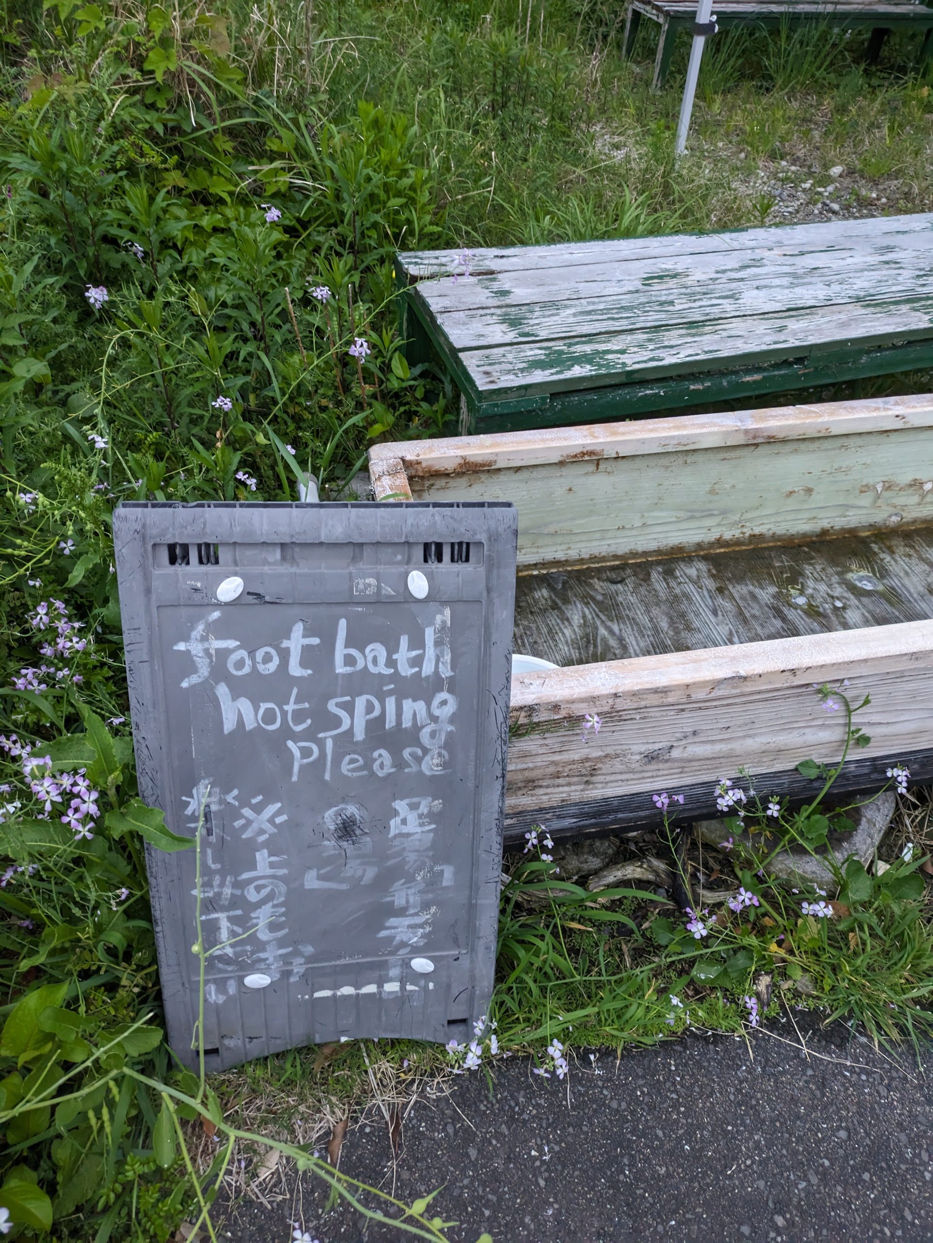
But this one was pretty clear: an out-of-commission 足湯 ashiyu, or foot bath.
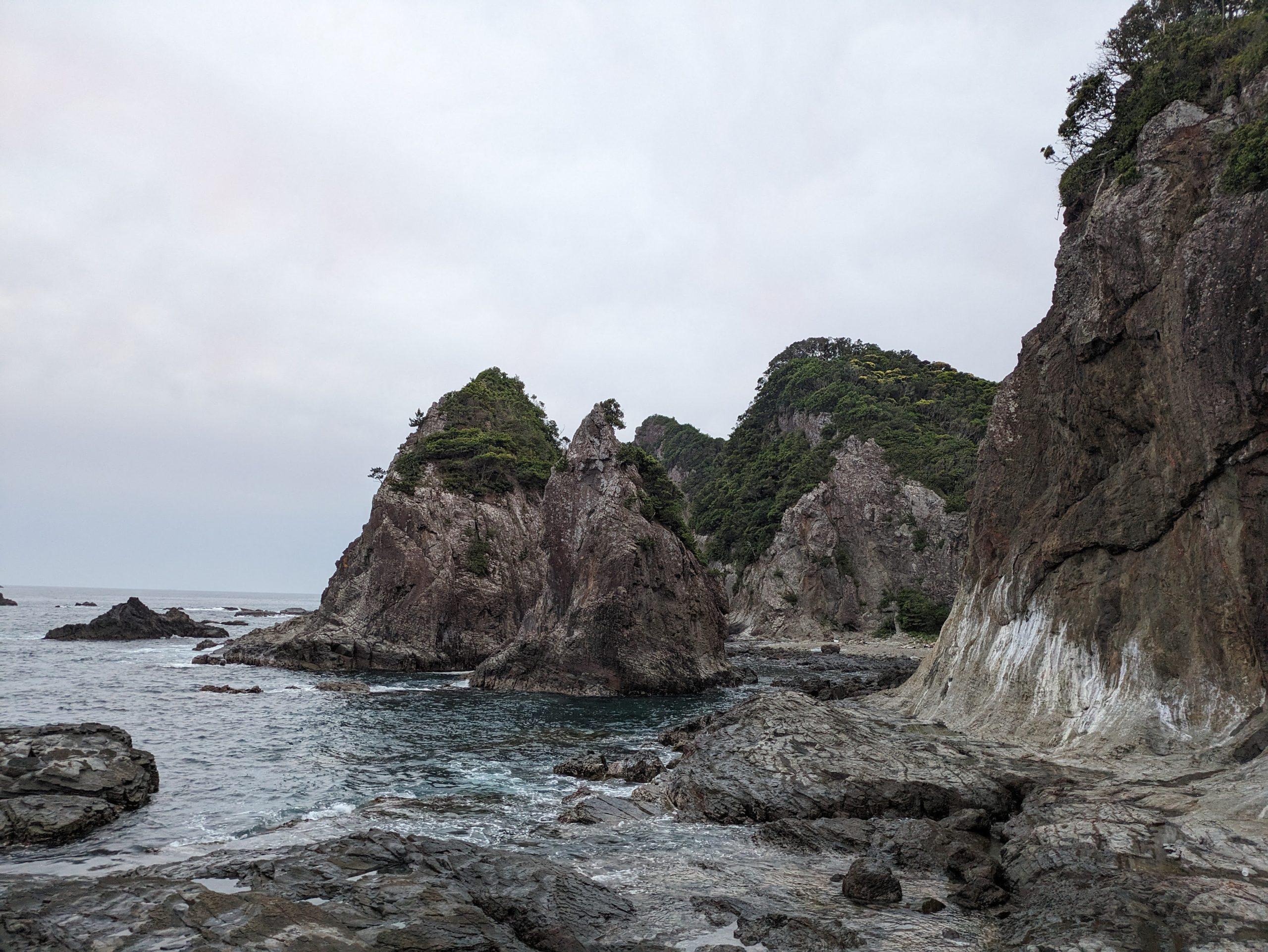
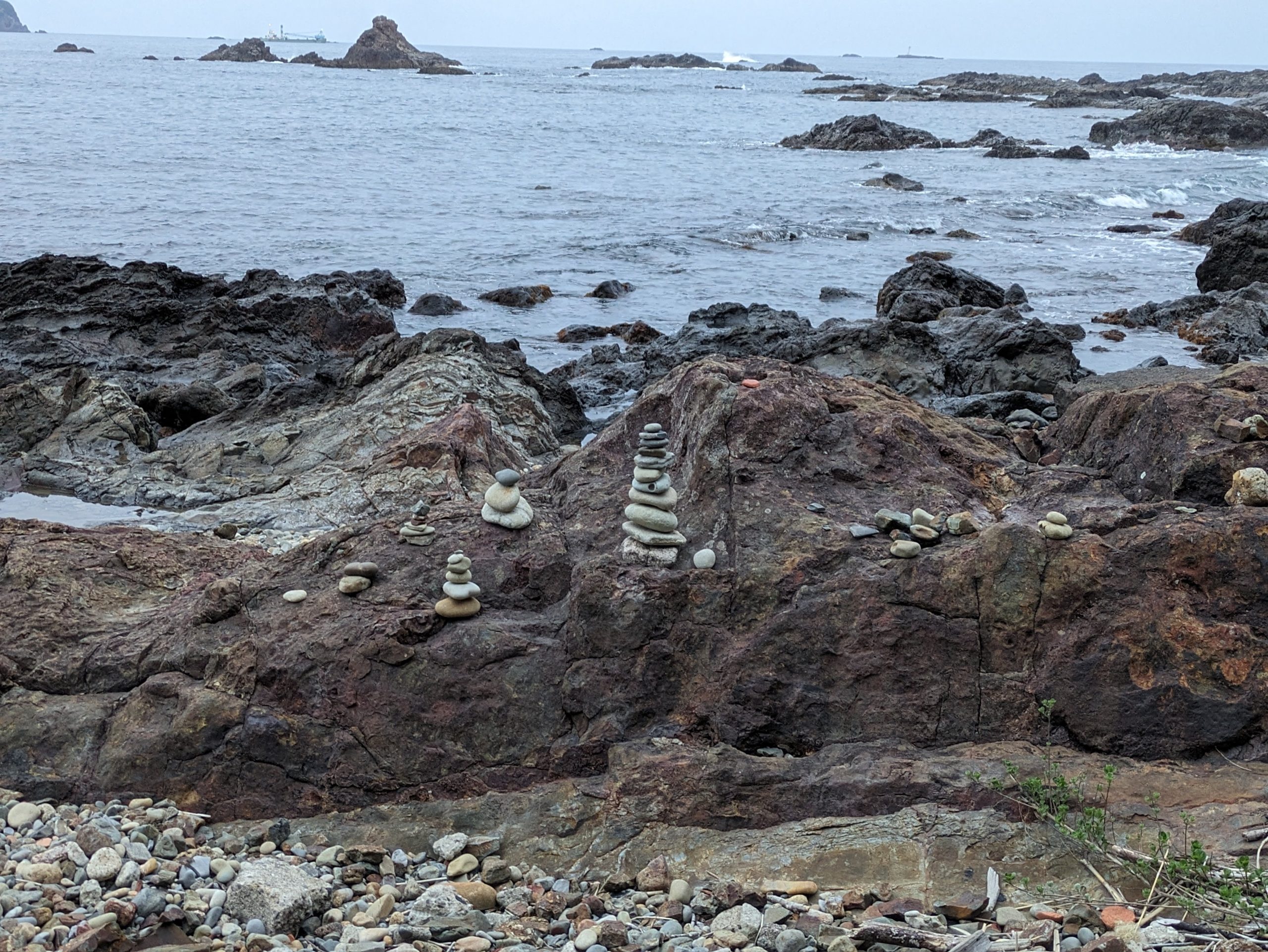
The rock formations got even more dramatic near the end of the path. I was the only person around, but someone had previously built some cairns, I noticed.
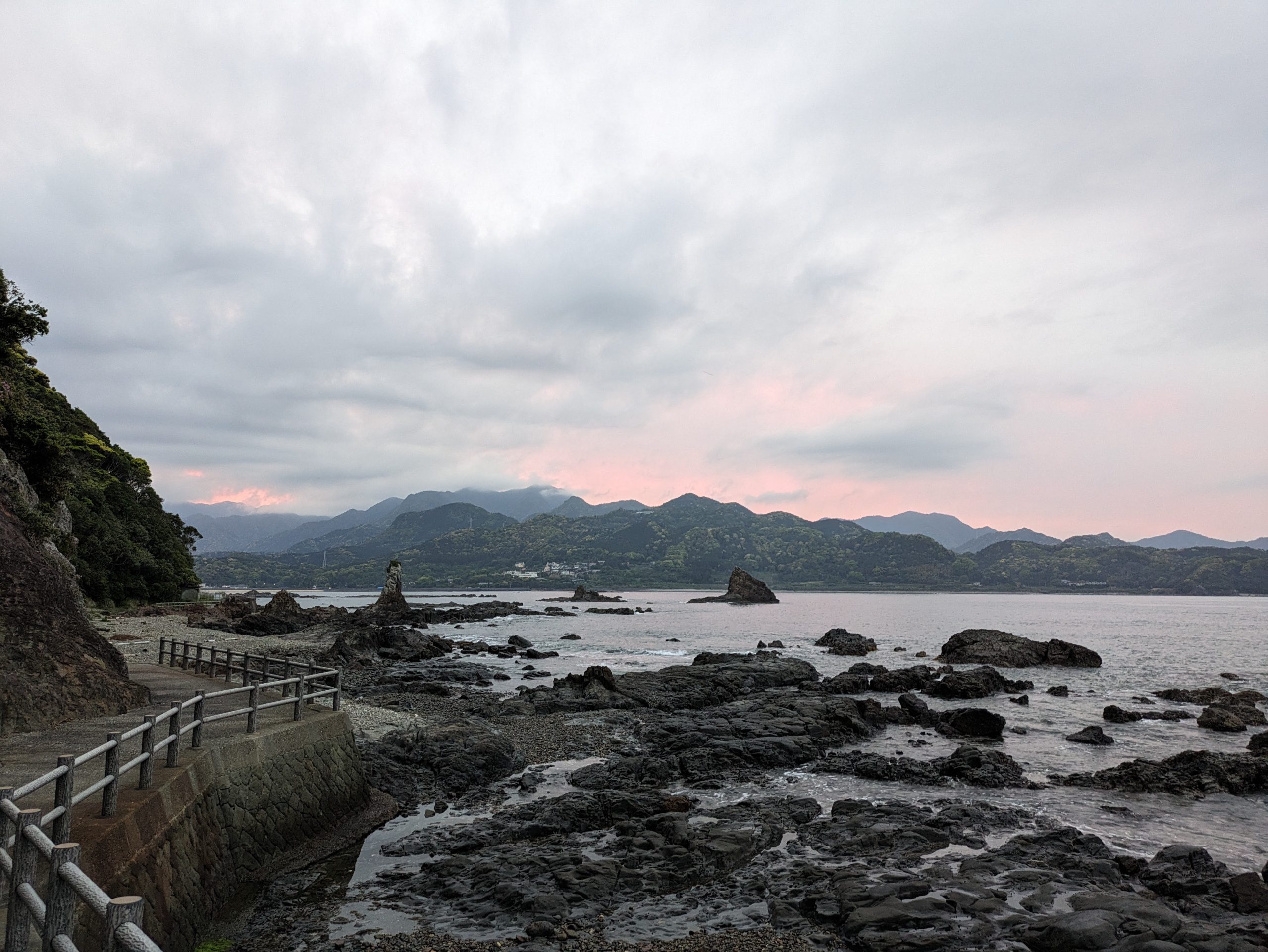
When I looked behind me, the sun had start to set.
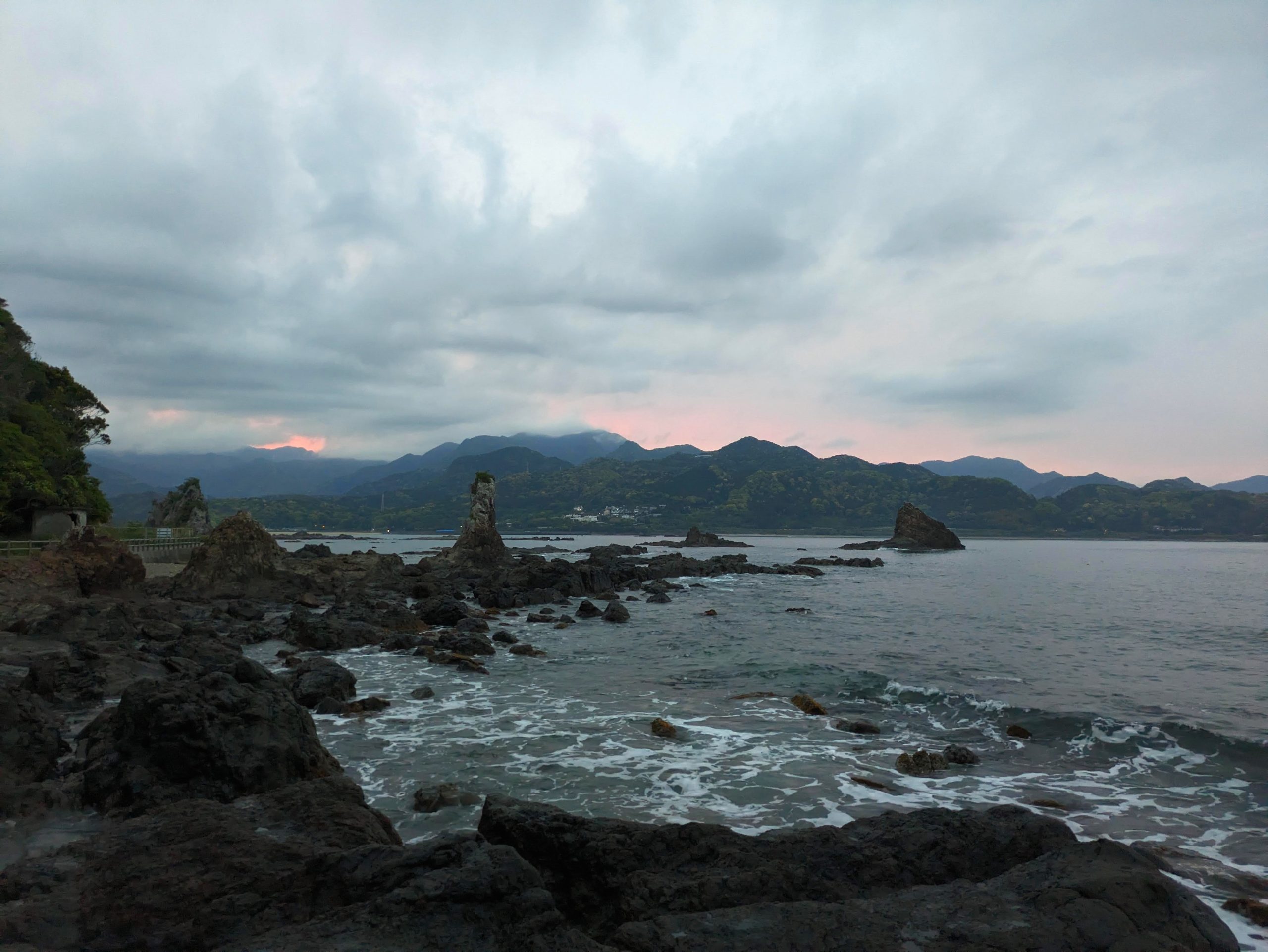
The colors were subtly changing every few minutes. Against the gentle rolling of the waves, it was a nice end to a relatively calm first day.
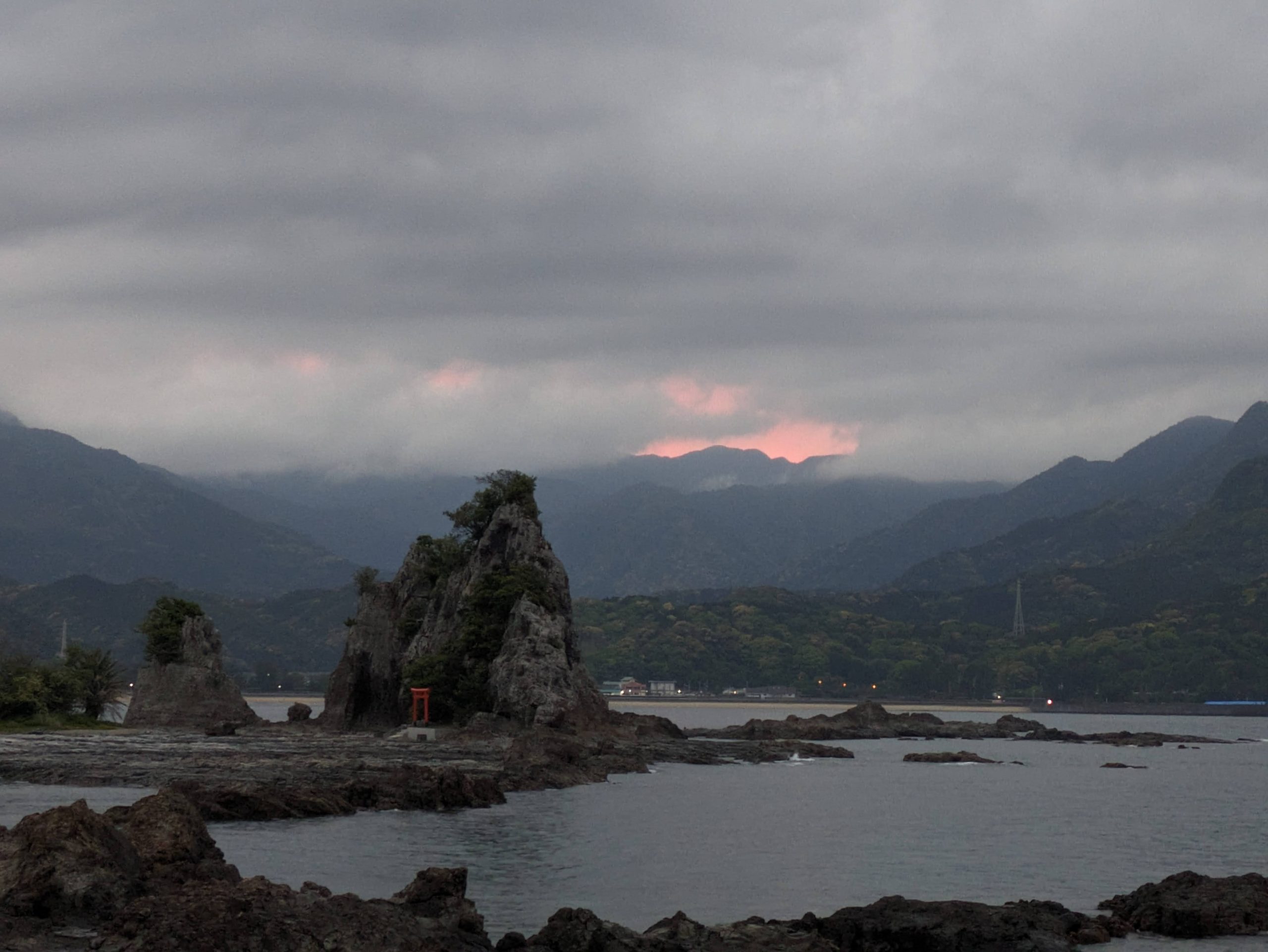
Back to being able to see the small island’s shrine again, this time at dusk.
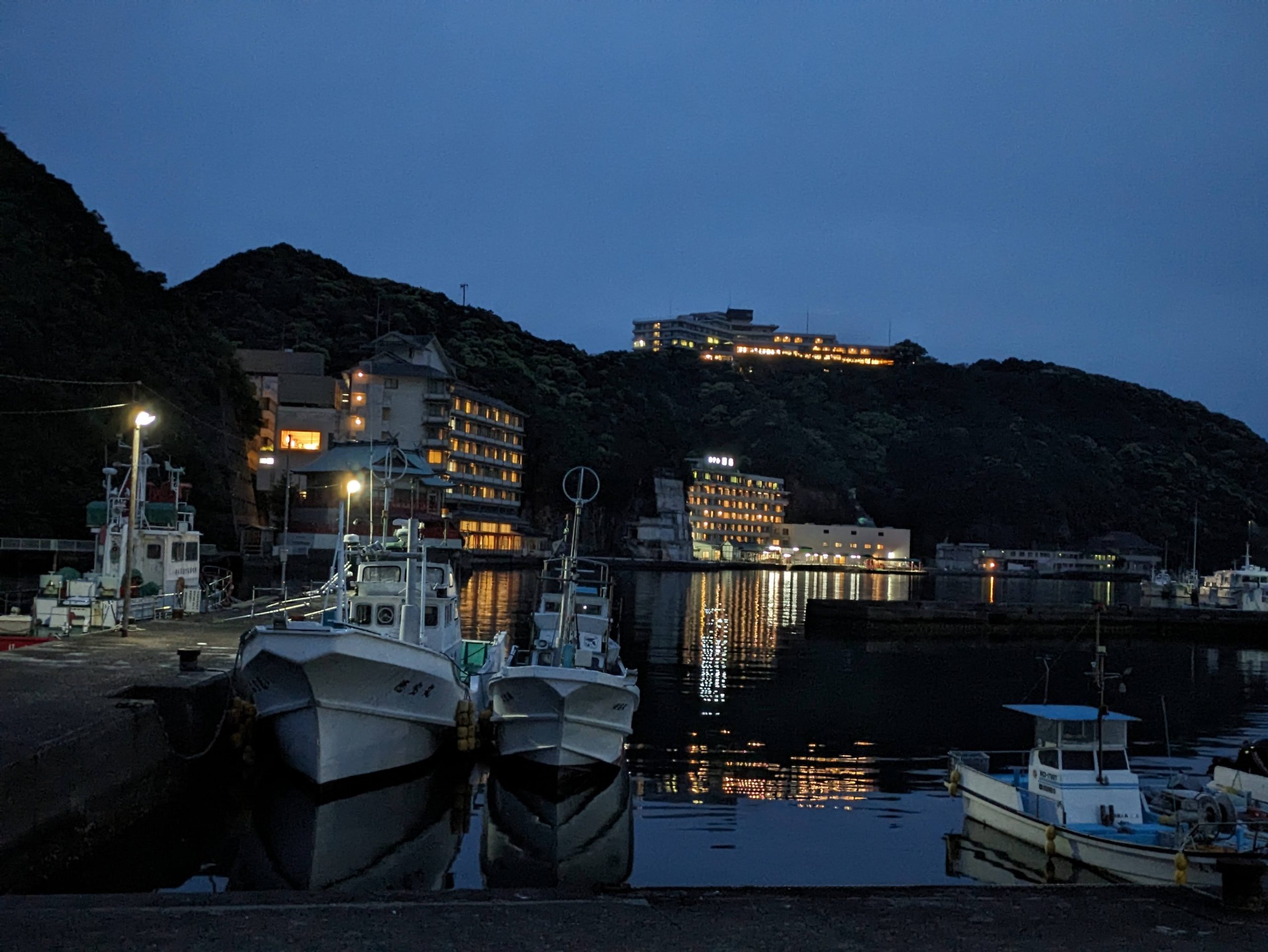
Walking along the harbor searching for somewhere for dinner in the sleepy town that was still open after dark…
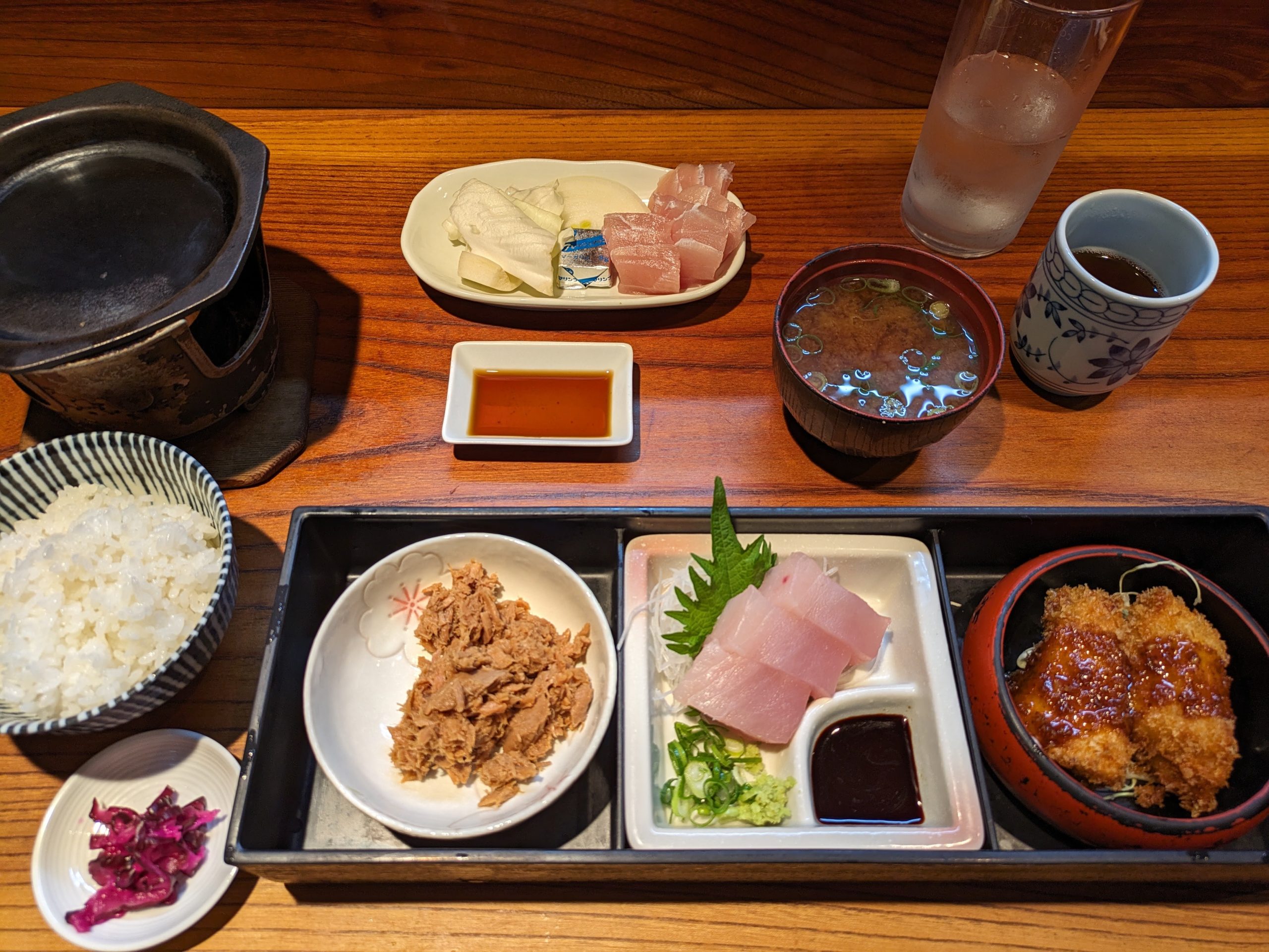
The place I found was delicious. Nachikatsuura is famous for its maguro, tuna, so fish is what I (successfully!) sought out.
Probably printed by the same person behind all the LANE BIKEs.
Myaku-Myaku spotted at Kii-Katsuura Station!!
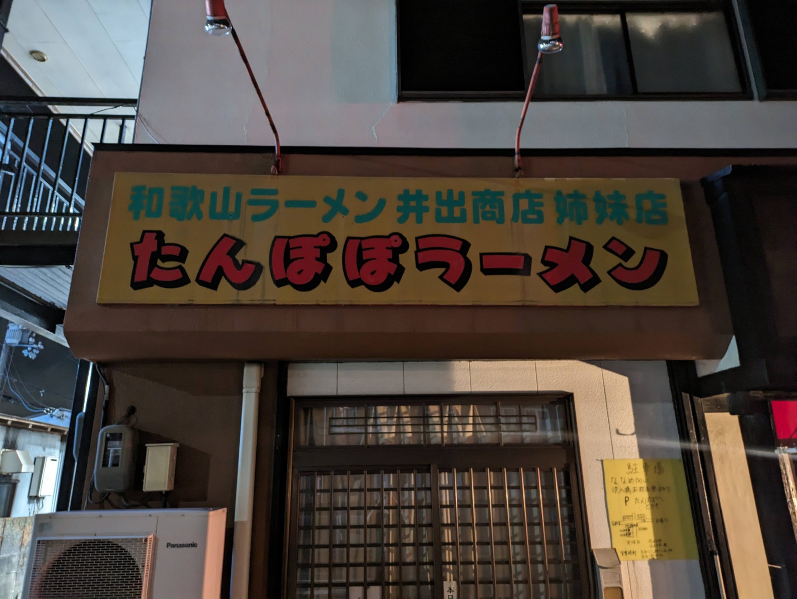
Another ramen-restaurant-named-Tampopo to add to the collection. I always do wonder these places are inspired by Itami…
Saturday, April 26, 2025
Today’s transit:
🚌 7:38 Nachi Sta. / Kumano Gobo Nankai 31 Nachisan Line Bus → 7:54 Nachi-no-Taki-mae
⤾ 🚌 9:02 Nachisan / 〃 → 9:34 Tenma
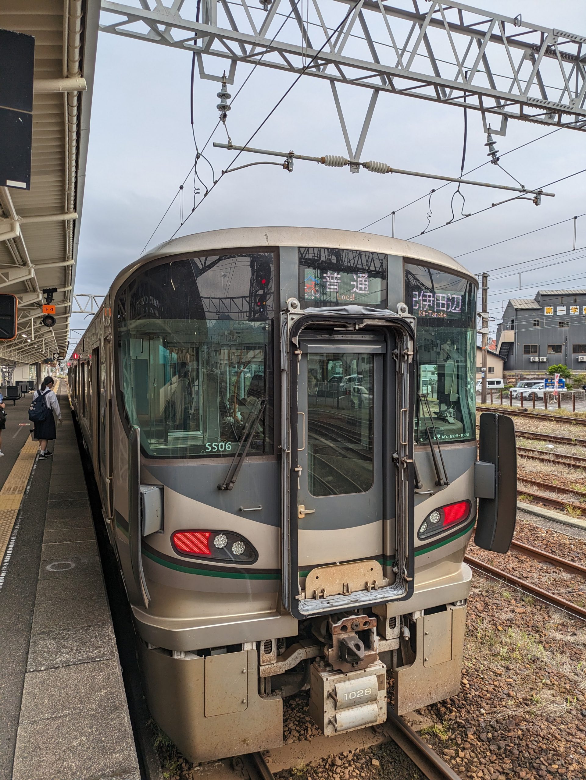
10:00 Nachi / JR Kinokuni (Kisei) Line → 12:12 Kii-Tanabe
12:18 Kii-Tanabe / 〃 → 13:08 Gobō
13:17 Gobo / Kishu Railway Line → 13:25 Nishi-Gobo
14:34 Gobō / JR Kinokuni (Kisei) Line → 15:36 Wakayama
15:45 Wakayama / Kisei Line → 15:52 Wakayamashi
16:05 Wakayamashi / Nankai Wakayamako Line → 16:09 Wakayamako
⛴ 16:20 Wakayamako / Nankai Ferry W7 → 18:30 Tokushimako
The main goal for the second day of my trip was to get to Shikoku by ferry, but that wasn’t until the late afternoon (or whenever I wanted, really, since there are eight departures a day, and no need to reserve beforehand). That meant that on my way, I could stop and ride the country’s shortest private railway… but before that, I had to go see another superlative – the country’s tallest waterfall – and walk some of the Kumano Kodo, the term for the ancient pilgrimage routes branching across the peninsula that have been used for over a thousand years.
Walking the 15-or-so minutes from my hotel back to Nachi Station, where I had gotten off last night, and where the bus would pick me up this morning. (This stretch is not quite the promised “ancient pilgrimage route”.)
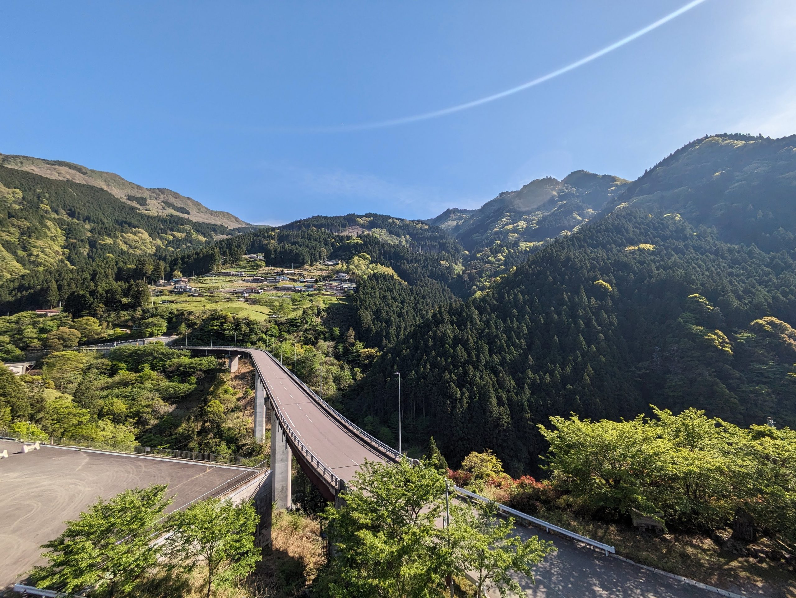
The bus ride up into the mountains provided pretty amazing views out the windows.
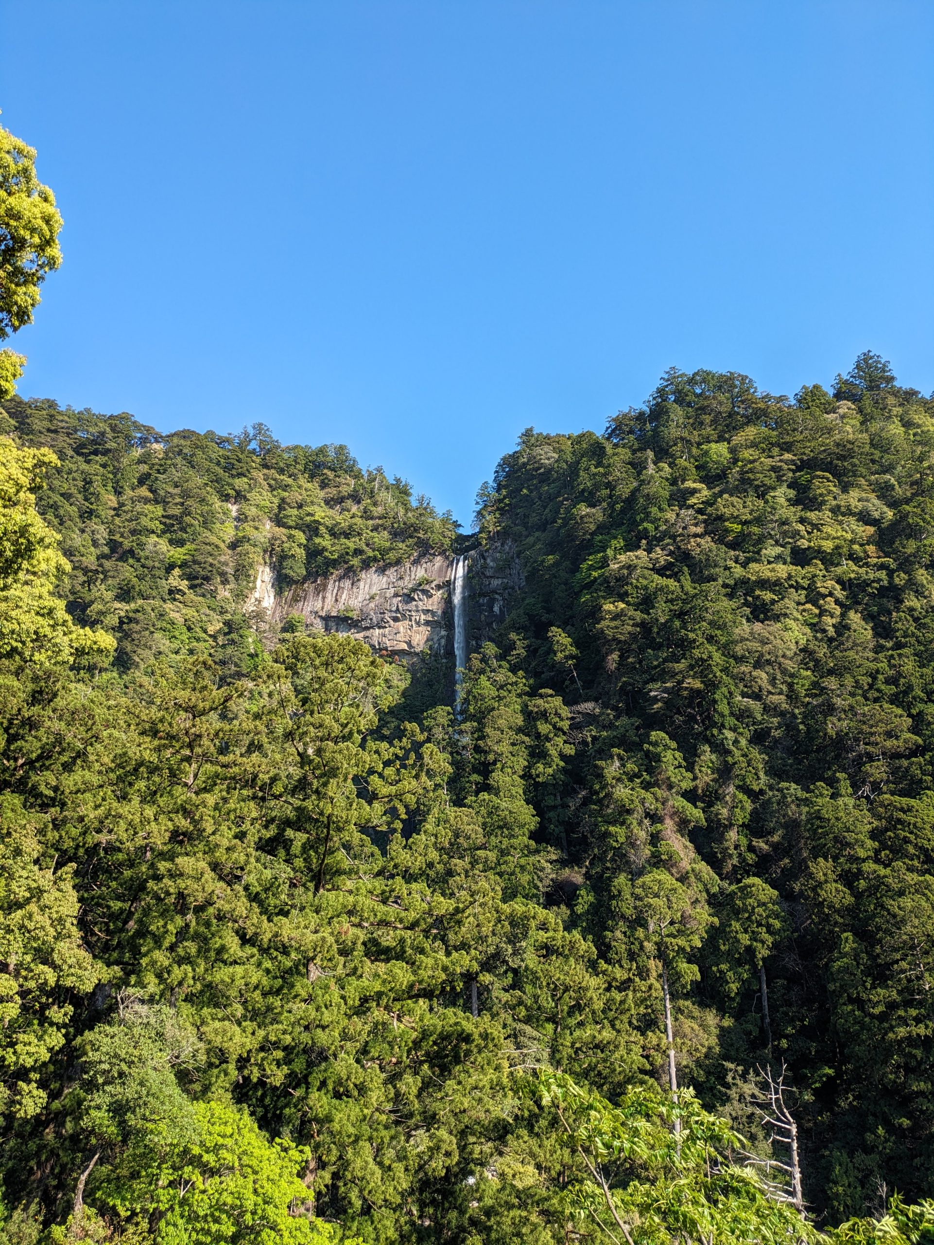
And here it is, Nachi Falls! Quite small at this distance, but we can get closer.
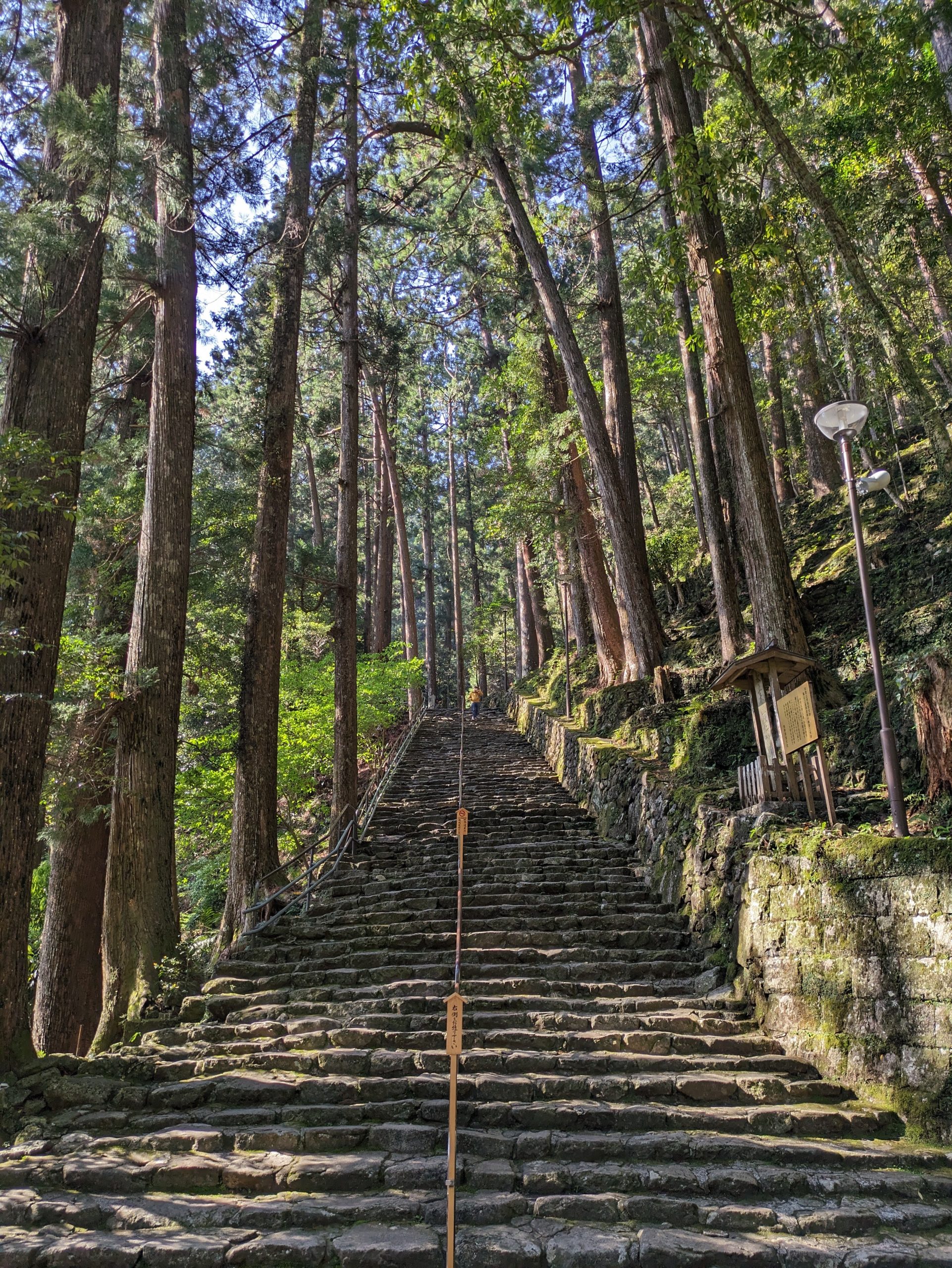
Cobbled steps led down to a better vantage point.
And looking back, from the bottom of the steps.
I loved this super-vertical view of the falls through the trees!
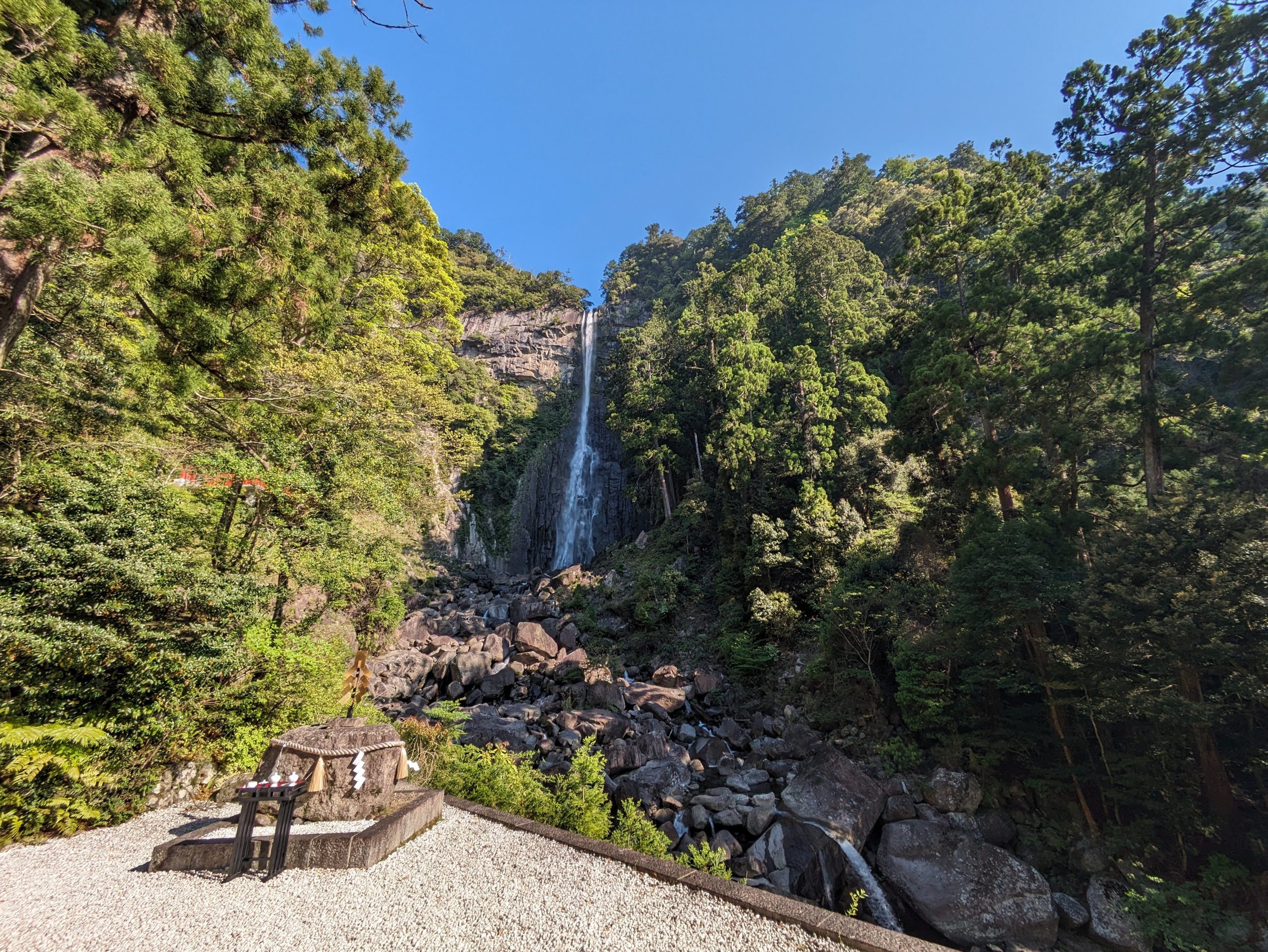
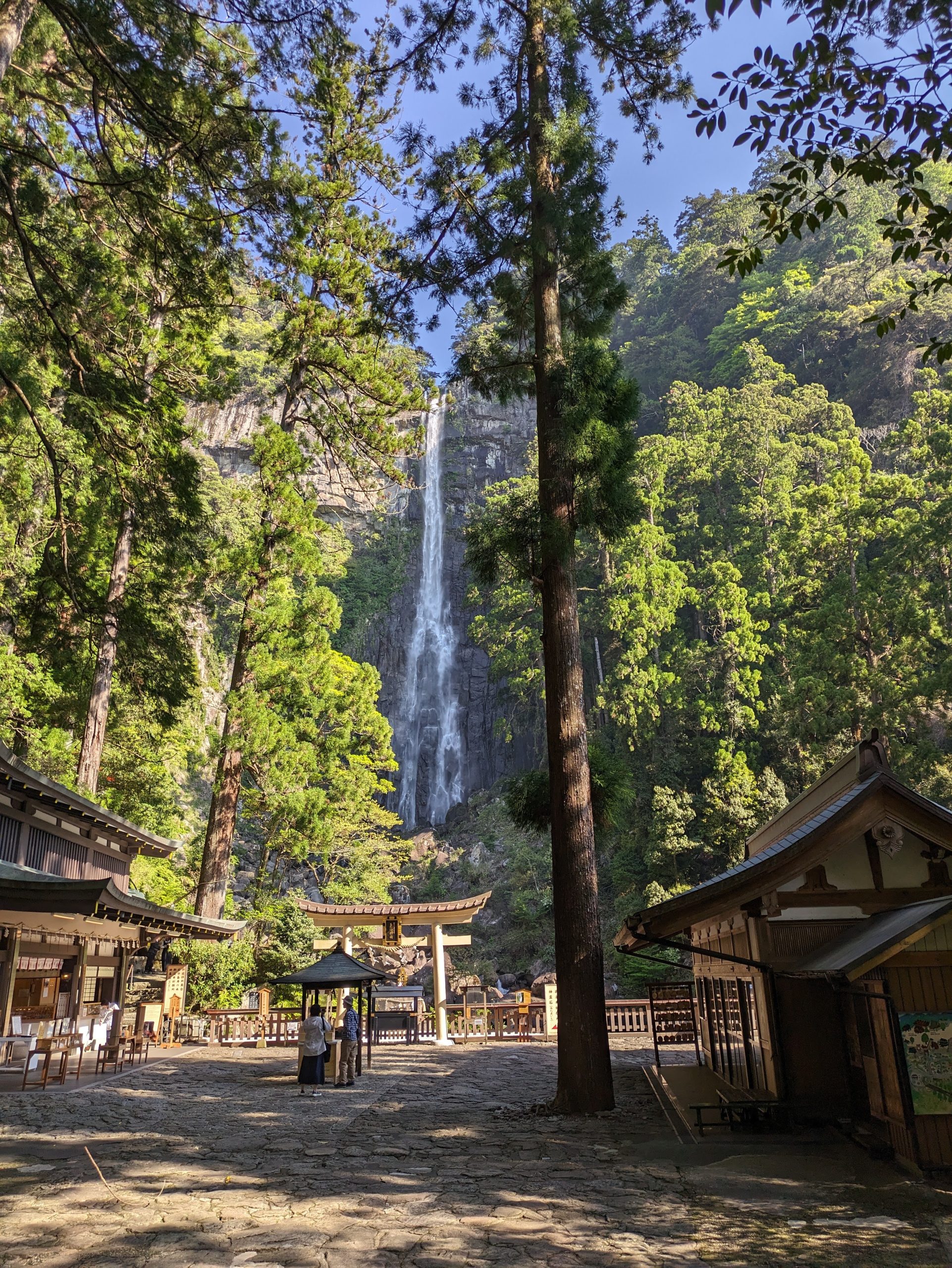
And a more unobstructed view, at the site of the wishing shrine.
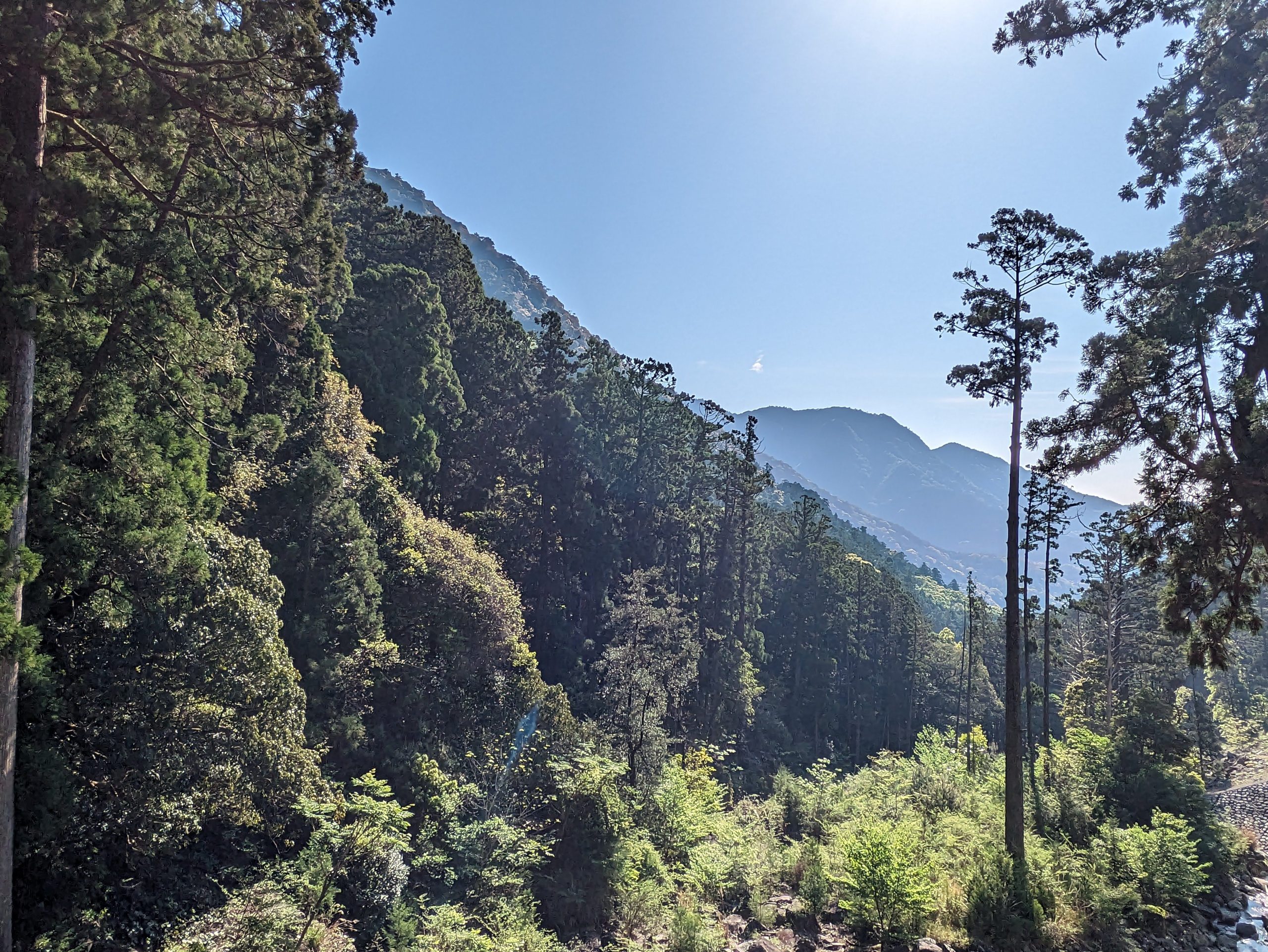
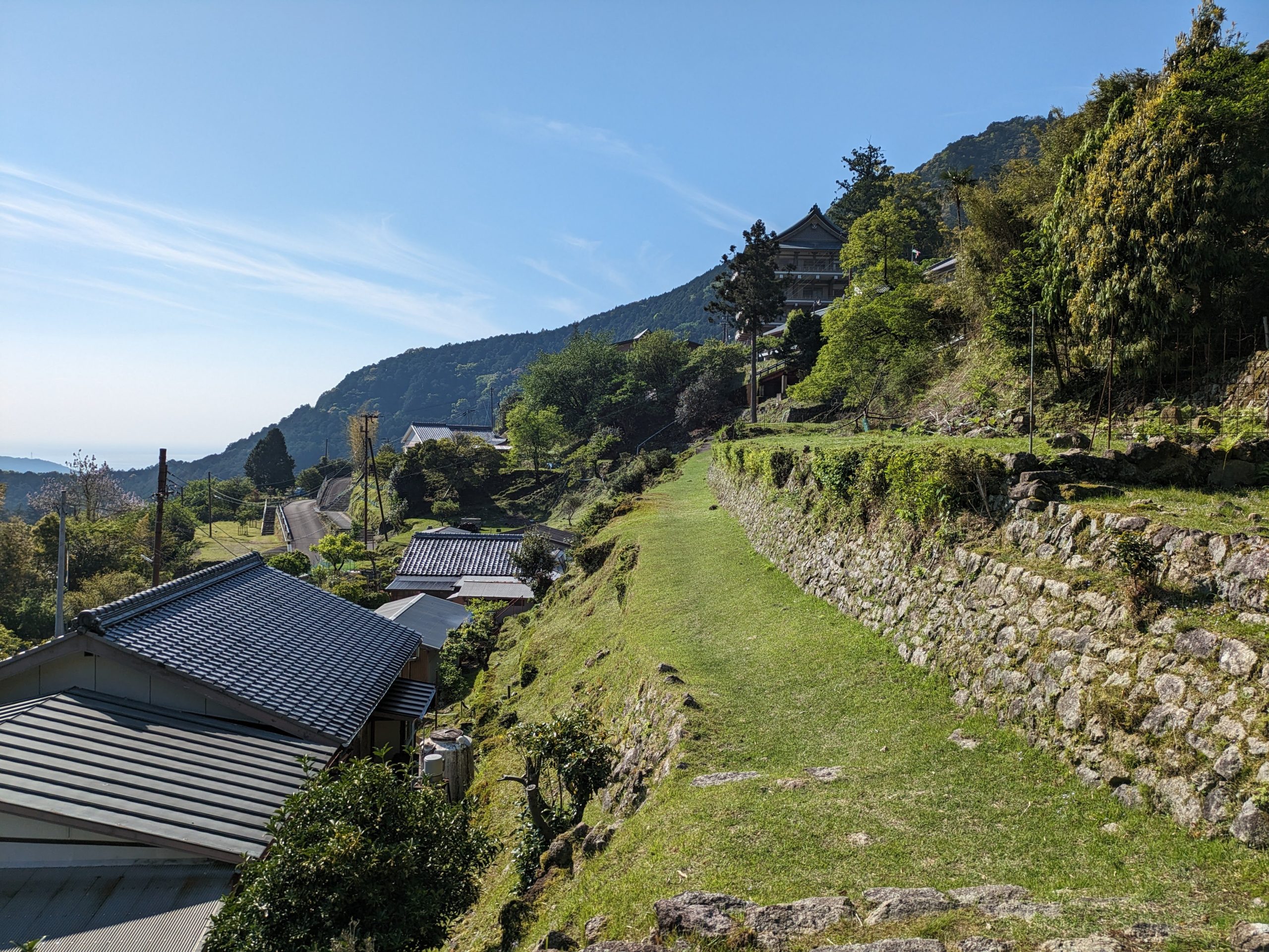
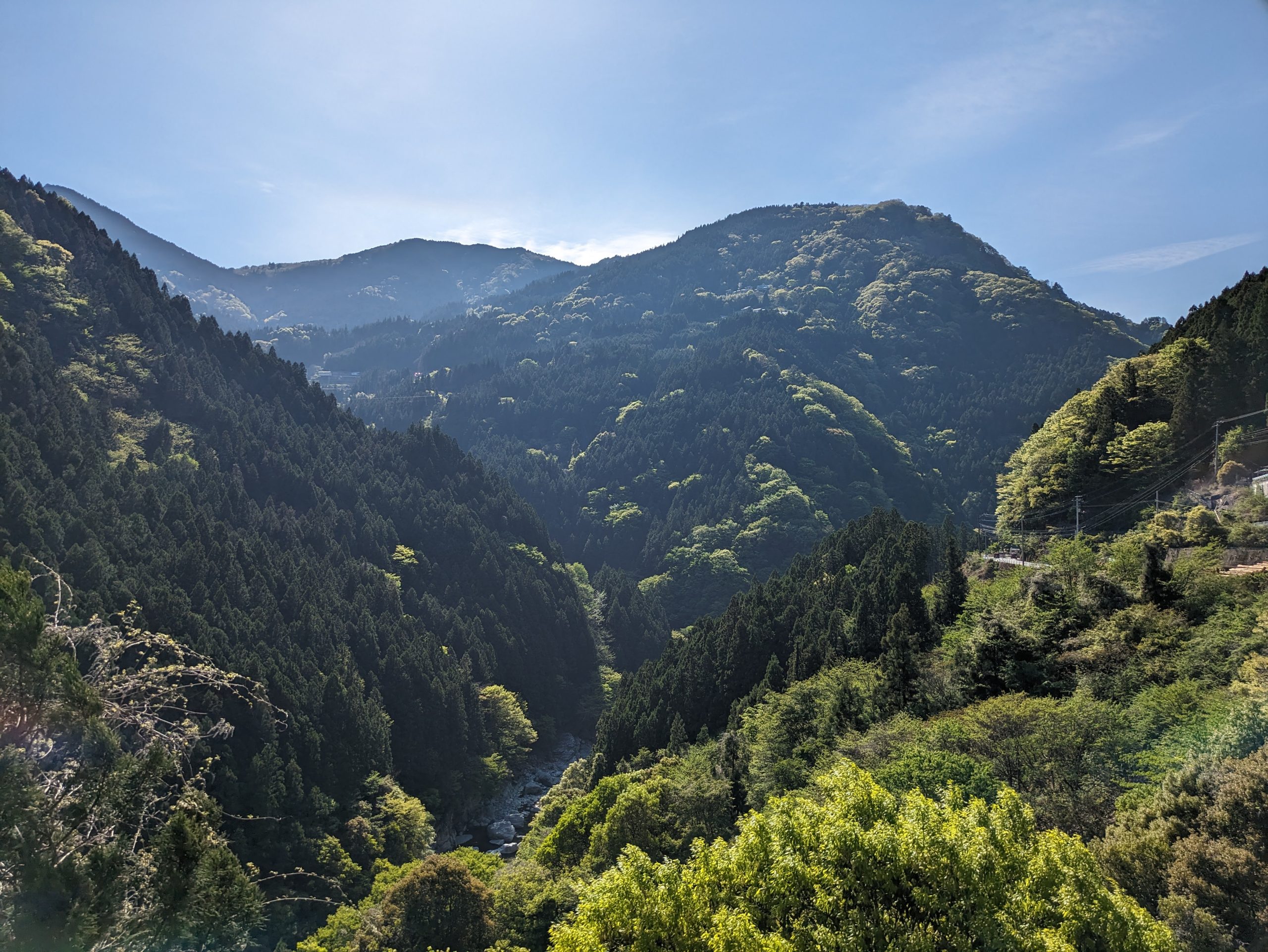
Plus super great, wide-sky views of the mountains to my right.
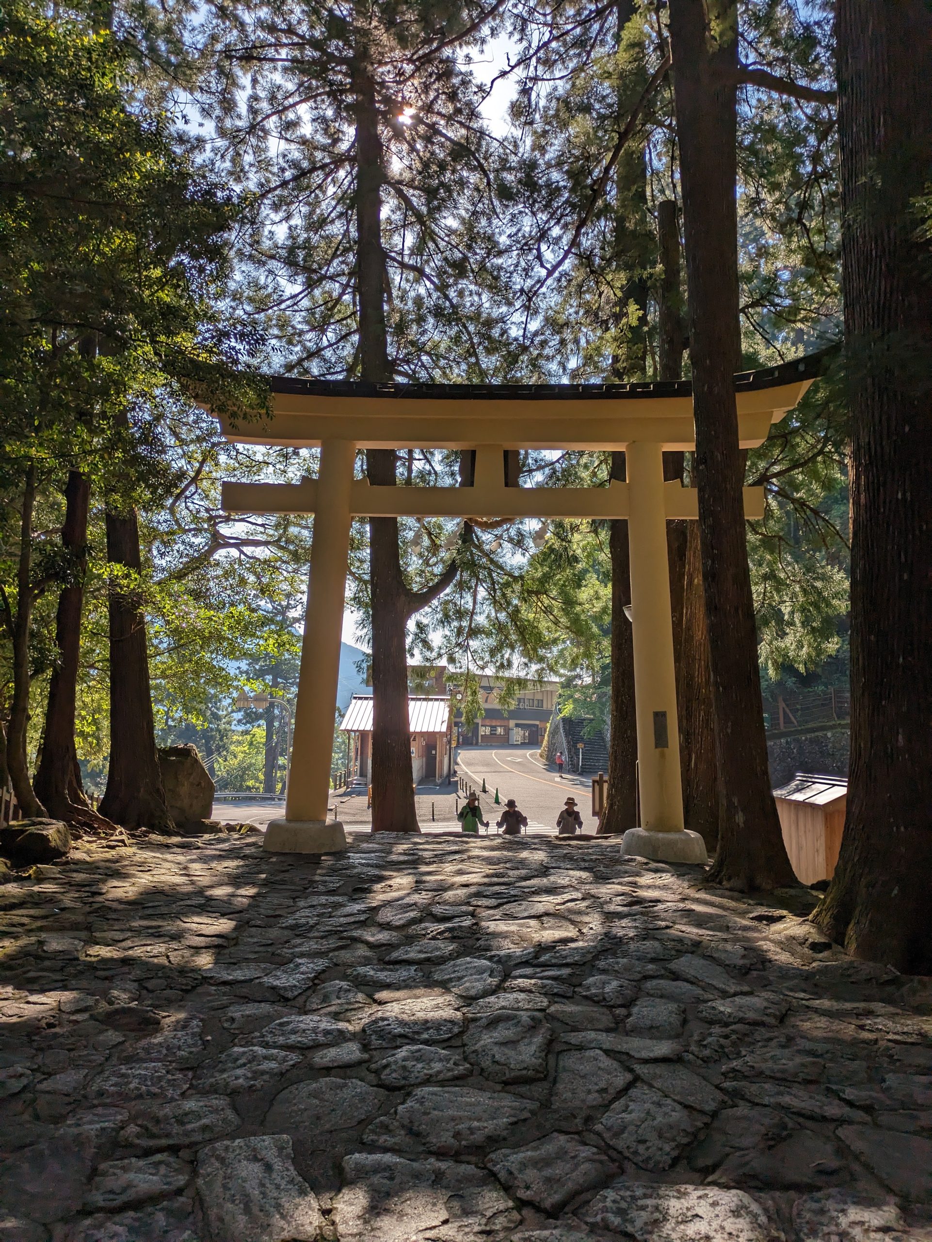
This torii marks the site of the shrine, with the temple next door – but as a plaque points out, this demarcation is rather recent (150 or so years ago), and Buddhist temples and Shinto shrines were often intertwined in the past.
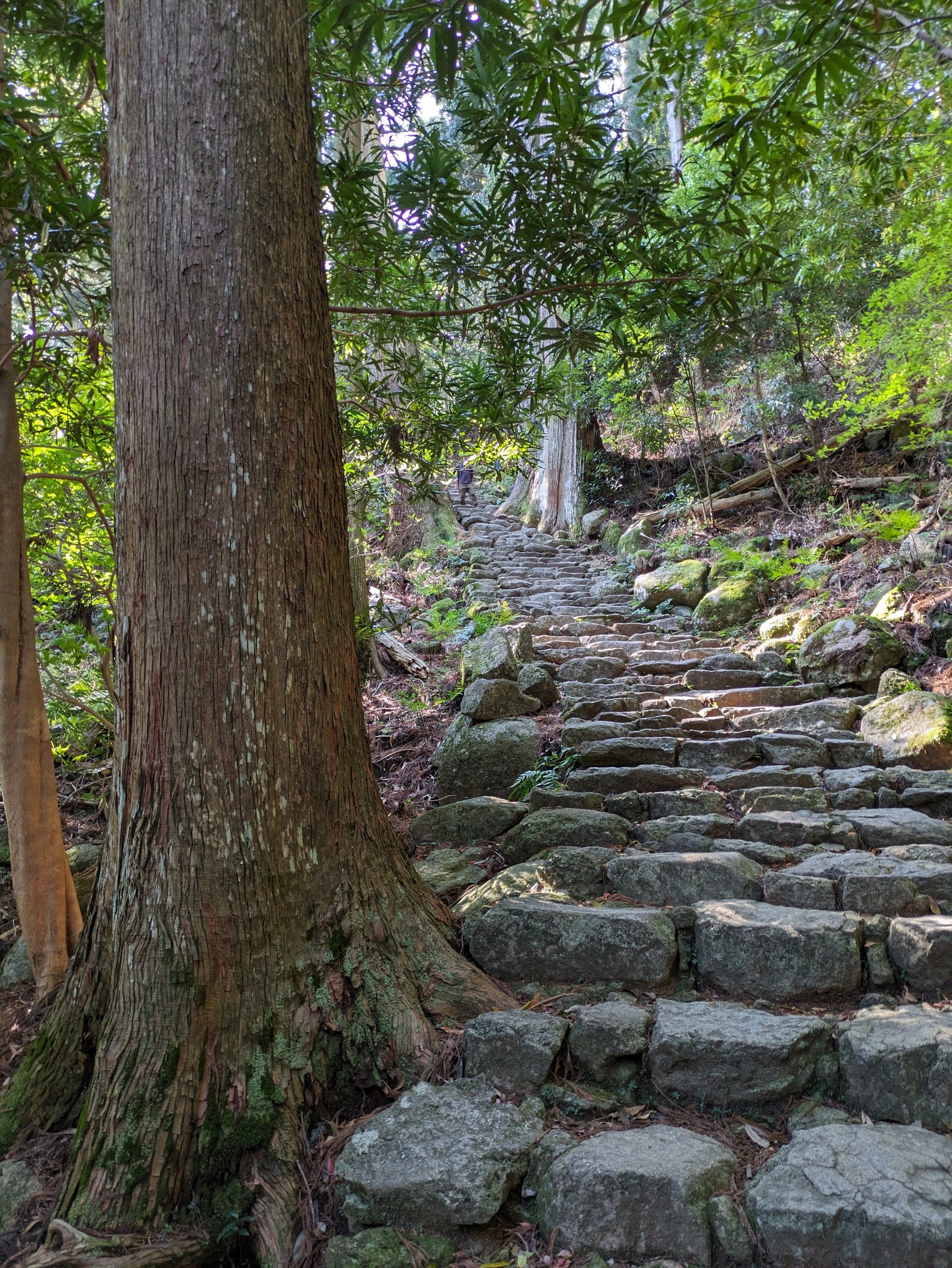
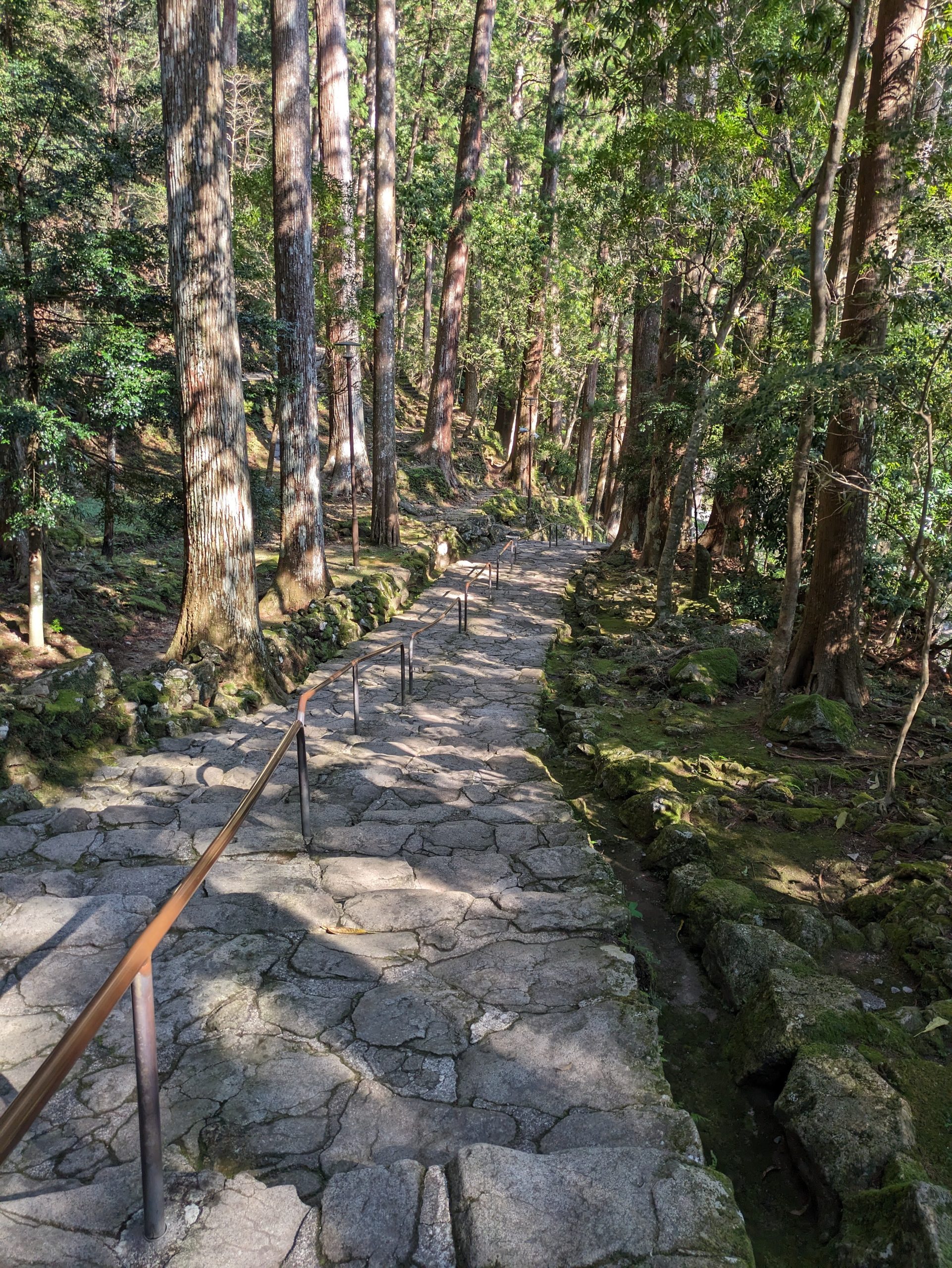
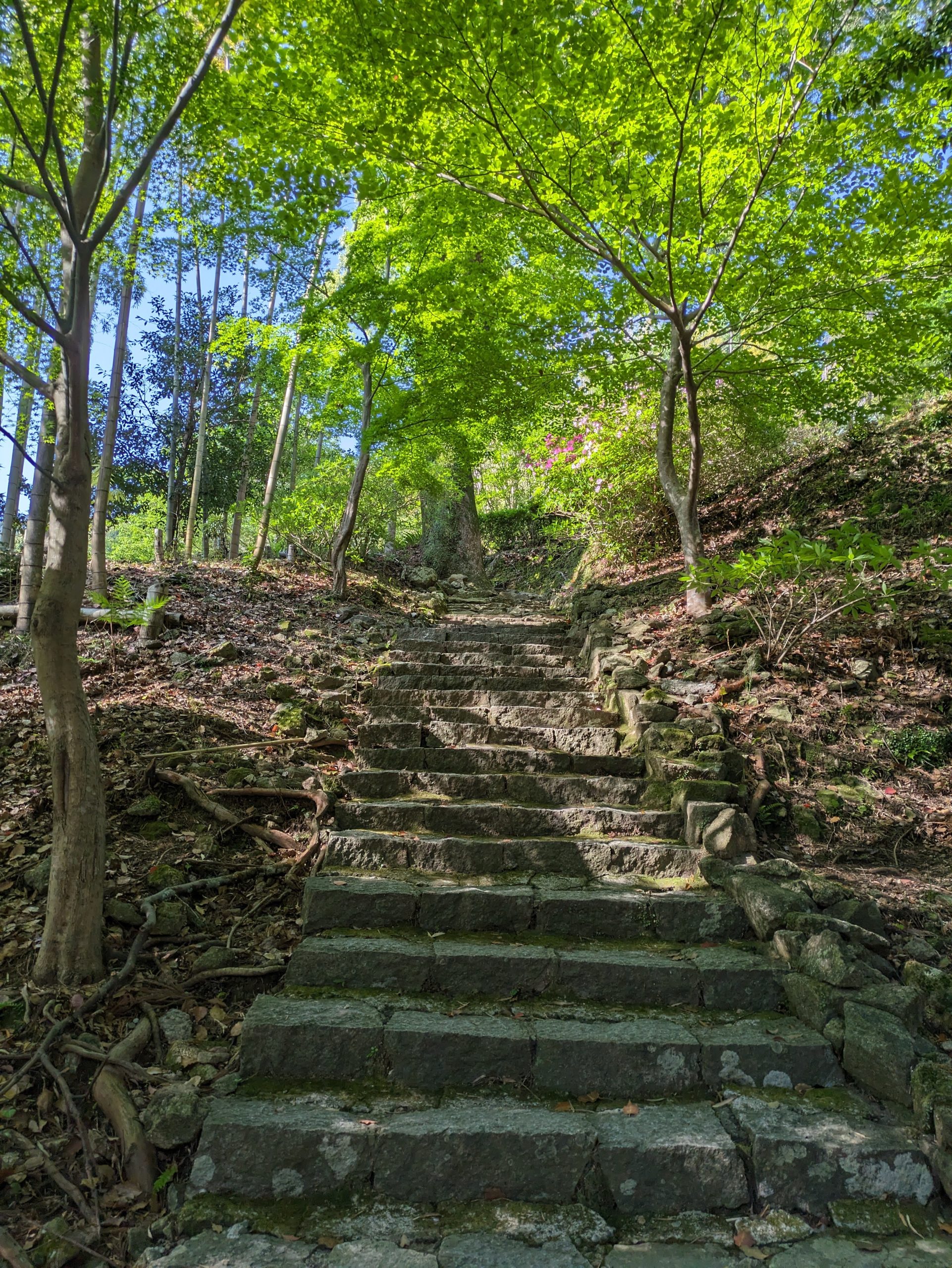
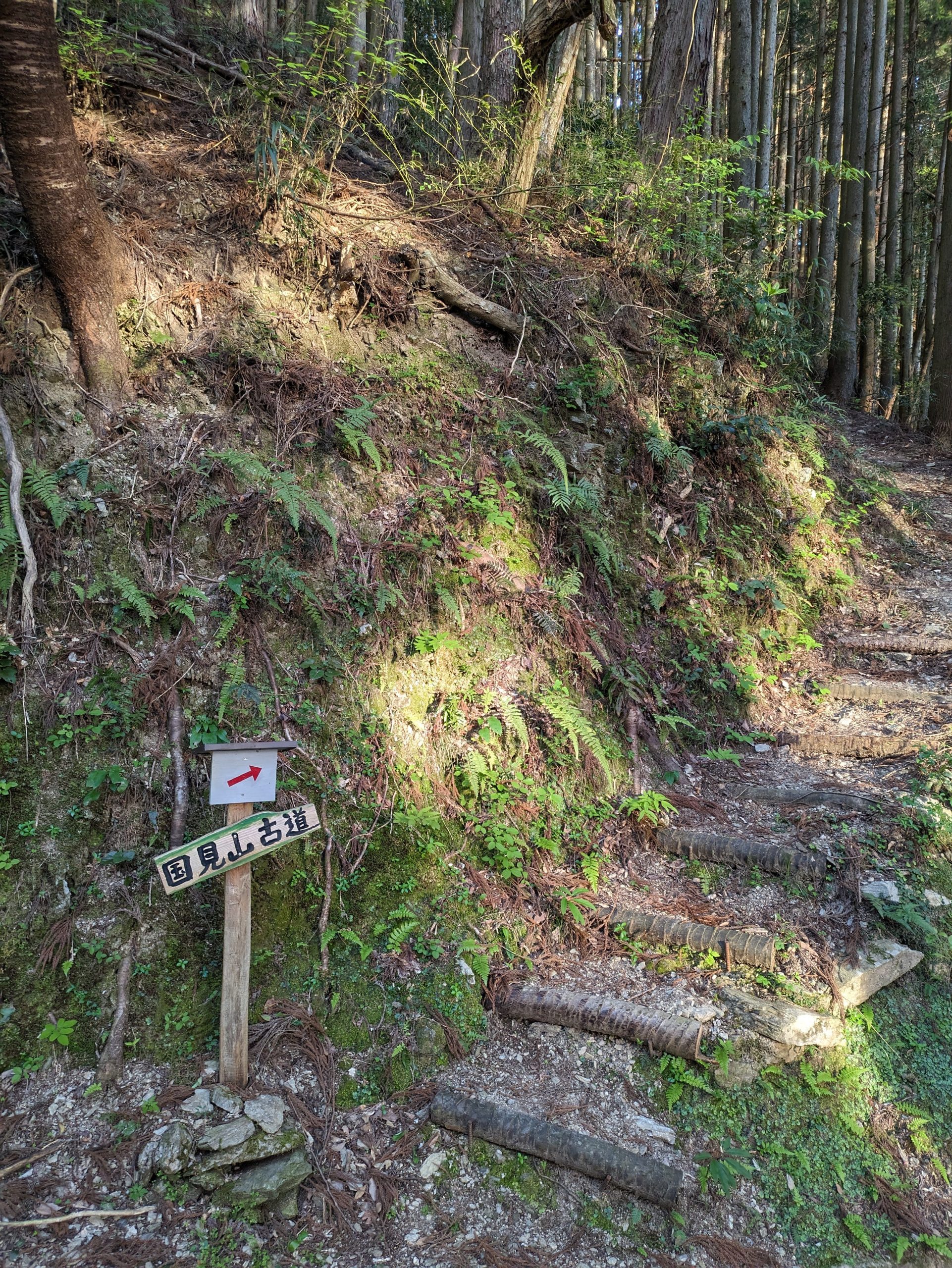
I went up high to see the temple’s pagoda and find a different viewpoint of the area. This is part of the Kumano Kodo!
Sadly one of my transit mascot plushie keychains fell off of my bag while walking along this trail… so if you ever see a blue platypus around this area…
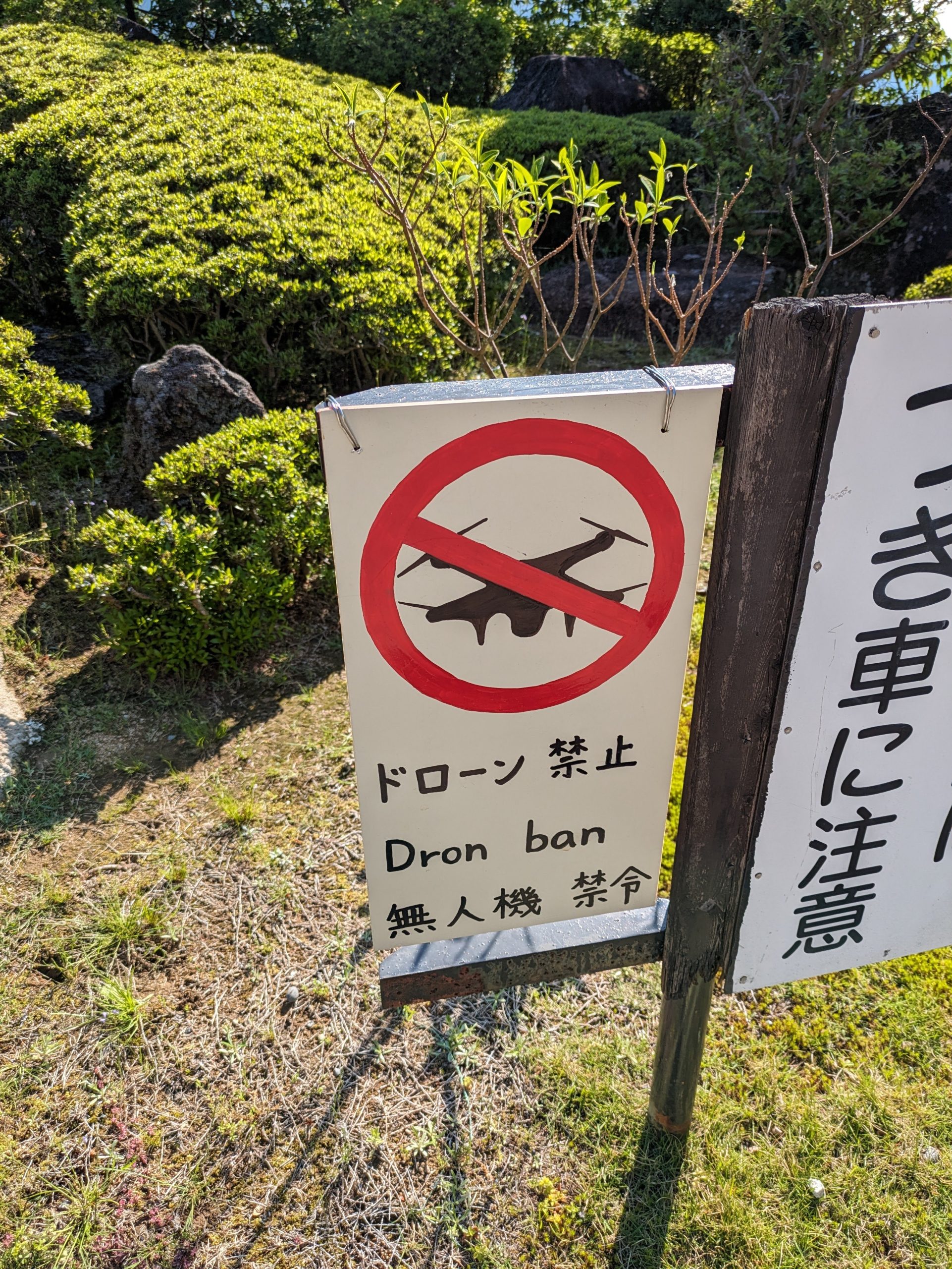
Dron ban
Super hilly! I mean, it’s no terraced rice fields or whatever, but…
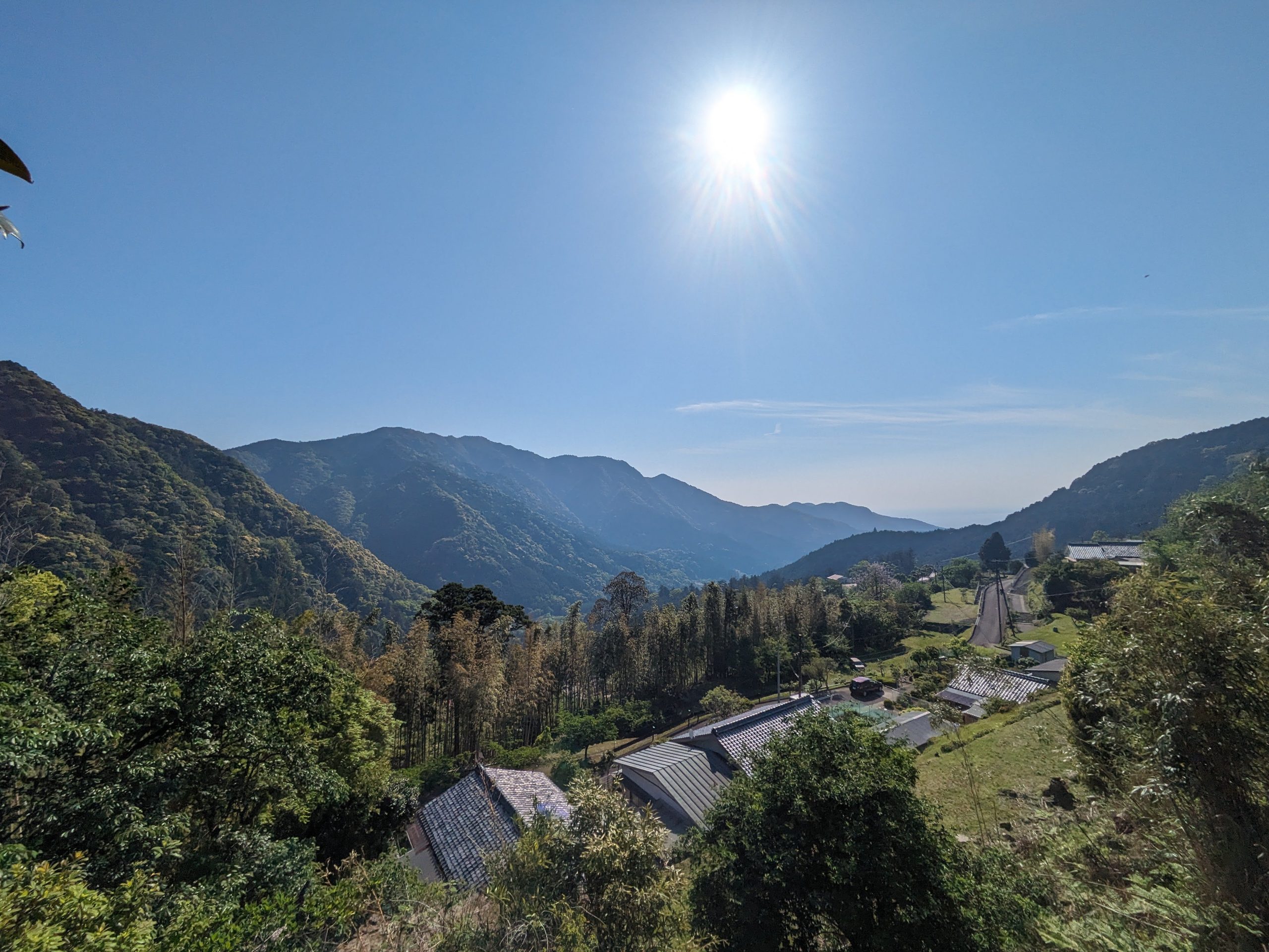
Another view of the mountains. So grateful for being able to get to a place like this by public transit!
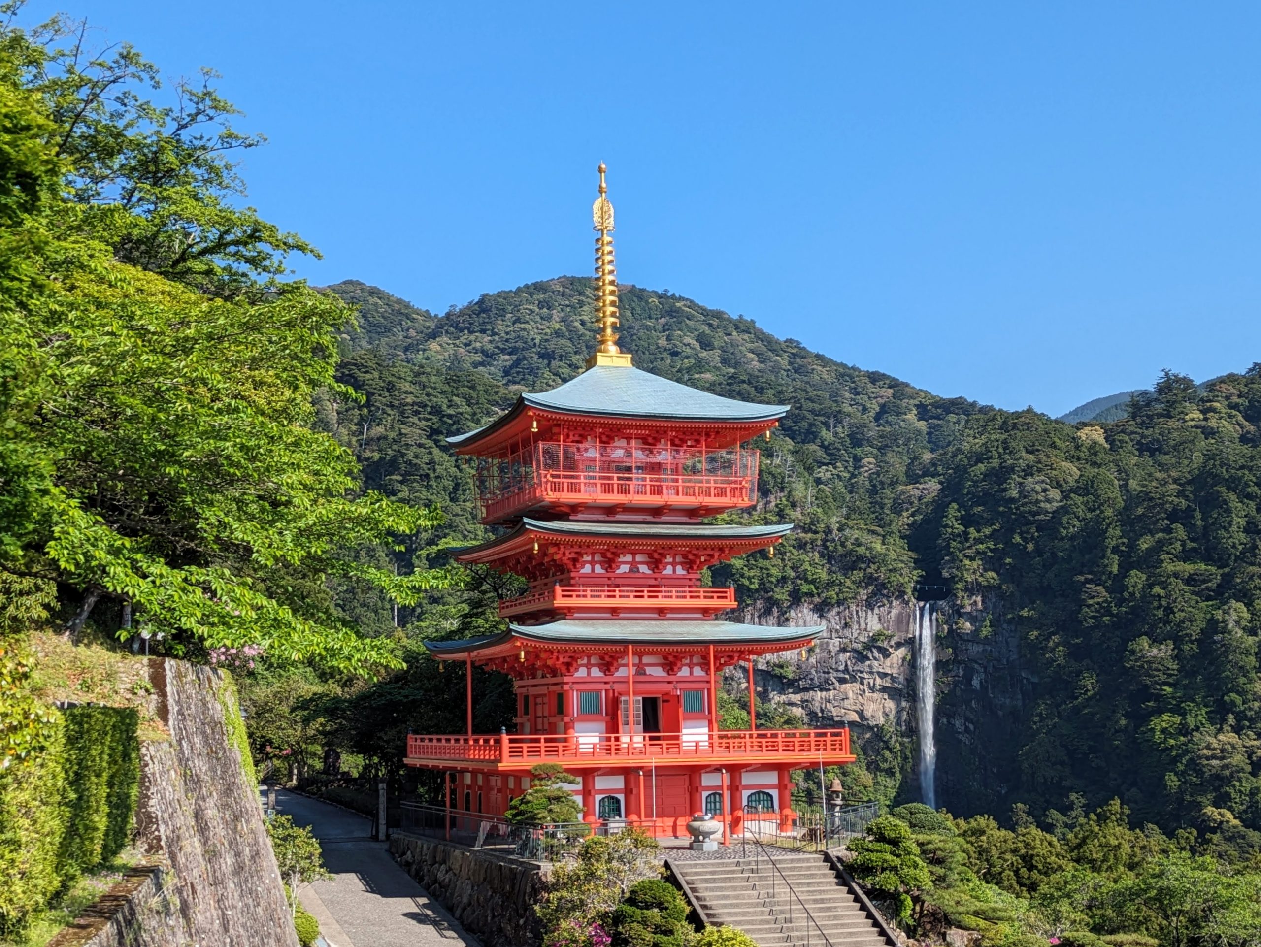
The famed Three-Storied Pagoda at Seiganto-ji Temple, with Nachi Falls in the background. I love the faint view of the shimenawa across the opening above the crest of the waterfall.
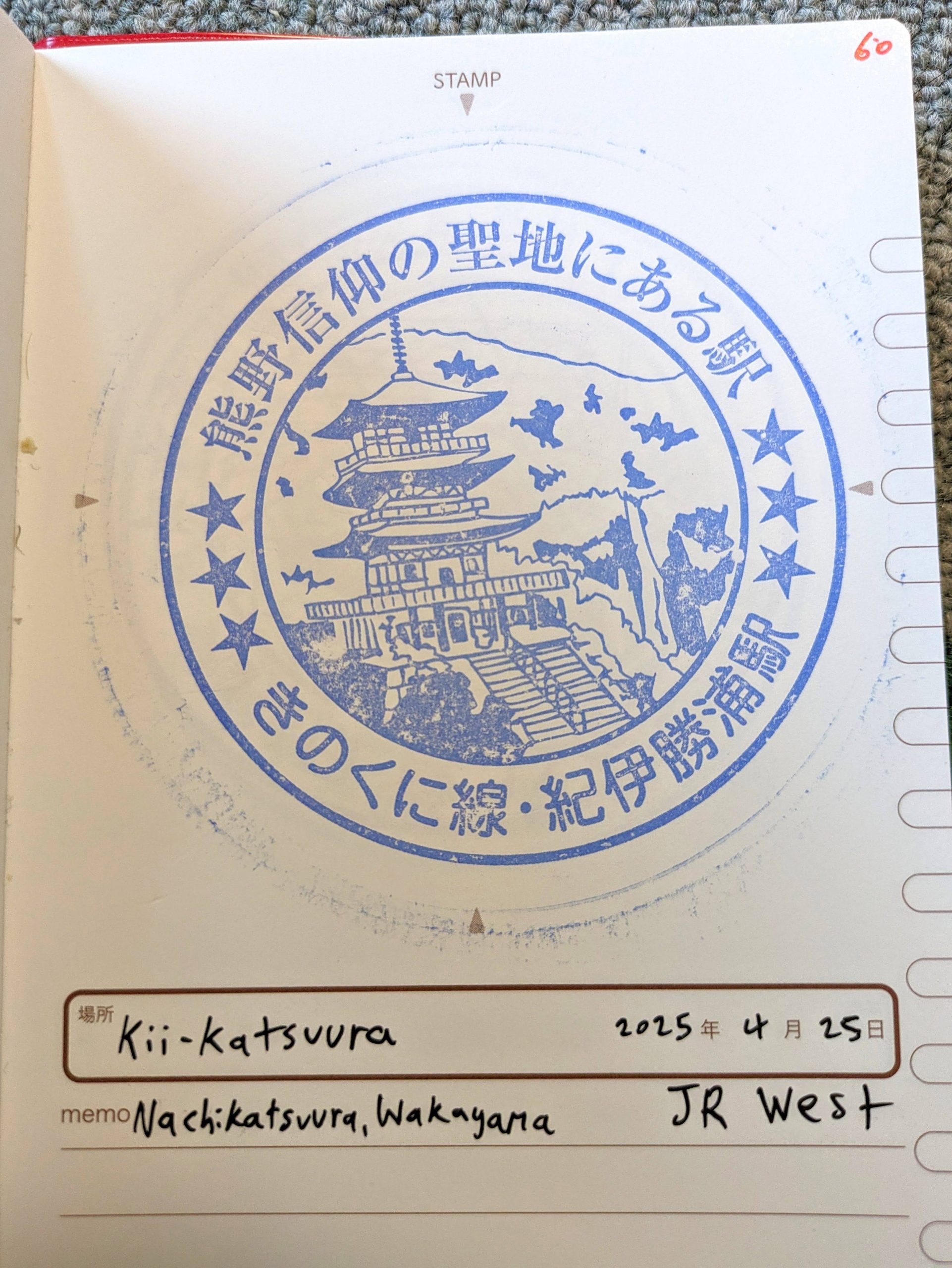
This exact, picturesque vista is what’s featured on the eki-stamp of Kii-Katsuura Station, which I had snagged the night prior.
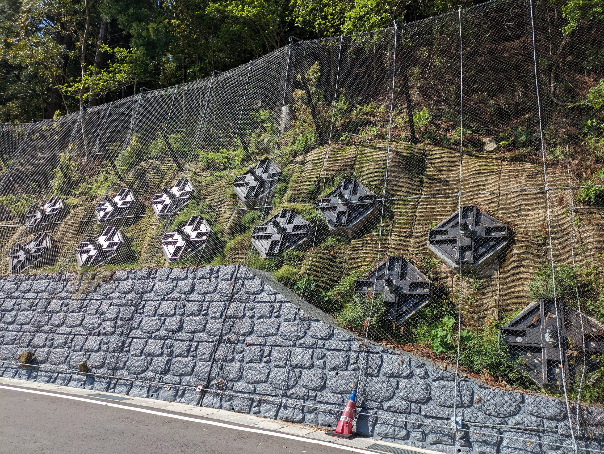
Very weird-looking structural supports on top of the retaining wall for this hill. Not the usual grid-pattern shotcrete you see.
There’s Yatagarasu and his three legs again.
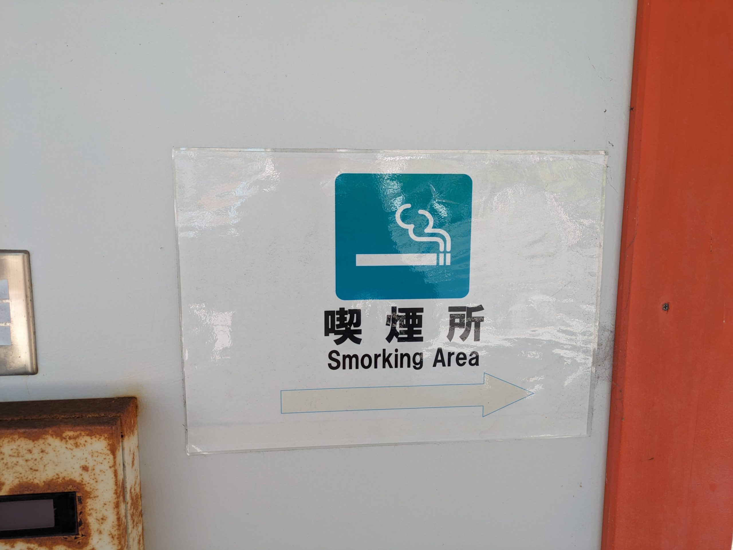
OH MY GOD IT FINALLY HAPPENED. I FINALLY SAW A SMORKING SIGN. MY LIFE IS COMPLETE.
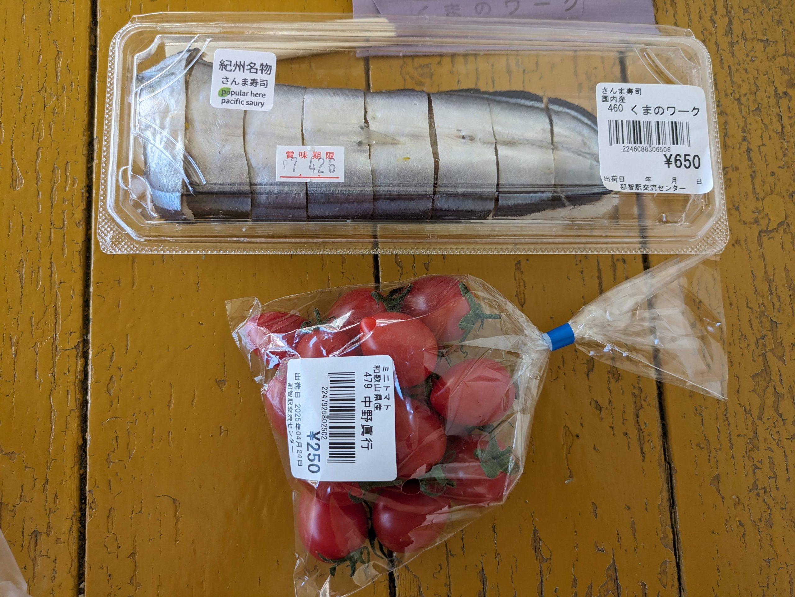
Pacific saury, or sanma, is not traditionally eaten as sushi in Japan, but it is here in the Nanki region and particularly in Wakayama. It was… uh, well, not great, honestly. Oh well! Trying new things is always worth it.
Following my bus-assisted jaunt up to the mountains, I returned to trains as my form of transit, heading westward to continue around the peninsula.
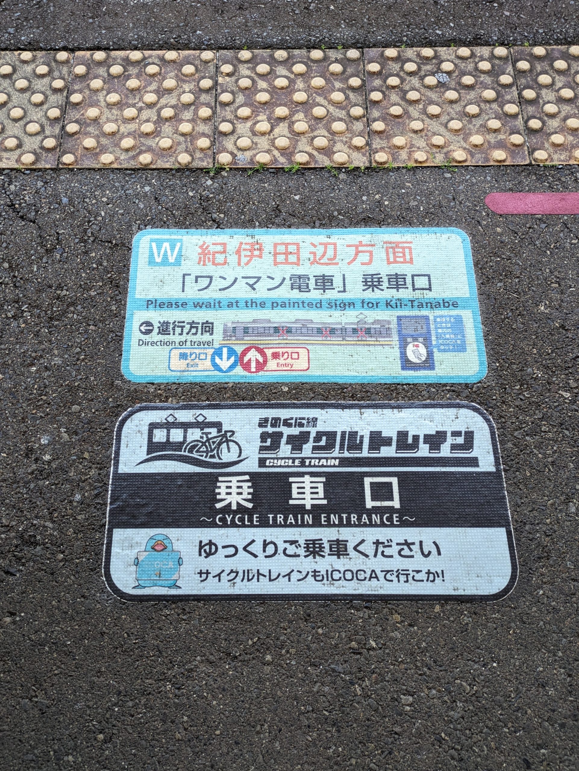
Like I mentioned yesterday, local trains on the Kinokuni Line are “Cycle Trains” and you can bring your bike on board! Very, very rare for Japan but great to see.

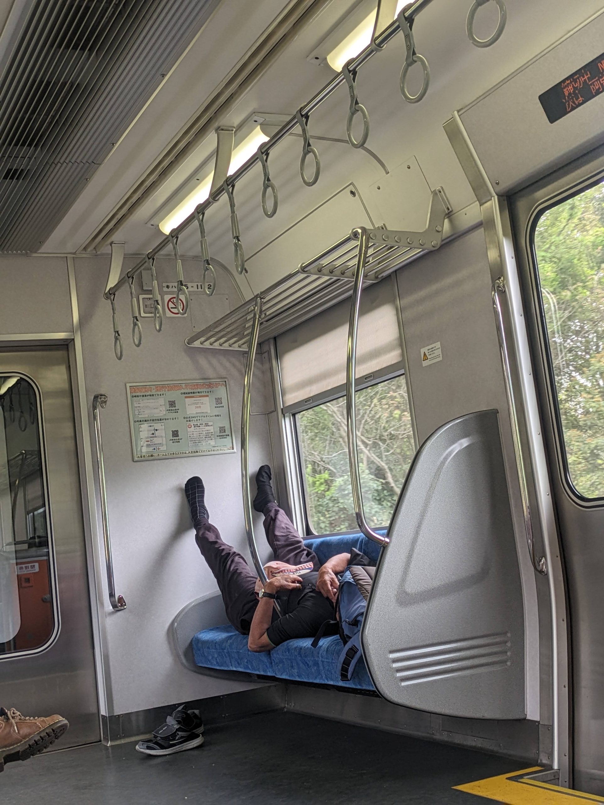
This man was making good use of it. Yay for multimodal transit! The little bungee cords he was using to attach it to the hand straps were hilarious, though.
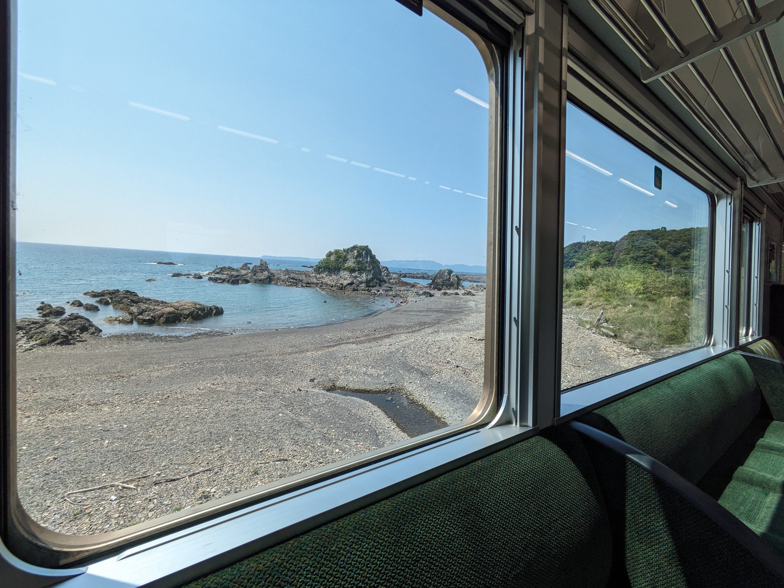
Beautiful coastal train window view. :)
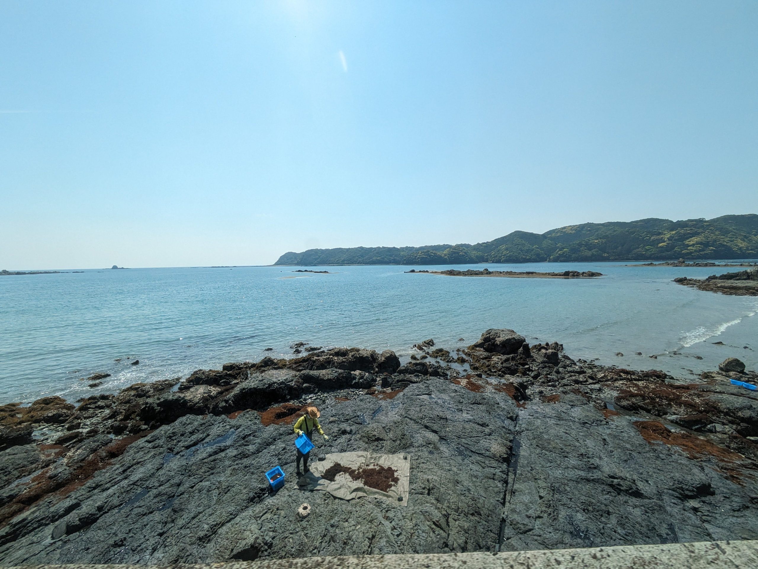
I’m not 100% sure, but it looks like this person we passed is harvesting seaweed? Cool!
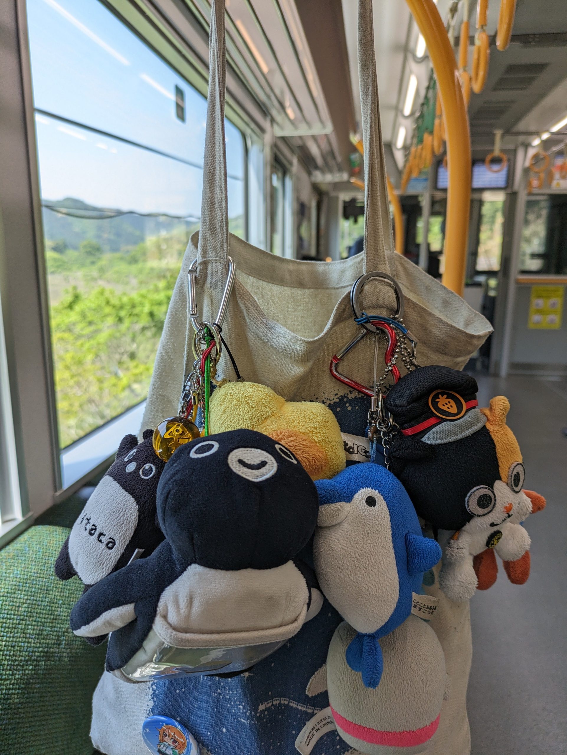
Here are all of my… remaining… transit mascot plushies. RIP Ico-chan.

I stumbled across a cure to my plushie-induced sadness: tons and tons of pandas stuffed into the ticket gates at Shirahama Station!!!
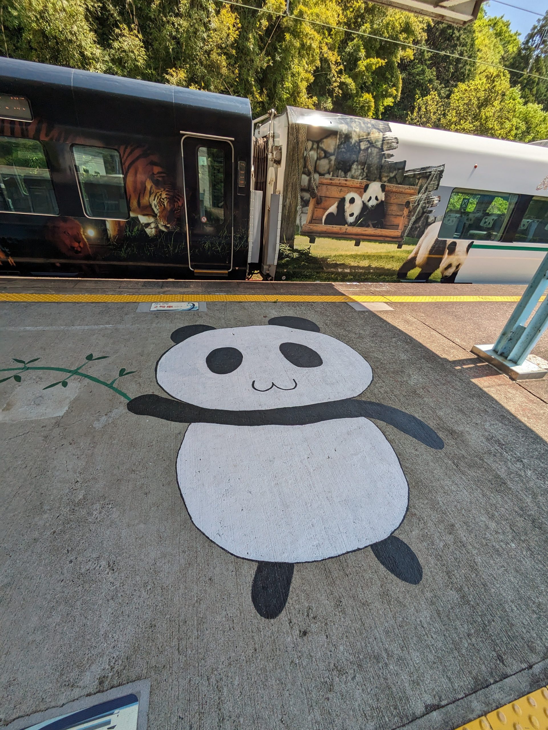
Pandas EVERYWHERE around this station, really. This is because an amusement park and zoo near the station, Adventure World, has four giant pandas.
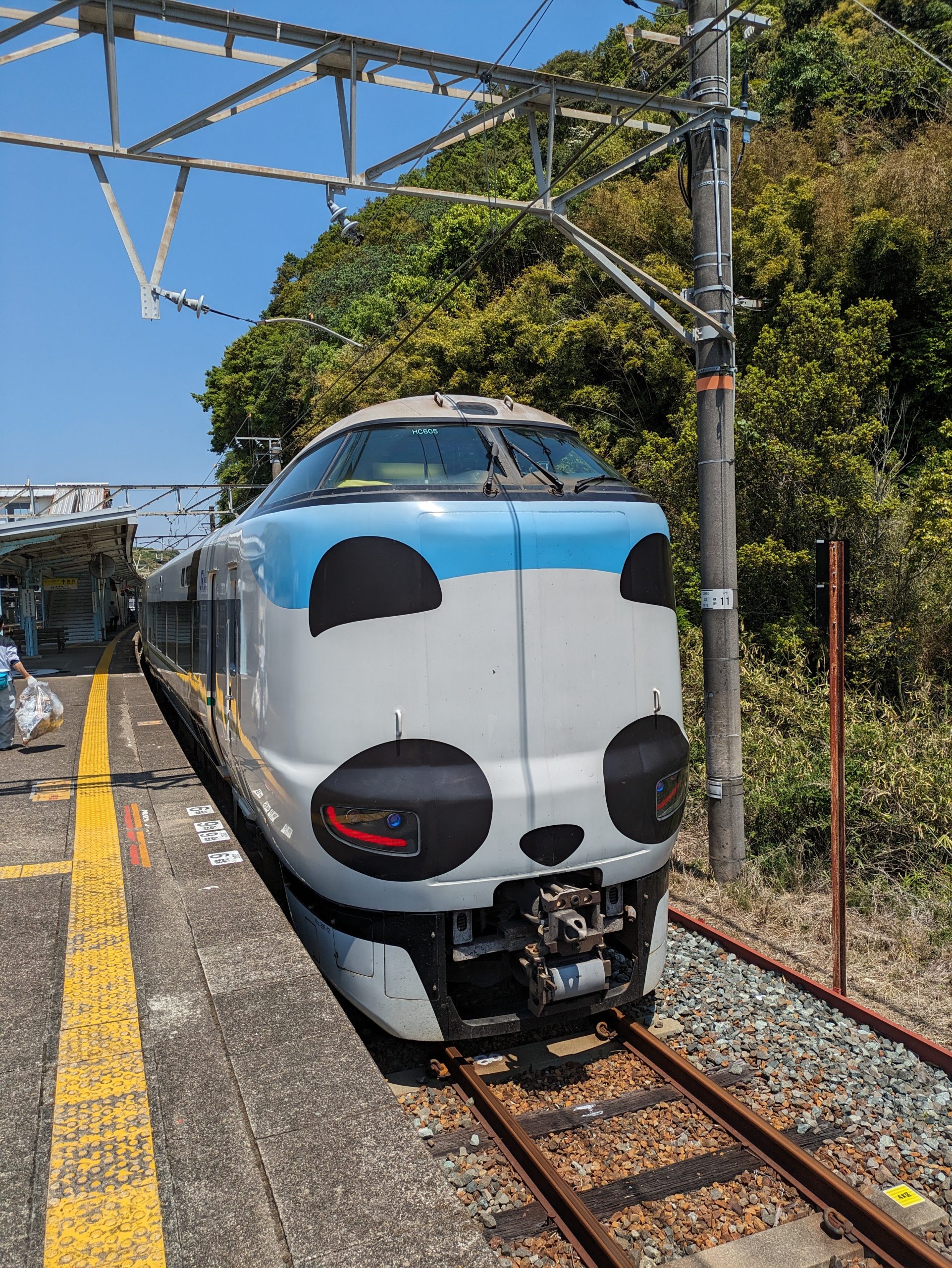
Well, had giant pandas. China took them all back in June 2025, the month after my trip ended… Even though all four were born here in Japan, China still owns them somehow (thaaaaat’s politics!) Here’s the Kuroshio limited express stopped at the station. JR West has said they’re keeping this panda, at least.
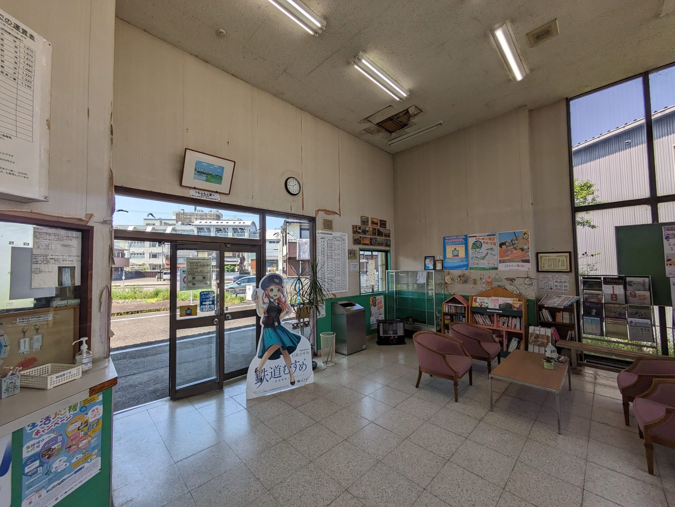
I kept riding, and an hour further west, I got off at Gobō Station to ride a very special, super short railway – the tiny Kishu Railway Line, only 2.7 km long. Besides being the shortest private railway, and second-shortest out of all railways in the country,1Behind only the third-sector Shibayama Railway (which I rode in September 2025, a few months after this trip!) That line functions as a de facto extension of the Keisei line out by Narita Airport, though… but Kishu Railway is a fully independent, standalone railway. it’s also the only private railway in the Kansai region that’s completely non-electrified. I’m so glad I rode it when I did, because in the latter half of 2025, its many troubles really started coming to light…
The line’s been deeply in the red for a long time – most people just bike or walk the short distance, and over 90% of people living in the 21,000-person city of Gobo say they “never use it”. It was previously owned by a Tokyo-based real estate company who kept it afloat due to management of a railway being something that, in their mind, indexes prestige and trustworthiness. Not just abstractly – they thought that being able to truthfully say something was developed by “XYZ Railway Company” would be advantageous, and talked about this aspect in interviews. But after being sold as a subsidiary to a Chinese investment firm a few years back, it was reported in November of last year that they’re now in a “management crisis” and trying to close the line due to how much of a money sink it is. Then in December, a level crossing malfunctioned, and it took a few months and a ton more money to repair it, sending them even deeper into unprofitable territory.
So now this Chinese company is trying to find a buyer, otherwise they’ll shut it down, maybe as soon as this year. It only costs ¥180 to ride the full line… Usually a railway company could just raise fares to try and help support itself a bit better, though, right? Nope – because to raise fares, they need to submit an application to the Ministry of Land, Infrastructure, Transport and Tourism (MLIT) – and in this comedy of errors, the person in charge of that had left the company, leaving them with a staff of only seven people, and now they have no one trained on how to fill out the forms. So they’re literally unable to raise fares. Bureaucracy, Japan.2If you’re interested, there’s more reading on this in Japanese here, here, and here.
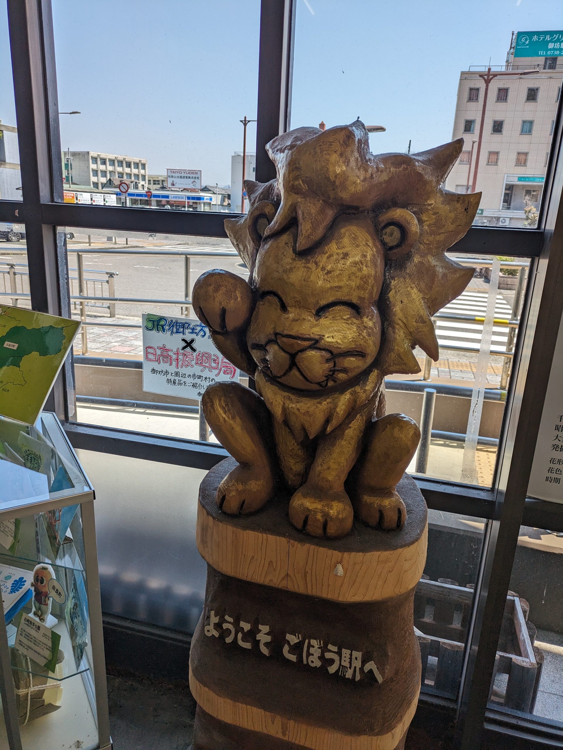
This isn’t a beckoning cat, or maneki-neko, but instead a maneki-lion! It was presented to the station in 2022 by the Gobo City Lions Club.
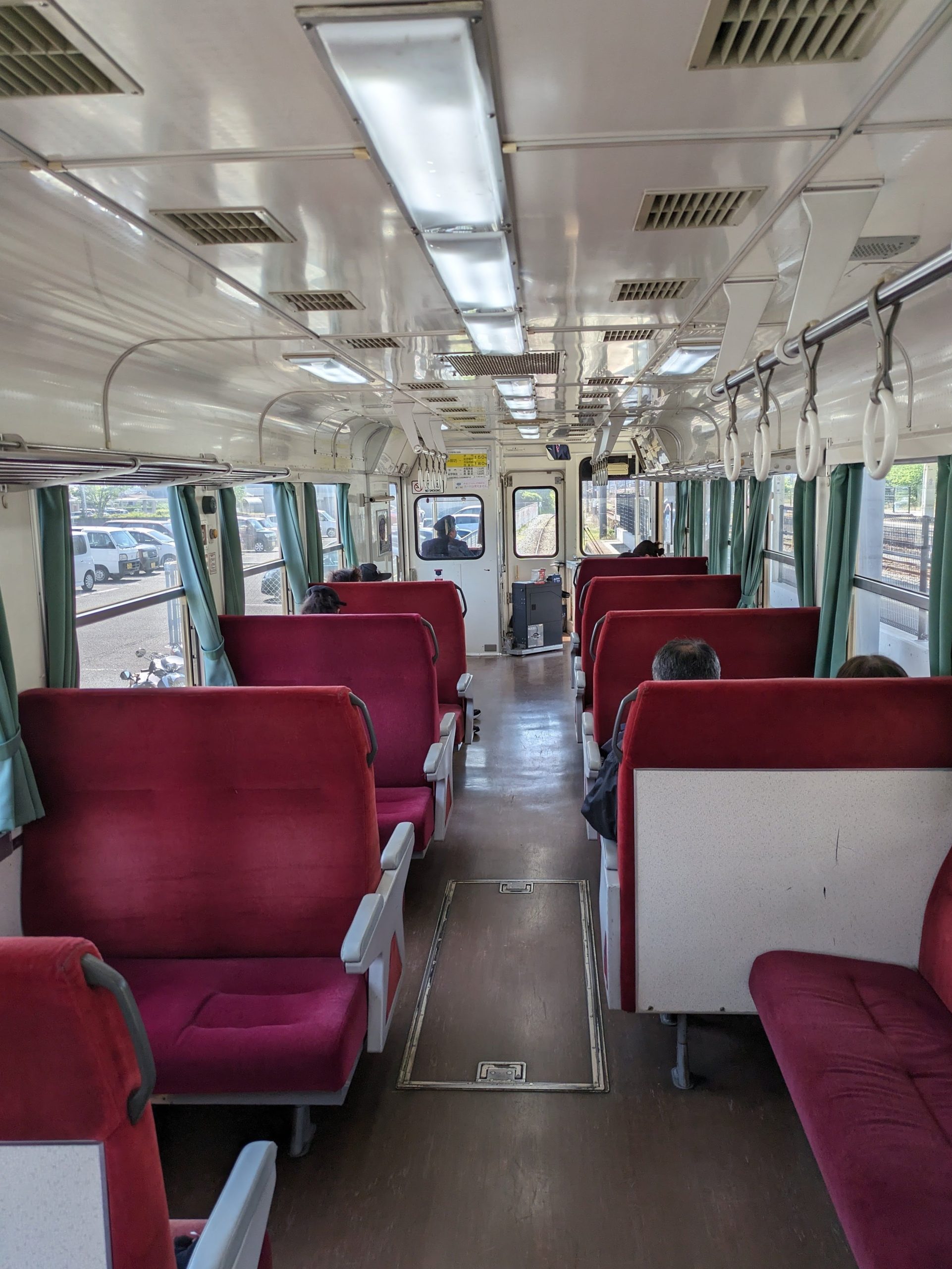
The inside of my small train. They share the JR-managed station, and trains leave from platform 0. You take a numbered ticket when you board and pay the driver on the train with cash when you alight. There were actually like a half dozen other people riding!
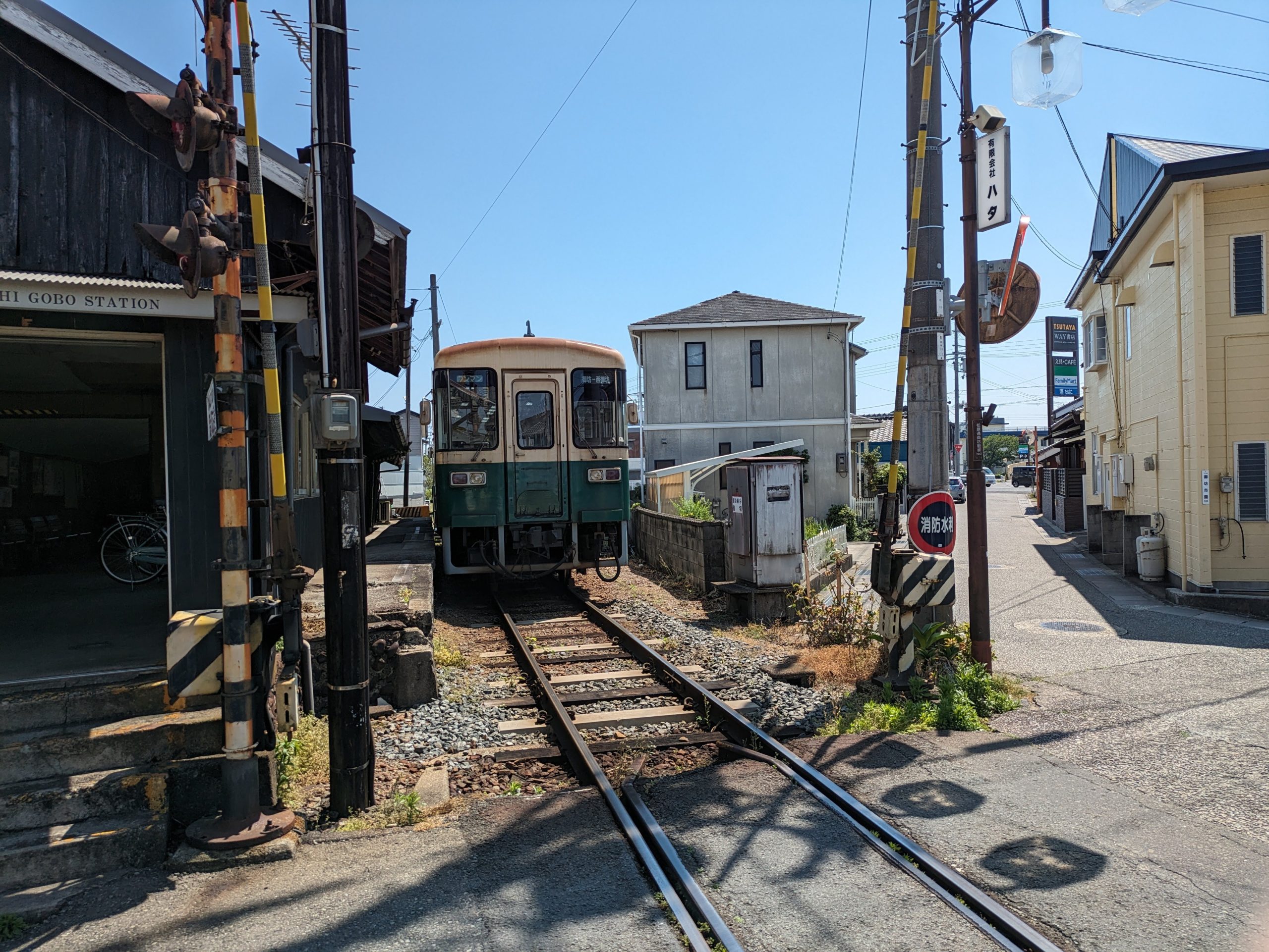
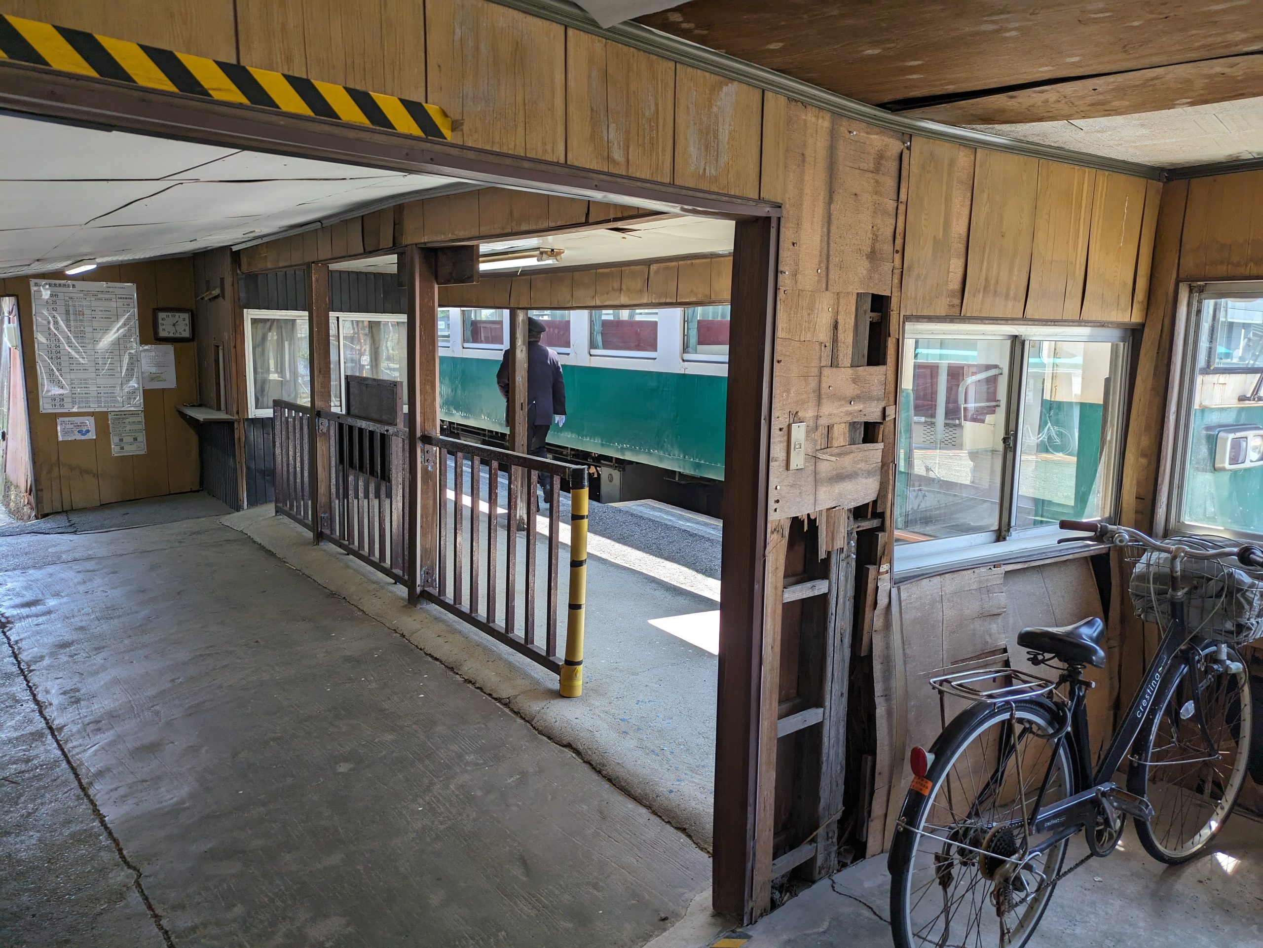
My train, parked at the terminus, Nishi-Gobo Station. The line used to go even further but was truncated in 1989. The station building wasn’t in the best condition, but a dad and his young son were still enjoying taking some commemorative photos there.
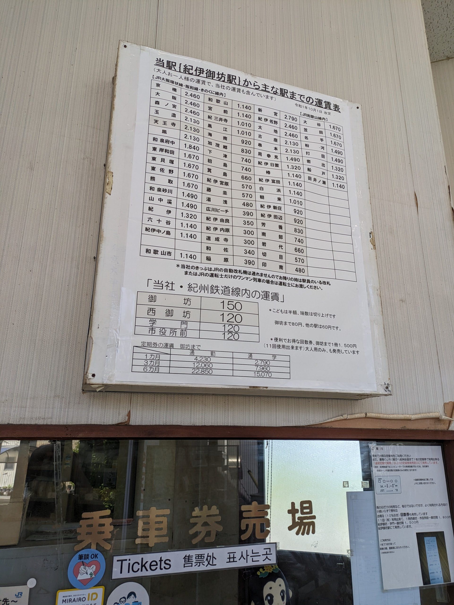
The waiting room of Kii-Gobo Station, the largest station on the line and the only staffed station with a ticket counter. The fare board most prominently advertised connecting fares to the JR line, for those heading up to Osaka or Wakayama City. They had eki-stamps and a little library of books to read.
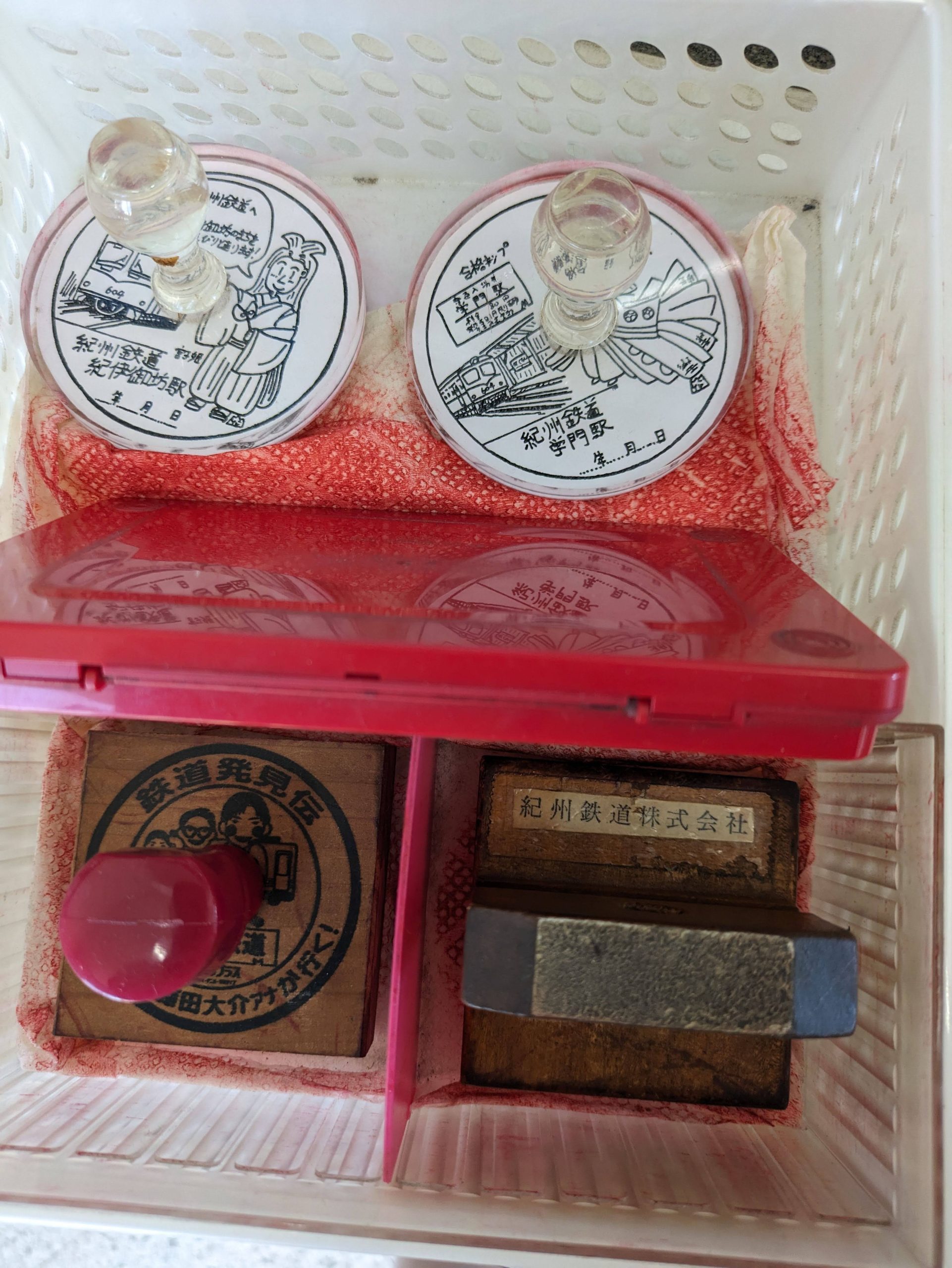
The eki-stamp in the bottom right is from a Nippon TV Plus documentary-style variety show called 鉄道発見伝 Tetsudō Hakkenden – “Railway Discovery Chronicles” – that aired for ten years, from 2013 to 2023. The show featured one of the channel’s announcers, a railfan, going around to different railway lines and companies across the country to showcase them and preserve their history in video.
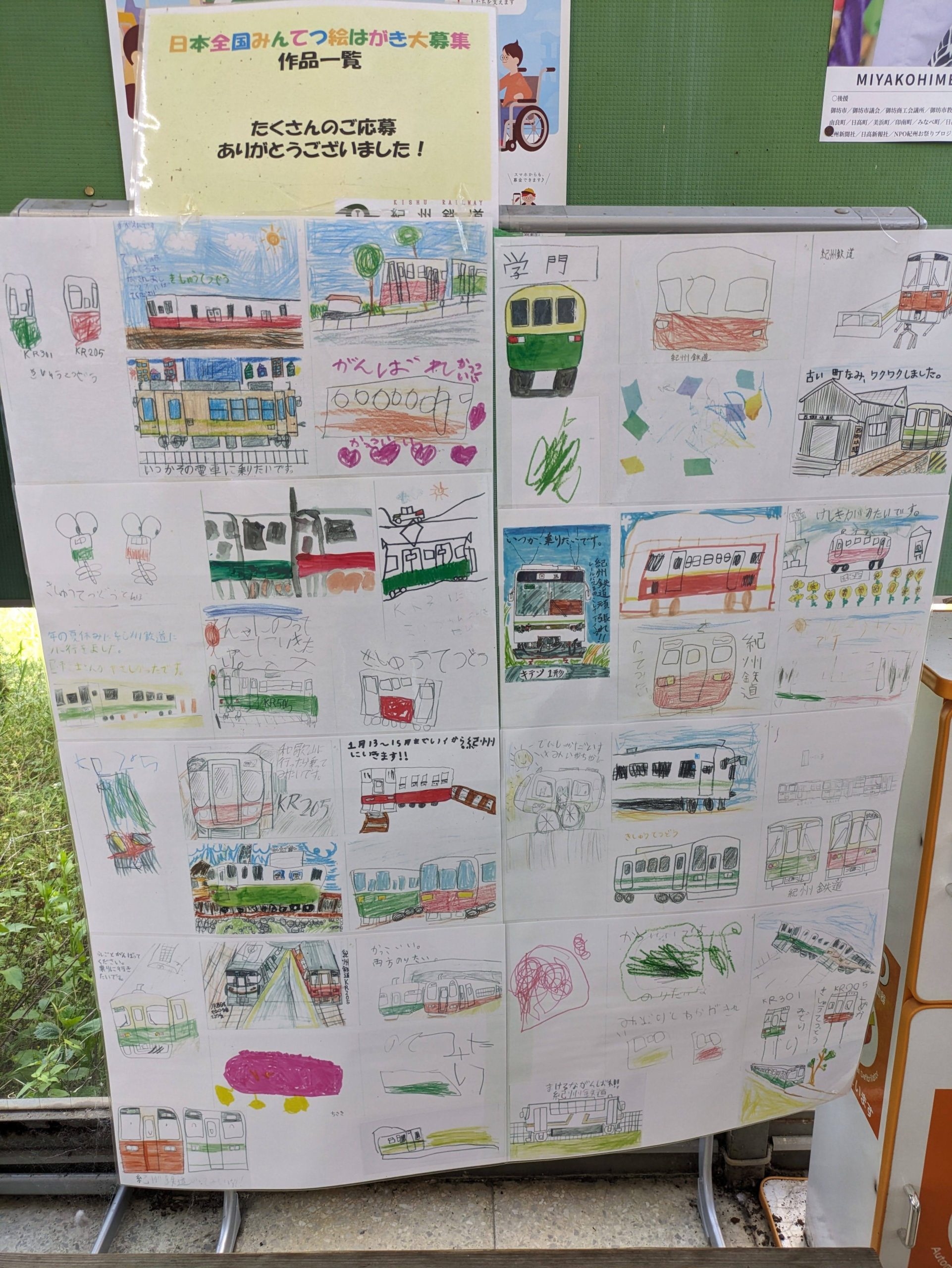
The network also left each company with a special stamp as a memento of the visit. I always love coming across these at the stations I visit! (The one from Kii-Gobo was my 10th overall one!) Plus, Kishu Railway trains doodled by local kids :’)
I unfortunately helped propagate the vicious cycle of “unprofitable line, service cuts, unprofitable line, service cuts…” It was faster to walk back rather than wait for the train, and that also allowed me to get those stamps, and see the station above – plus grab some quick curry rice for lunch from a cafe – so I had nice stroll through Gobo on my return to the JR station.
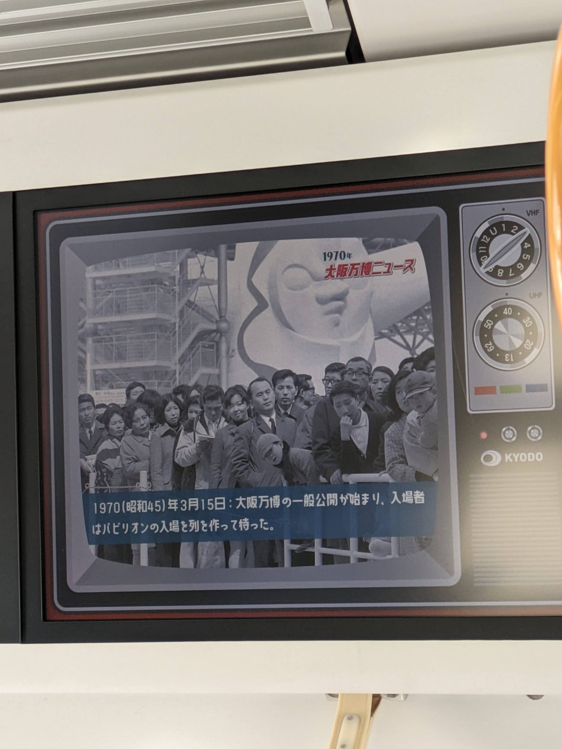
My favorite Taro Okamoto and the Tower of the Sun spotted on the screens on the JR West train!
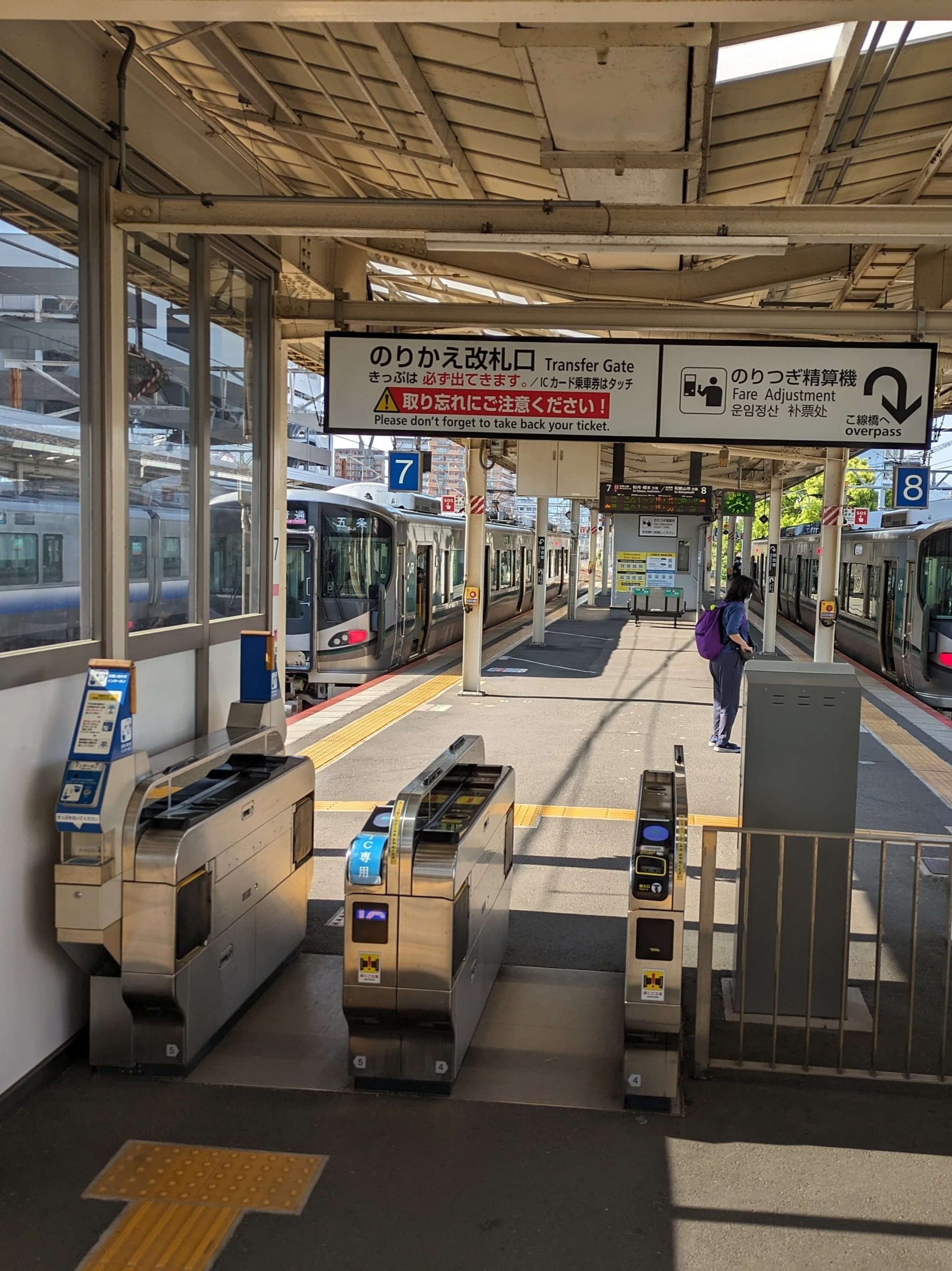
Weird transfer ticket gates guarding the entrance/exit to one single platform? Must be Wakayama Station!
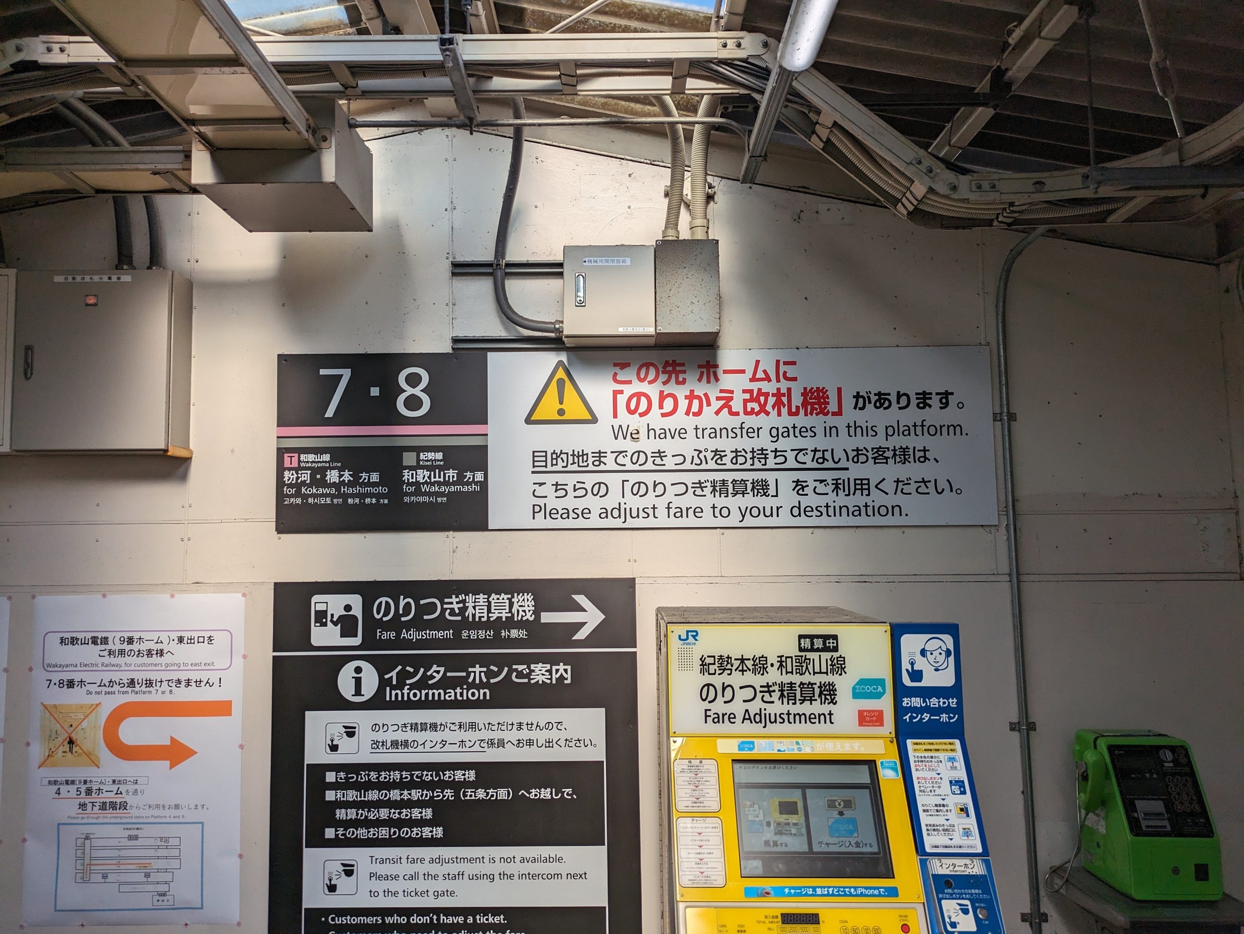
I suspect the reason that platform 7/8 has these is that eastbound trains on the Wakayama Line and westbound ones on the Kisei Line stop here – and lots of stations on those lines are unstaffed, so this helps cut down on potential fare evasion, not letting people transfer to/from those lines without proving they’ve paid the right amount for the section they’ve already ridden.
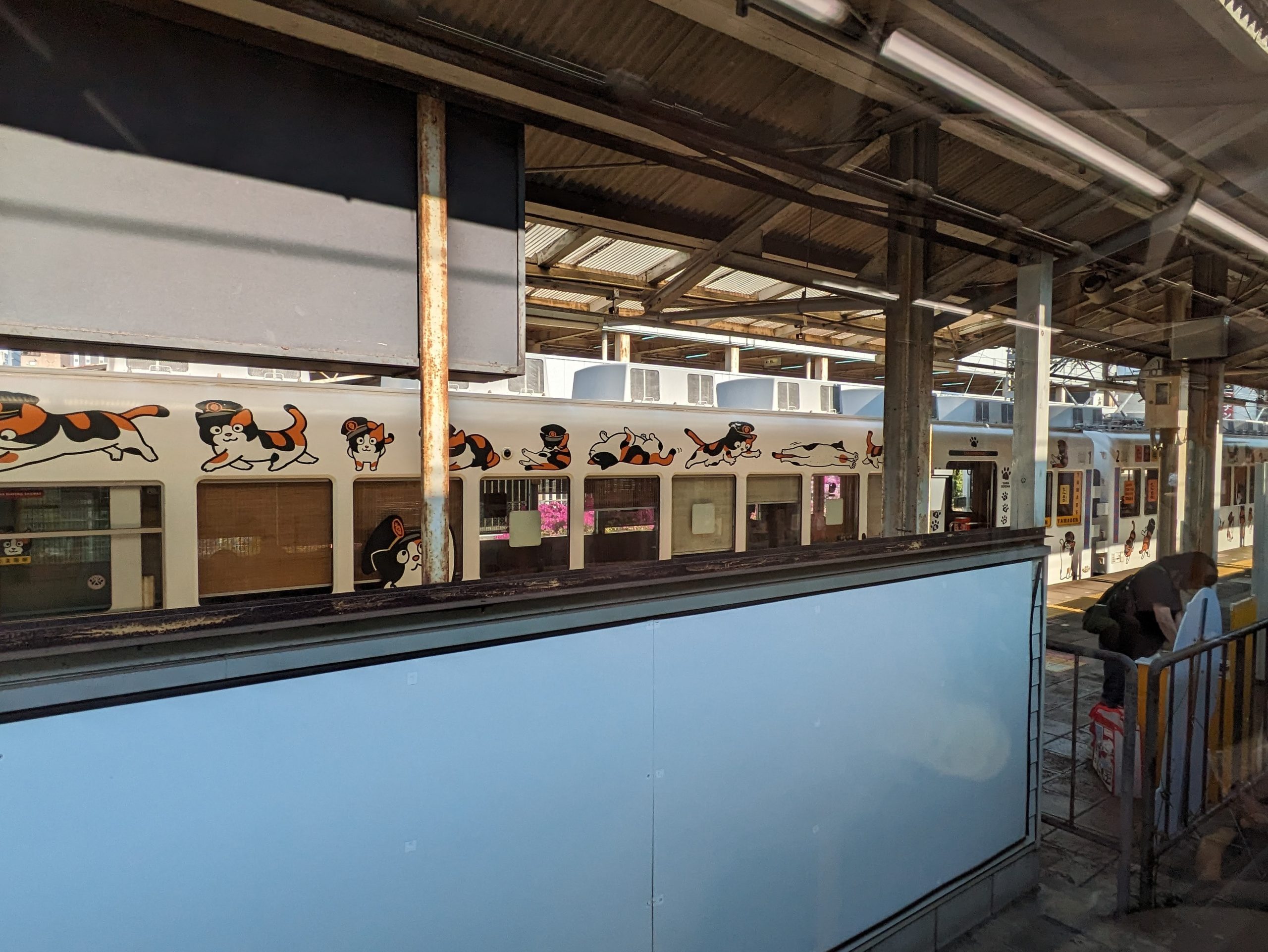
And, across the barrier, I see a Wakayama Dentetsu train (which I’ve ridden! it’s so magical!) featuring Tama, the Honorary Eternal Stationmaster cat. He’s one of the mascot plushies I have on my bag.
From here, I transferred from JR to a small line run by Nankai Electric Railway, Japan’s oldest private railway.3Taking into account corporate lineage and the like. The line exists to connect Wakayama City to Wakayama Port, where Nankai also runs the ferry over to Tokushima, Shikoku. Unfortunately, as I was working on writing this blogpost in March 2026, it was announced that the ferry service would be shutting down permanently in 2028. (As a result, the future of the train line is being questioned too.) Pretty sad news considering how great of a way I found it to get between these two places. So go and ride it while you can!
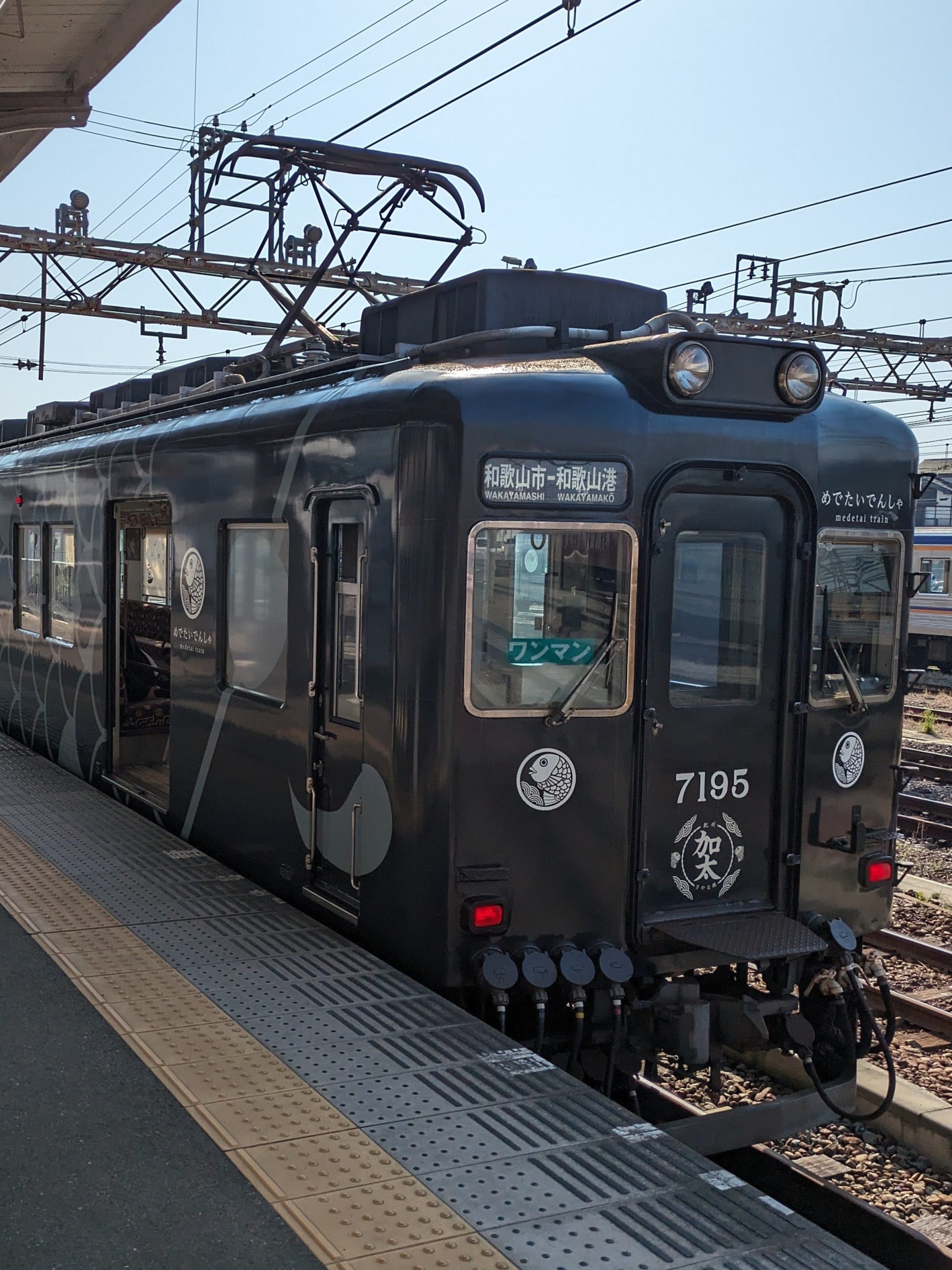
My train to get to the port had this cool black livery…
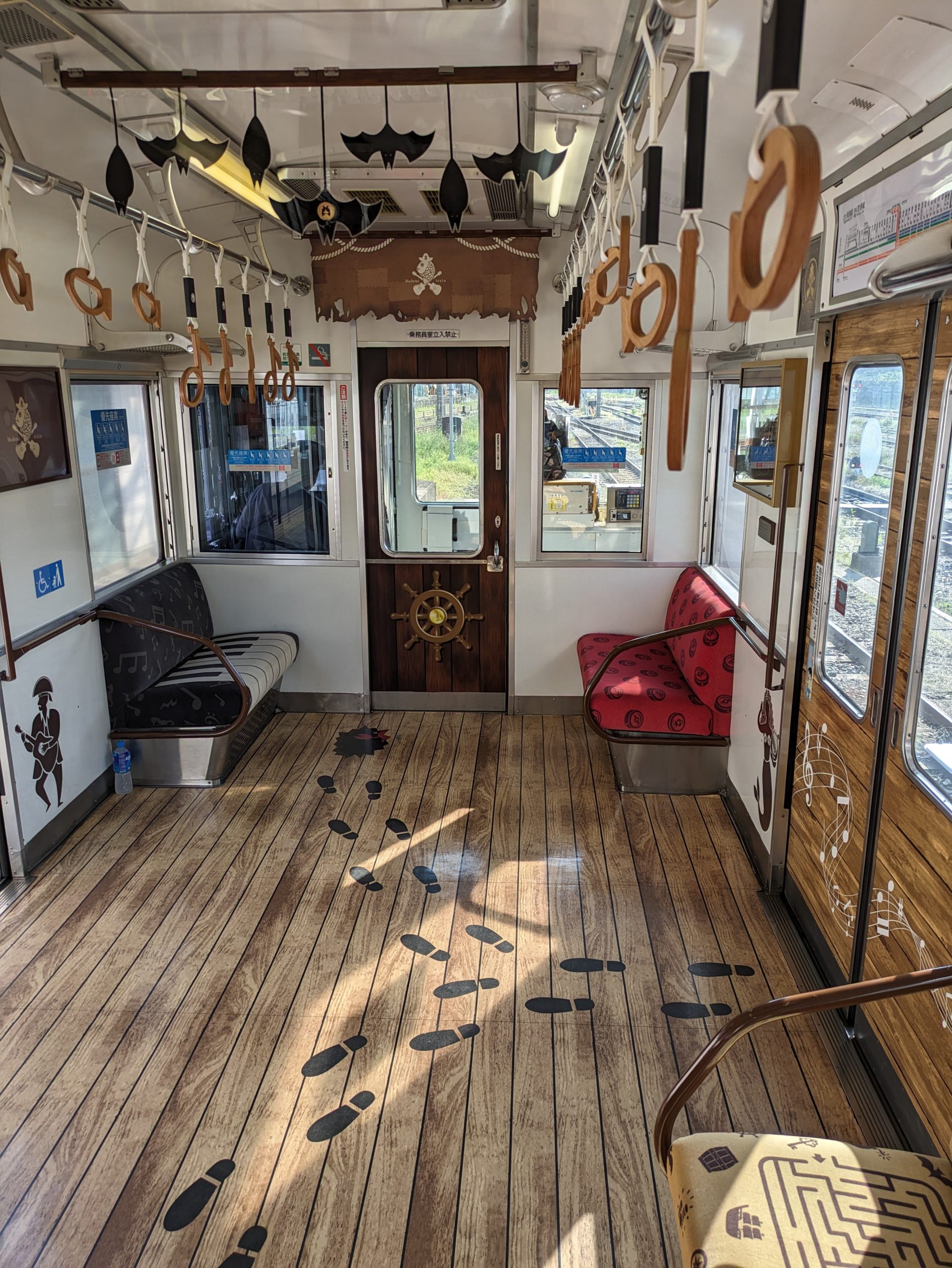
…and inside it was decorated like a pirate ship?!?!?
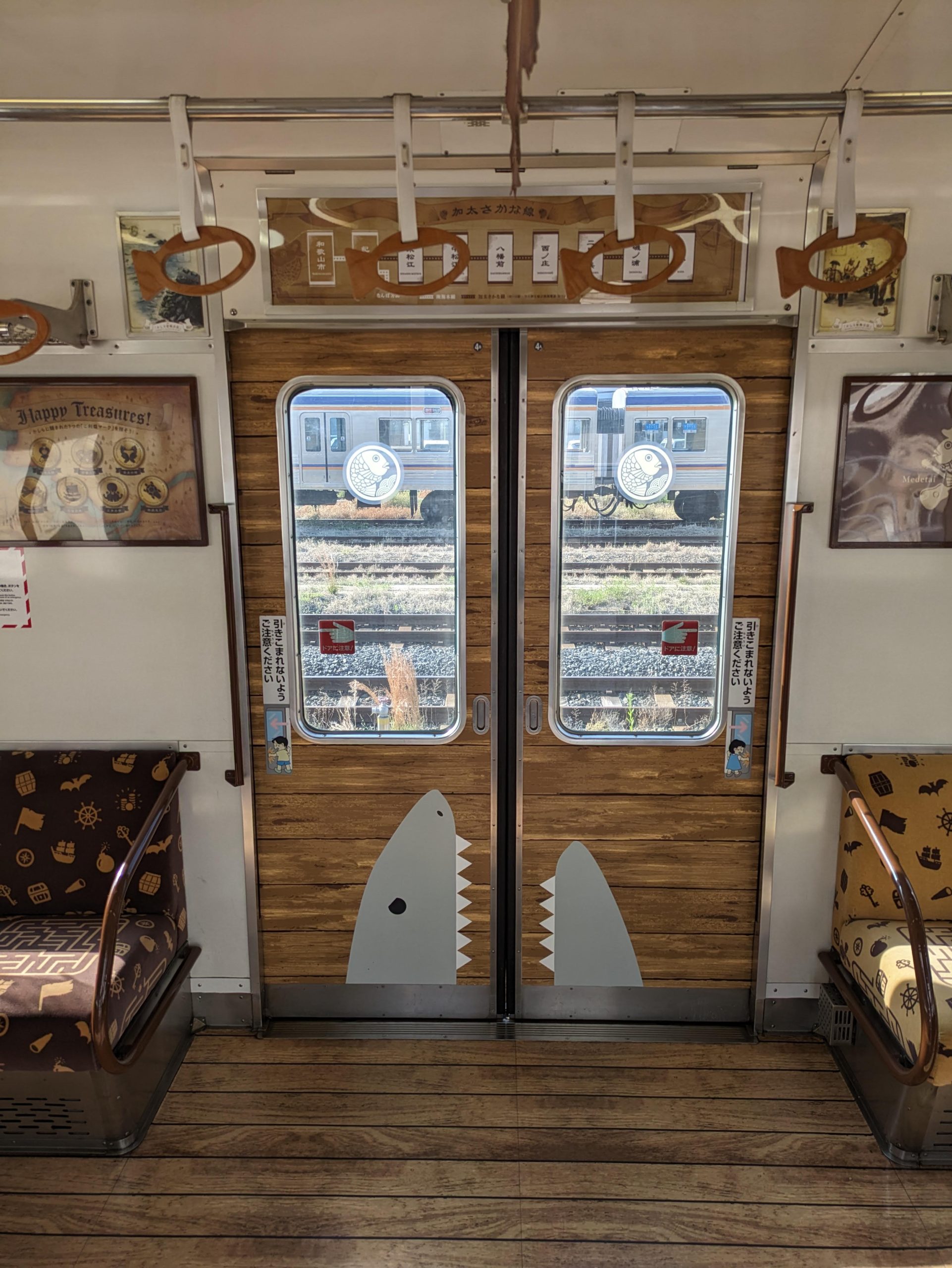
I loved the shark on the door and the treasure map-like route diagram, not to mention the fish hand straps. And the curtains for where ads are usually displayed were rolled up like hoisted sails!!
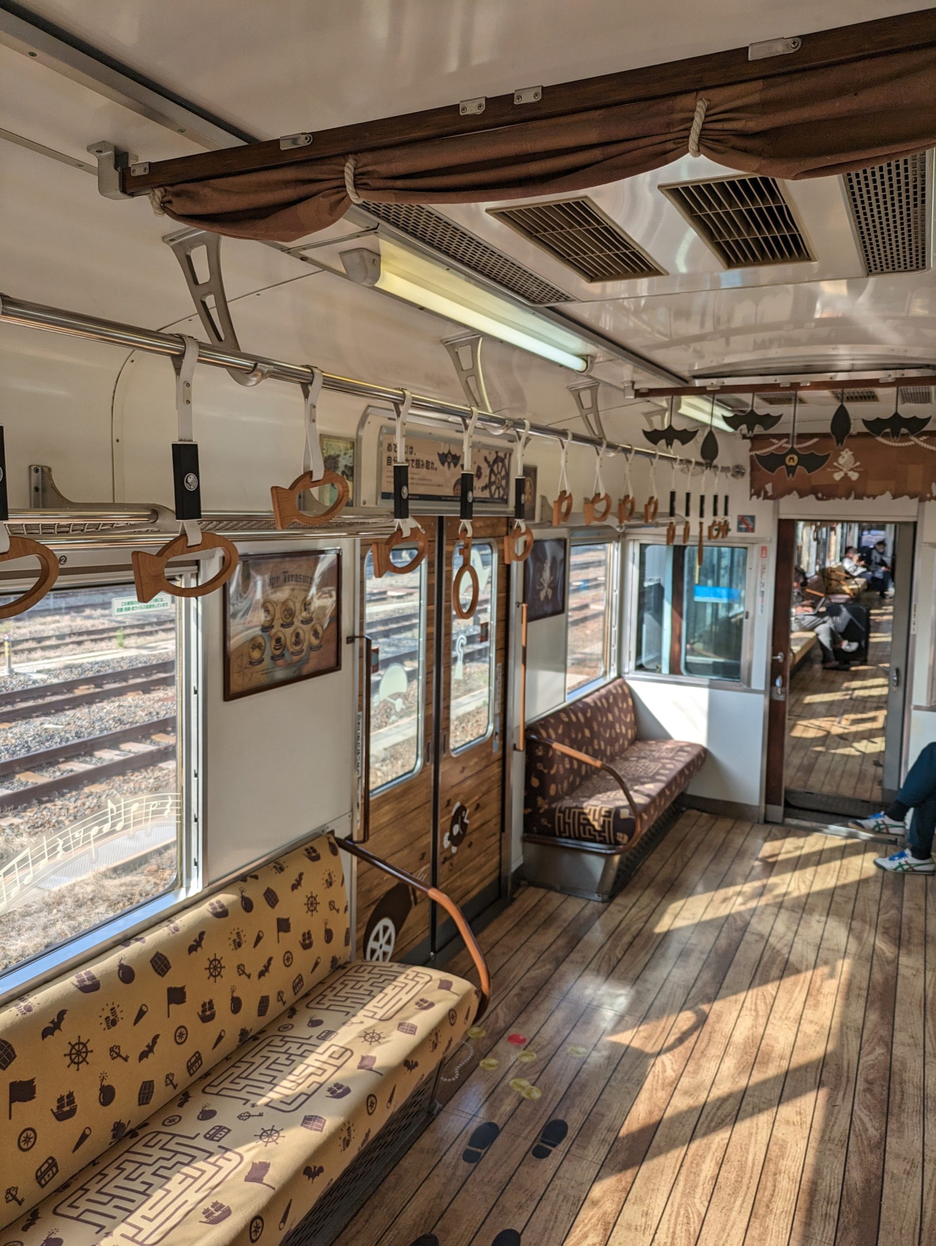
This is one of Nankai’s “Medetai Trains” – the “Kashira” design, specifically – and is (somehow??) related to a Wakayama-born musician named HYDE. It looks like this train doesn’t usually run on this route, so I got lucky!
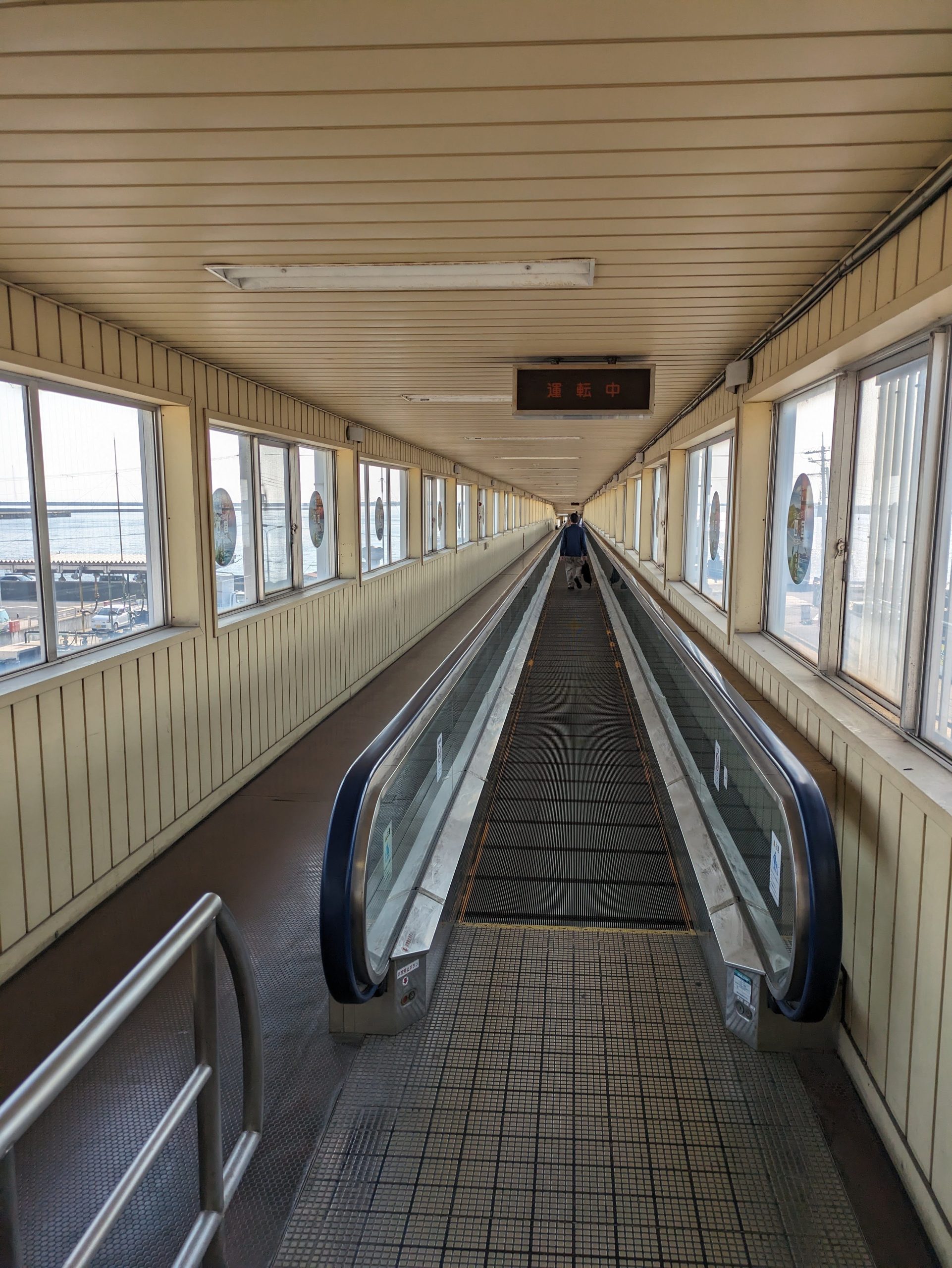
The hallway from the train station to board the ferry was looong – so long they had moving walkways!
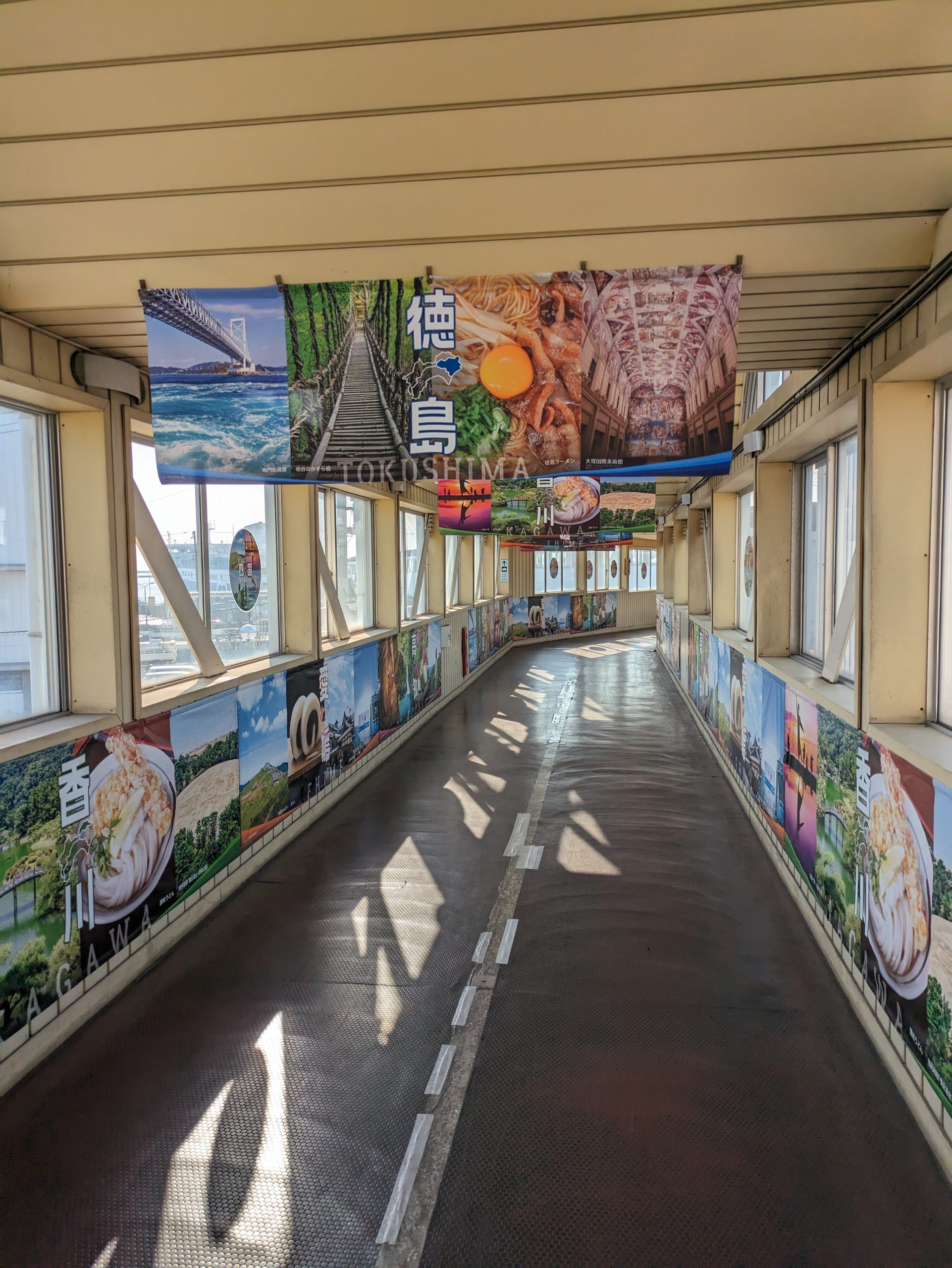
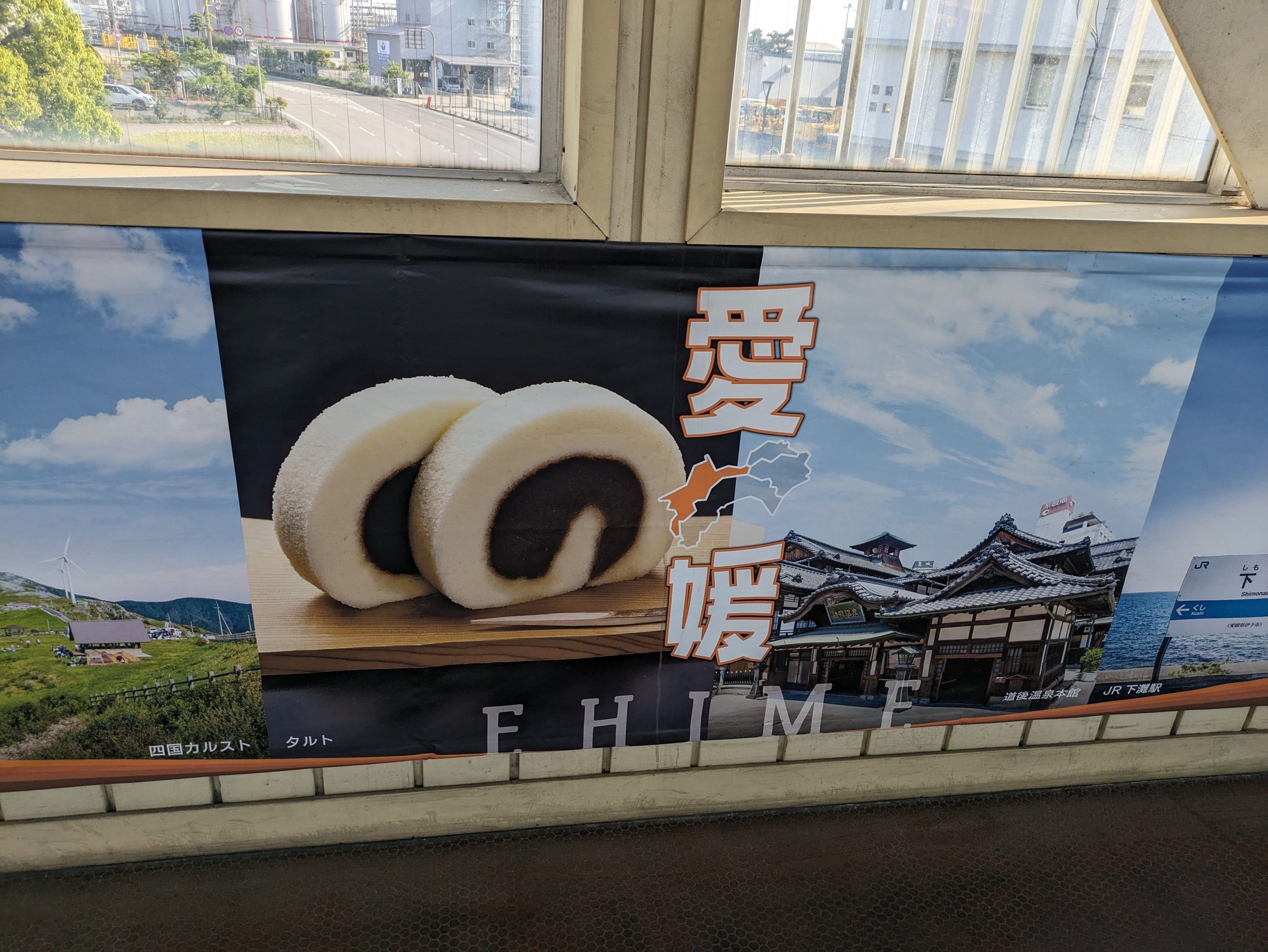
The sights of Tokushima stared to appear in the hallway. Not only Tokushima, but I see delicious sanuki udon from Kagawa on the walls too…
Ichiroku Tarts spotted!!! (Go read my blogpost on Juzo Itami if you don’t know what these are.)
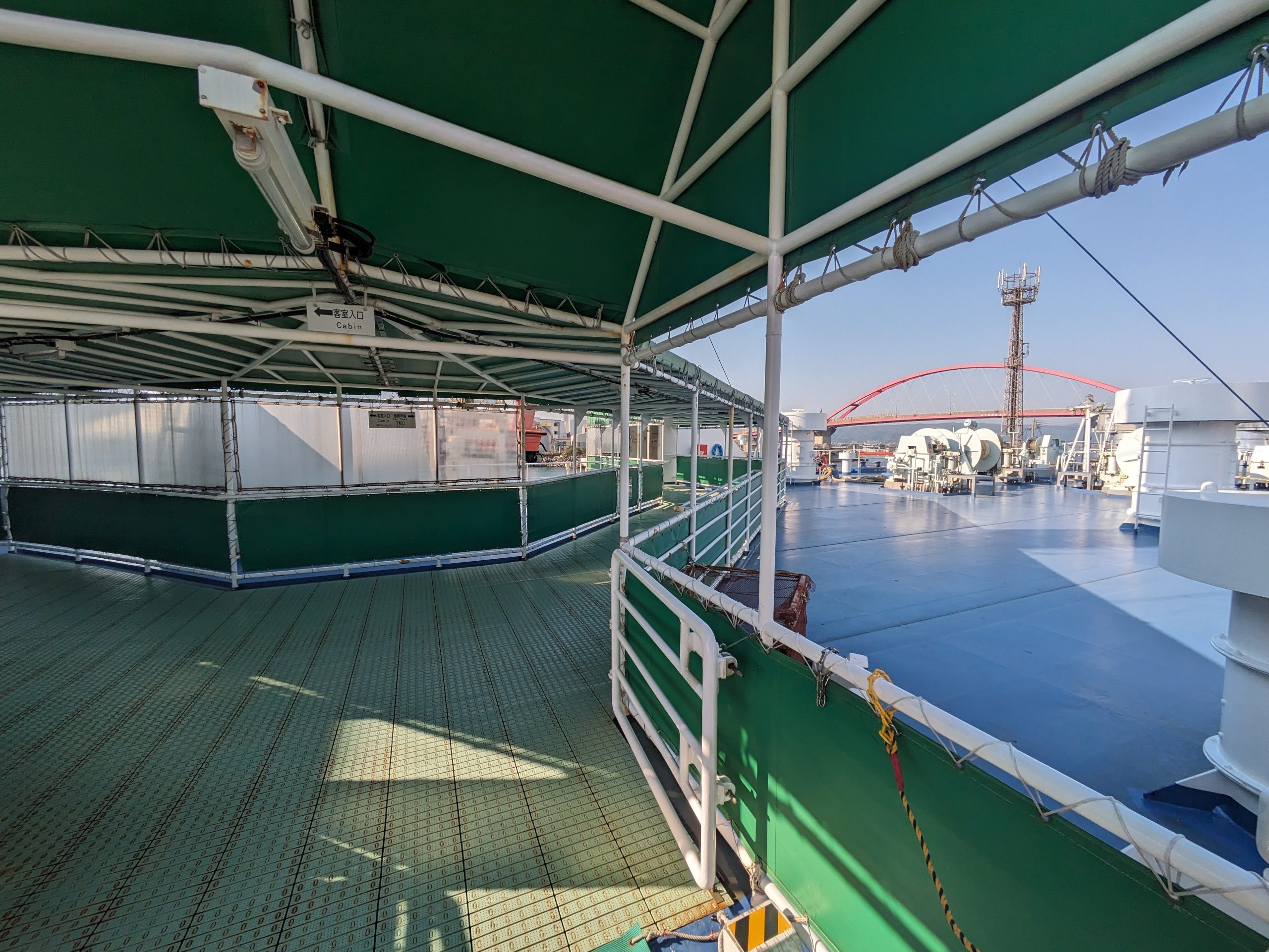
Connected deck to walk onto the ferry. I’m trying to include a lot of photos here for archival sake as it’s going to be discontinued in a few years!

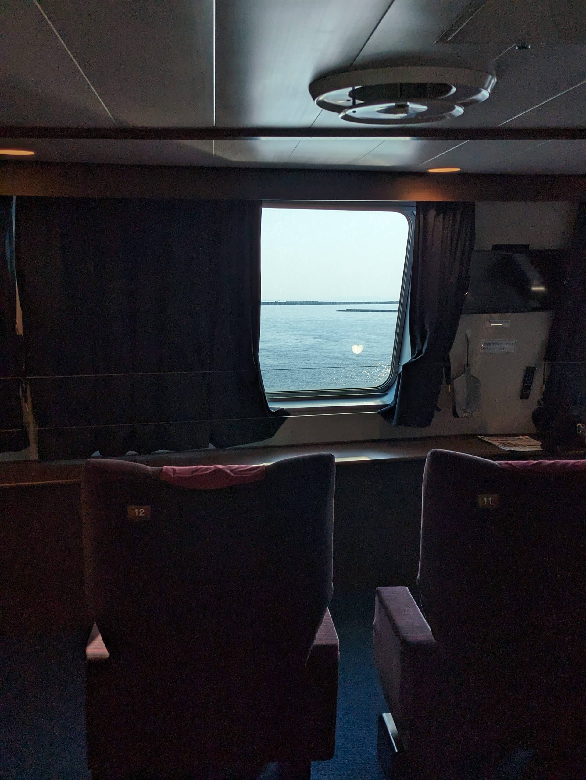
Cool ferry! The ride there takes 2 hours and 20 minutes, and the boat was pretty comparable in size to the, say, Seattle–Bainbridge Island ferry in Washington.

In very Japanese fashion, though, they had a tatami room where you could just lounge on the floor. I spent most of the ride here.
Some nice views out the front window, made nicer and cozier by the half-closed shades.
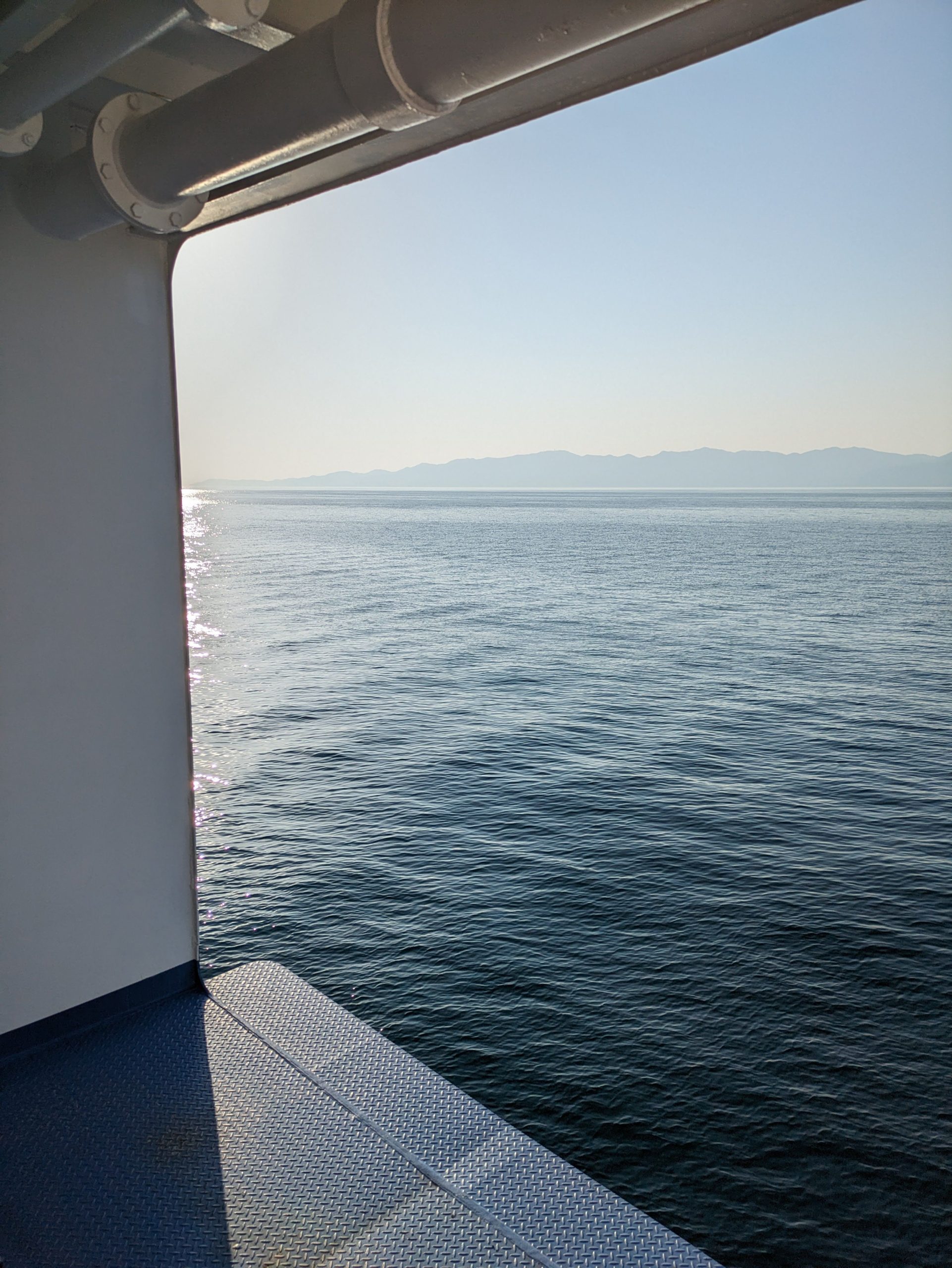
For as obsessed as Japan is with safety, the side here was just wide open…
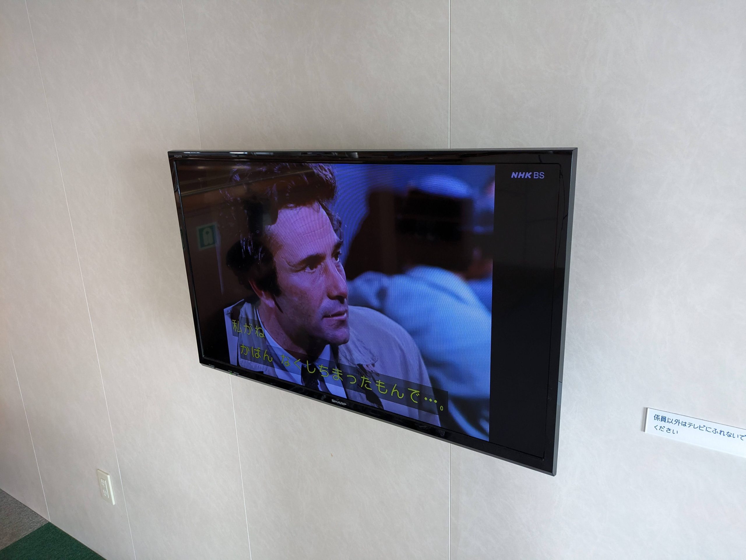
I really don’t know how to express just how much Japan loves Columbo. But they do.
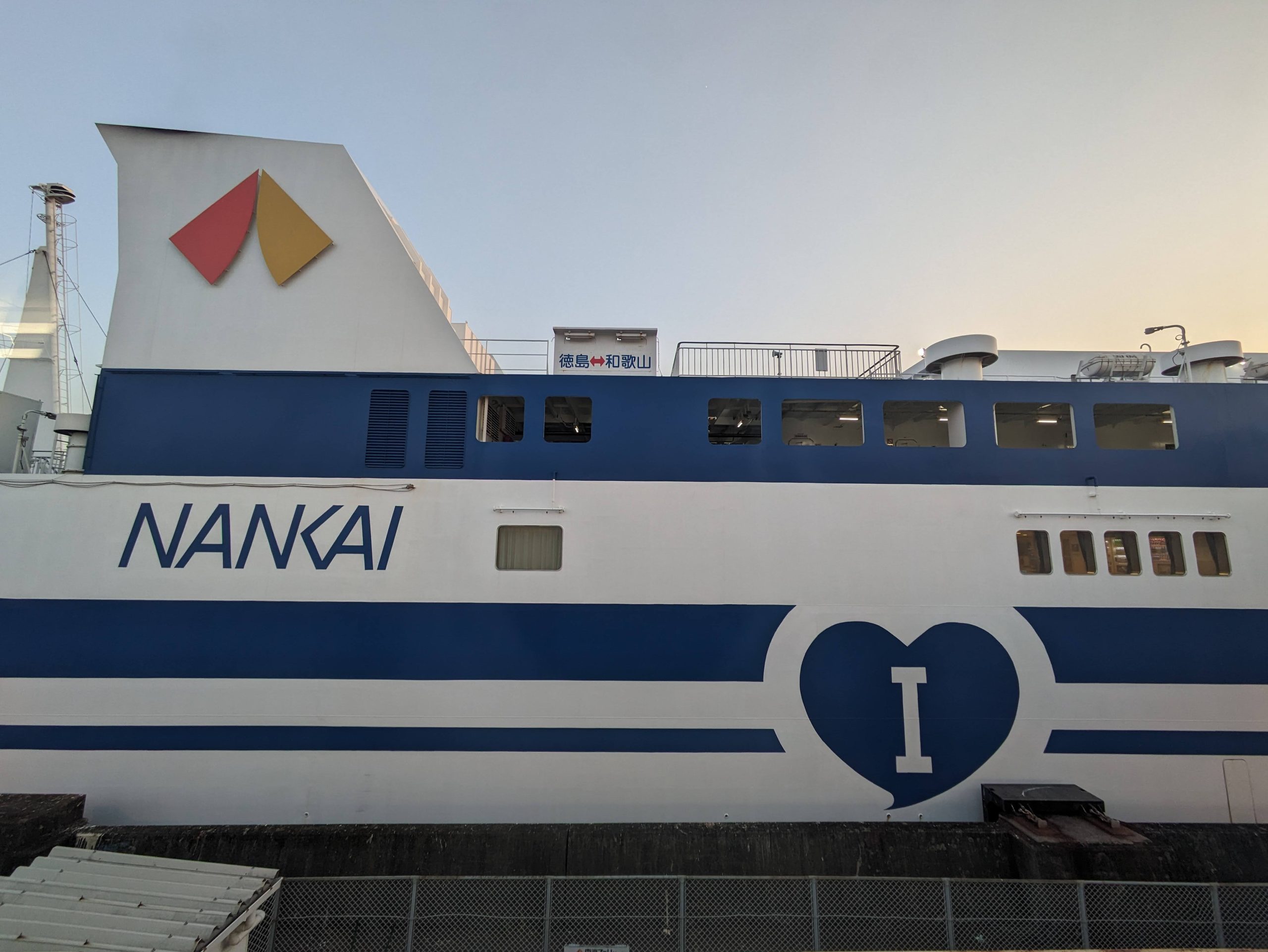
Nankai Ferry has two vessels, the Katsuragi and this one. It’s officially romanized “I”, but in Japanese spelled あい Ai, meaning “love”.
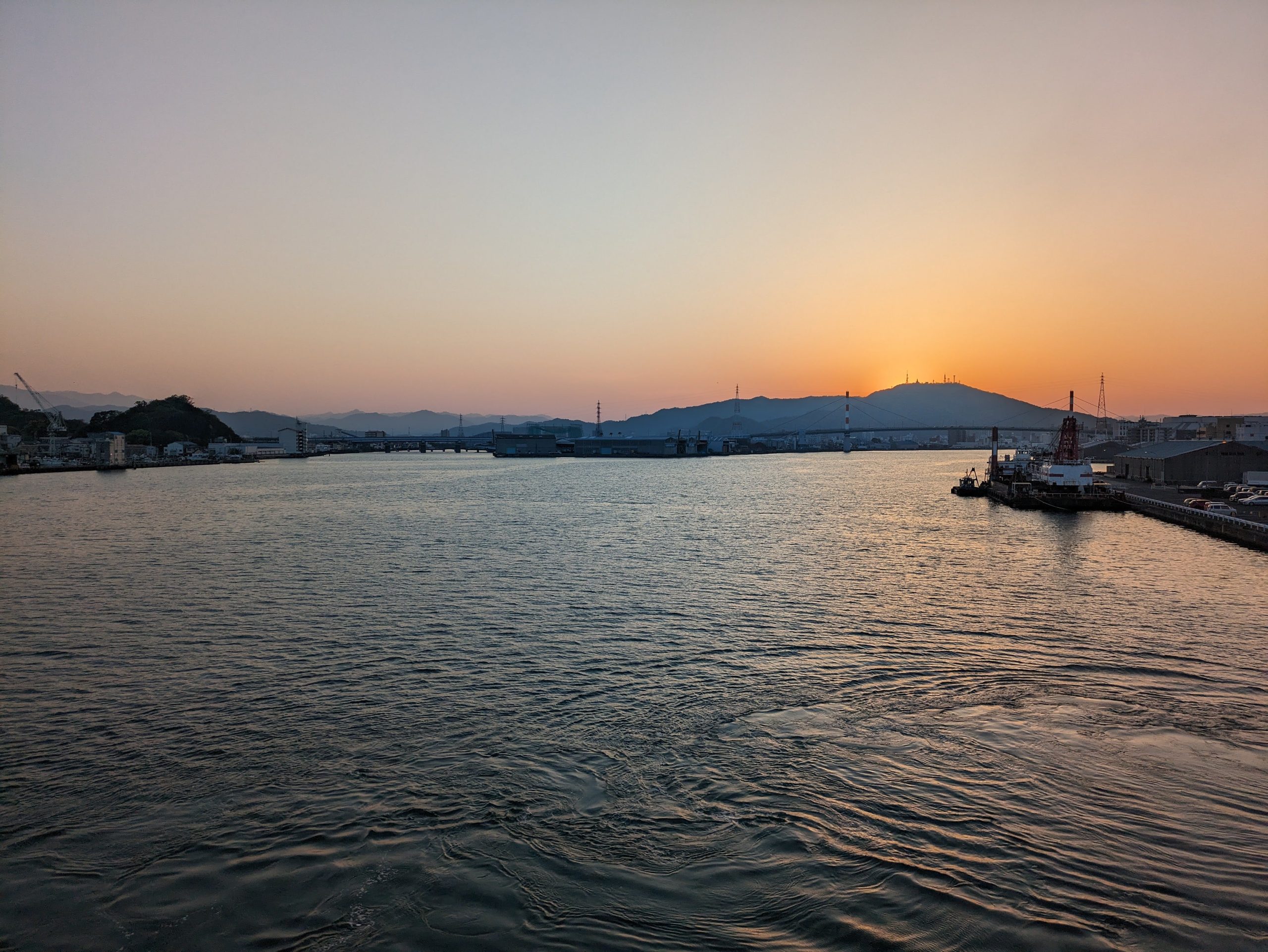
Arrived just in time to see a nice sunset across the port. The ferry usually costs ¥2500 (plus they have a transfer discount with the railway line too) but I got to ride for ¥500 due to a coupon I had gotten from the Kansai Pavilion at the World Expo earlier that month – which I went to, of course, to get the Myaku-Myaku commemorative ICOCA. (The “Kansai” Pavillion included Tottori and Tokushima, so, uhhh, quite broadly defined lol.)

Here’s my ticket I purchased, plus the coupon from Expo 2025 which they were giving to attendees in hopes it’d help encourage people to go ride the ferry… they were pretty shocked when I told them I already had plans to go ride it less than two weeks later! When I got in to Tokushima Port, I simply handed them both, and they refunded me 80% of my fare in cash. Crazy deal. I guess I’m not helping the ferry survive either…
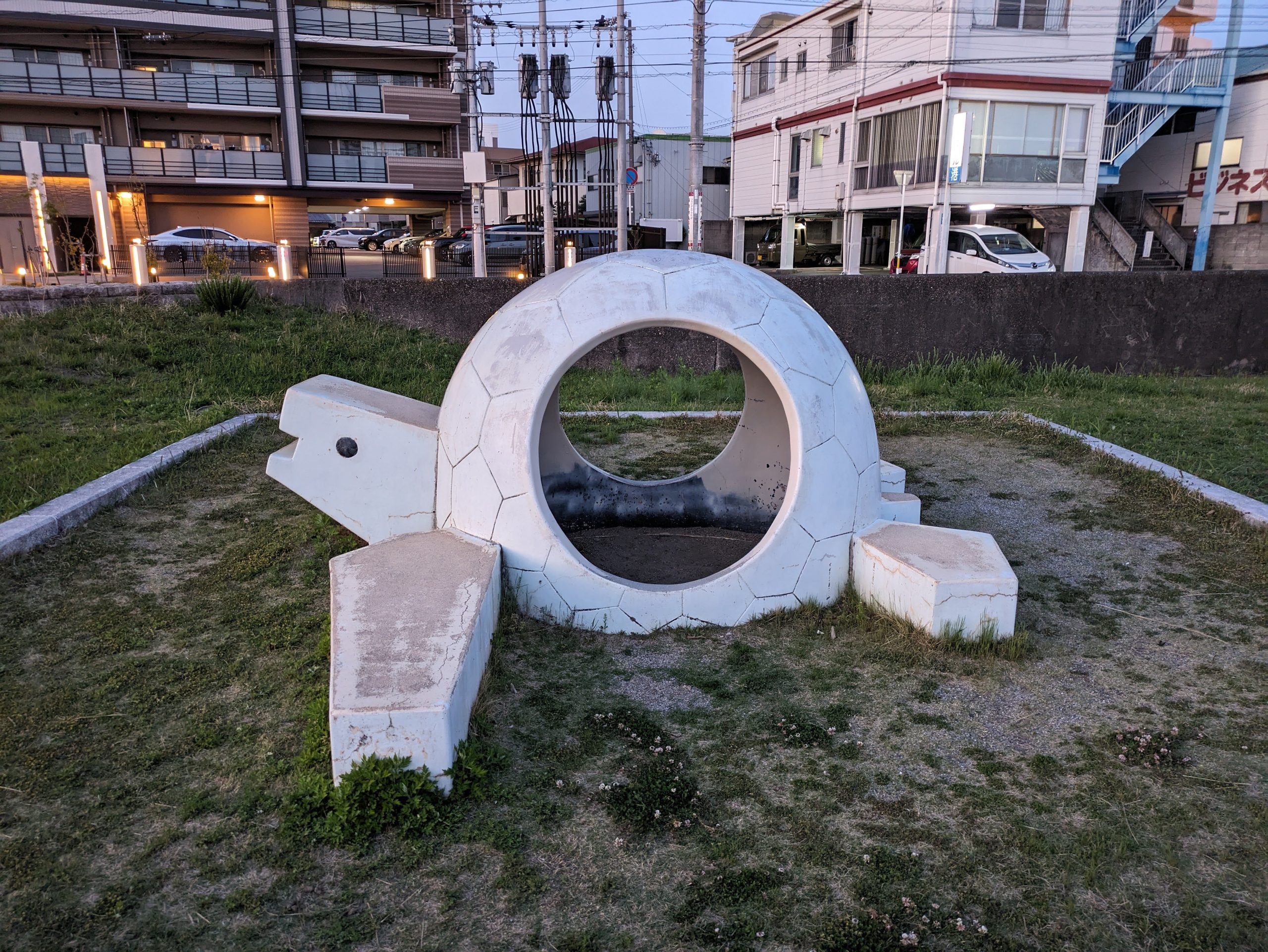
It was a bit over an hour walk into the main city and to my hotel. Opting for that over the bus let me see some of the city on the way, including this great circular turtle guy.
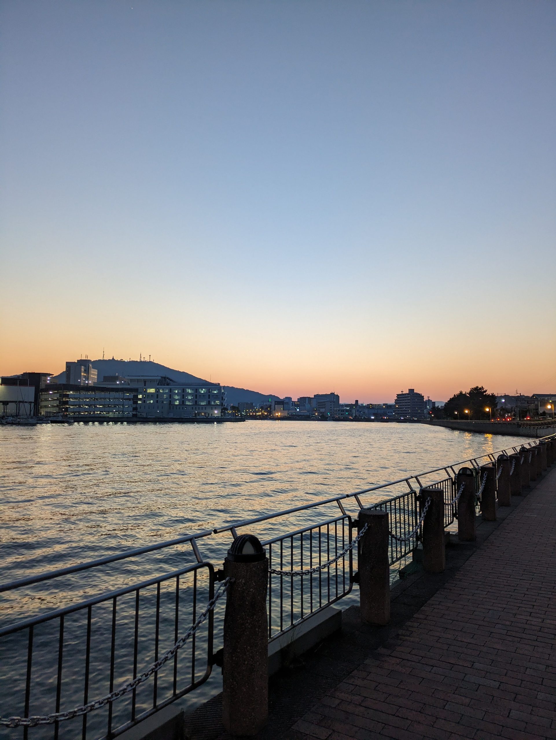
The Shinmachi River, which runs through the heart of Tokushima City.
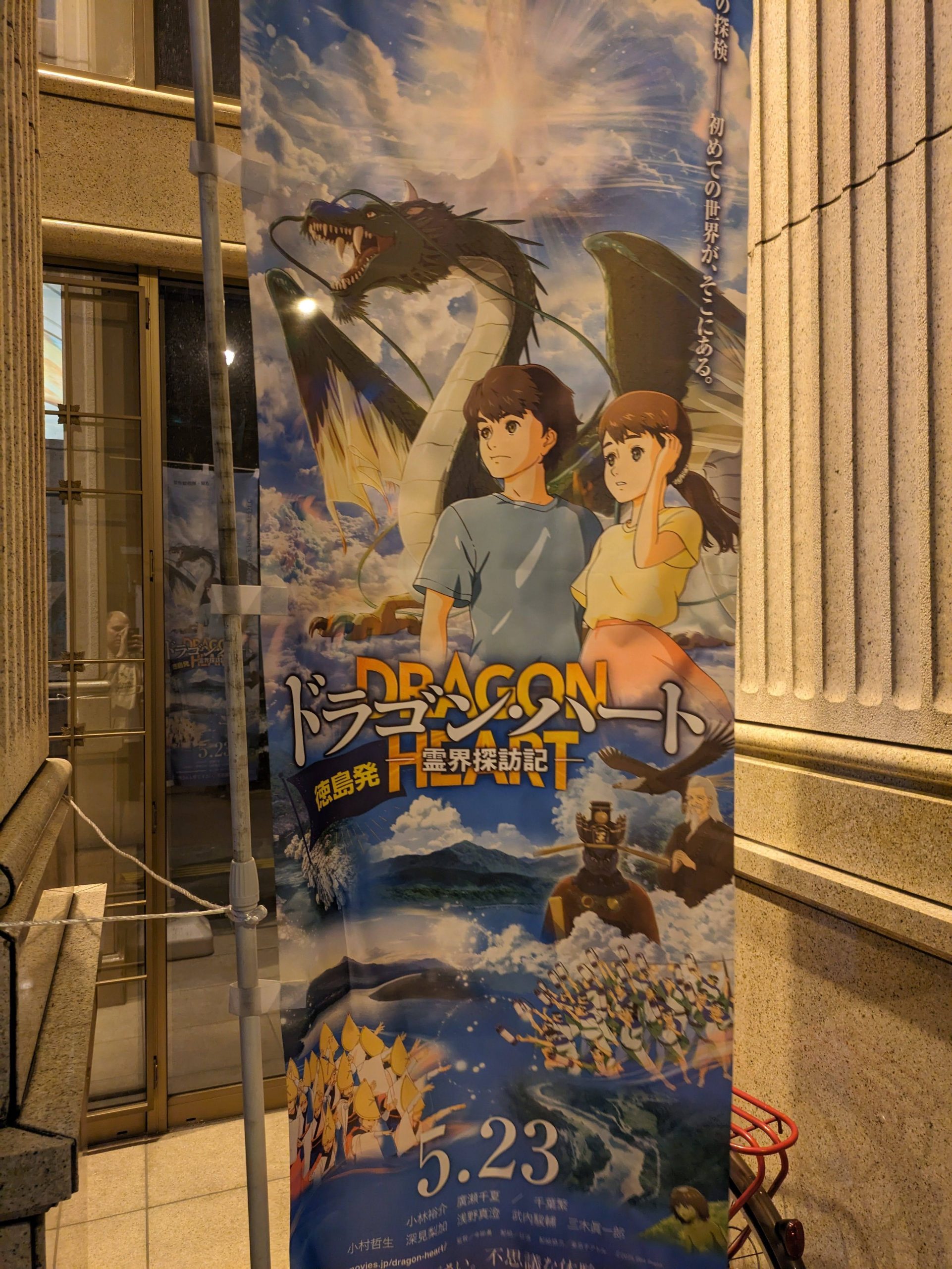
Oh no oh god it’s the latest propaganda anime film that’s promoting the Happy Science cult.
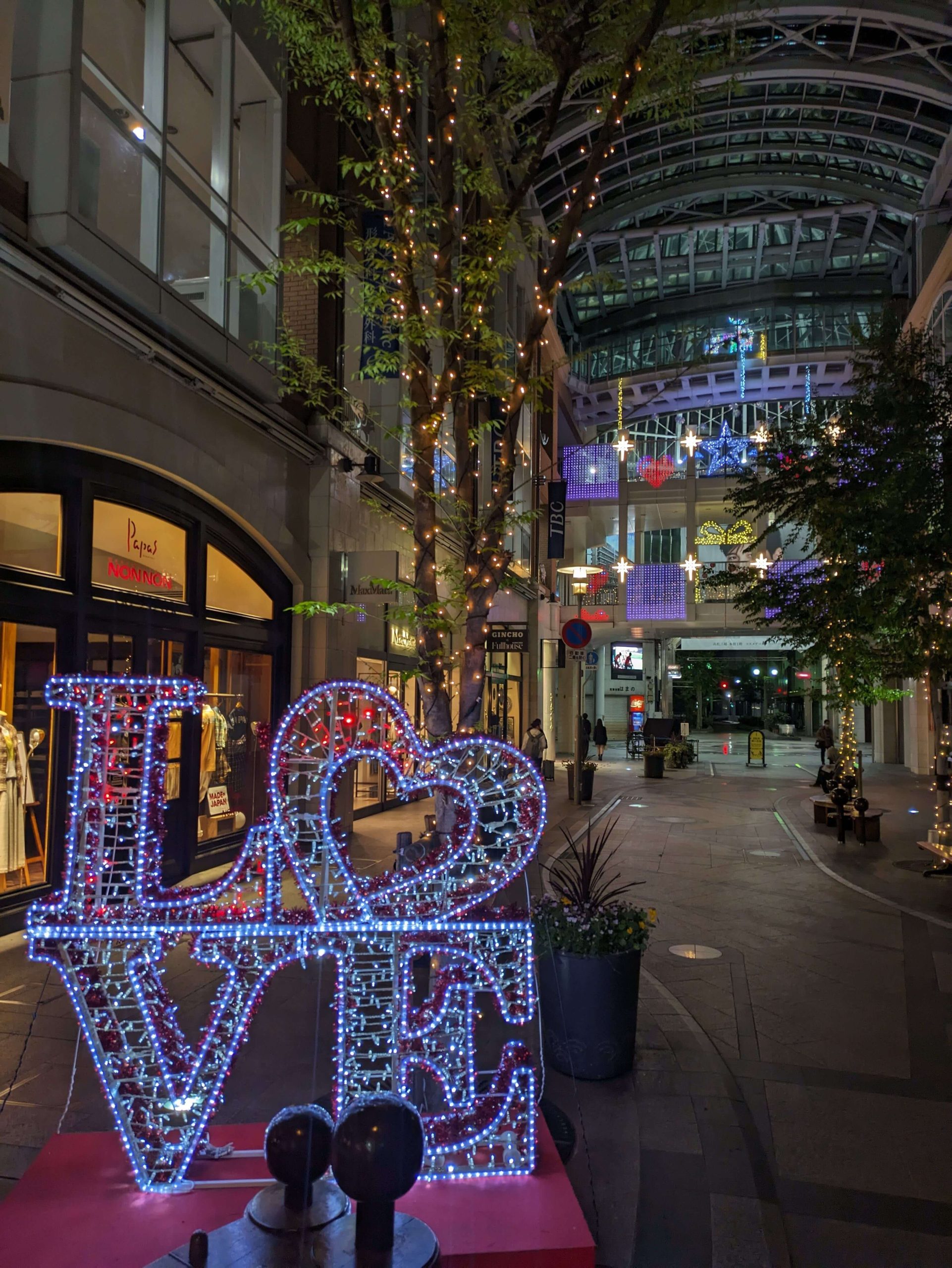
After dropping my bag at my hotel, I went to see a performance of Awa Odori. (Just as “Kii” is the old feudal province name for the present-day Wakayama Prefecture, “Awa” is the old name for Tokushima. These pop up everywhere all over Japan once you start to notice them.) In Japan, Awa Odori is probably the thing that Tokushima is most famous for – a dance style and gigantic festival that’s held every August, with 12,000 dancers and over a million visitors who come to spectate. A local history museum right by my hotel, the Awa Odori Kaikan, puts on five demonstration shows every single day with all sorts of different dance troupes taking turns performing for locals and tourists.
I made it just in time for the 8 p.m. evening performance and it was so cool.
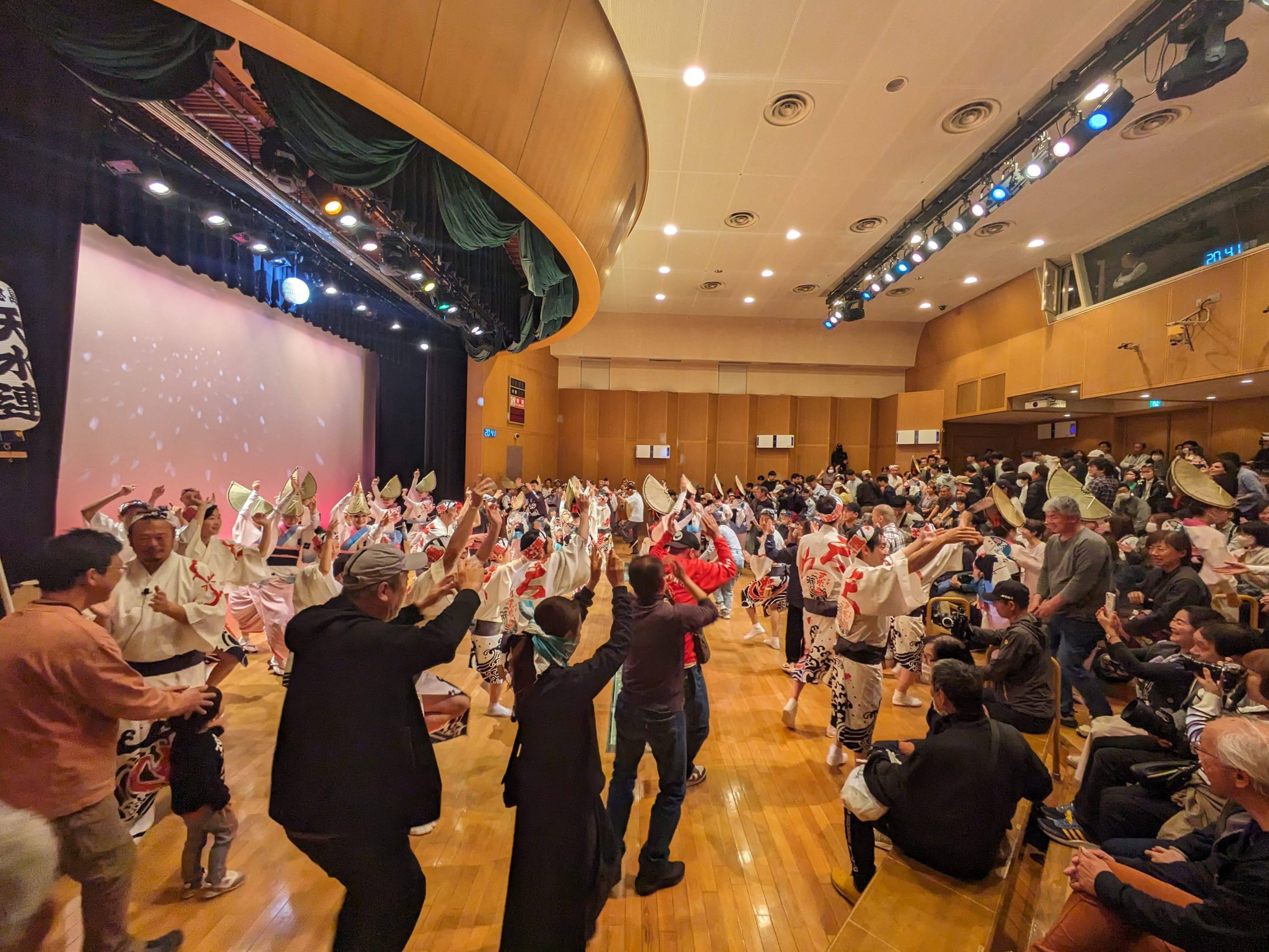
Participation was encouraged! After some demonstrations and explanations, everyone was invited to come up and essentially just party and have a good time. One of the lyrics to the central song can be translated along the lines of “The dancers are fools, the watchers are fools, both are fools alike, so… why not dance?”
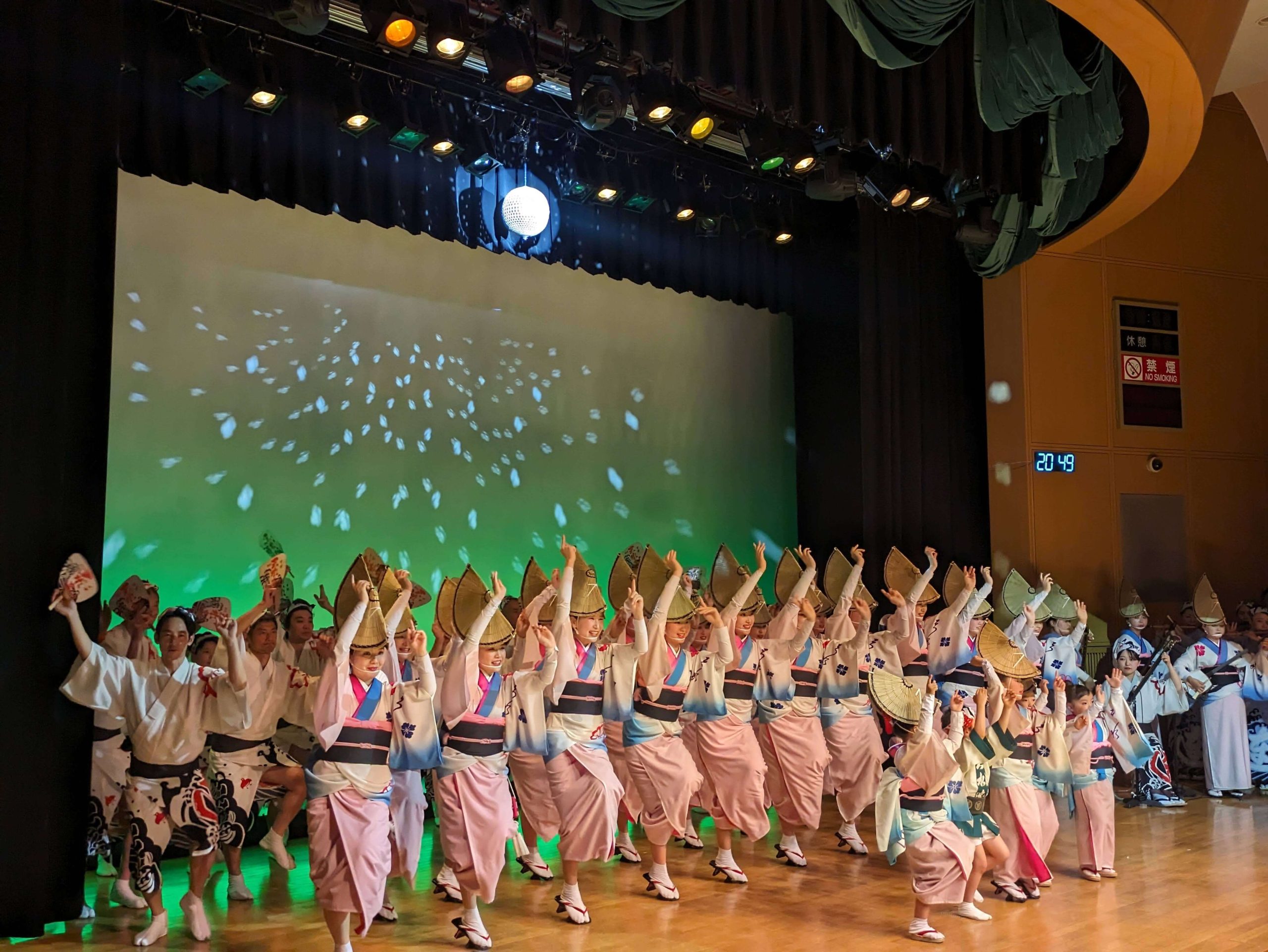
There were different dancing styles for men and women, and for different roles and ages of performers too. I sat next to a very spirited kindergartener who was beyond excited to see his mom performing – she had started dancing college and kept doing it as a hobby ever since.

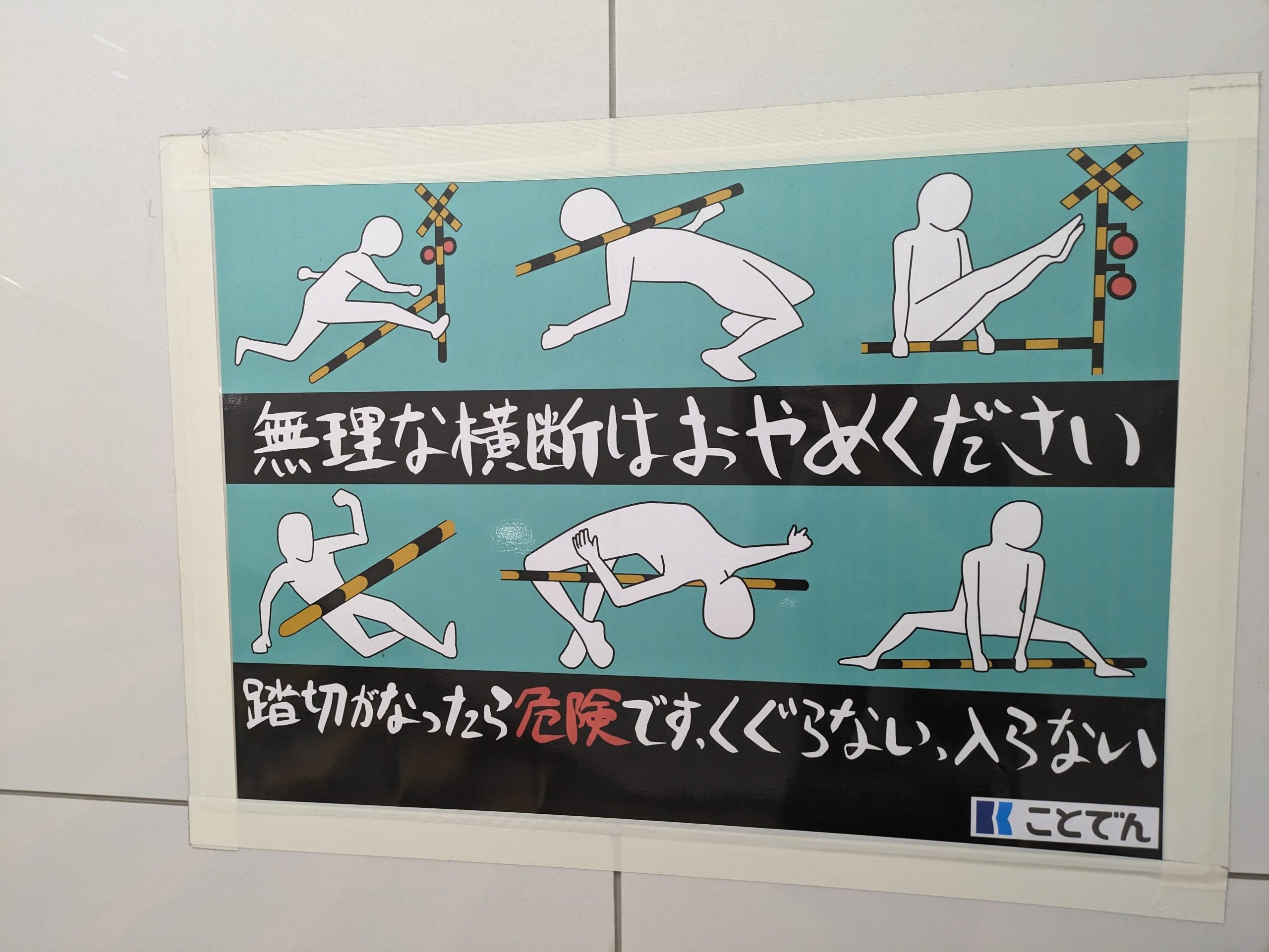
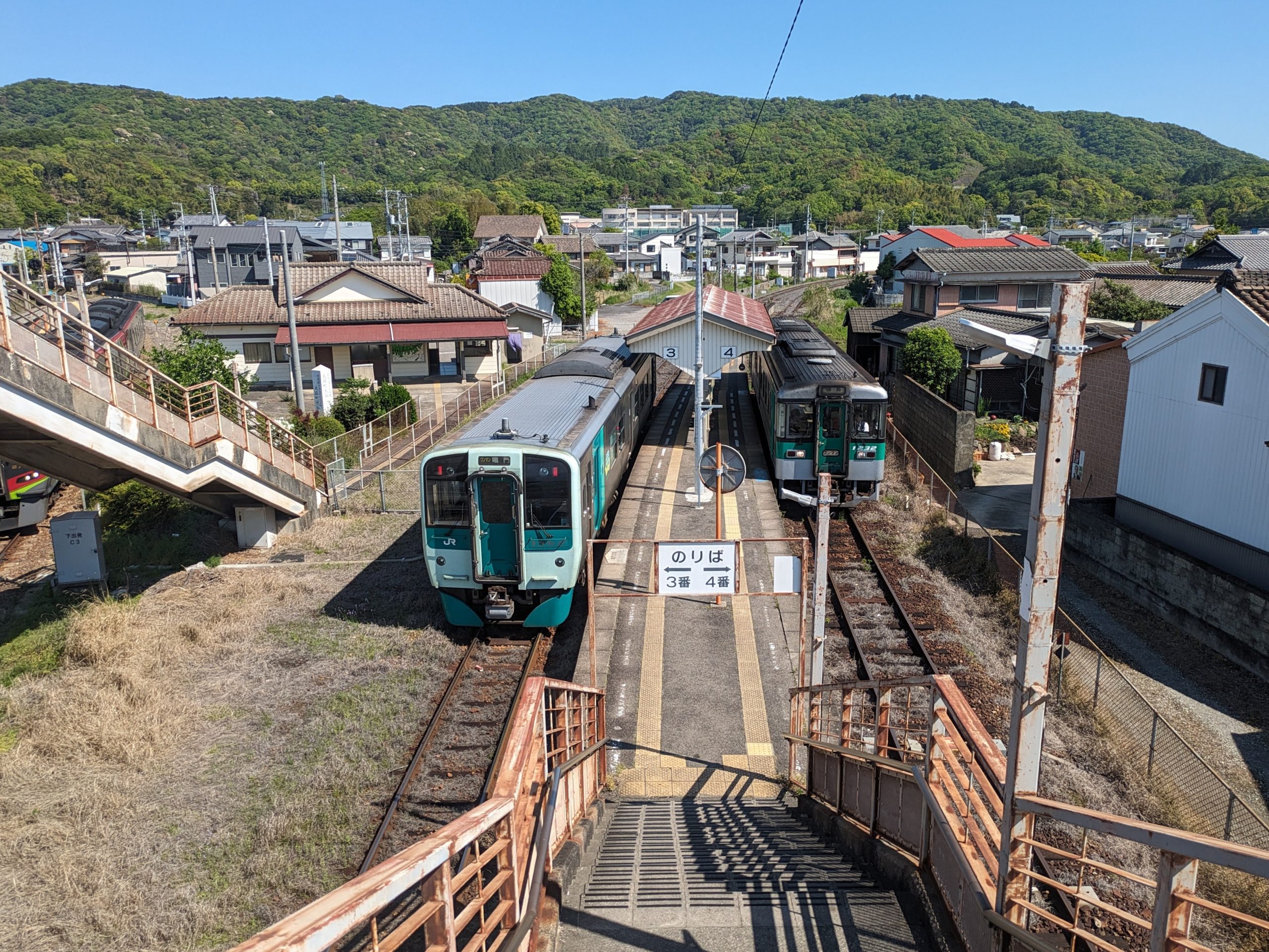
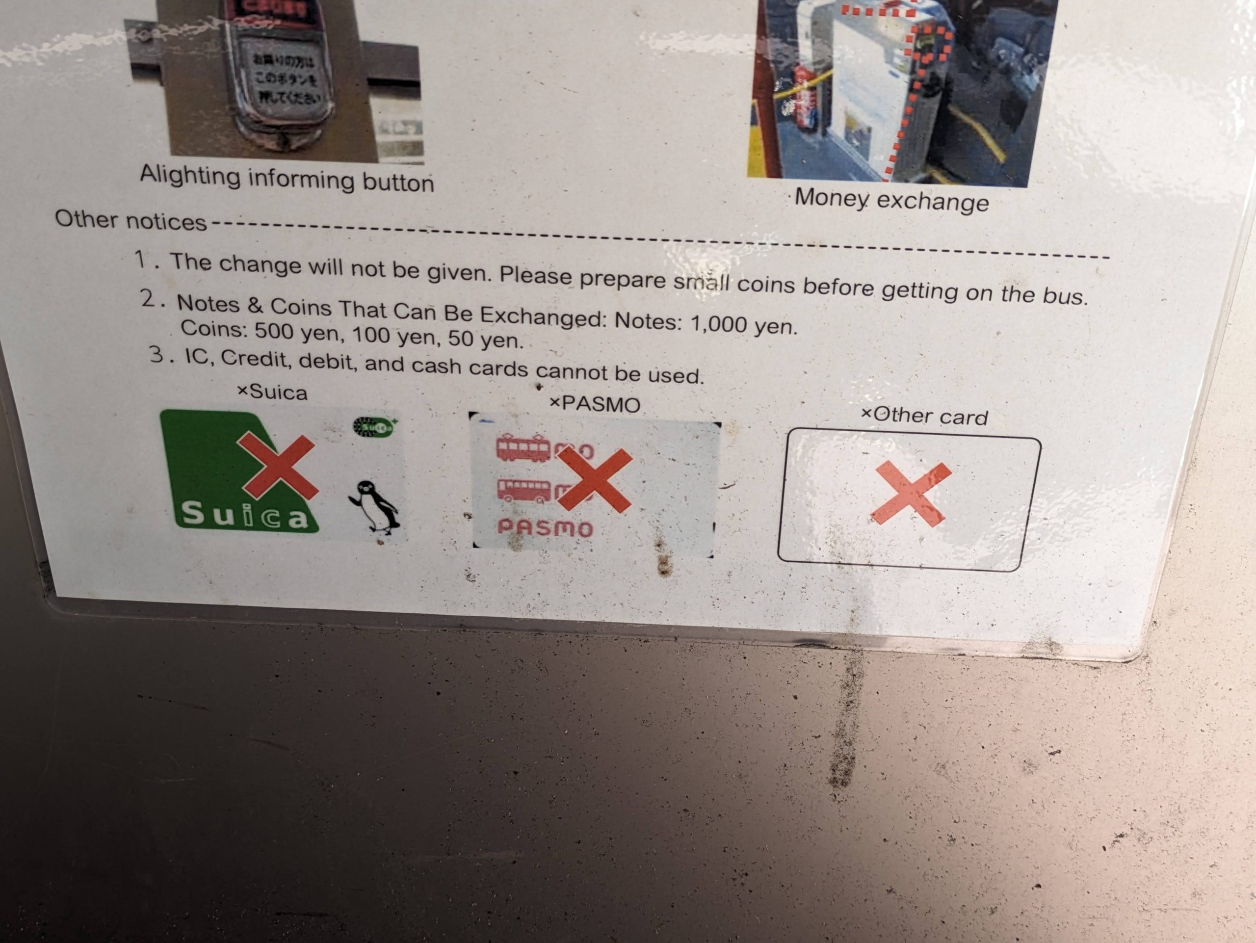
Forget support for IC cards… Tokushima is the last prefecture in Japan that doesn’t even have automatic fare gates. Even at the most major station in the prefecture, staff still inspect paper tickets all by hand. But – exciting news – it was announced just a few days ago that this would be changing come September!!!
Growing up in Wisconsin, I was very happy to have one of these.
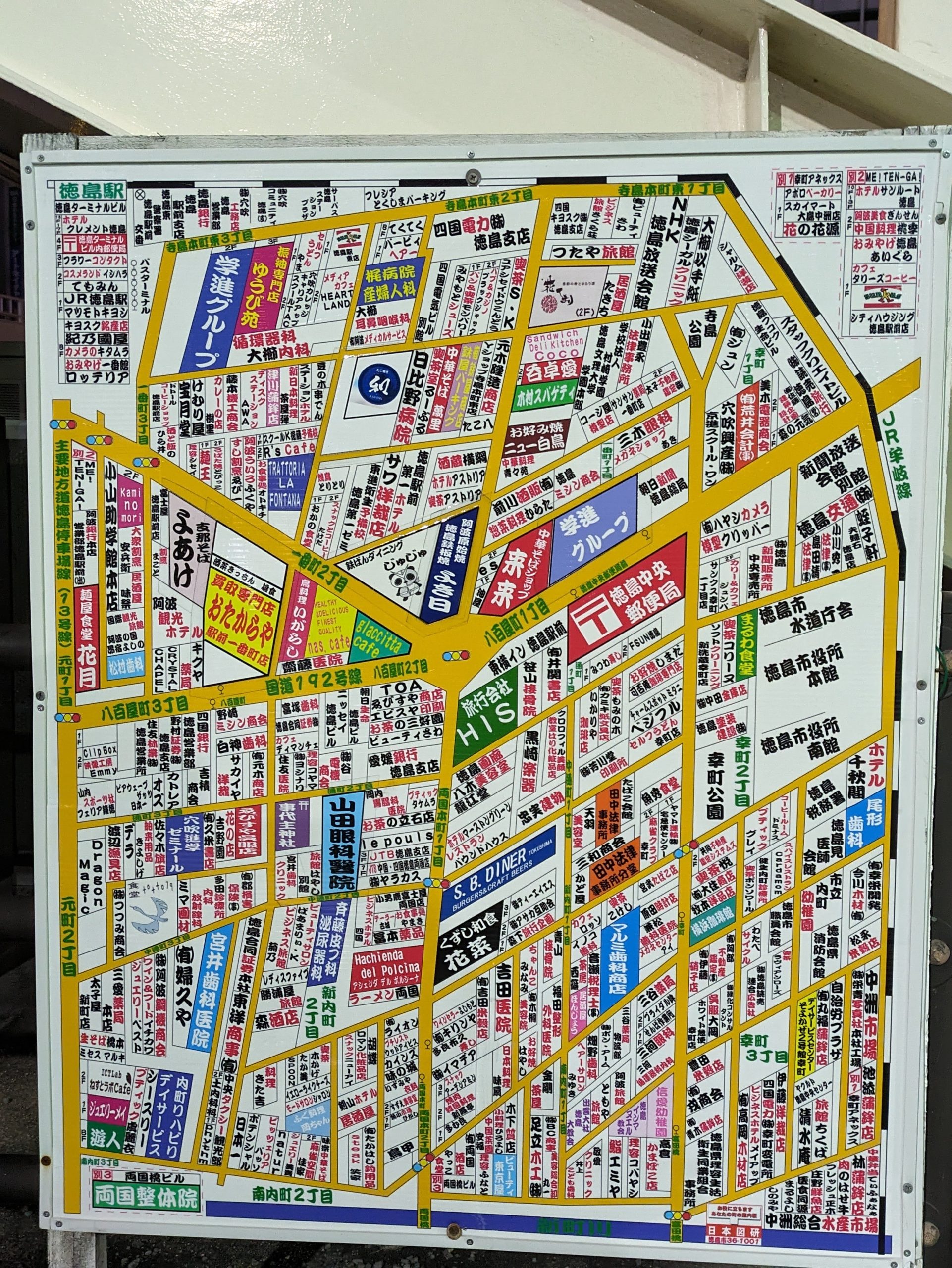
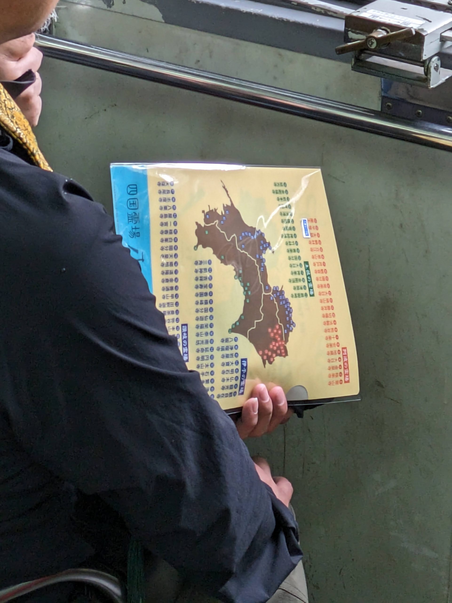
Most visually coherent Japanese map. Graphic design is my passion.
Sunday, April 27, 2025
Today’s transit:
7:35 Tokushima / JR Kōtoku Line (thru to Tokushima Line) → 9:45 9:53 Awa-Ikeda
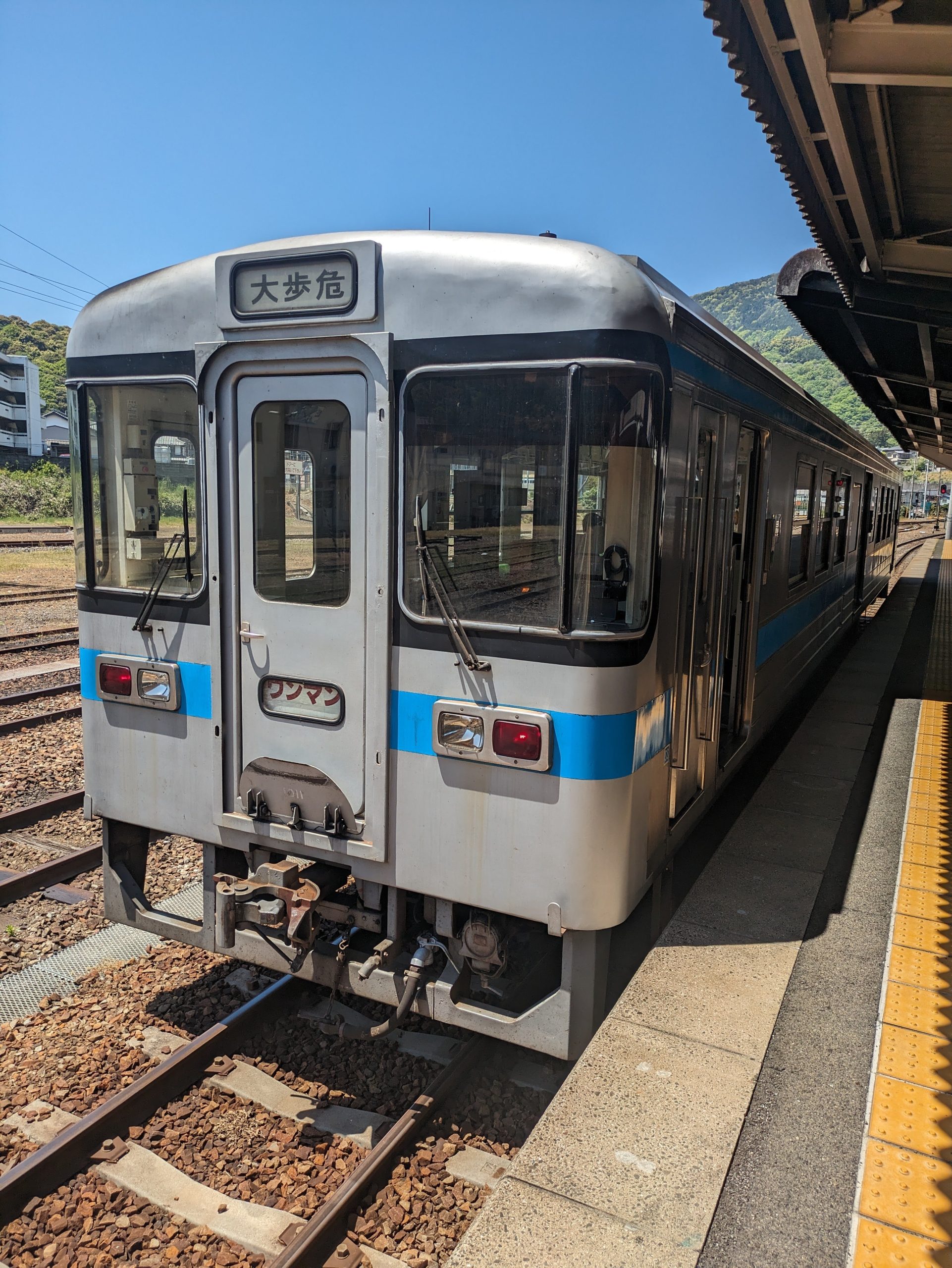
12:11 Awa-Ikeda / JR Dosan Line → 12:50 Ōboke
🚌 14:53 Oboke Sta. / Shikoku Kotsu Iya Line Bus → 15:17 Hotel Kazurabashi
⤾ 🚌 16:51 Kazurabashi-Yumebutai / 〃 17:12 Oboke Sta.
18:19 18:22 Ōboke / JR Dosan Line → 19:21 19:23 Tosa-Yamada
⤾ 19:30 19:32 Tosa-Yamada / 〃 → 21:18 21:20 Awa-Ikeda
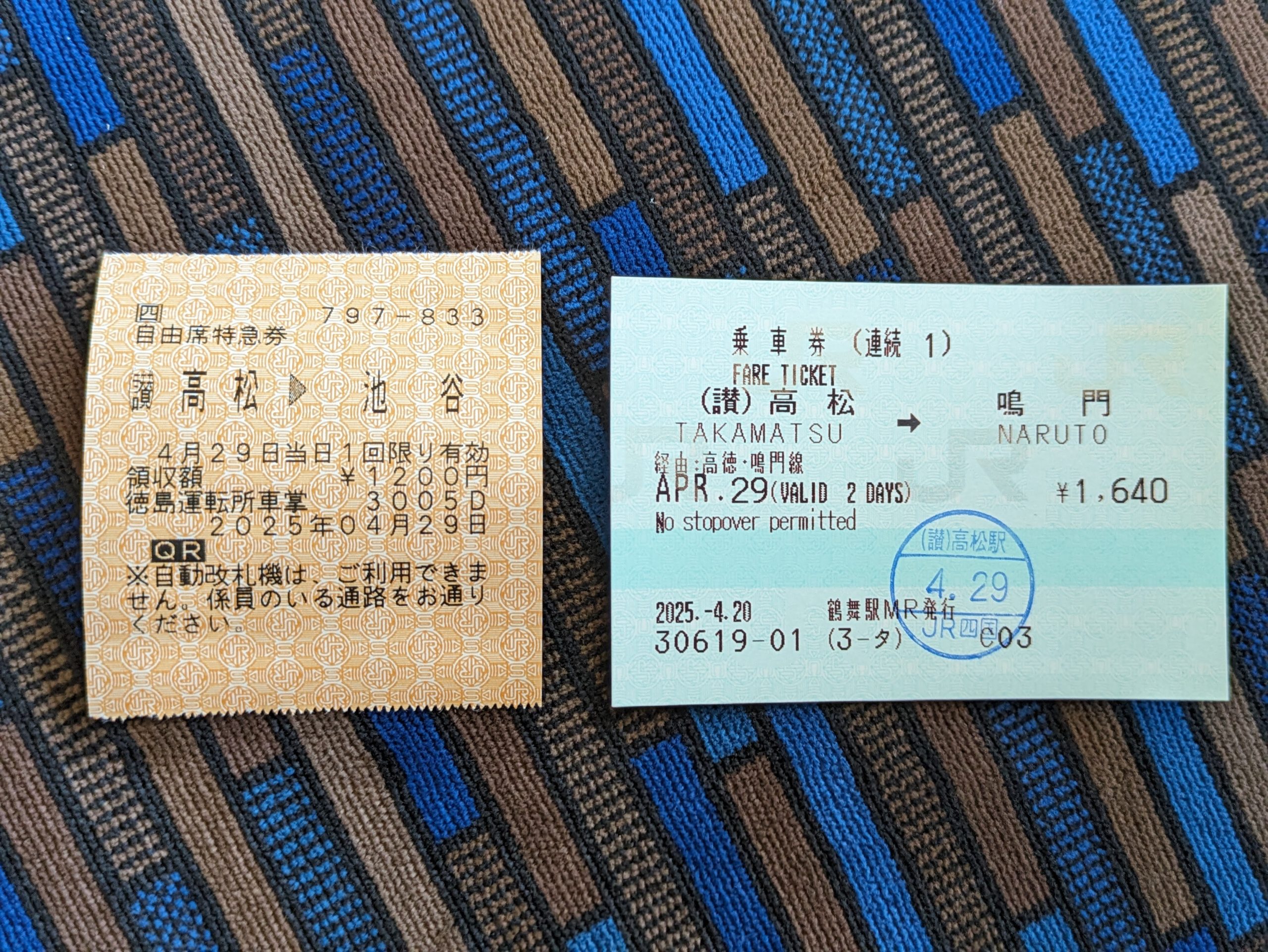
Shikoku as a whole has a dearth of Midori-no-magoduchi, aka JR ticket counters, and I was about to start heading into pretty deep rural territory, so this was my last chance to get my tickets for the days ahead. I planned to make use of three fairly-obscure “free pass”-style all-you-can-ride tickets – one solely for use on JR Shikoku, and the other two jointly issued between them and other railway operators. First, I bought…
- For today, 4/27, Shikoku Saihakken Hayatoku Kippu (¥2400)
…which is good for unlimited rides on local (and rapid) JR Shikoku trains for one day. It’d easily save me money given today’s plan, which was to go inland to Awa-Ikeda in Miyoshi City, down to Oboke Gorge and see the Iya Valley, and then back up to Awa-Ikeda to sleep that night. For the following days, the remaining two tickets would let me get up and over to Takamatsu, ride all of local operator Kotoden’s network, and then to get down and around the Muroto Peninsula to the far south:
- For tomorrow, 4/28, Kotoden JR Kururin Kippu (¥2200)
- For the days after, 4/29–5/1, Tokushima Muroto Kochi 55 Free Kippu (¥5800)
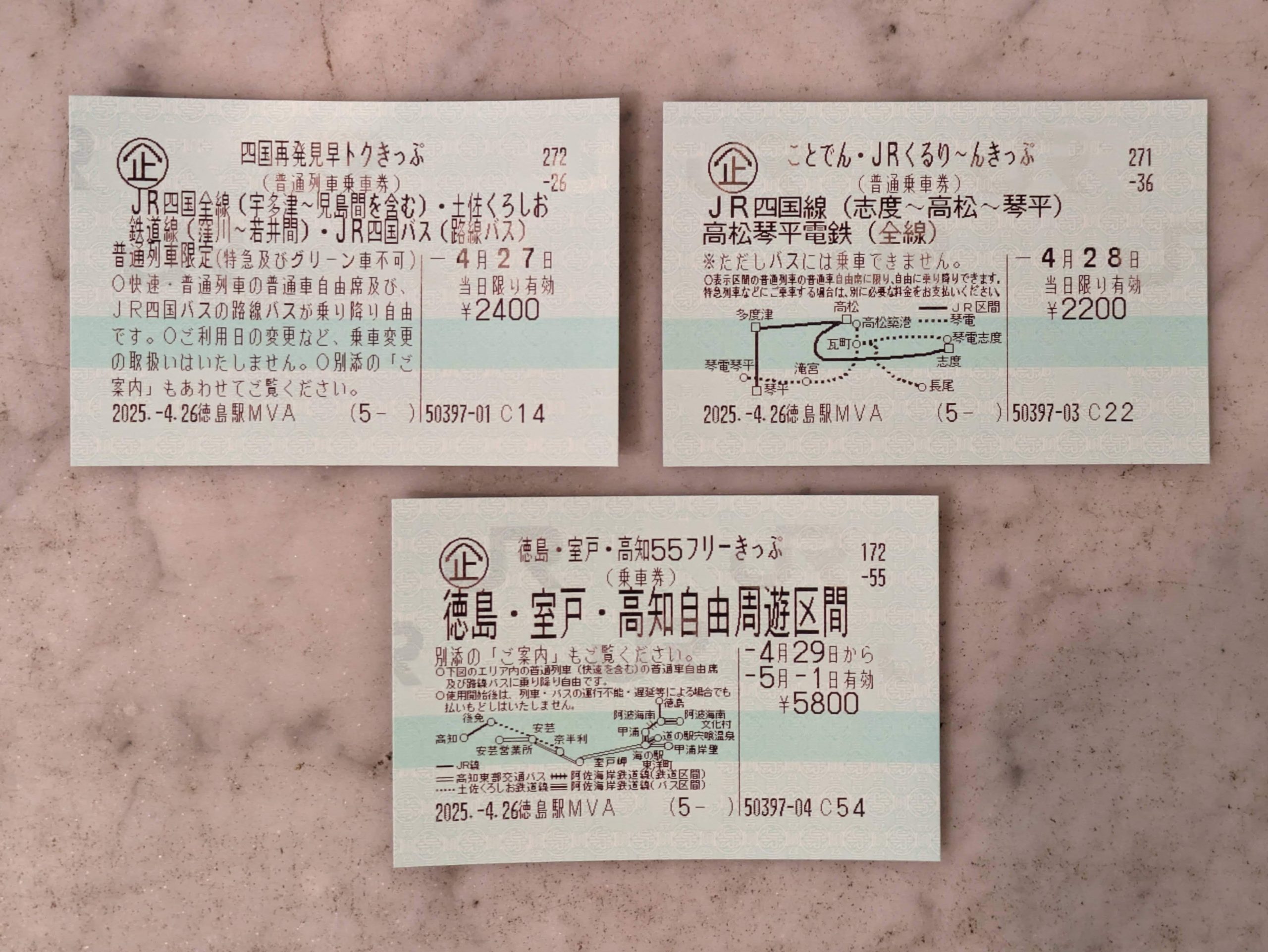
I love tickets with little maps printed on them! The “MVA” in the bottom left is a code for the type of machine I used to get the tickets: “MARS Vending with Assistance”. (Not officially confirmed by JR, but a sensible, educated guess.)
Regarding the machine where I bought these tickets, pictured below, JR West and JR Shikoku call these 緑の券売機プラス midori no kenbaiki plus or “green ticket vending machine+” with the ‘plus’ indicating remote staff assistance being available via what’s essentially a videocal. Not that anybody asked… but, for what it’s worth, other companies use the following nomenclature:
- JR Hokkaido: 話せる券売機 hanaseru kenbaiki, “talking ticket vending machine”
- JR East: 話せる指定席券売機 hanaseru shiteiseki kenbaiki, “talking reserved seat ticket vending machine”
- JR Central: サポートつき指定席券売機 sapōto-tsuki shiteiseki kenbaiki, “reserved seat ticket vending machine with support”
- JR Kyushu: ど~ぞ do~zo, “go ahead~” – …not even sure what to say here, but yes, it is an incredibly weird name.

This is the funniest piece of tech to exist in the 2020s. I think it’s just due to the physical handset/receiver, but…
Awa Odori on the streetlights of Tokushima!
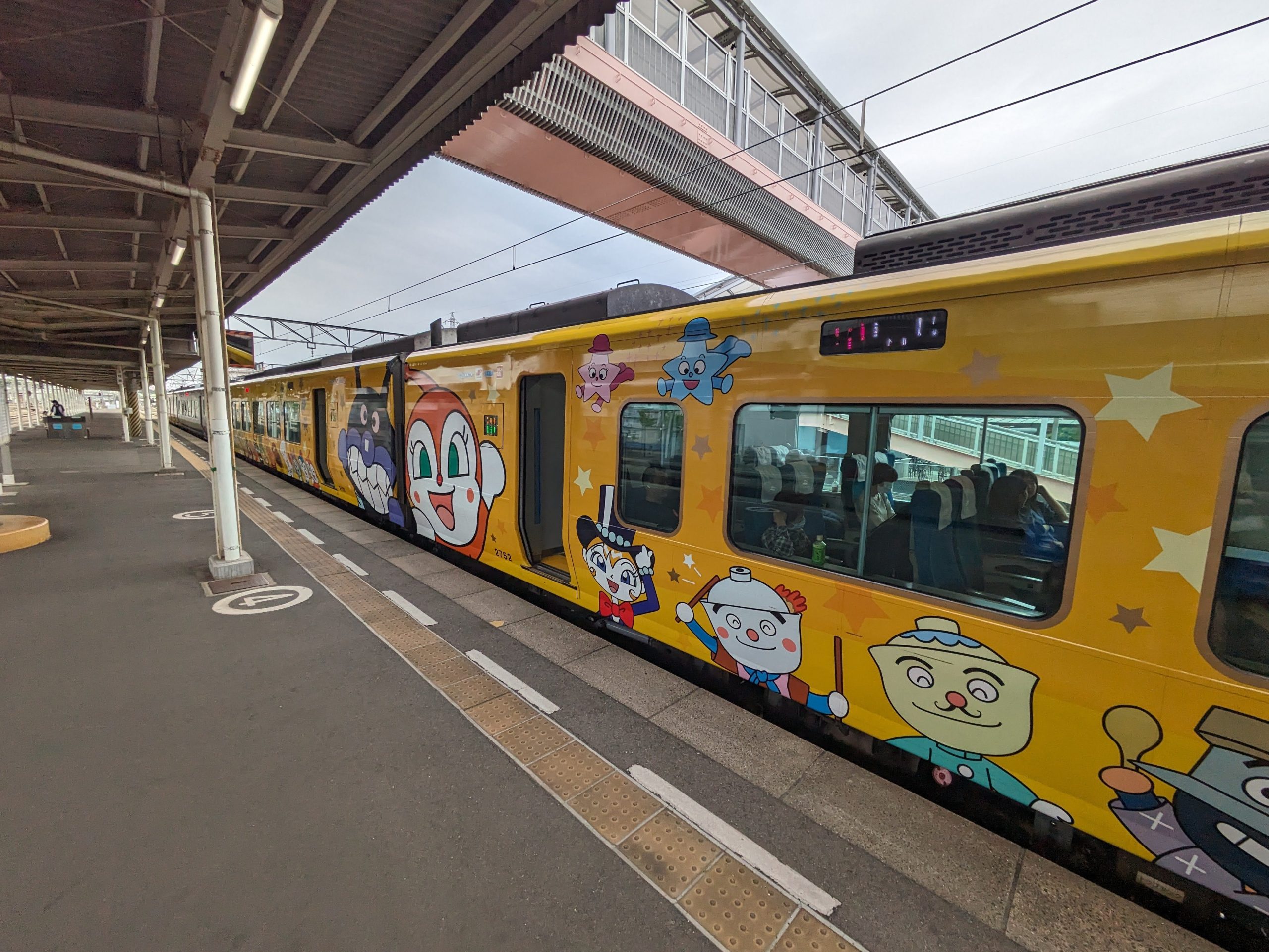
The creator of Anpanman is from Shikoku, specifically Kochi, so the characters are everywhere around this island. We’ll be seeing more and more of them starting soon.
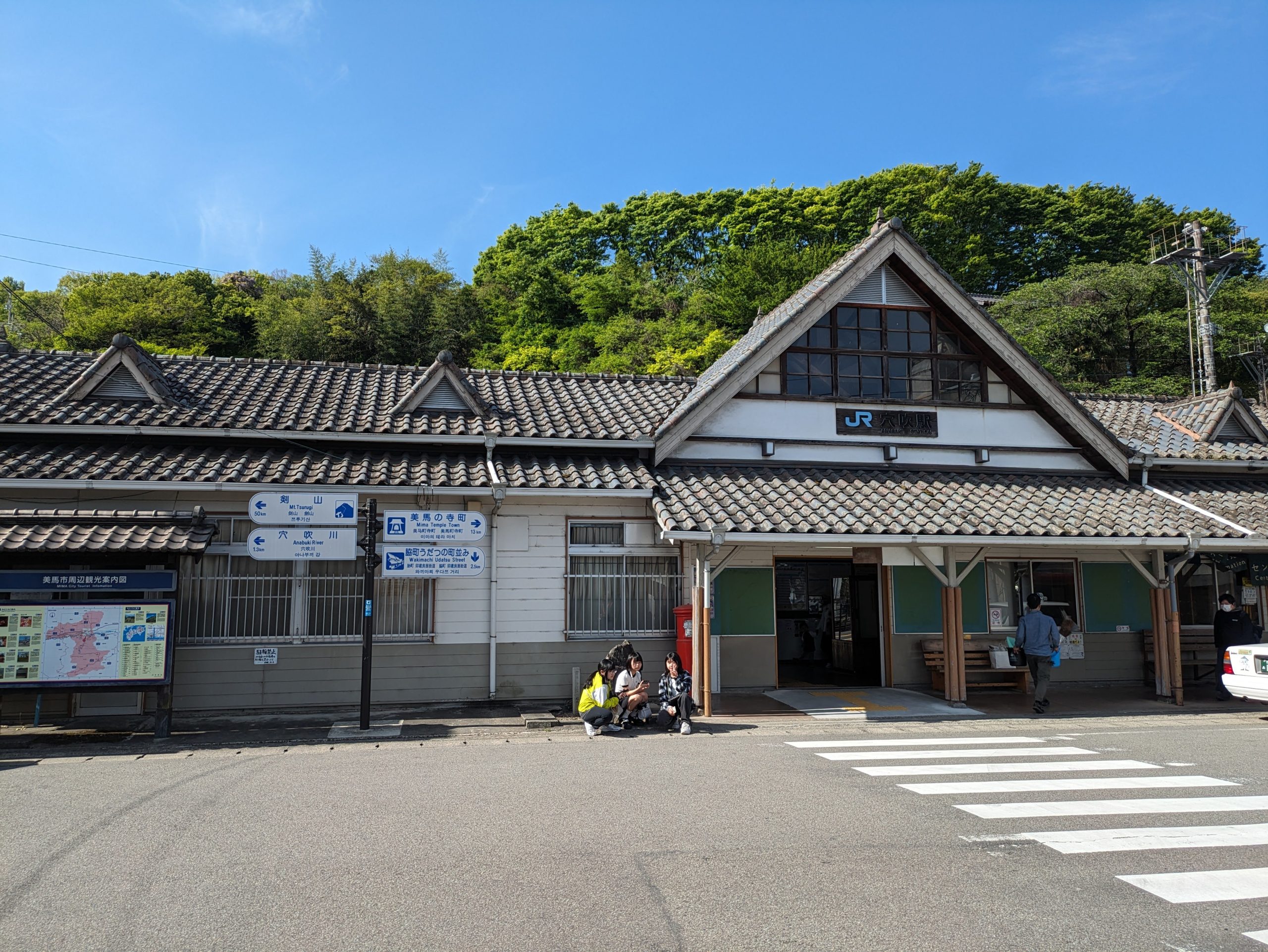
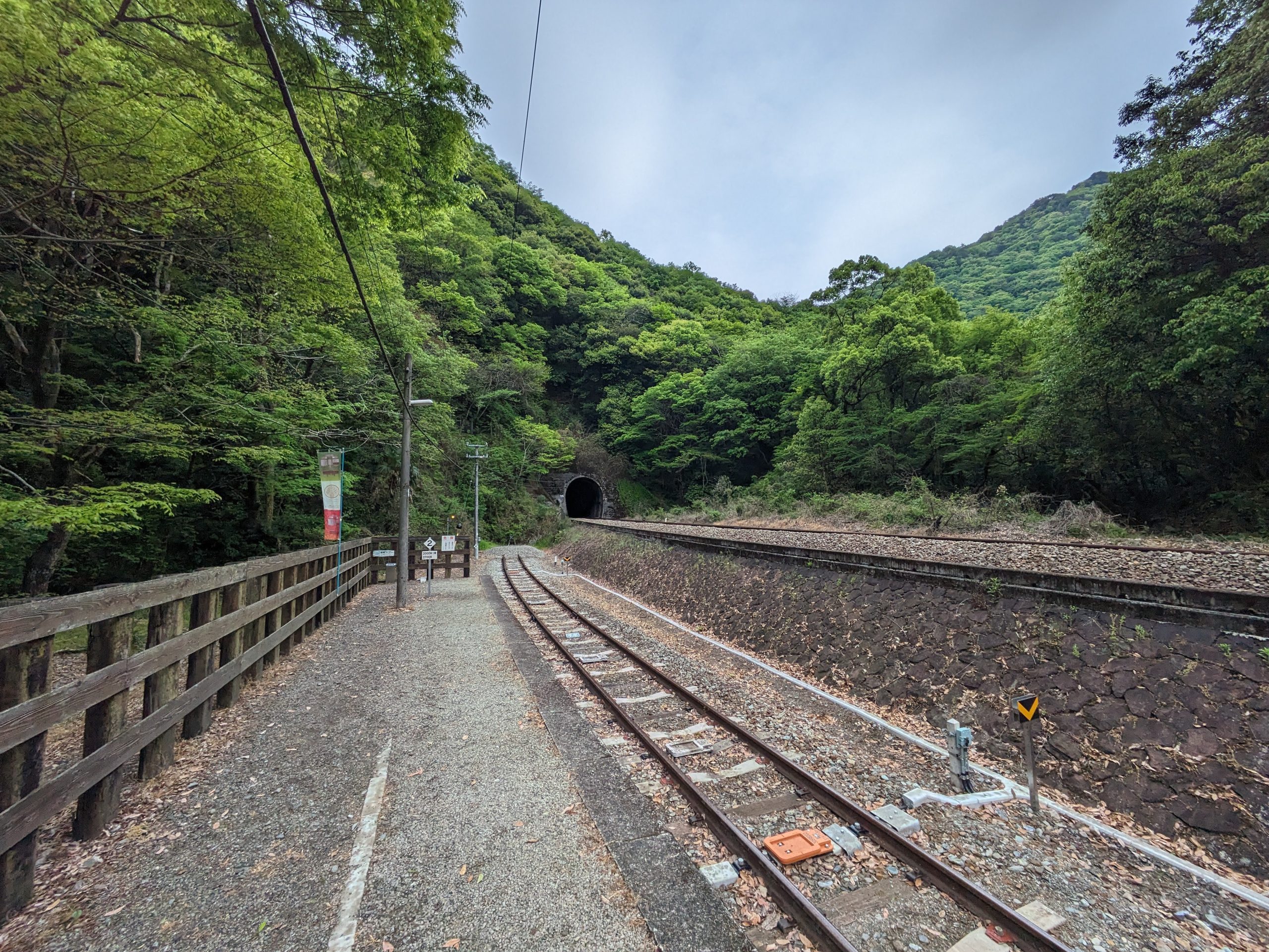
A stop on my way inland. We had a ~15 minute wait (for a passing train, like usual) at the unstaffed Anabuki Station, so I walked around and bought some snacks.
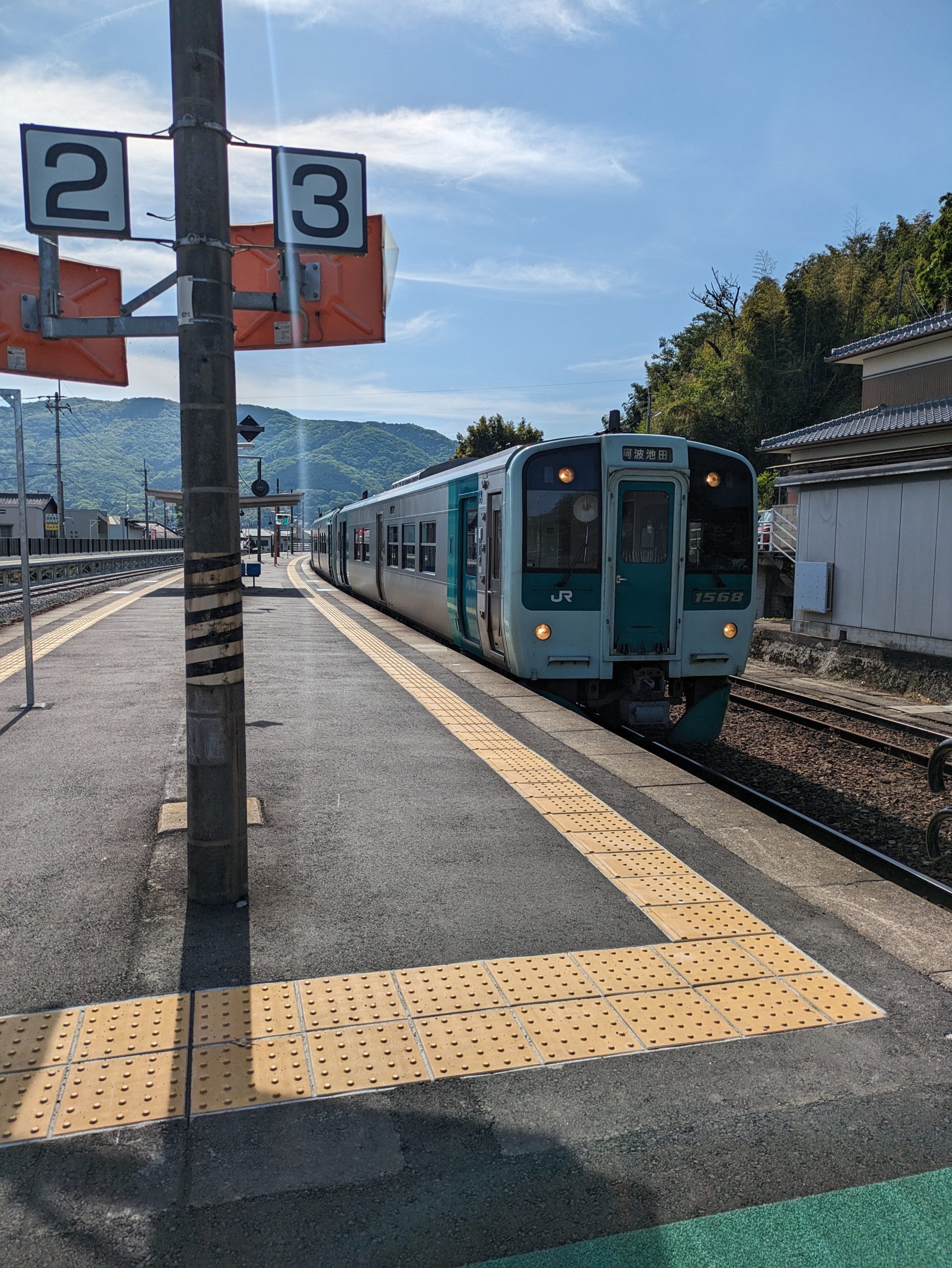
My two-car local train from Tokushima to Awa-Ikeda.
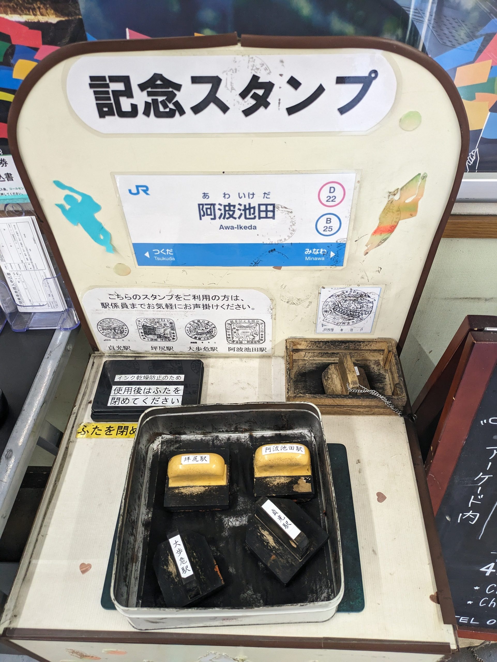
Lots of eki-stamps at Awa-Ikeda, located in northwestern Tokushima. Surrounding unstaffed stations had their former stamps saved and moved here :’)
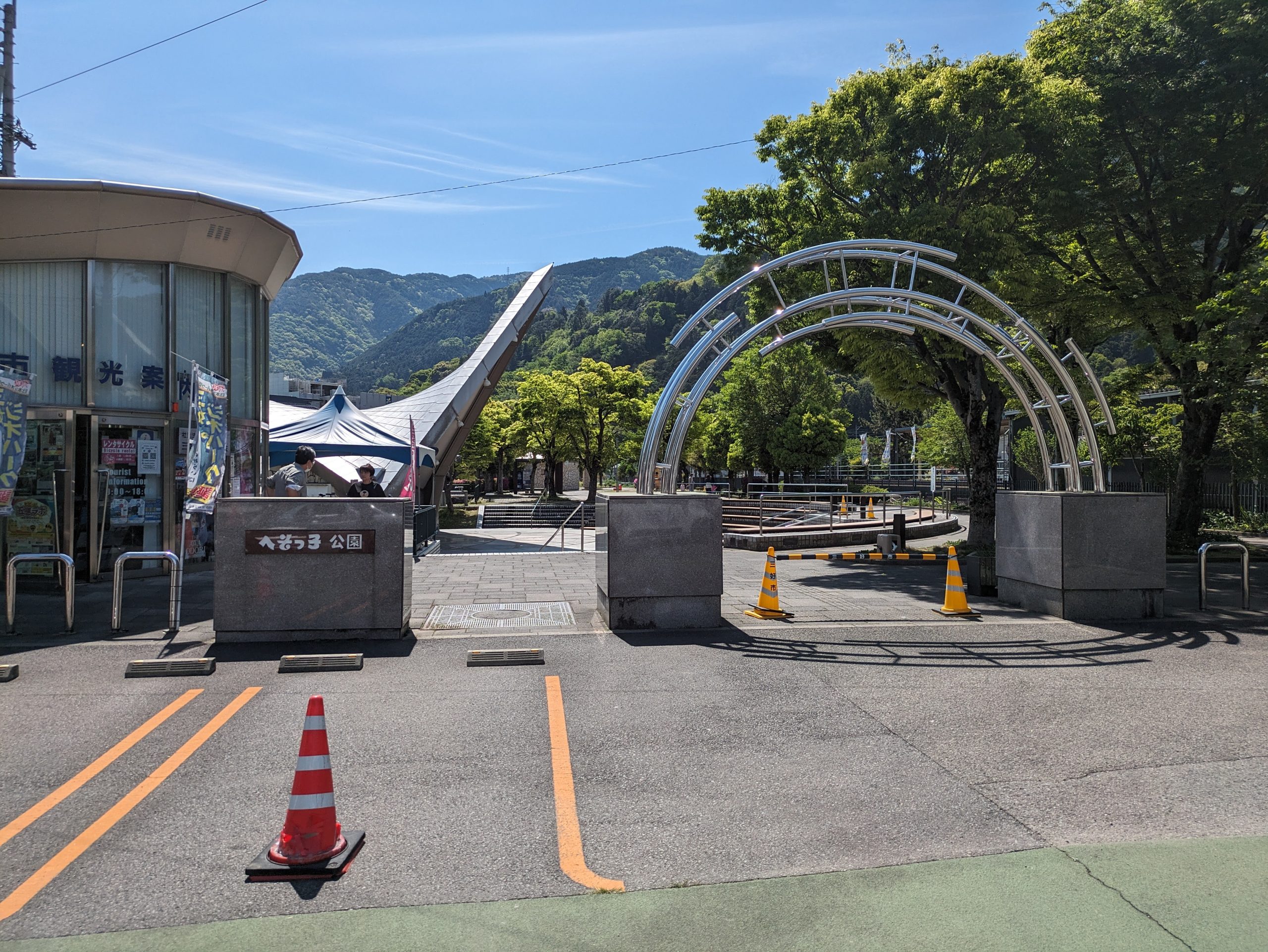
A little park and tourist info center were located right outside of Awa-Ikeda Station. I went into the info center to ask if a bus I planned to take would accept PayPay payment (answer: yes) and before answering the woman sighed in relief and was, like, “oh god, I was so nervous that you wouldn’t speak Japanese…” lmao
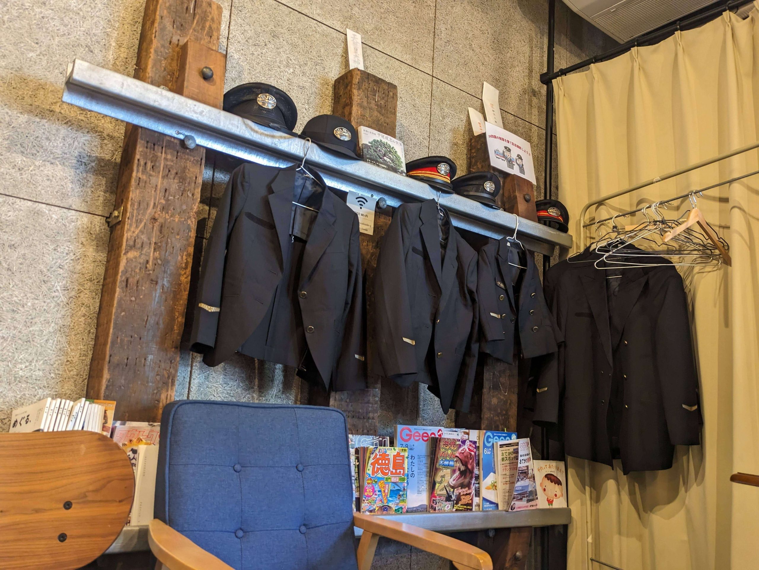
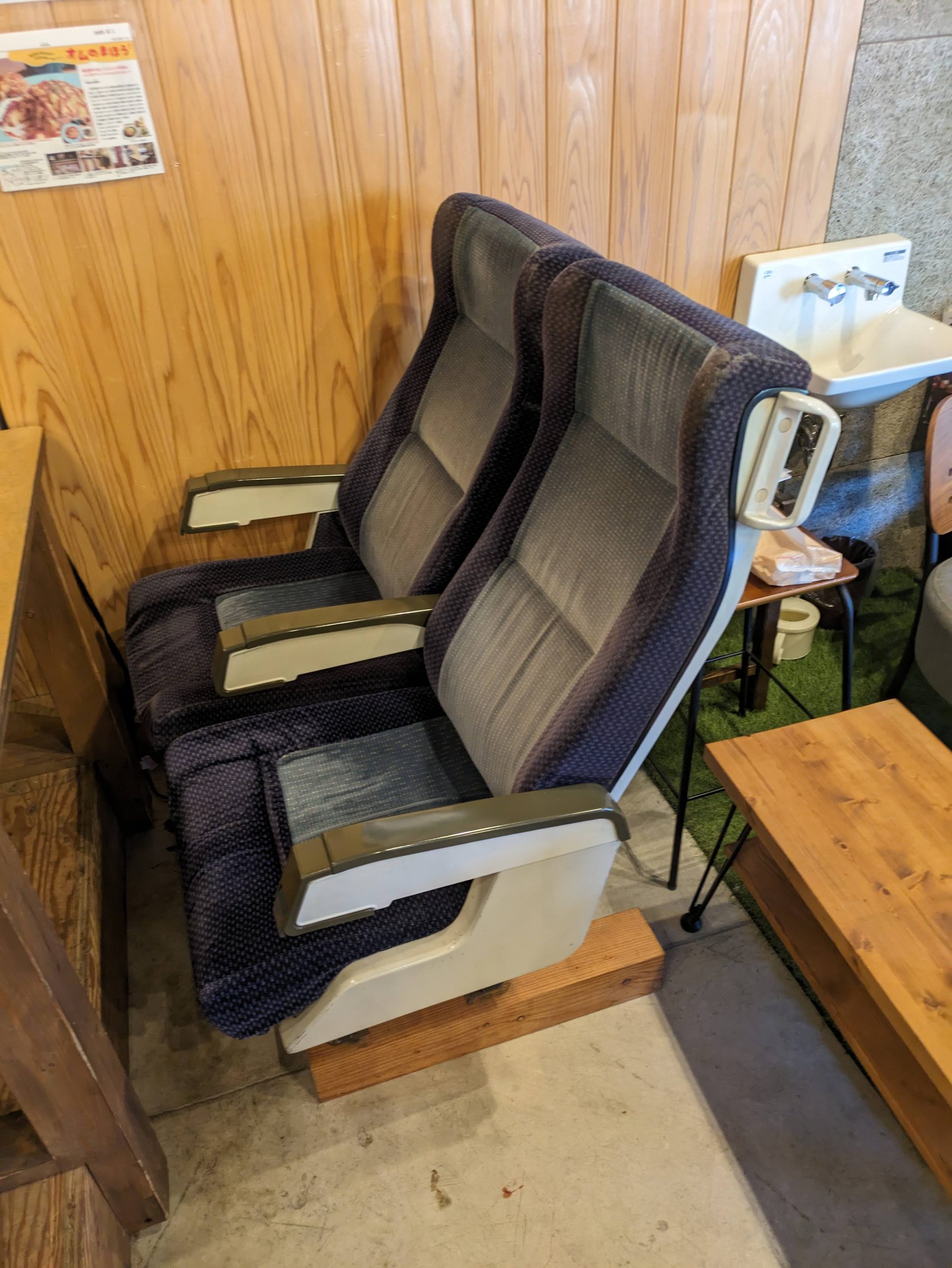
It turned out that my hotel, 4S STAY, was operated by JR Shikoku! I had no idea until I arrived at the restaurant/cafe that also functioned as a check-in counter (??) – no one was there, so I had to call on behalf of me and a different guest who was trying to check out – and saw a bunch of conductor uniforms hanging up on the wall, and train seats used as cafe seating. Cool!
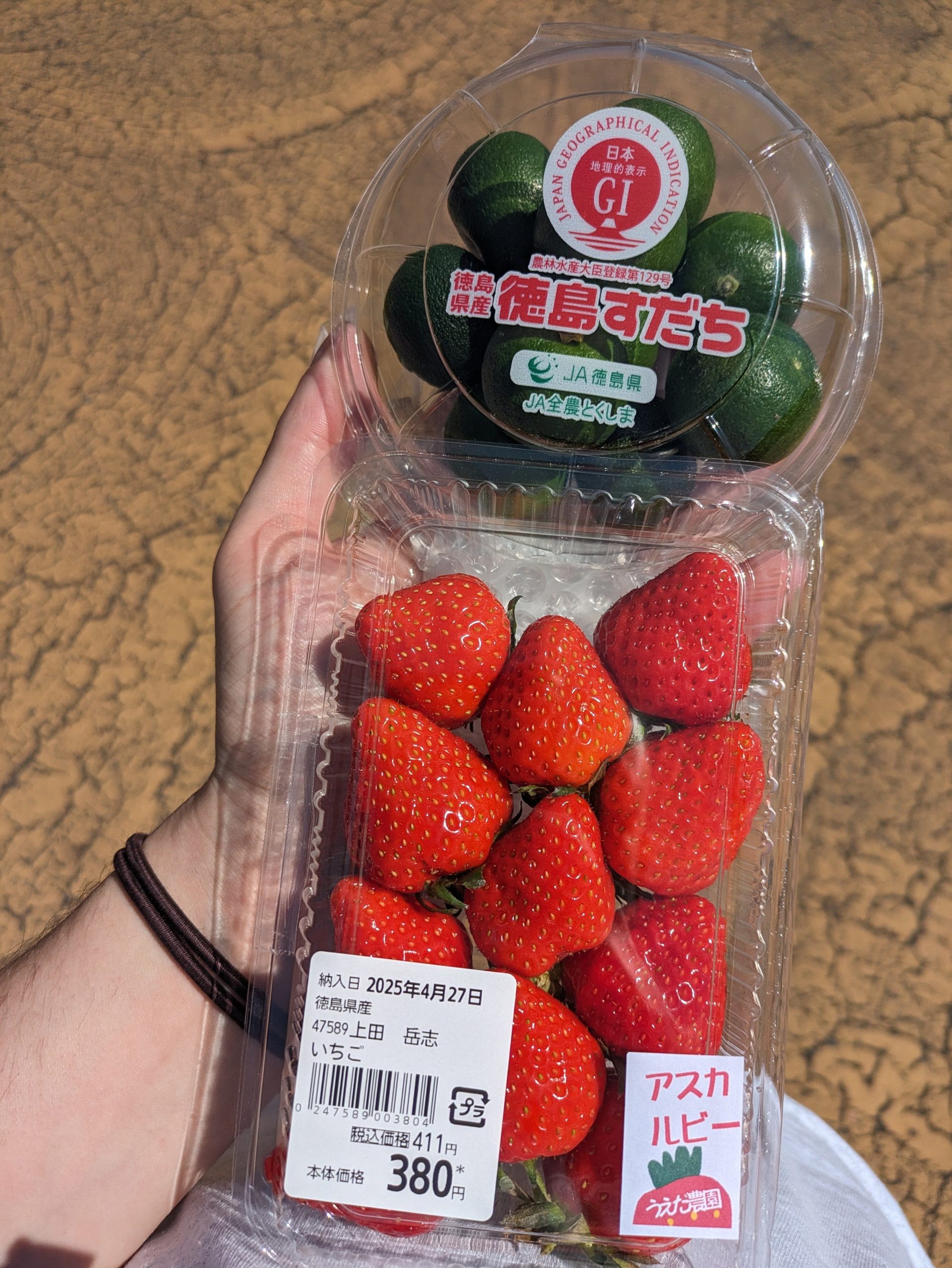
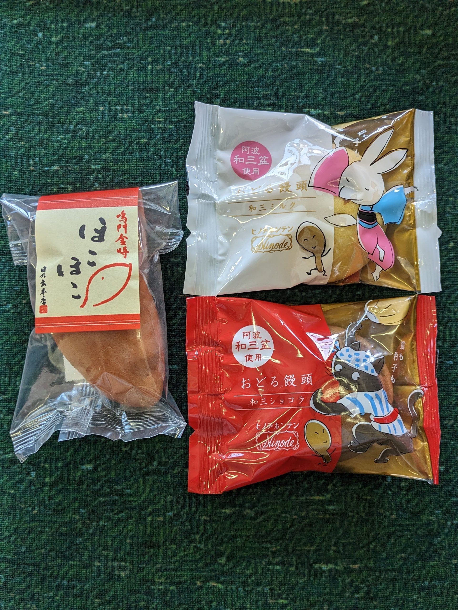
Sudachi, a citrus fruit, is a speciality of Tokushima, so, as a certified fruit-lover, I wanted to try some before I left. Here’s my haul from a random supermarket (which happened to be called Daiso…??)
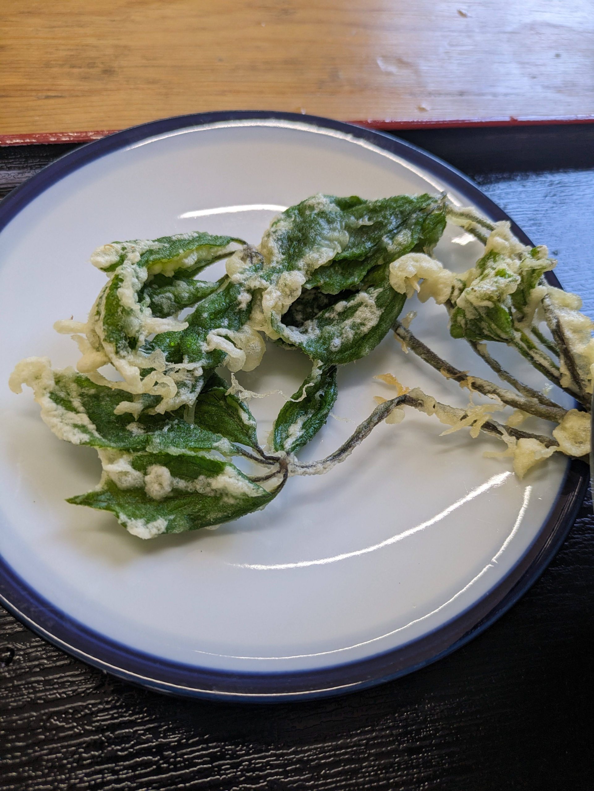
While waiting for my train down to Oboke, I walked around the city and grabbed some udon from a little shop on the top of a steep hill, amusingly just called “Awa”. The woman working there suggested I try this atop my noodles – sansai tempura, or tempura of edible wild plants, which are a springtime specialty. (NHK has a video on their use in tempura here!) This vegetable specifically is koshiabura. It doesn’t have an English name but it was so damn good, and is apparently known as the “queen of wild vegetables”. While talking with some friends online that day, I described it as “my best discovery since coming to Japan”. It’s truly heavenly.
It was four-and-a-half hours between the previous local train and this one!
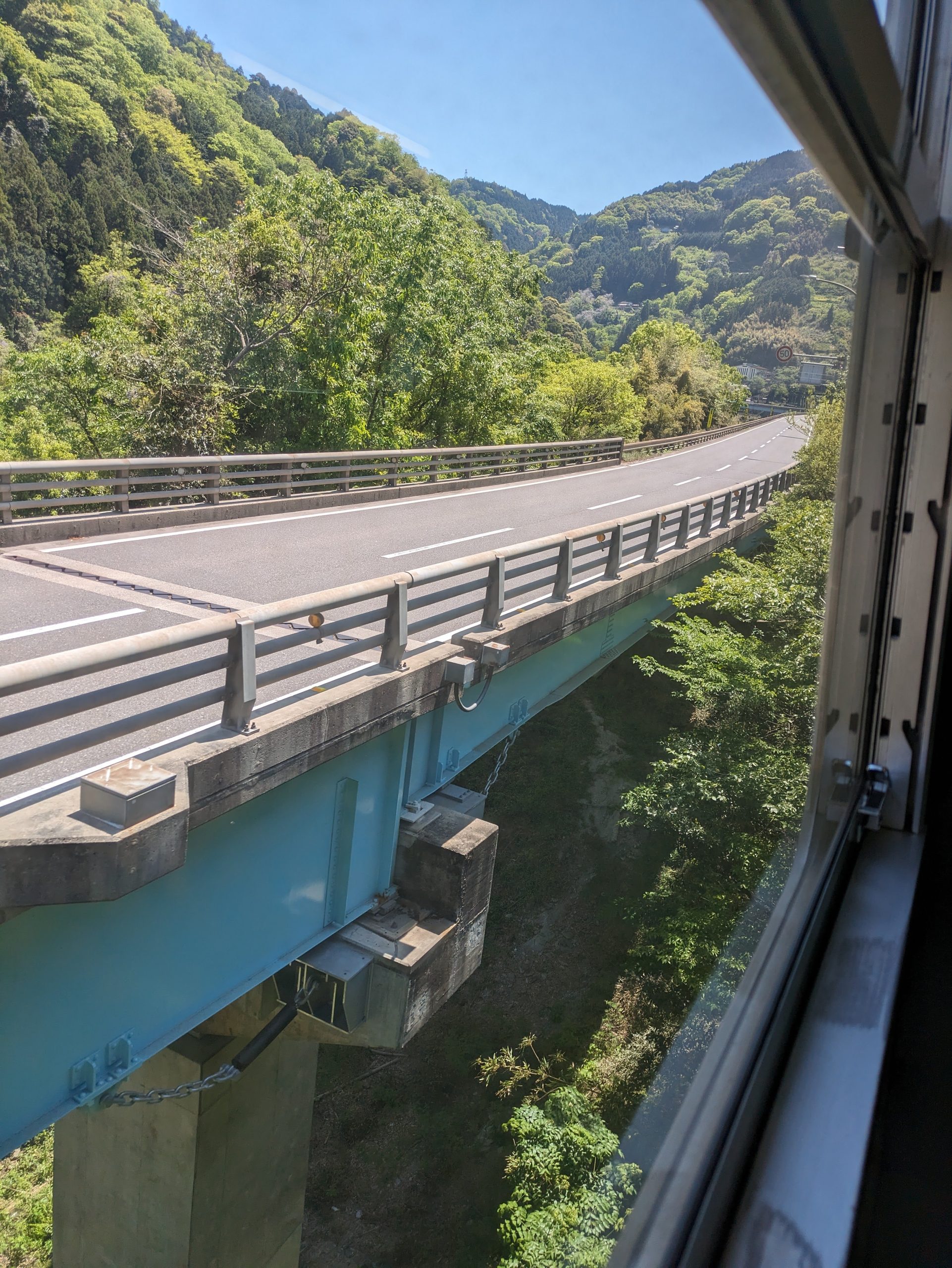
Some of the rail bridges ran parallel to the road but from a distance away, which made it easy to see just how high up we were in certain parts.
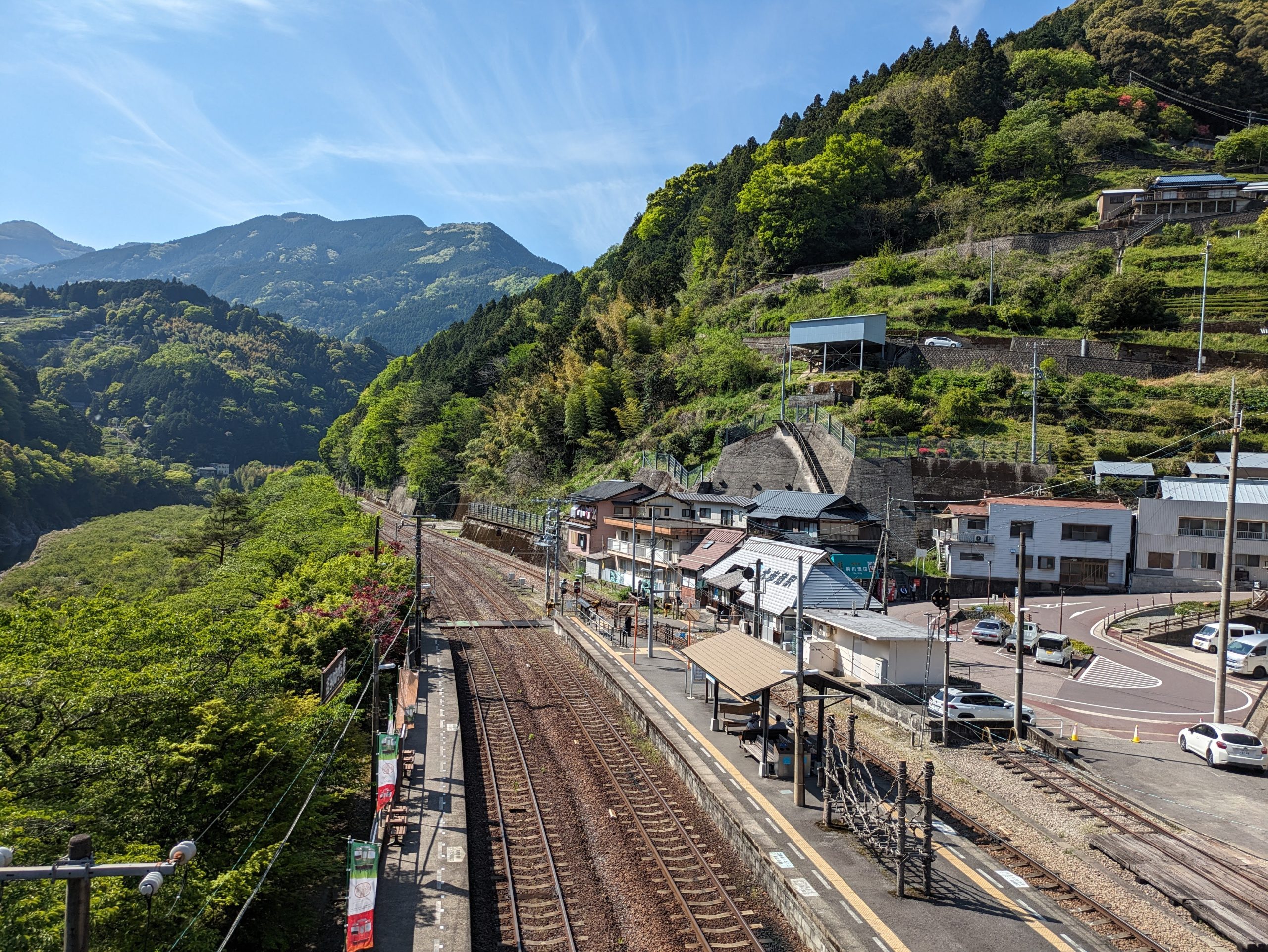
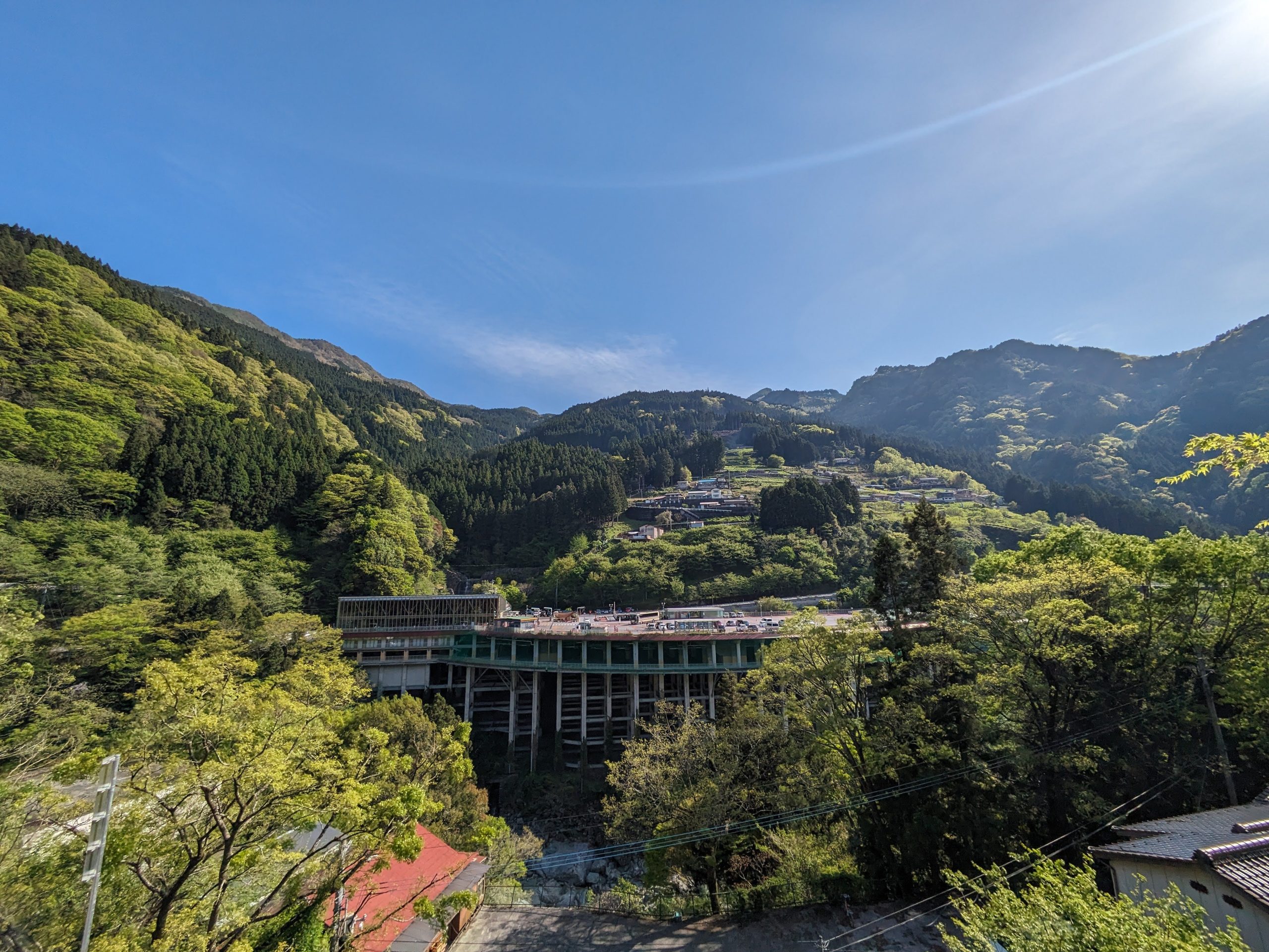
After a relatively short 40-minute ride, we arrived at Ōboke. The station, just like Awa-Ikeda from where I had dropped my bag and gotten lunch, is still officially in the city of Miyoshi – a place that’s experiencing such rapid population decline that it’s the smallest municipality in the prefecture, even smaller than the towns,4If the towns are less small than you’d think, that’s because Japan loves merging multiple towns/villages into slightly larger ones. despite having kept its previously earned status as a city. Over 40% of remaining residents are 65 or older, and its ~20,000 residents living in 720 km2 of land means that it has one of the lowest population densities in all of Japan.5Although no other place can hold a candle to the former coal mining town of Yubari, Hokkaido, which lost over 90% of its population in 50 years once the mines closed. This good BBC article paints a hopeful picture, though, about efforts to revive the rural area by turning its former schools into unique inns, something I came across while doing my planning and research into my trip too.
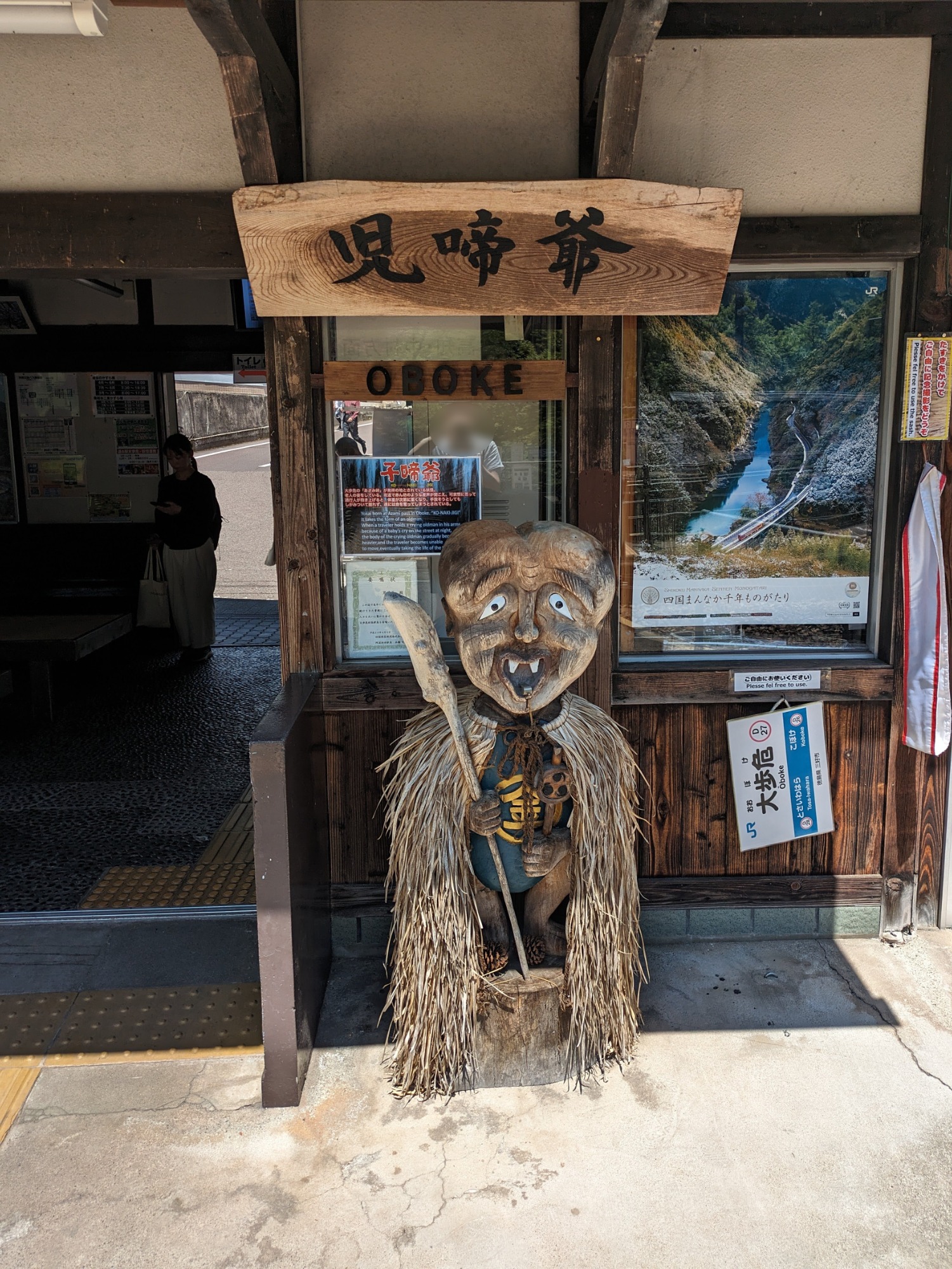
The area has long been the setting for various yokai legends, so there are a lot of sculptures of them around the area.
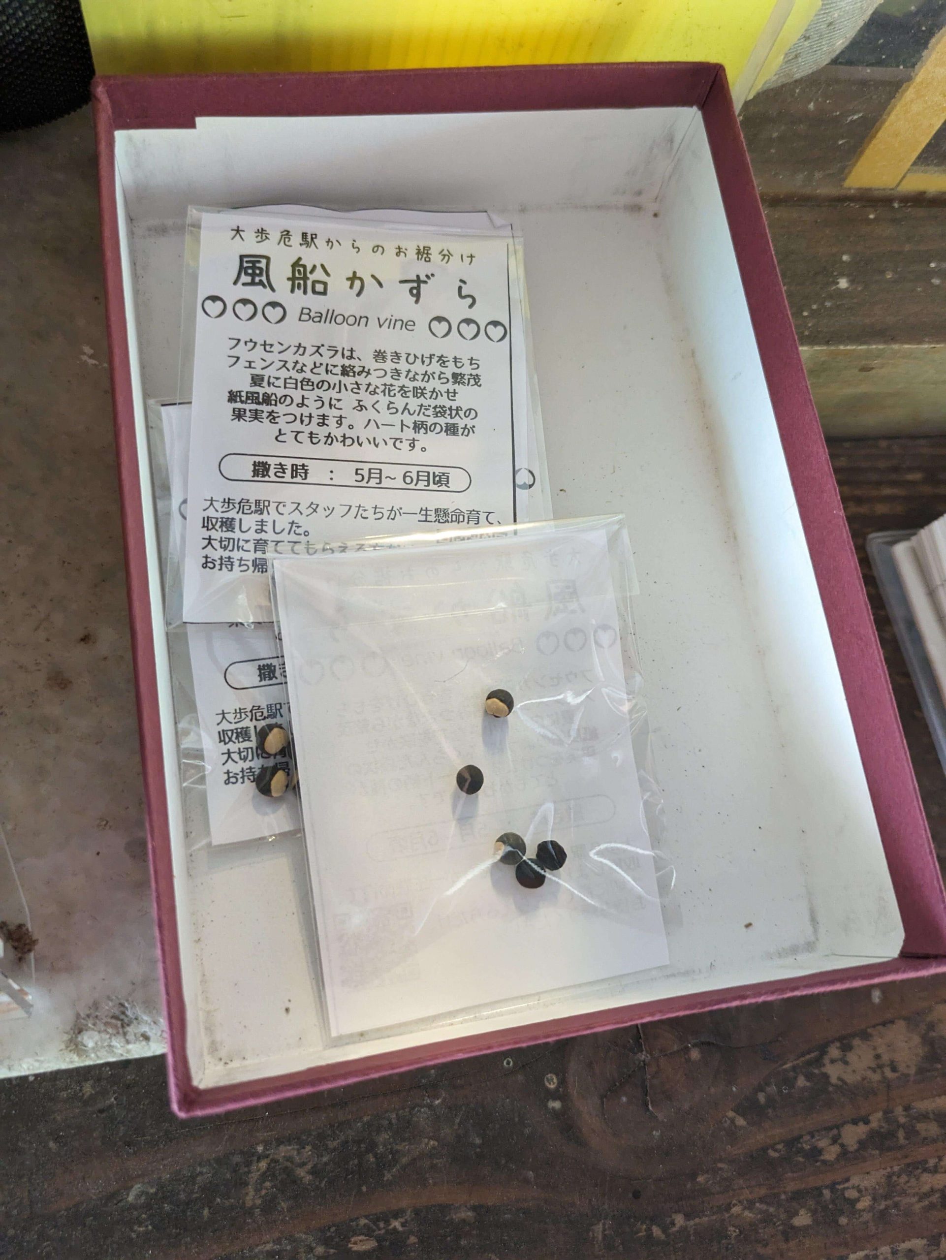
The station also had a box with bags of free seeds for the taking.
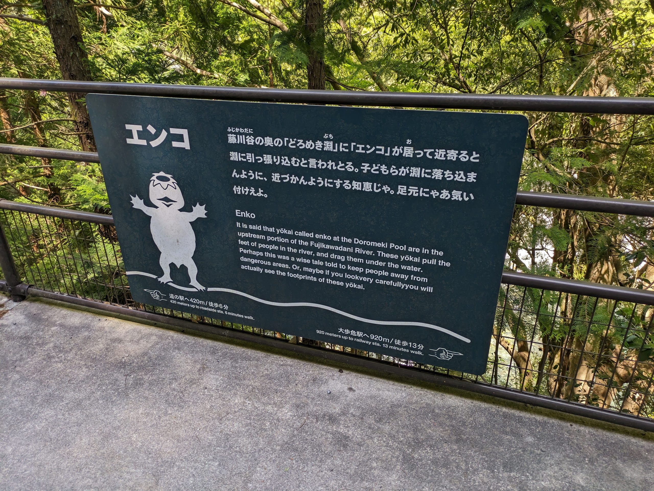
This yokai, the enko, looked like a kappa to me, but it’s apparently slightly different. Folklorist Matthew Meyer’s wonderful Yokai.com project describes them as “resembling monkeys or hairy kappa […] about the size of a three year old child […] long associated with monkeys due to their long limbs, migratory habits, mischief, and hairy bodies”.
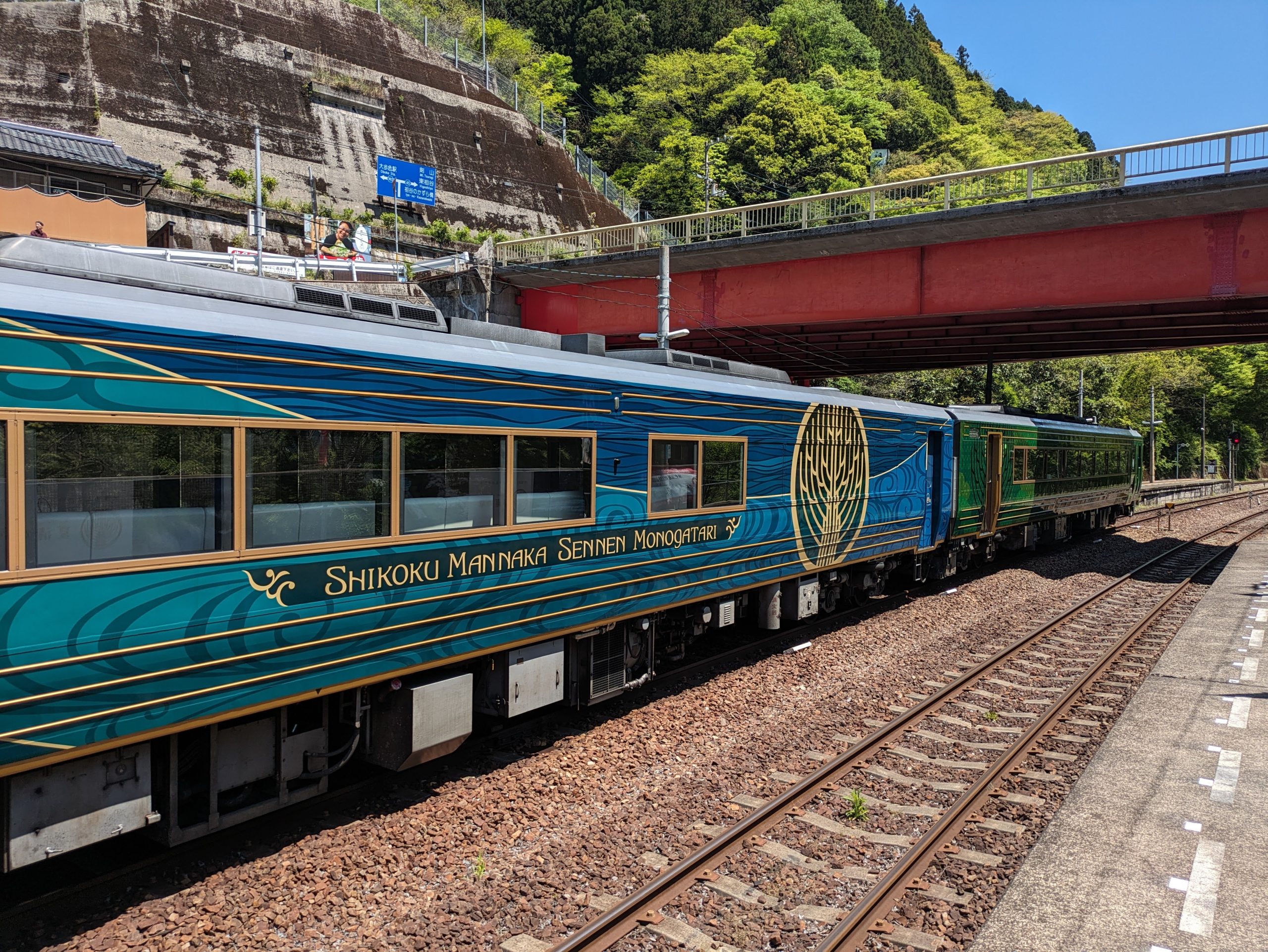
Waiting at the platform was one of JR Shikoku’s sightseeing trains, the Shikoku Mannaka Sennen Monogatari. Such pretty livery! I’ll be taking a similar, but even-more-special (IMO) one, in the next part of my trip.
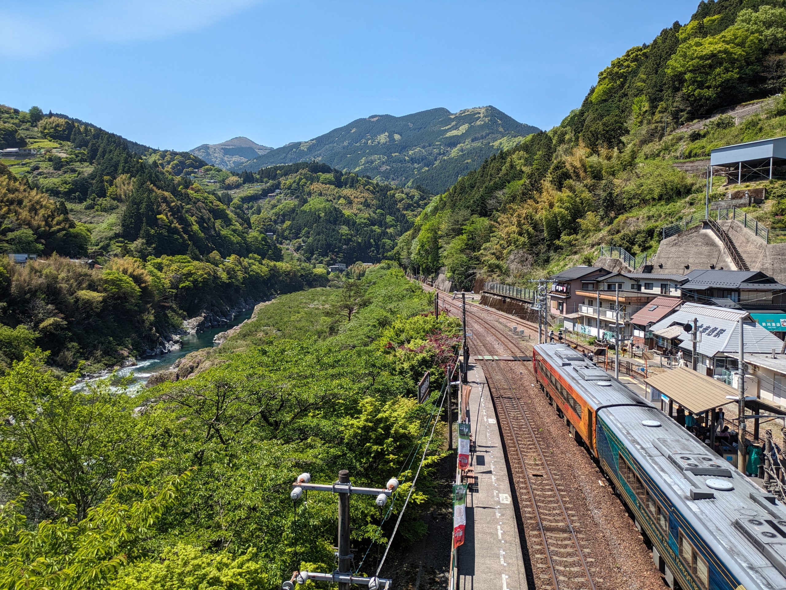
Out of the train station, I walked up the hill and circled around onto the bridge overlooking the gorge. So overwhelmingly, intensely green! The weather was just perfect. The surrounding area is known as “Oboke-Koboke”, the joint names of two different canyons located along the Yoshino River, the other just north of here. Character-by-character, their names literally mean “big danger walk” and “small danger walk”, understandable given the risk that one would have to take on to traverse their steep, rocky slopes!
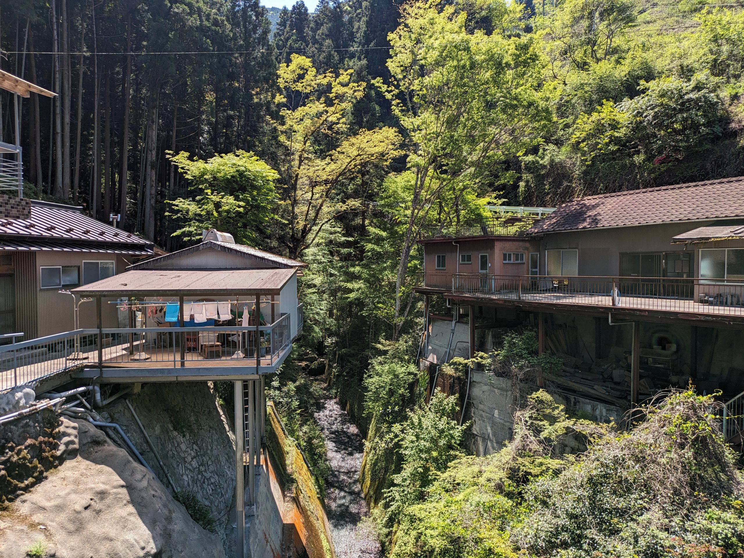
Perilously built houses over different branches of the canyon…
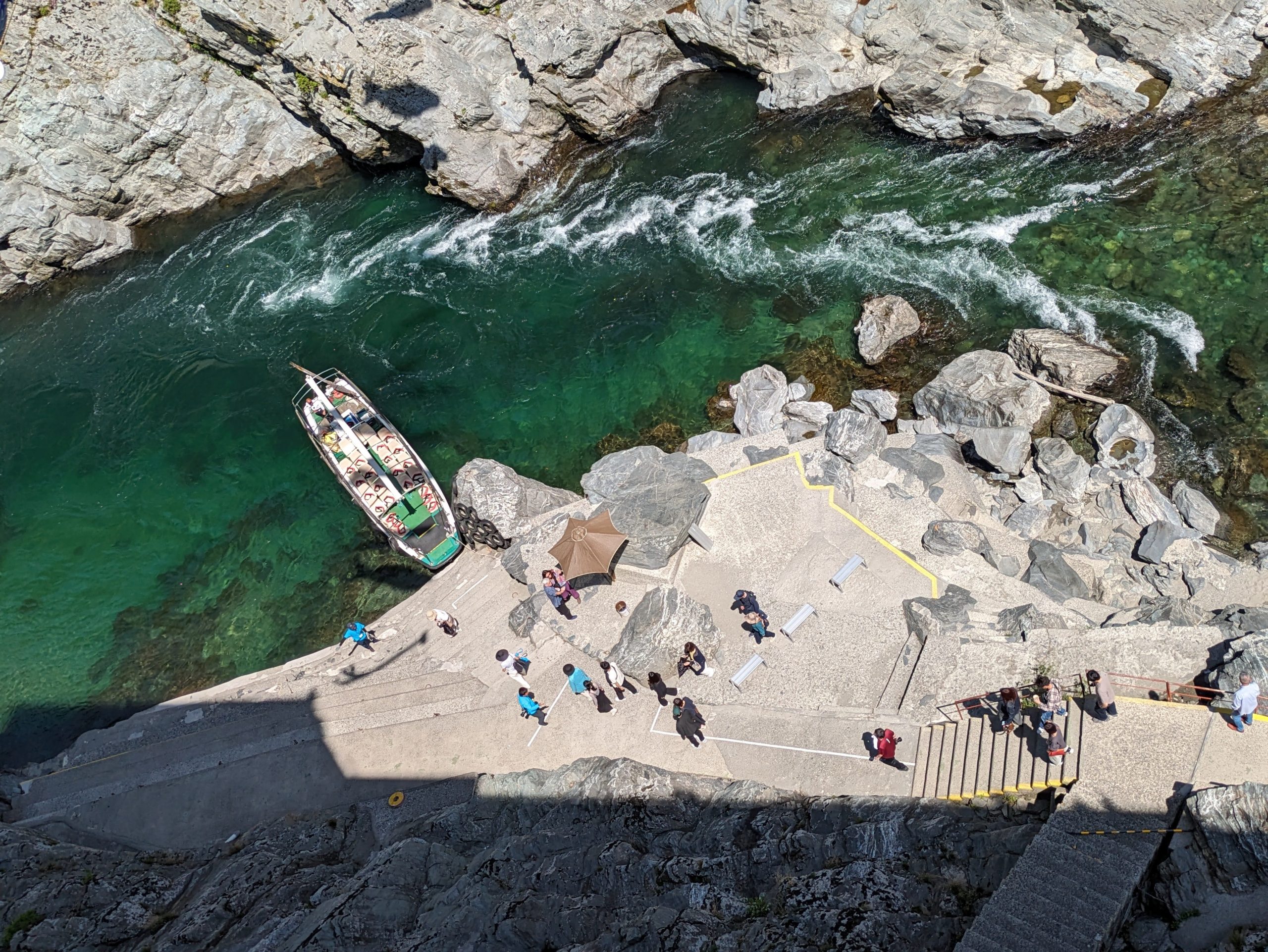
A local hotel and restaurant runs short sightseeing boat tours on the river. After seeing the scenery, I was glad I budgeted a bit of time to give myself a chance to do it! Here’s a view straight down into the canyon of the boat I’d be going on shortly.
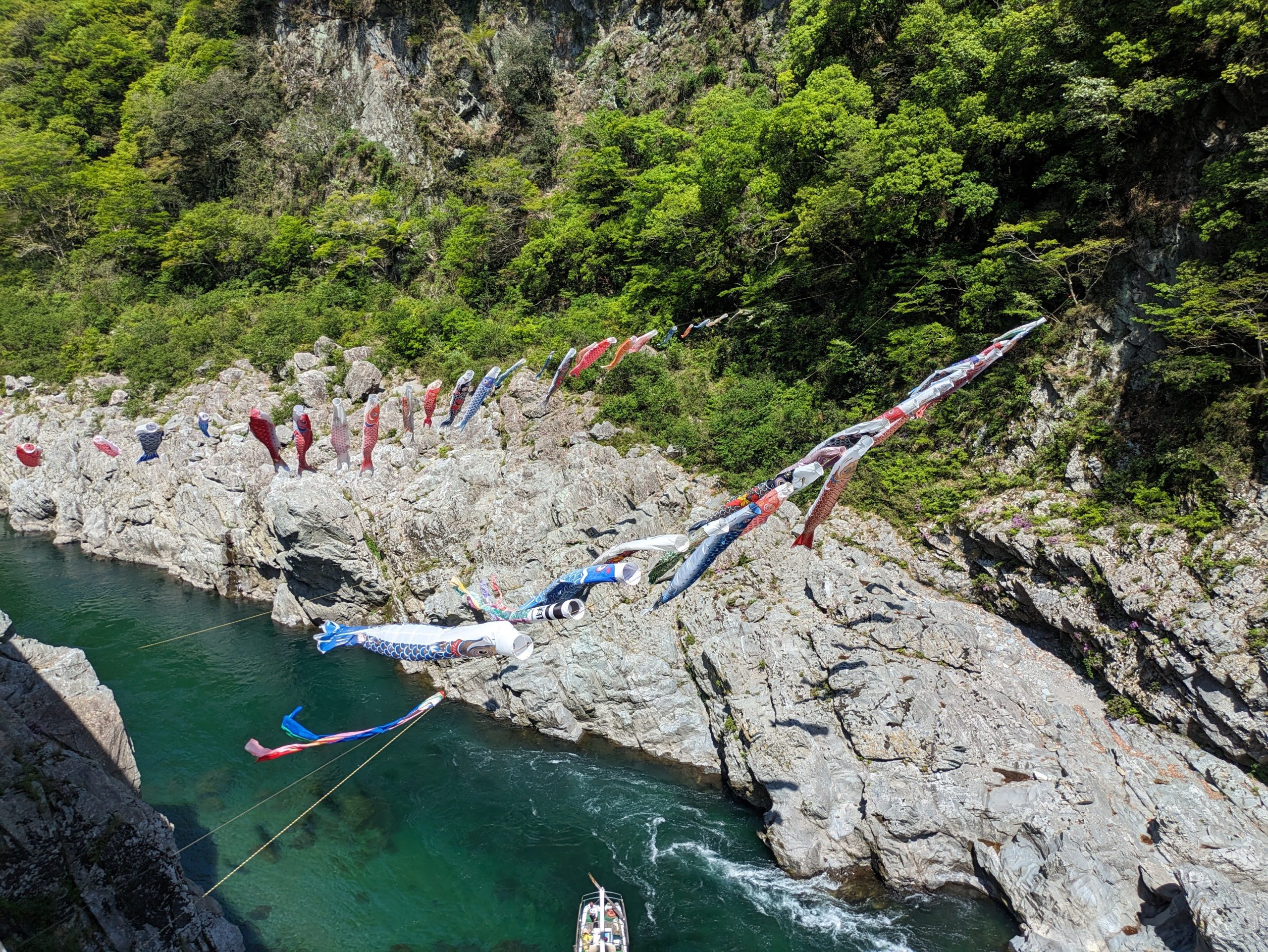
More koinobori – spanning the whole canyon! These must be quite the effort to put up and take down every year.
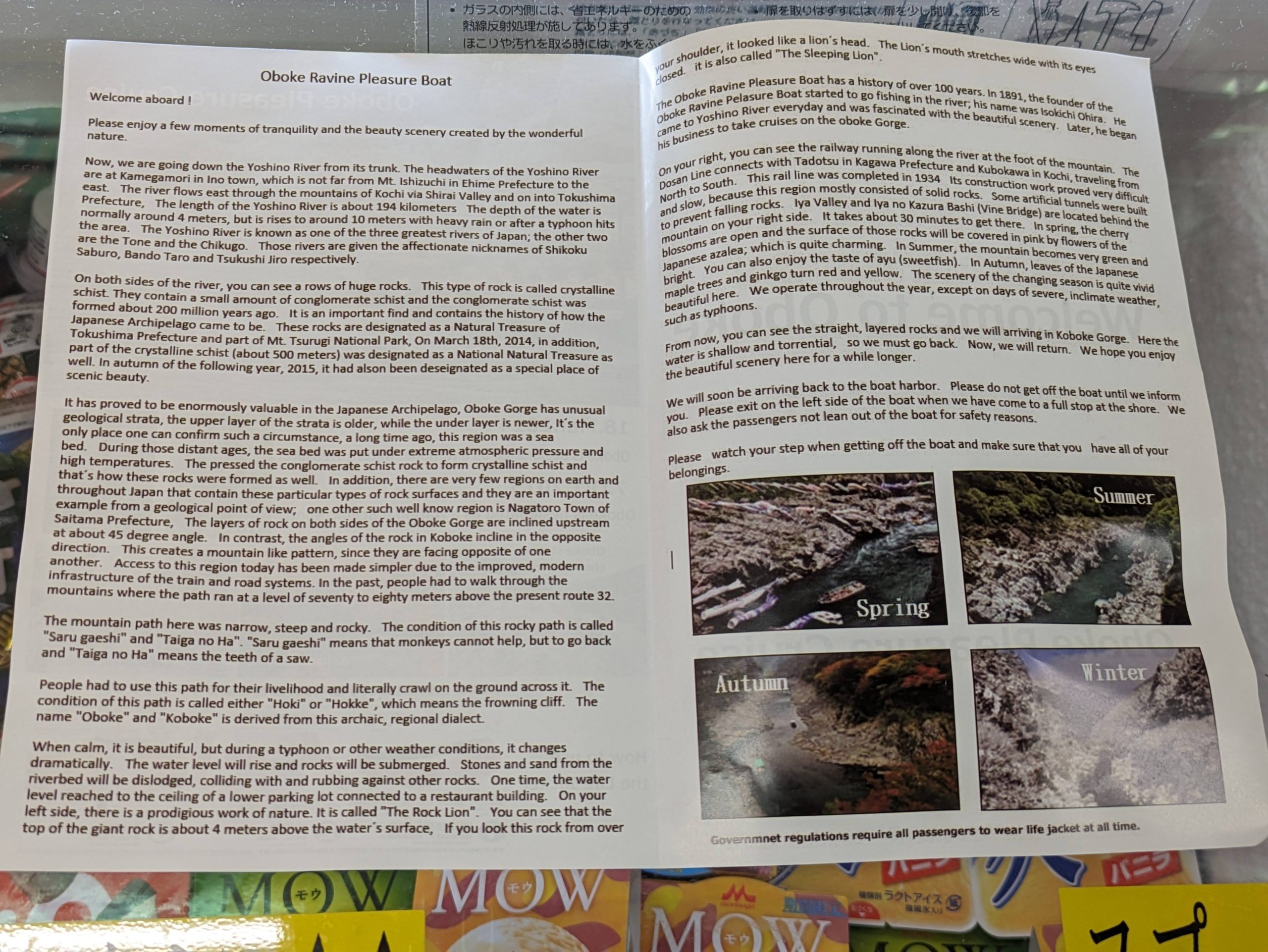
The boat tour was of course in Japanese, but they’re trying to make it more approachable for foreign tourists… which in this case means they just took the the entire transcript of what the tour guide is trained to say in Japanese, translated it, and straight-up dumped it into this pamphlet which was handed to me in the lobby. LMAO.
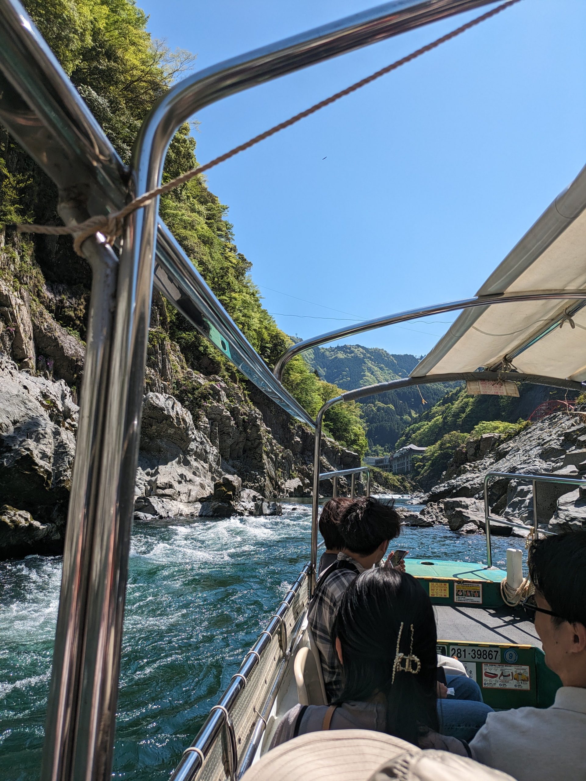
It was incredible getting an eye-level view from the bottom of the canyon. The Yoshino River is one of most dangerous in Japan, with famous rapids and white water rafting, but this area was pretty calm.
The water was spectacularly clear. I loved the patterns and reflections of the sunlight shining up onto the rocks, dancing as we sailed by.
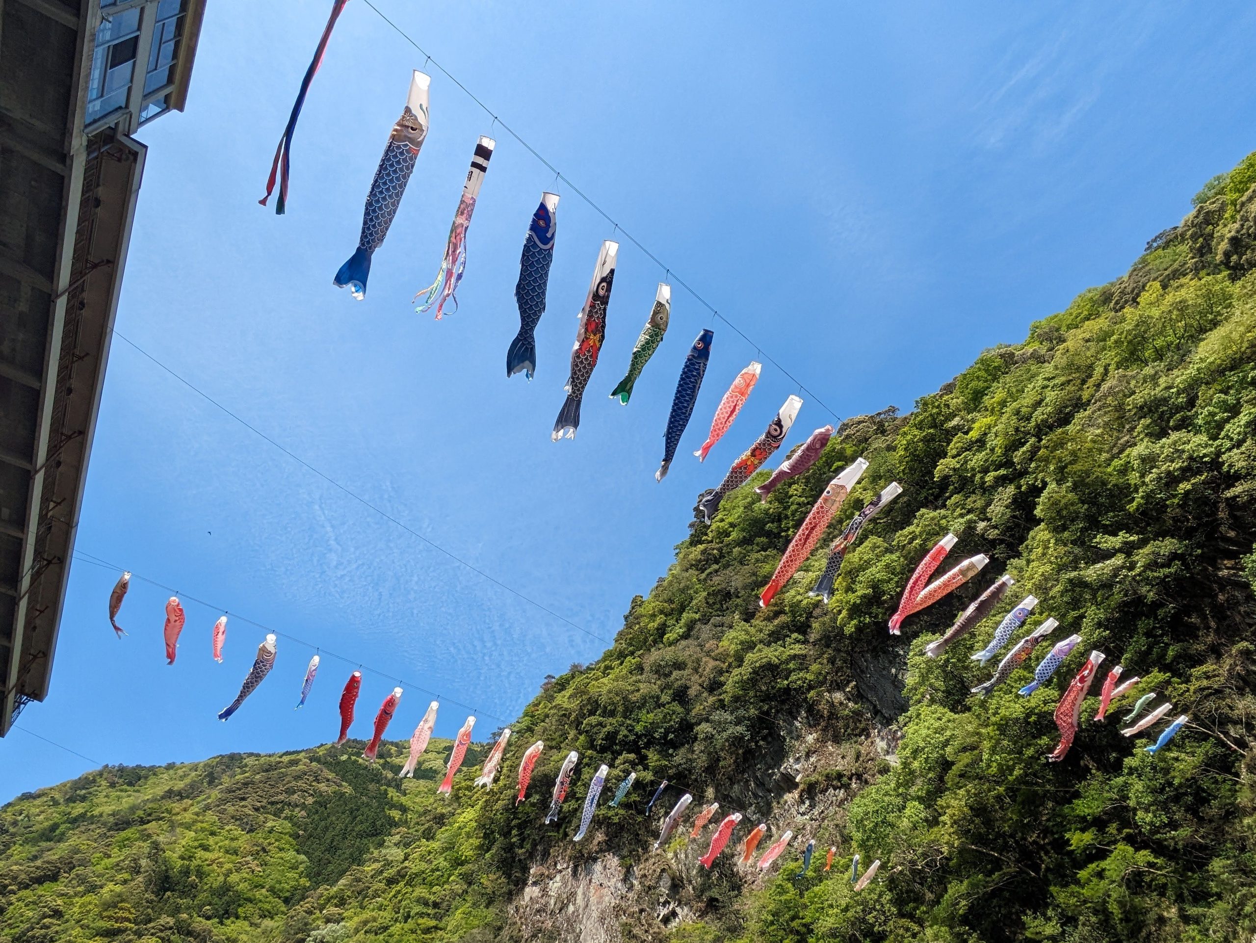
Another view of the carp streamers from below, fluttering around as they caught the wind.
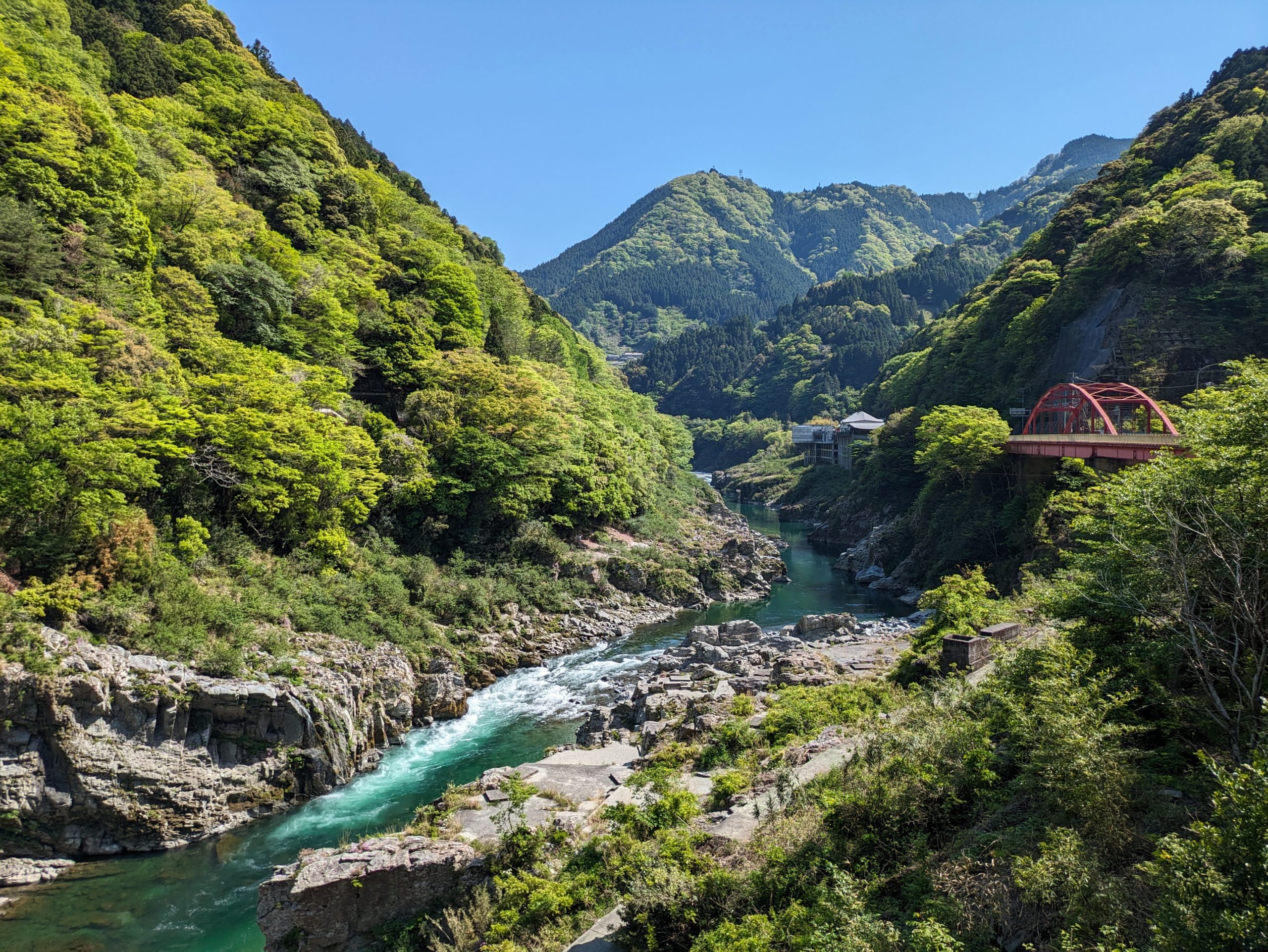
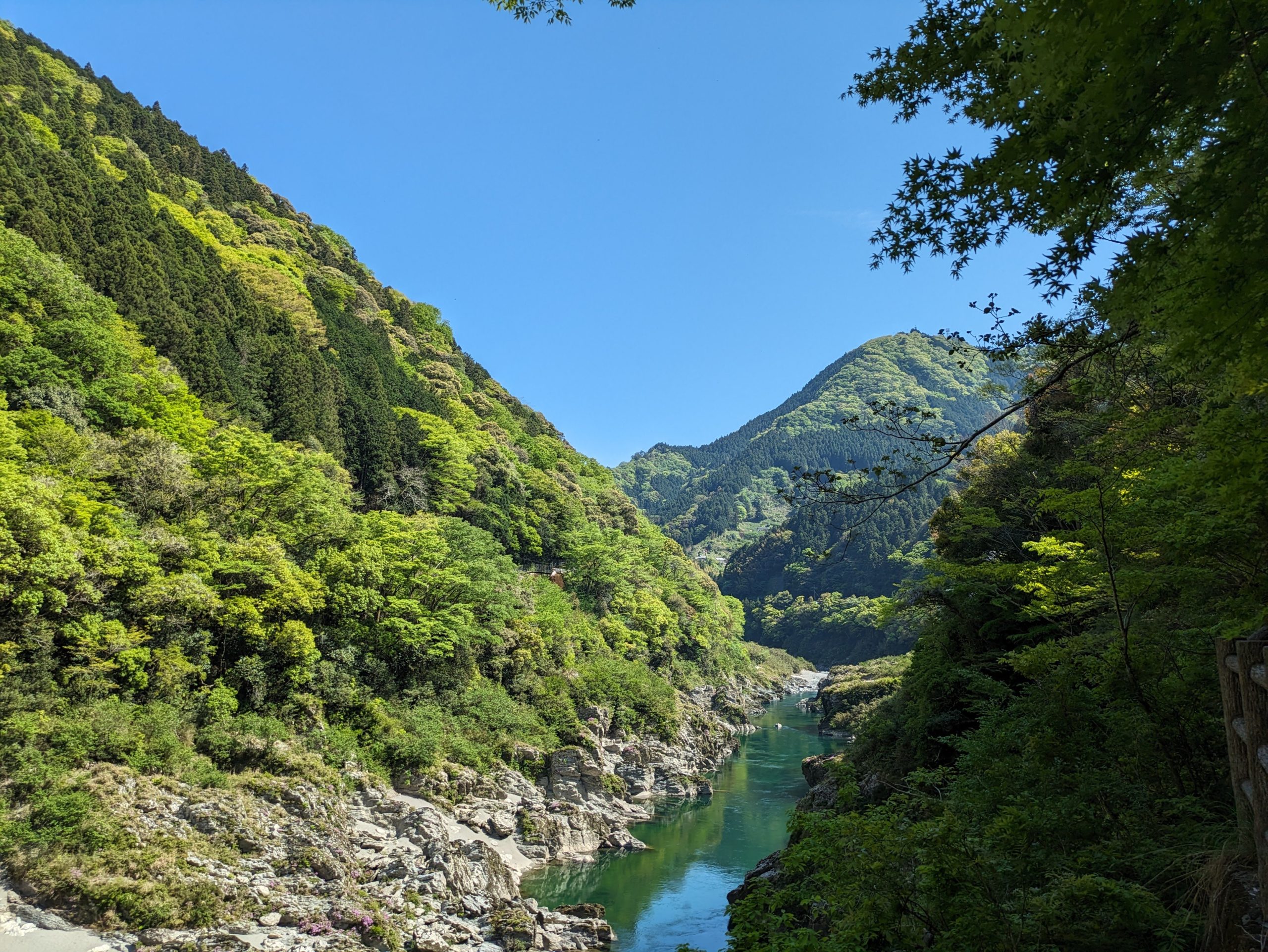
Around halfway back up the trail to the road were some truly gorgeous (pun not intended) views – water turning from white to turquoise, surrounded by shades upon shades of blue-green hills, and even an iconic, red Japanese bridge. Probably my favorite photo from the entire trip here.
Poking around the lobby of the boat departure building a bit more. cherrybloosam……
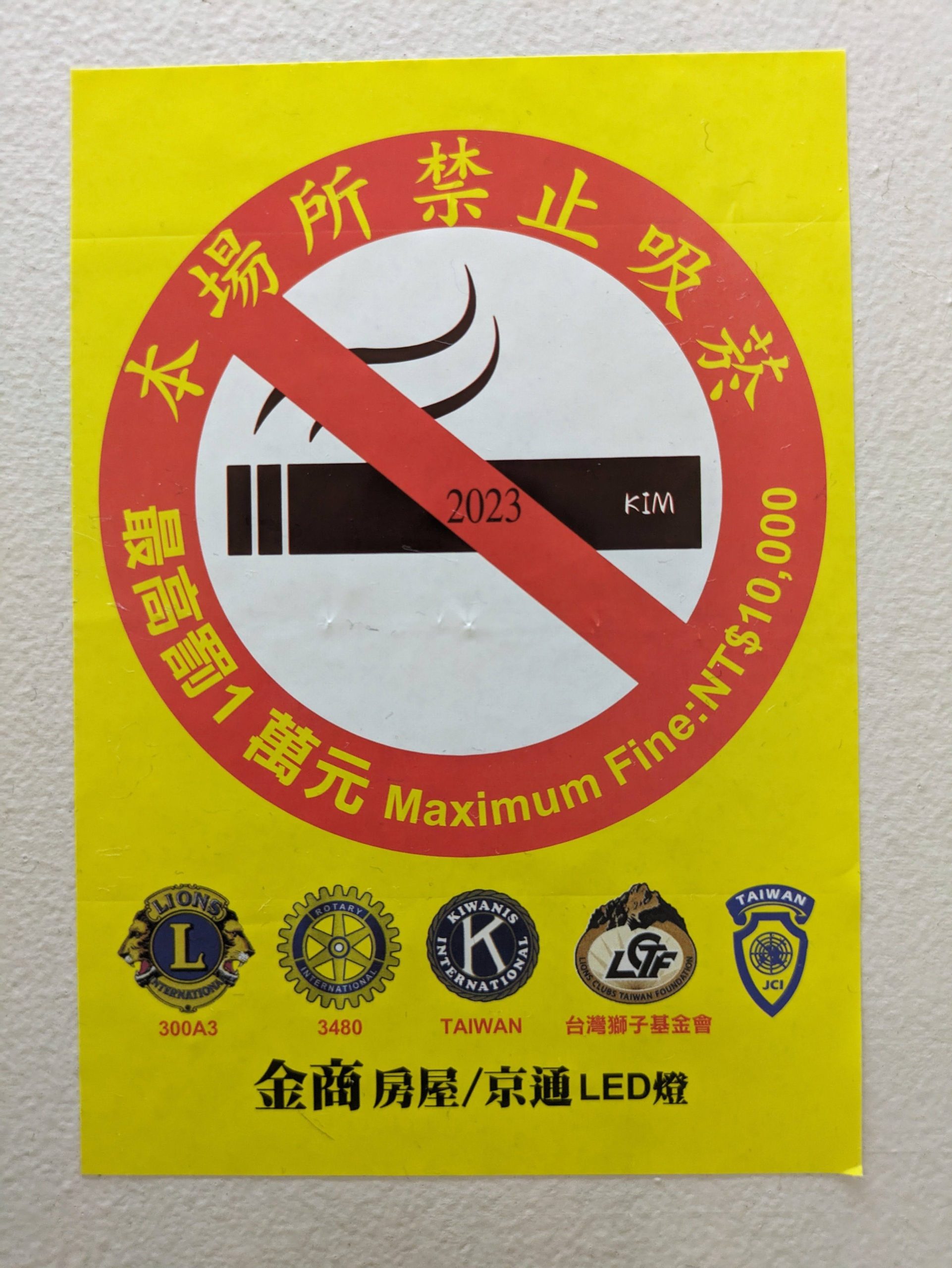
why??? why was this here????? taiwan??? taiwanese dollars??? lions club???? 2023???? who is kim????
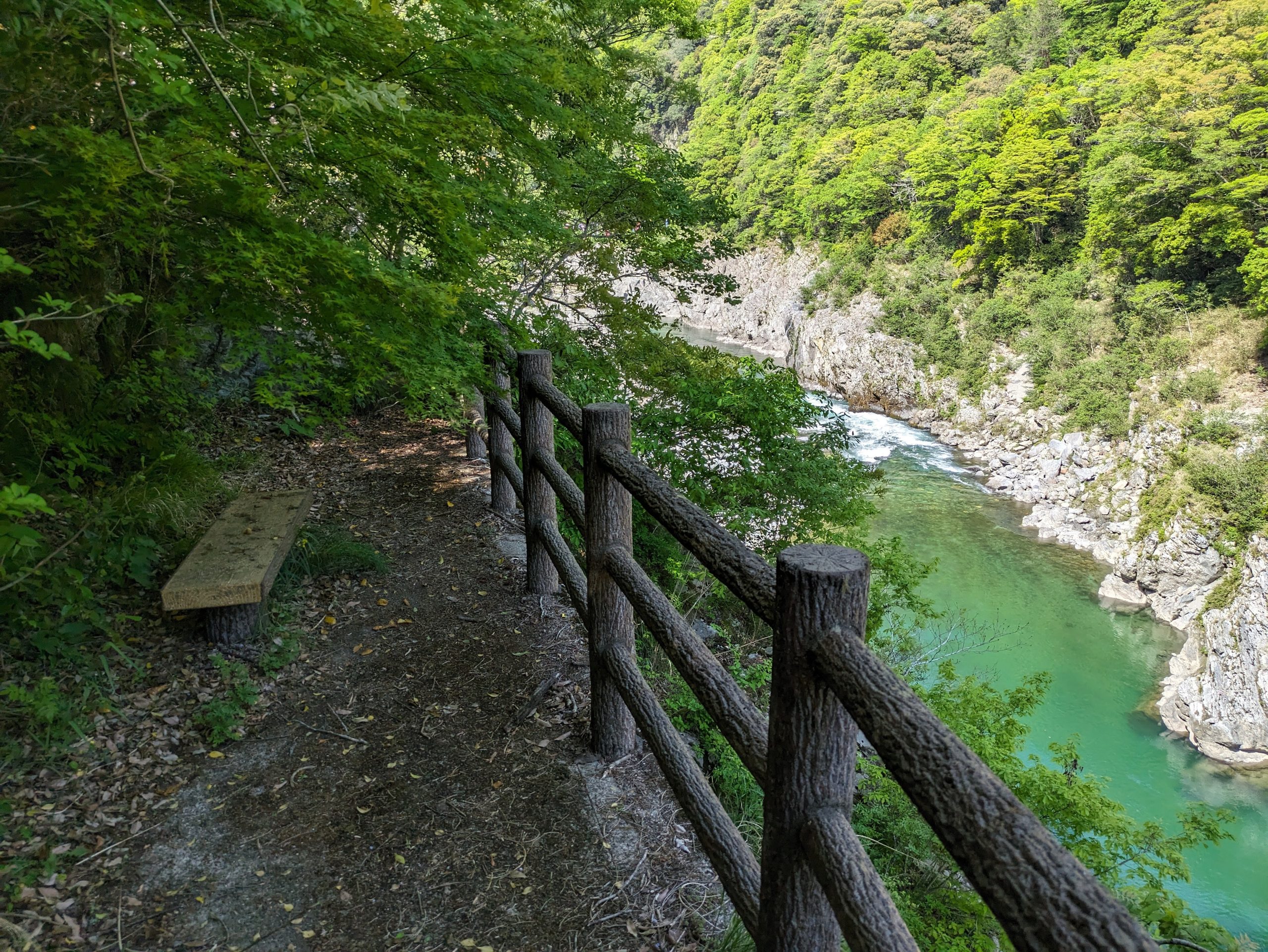
There were lots of little (ill-maintained) trails down from the road to rest areas and overlooks of the river.
Sitting on the bench and peering over the fence gave this view… I think it’s impossible to take a bad photo here, honestly.
After my boat ride, I headed back to the train station to where the public bus arrives a few times a day to take people back and forth, in and out of the valley. I had read about how supposedly hard the Iya Valley was to reach by public transportation, but in practice, it wasn’t too bad – seven departures a day with five of them in the afternoon really isn’t that dire in my view, as long as you plan it in advance! I took the bus just before 3 p.m., arrived around 25 minutes later, and had a flexible amount of time to explore the area, as long as I made it onto the last bus back out of the valley at 5:30. It’s not that big of an area to walk around, and a couple hours was definitely enough time.
Crossing the bridge to get back to the stationfront bus loop. Have you see a prettier train station? This one was really, really far up that mental list for me.

My bus – nice color scheme and livery, by the way – had a prominent sticker telling me they were part of the NBA. (That’s the Nihon Bus Association, naturally.)
I got off at a stop midway down the long, winding road, in front of an inn named Hotel Kazurabashi, which I figured would give me some great views as I walked the half hour to the little concentration of shops and houses built around the low-lying area around the Iya River. I was right! Imagine living here…
There were sweeping views like this pretty much the whole walk from the high roads on the side of the valley down to the village.
Kazurabashi Yumebutai (a visitor’s center with a name meaning “Vine Bridge Dream Stage”) as seen from across the river – this is where my bus home would pick me up.
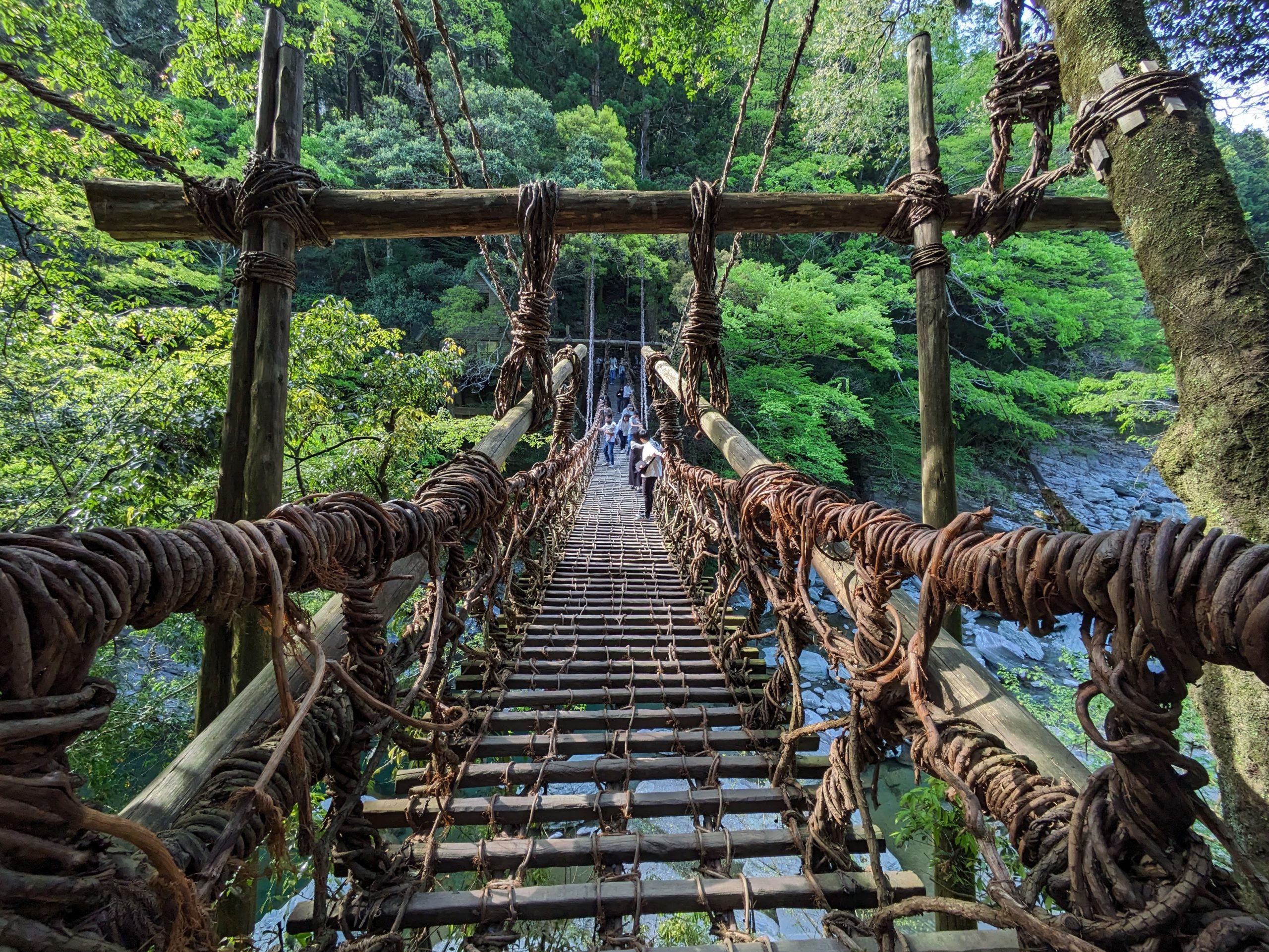
This vine bridge spanning the river is the main attraction of the area, and indeed was really cool to see – but, frankly, even scarier than I thought it’d be, with quite large spaces between the slats suspended 14 meters above the ground. But I made it across! The japan-guide.com page for the area writes: “Suspension bridges made of mountain vines (kazurabashi) were the main means for people to cross the river of the Iya Valley in the past […] 13 bridges once spanned the valley, but only three survive today.”
Here was the view from the river below, with the bridge in the background. I loved the light here at this time of day.
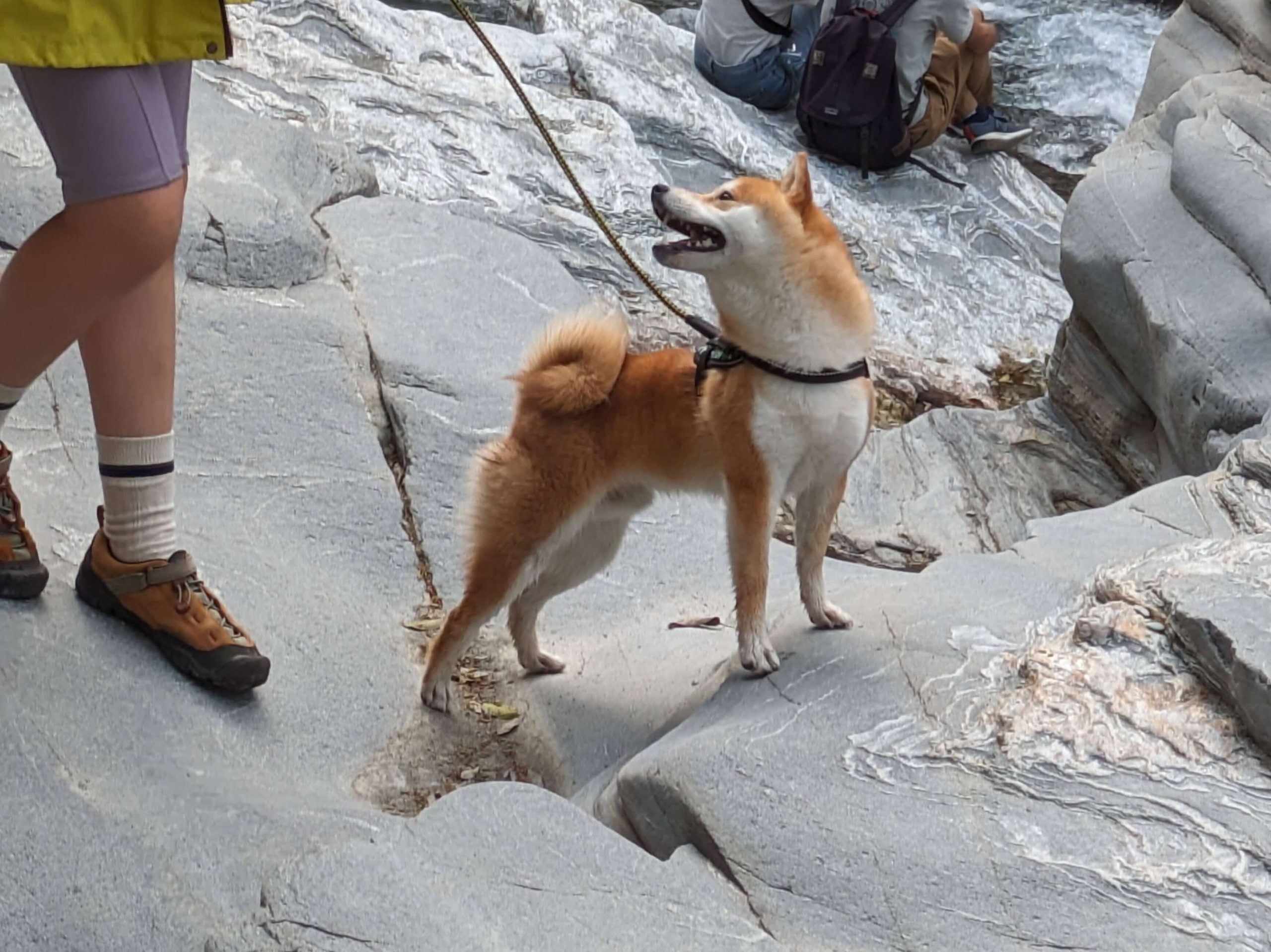
There were some cute dogs playing in the area as well. :D
The bridge is anchored super securely to nearby trees, and is rebuilt every three years to prevent deterioration by a local preservation association.
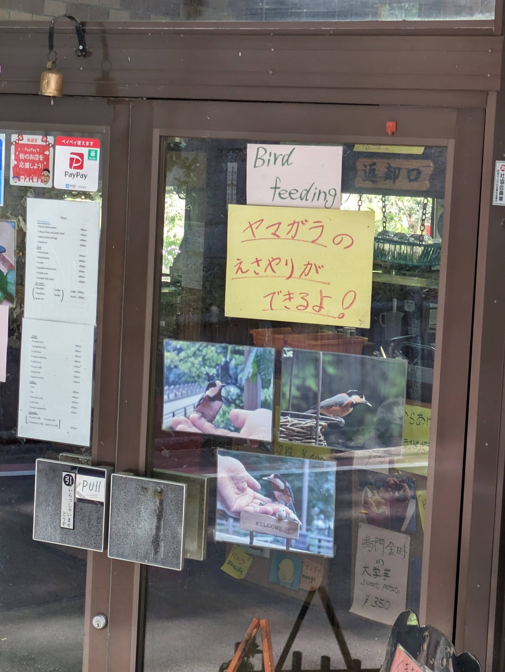
I walked by a cafe that advertised BIRD FEEDING?!?!? Yamagara, a type of tit, are very common in the area. Well, I had to go in…
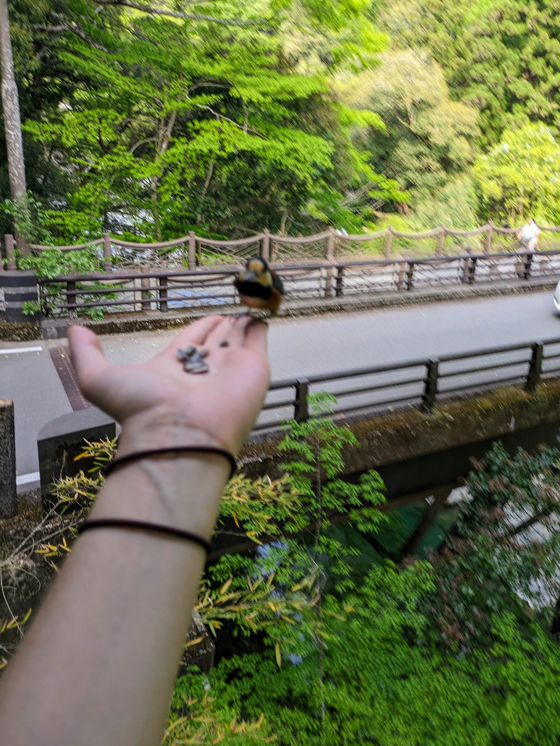
I ordered some pancakes. While I waited, the owner gave me some birdseed and told me to stick my hand out on the balcony and be patient. And they came!!! Blurry pic, but it was really special. :)
I didn’t have time go deeper into the valley to Oku-Iya, or “Inner Iya”, where headlines talk about how the number of scarecrows outnumber the number of people. The area didn’t seem like an absolute must-see for me, and with public transportation I would’ve needed a full day, or to have stayed in the valley (which I looked into, but was super duper expensive). Another way to explore, which I also researched but ultimately decided against, was a private taxi tour via a local company named Kazurabashi Taxi who will drive you around and act as a guide to whatever spots you want, in the amount of time you have, or alternatively take you on recommended courses. While it wasn’t for me in the end, I’m glad these alternatives to private cars exist in the area which really make the area more accessible to a broad range of people.
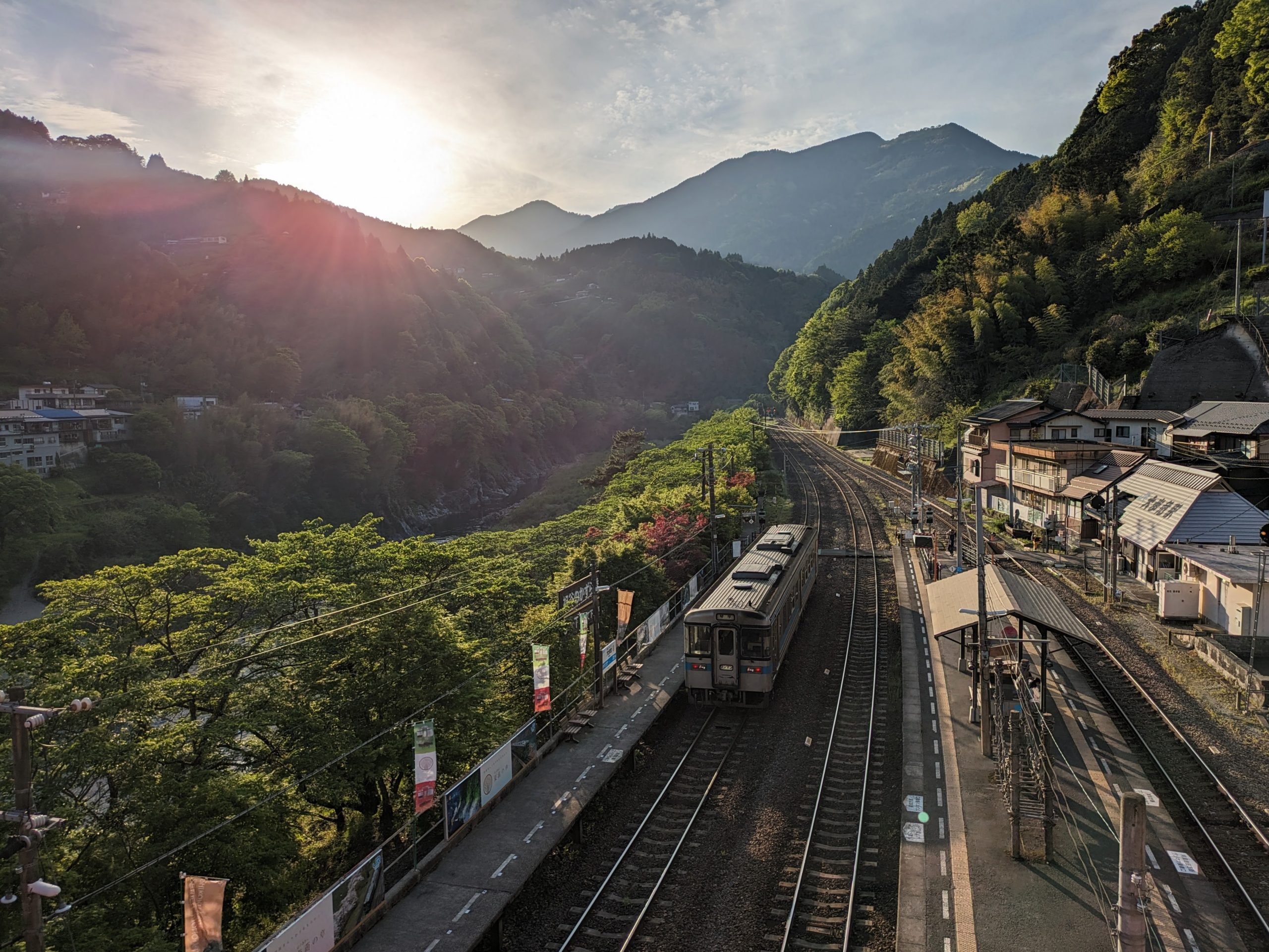
The sun was starting to set as I got back to the station, which made the gorge take on quite a different character compared to before. My train back up northward was there waiting for me… but I made a last-minute decision to instead go south to Tosa-Yamada Station (across the prefectural border, in Kochi) and then back up, which would also let me ride the central section of the Dosan Line as opposed to missing it.
I liked this person’s peculiar parking perch.
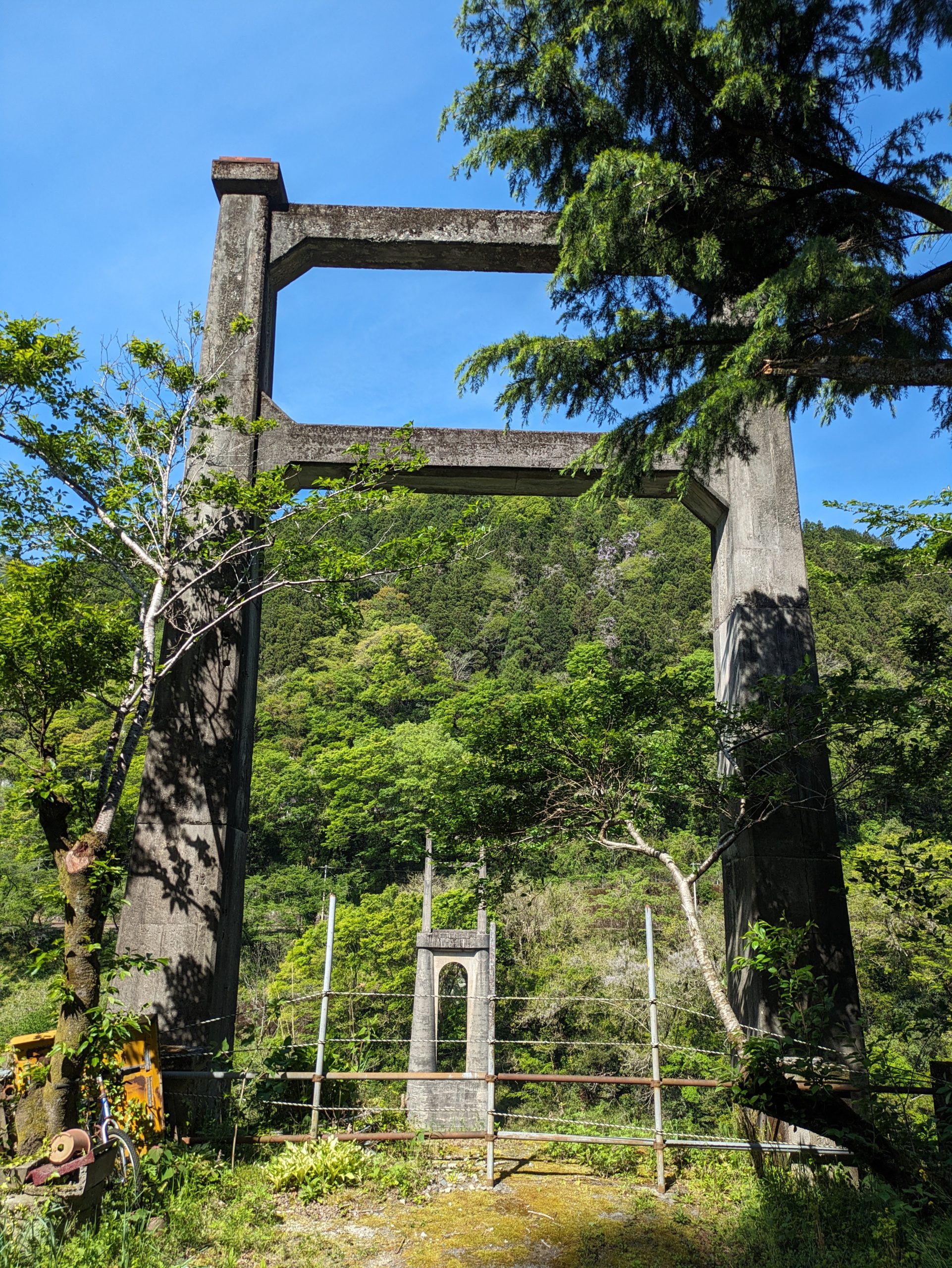
Nearby are the remains of an abandoned bridge, originally constructed to connect the station to National Route 32 on the other side of the river. It was built in 1934 and decommissioned in 1974 when the current bridge opened.
As I waited for my train, now in the south direction, I wandered the hillside, and found a trail through the woods that wasn’t on Google Maps. I didn’t have time to go all the way up to what promised me it would be a “country-seeing-mountain”, though.
After quite the incline with a lot of switchbacks, the trail spit me out on a road covered with leaves and moss, which eventually connected back to this main road.
We’ll see a big version of this guy tomorrow! While I still had time to snap this photo, my exploration and road back to the station was more windy and took me a bit longer than I predicted…
…meaning I arrived after the barriers were down at the level crossing. I legitimately didn’t know what to do here, but the driver of the train on the opposite platform (who was luckily there!) signaled to me that I should indeed lift up or crawl under the 遮断機 shudanki pole/barrier and cross the tracks to get to the platform on the other side.
Ignoring flashing lights and warning bells to run across train tracks goes against all of my self-preservation instincts which made this moment probably even more tense than the vine bridge, to be honest. But watching the sunset from the train, and then riding around at night – I even got to lie down on the bench seating, and chill out out listening to music (I was literally the only person aboard) – was a nice way to relax and end the day.
I rode the train for an hour south, and then for almost two hours all the way back north (past Ōboke where I had come from) to Awa-Ikeda.
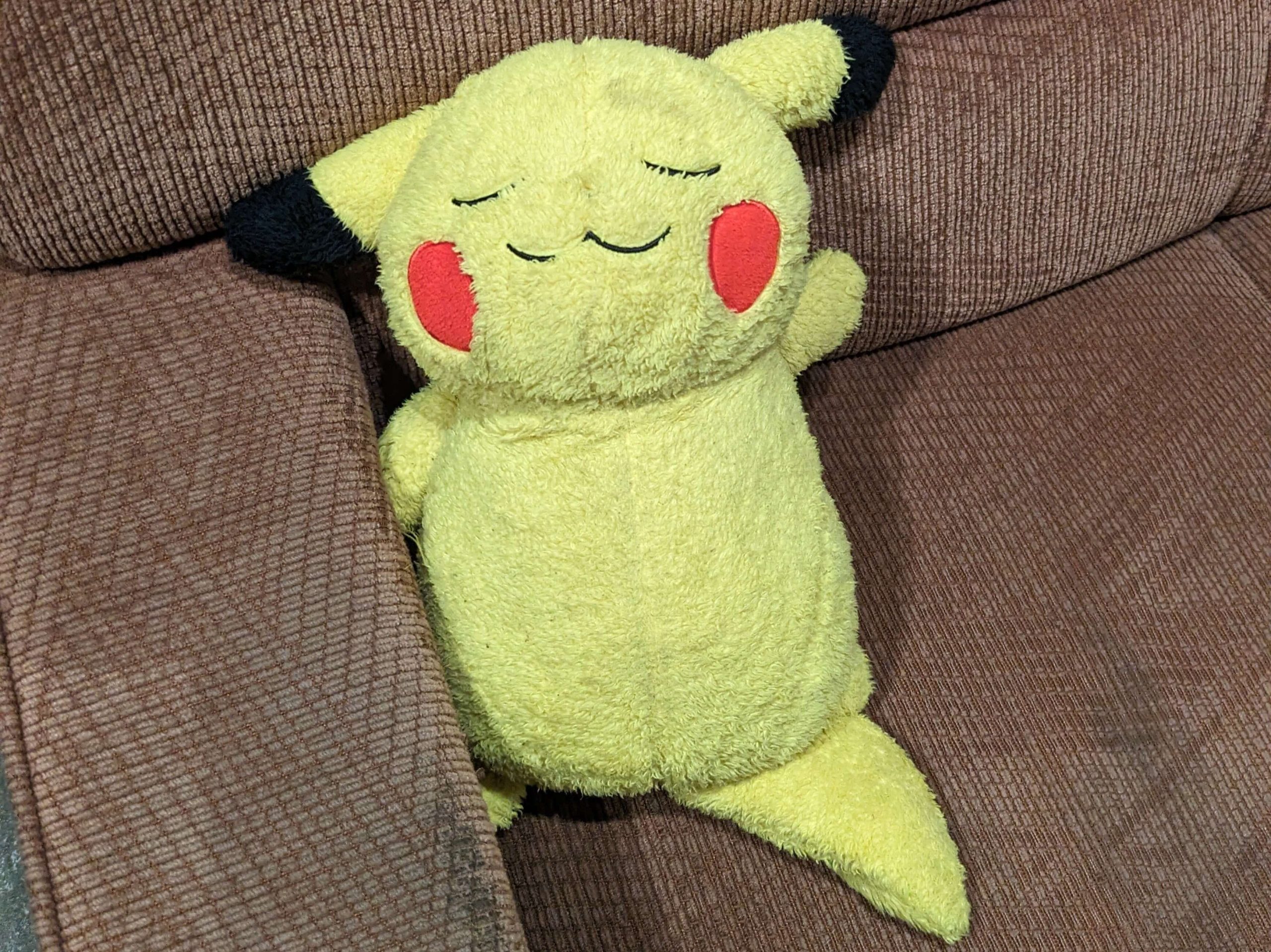
And then I did what this Pikachu is doing. Zzzzz.
Monday, April 28, 2025
Today’s transit:
7:58 Awa-Ikeda / JR Dosan Line 8:58 Kotohira
9:05 Kotohira / 〃 → 9:18 Tadotsu
⤾ 9:50 Tadotsu / 〃 → 10:04 Kotohira
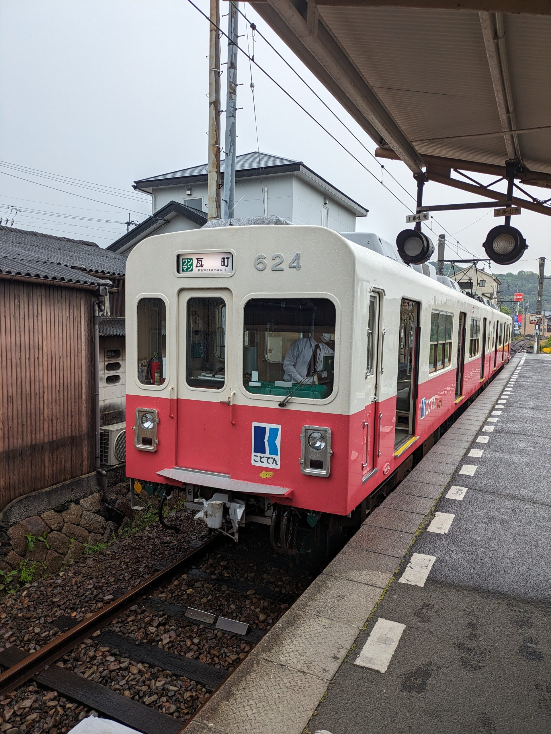
10:12 Kotoden-Kotohira / Kotoden Kotohira Line → 11:10 11:12 Kataharamachi
13:15 Kawaramachi / Kotoden Shido Line → 13:55 Kotoden-Shido
⤾ 13:58 Kotoden-Shido / 〃 → 14:15 Yakuri
14:45 Yakuri Tozanguchi / Yakuri Cable Line → 14:49 Yakuri Sanjo
⤾ 15:00 Yakuri Sanjo / 〃 → 15:04 Yakuri Tozanguchi
15:40 Furutakamatsu-Minami / JR Kōtoku Line → 15:51 Ritsurin
16:16 Hanazono / Kotoden Nagao Line → 16:49 Nagao
⤾ 16:55 Nagao / 〃 → 17:31 Kawaramachi
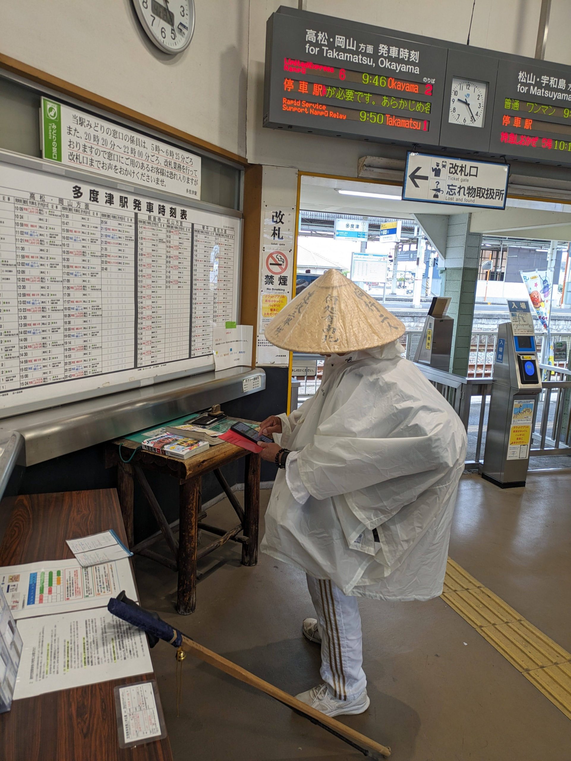
The last time I was in Shikoku was in January 2024, just after I had first moved to Japan, so I wasn’t quite as aware of the details of the IC card landscape at that point. While I had gone to Kagawa Prefecture and picked up a rainbow-colored SHIKOKU ICOCA, I didn’t expect that the old blue-colored design, before the update in 2020, might still also be available… I had asked, and they were sold out at the large station in the heart of the city, Takamatsu, but at the time I didn’t think to check the smaller ones that might have remaining stock (as fewer people are going there or buying cards from them). But according to my searching on Twitter, they did indeed still have stock, which was later confirmed by friends who went to check as well!
This resulted in my route up the city to take on a Y-shape, riding up past Kotohira and branching up to the left so I could try to buy the card at Tadotsu, which was my best-and-closest bet. If I was successful, the timetables would work out in a lucky way where I could head back to Kotohira after not too long, and then take Kotoden line into Takamatsu proper – a new line to ride for me, so definitely the better pick instead of having to take JR up and around (and then needing to spend more time to riding Kotoden out and back that night in order to complete the system…!)
On my way up toward Kotohira, though, I passed through a very peculiar – and funny – station, and one that’s well-known to many railfans in Japan. It’s a hikyo station, or secluded station, meaning that access is very, very difficult because it’s not close to any type of civilization at all. Here’s a quote from the Wikipedia article to paint the picture:
“The only way to reach it is on foot, via a 600-meter mountain road to Tokushima Prefectural Road No. 5. However, the road is little more than a hiking path, often blocked by fallen trees, and there is a risk of falling off the cliff because there is no fence. Also, depending on the season, pit vipers and hornets may appear.”
So why was it even built? Well…
This photo of the tracks might give you a clue, especially paying attention to the elevation. Reminder, the line’s still single-tracked.
Yep, it’s a switchback! One of the only two in Shikoku. Originally built as a signal station, local trains pull forward on the flat track, make their stop, and then drive in the opposide direction back to where the tracks branch before this time continuing on the uphill one and into the tunnel.
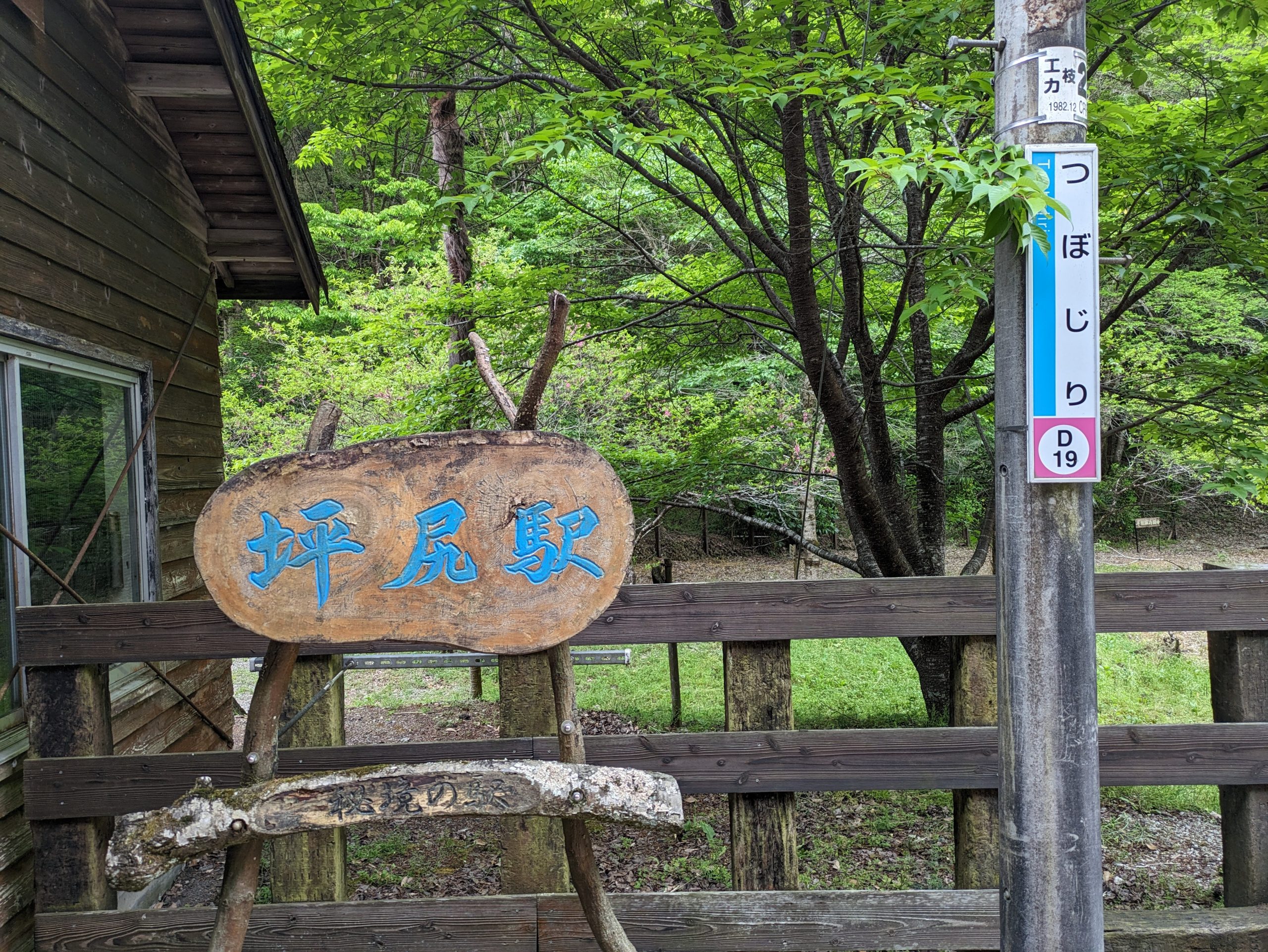
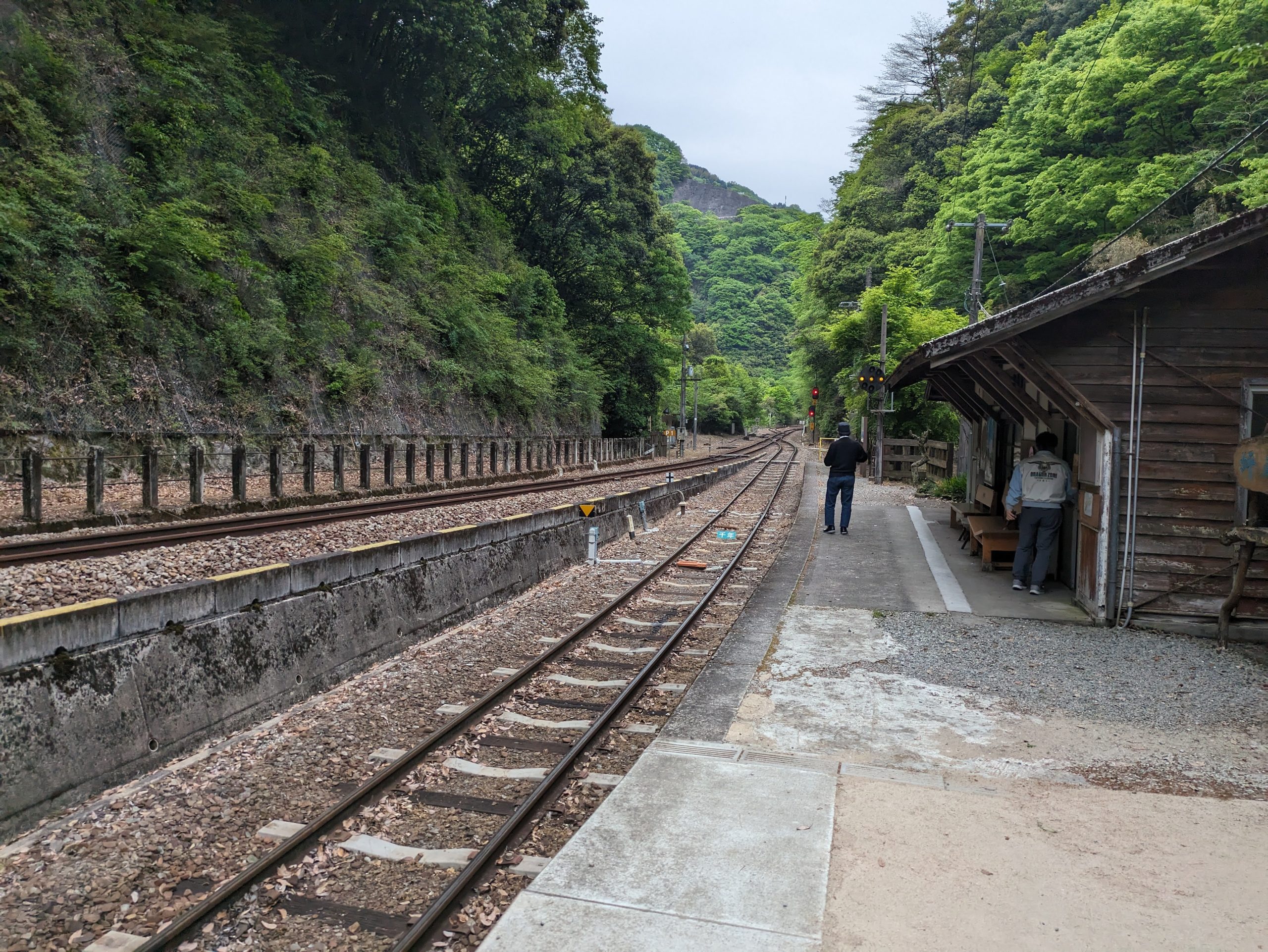
Tsubojiri Station in its quiet glory.
Like many stations in Japan, even occasionally unstaffed ones – especially if they’re somehow special or B-league famous like this one – Tsubojiri has an eki-stamp. It was installed in 2008, but two years later, in February 2010, it went missing. Then a few months later, in late April, a JR East employee discovered it up in the far north of Aomori, at Nakasawa Station on the even-more-rural Tsugaru Line…… a full 1300 kilometers away. It eventually was transported back to its rightful home, with the story written up and posted in the station for fellow travelers to enjoy and laugh at. (It inspired a few copycat thefts in the future, too!)
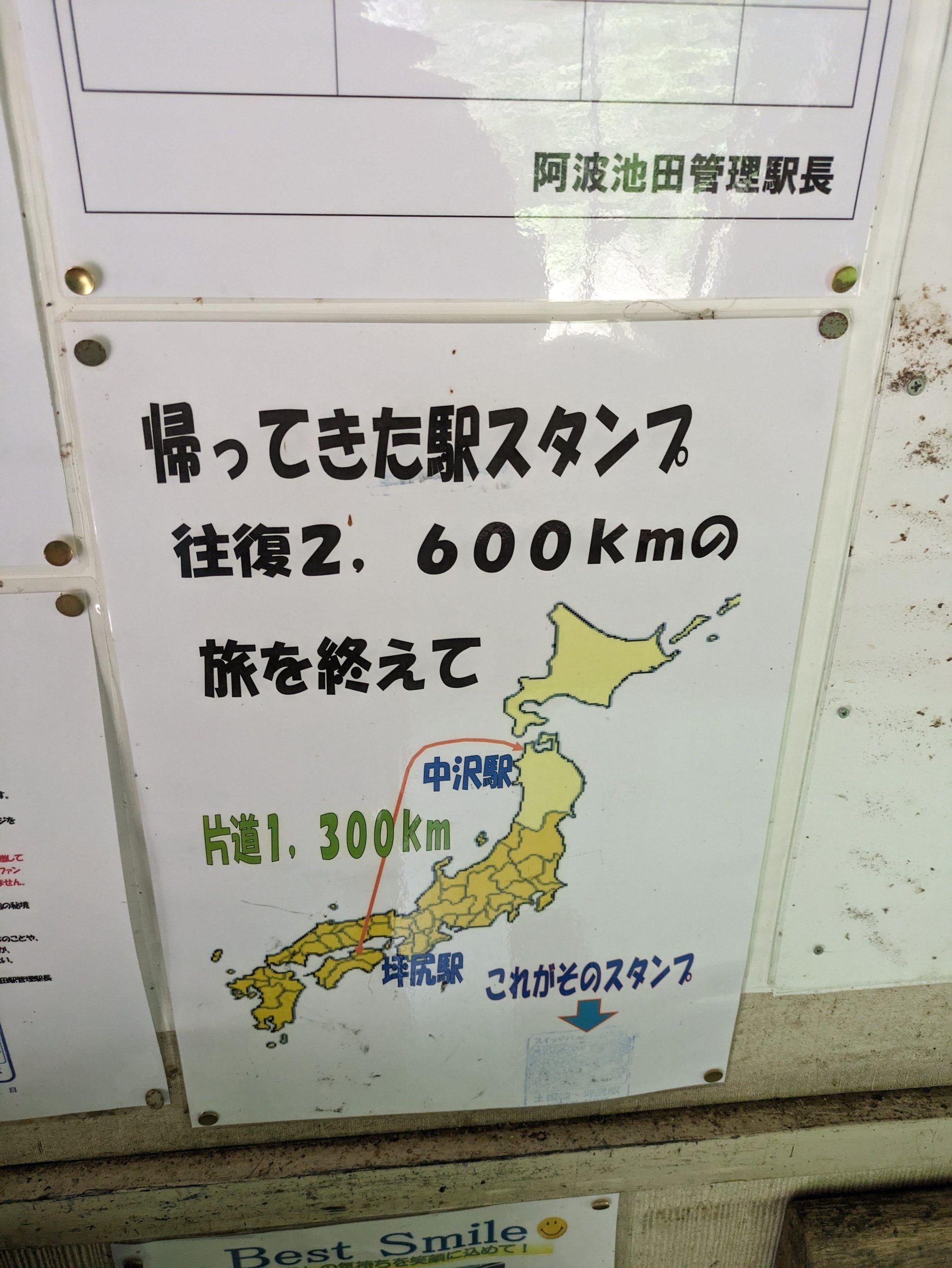
A map showing the stamp’s long round-trip journey was up on the wall.
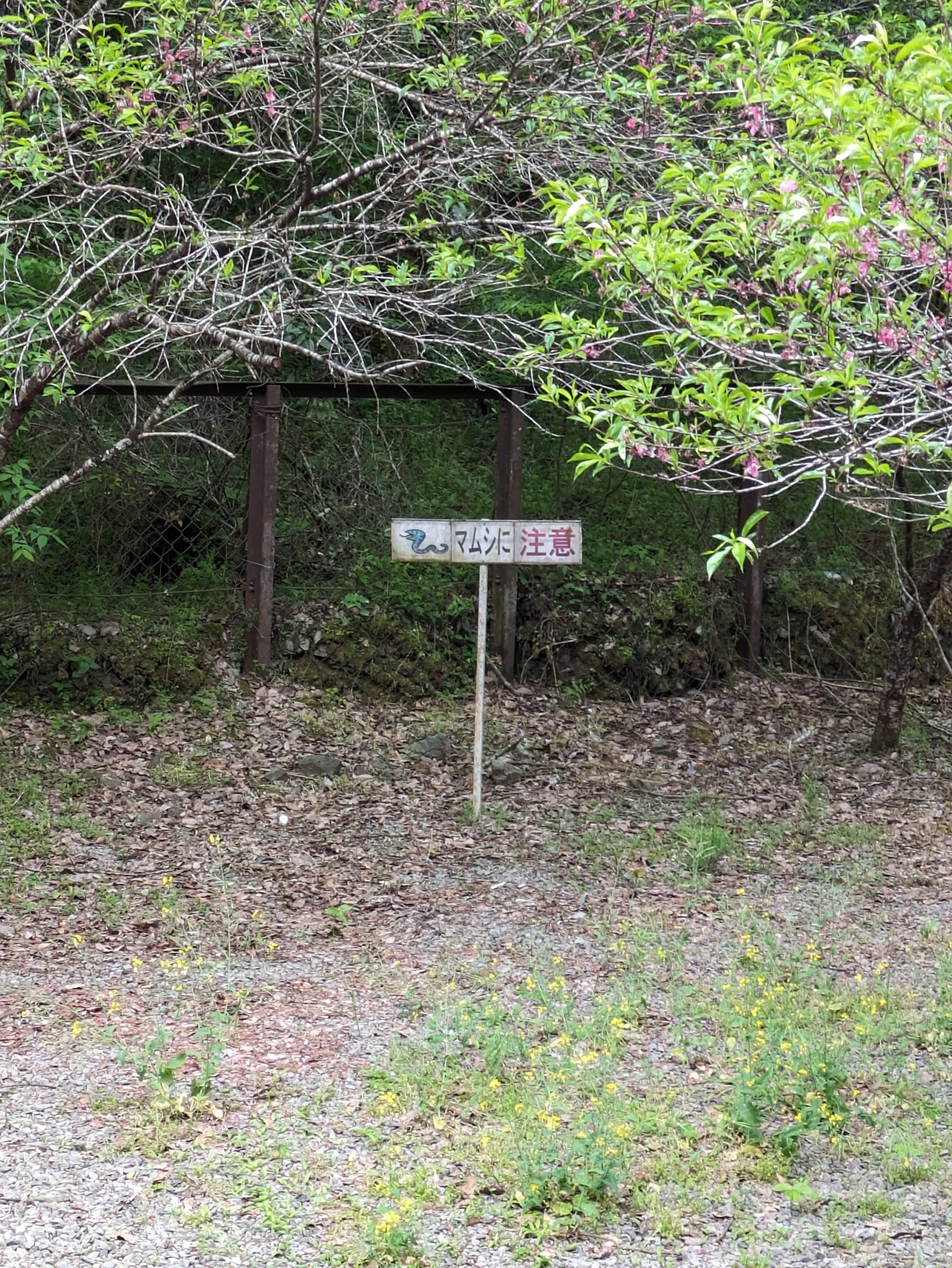
The pit vipers sign!!!! As prophecized!!!
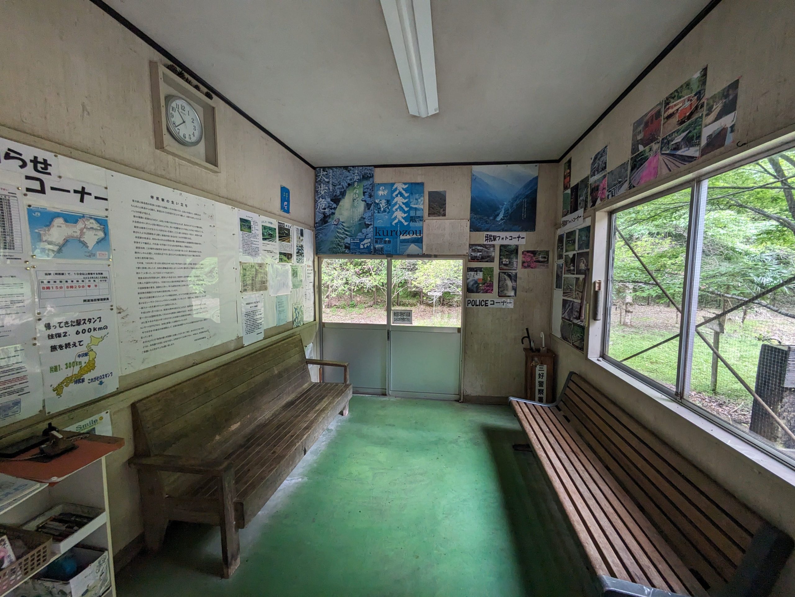
The small waiting room. If you miss your train, you’re gonna be stuck for quite a while, as there’s only three departures a day in each direction.
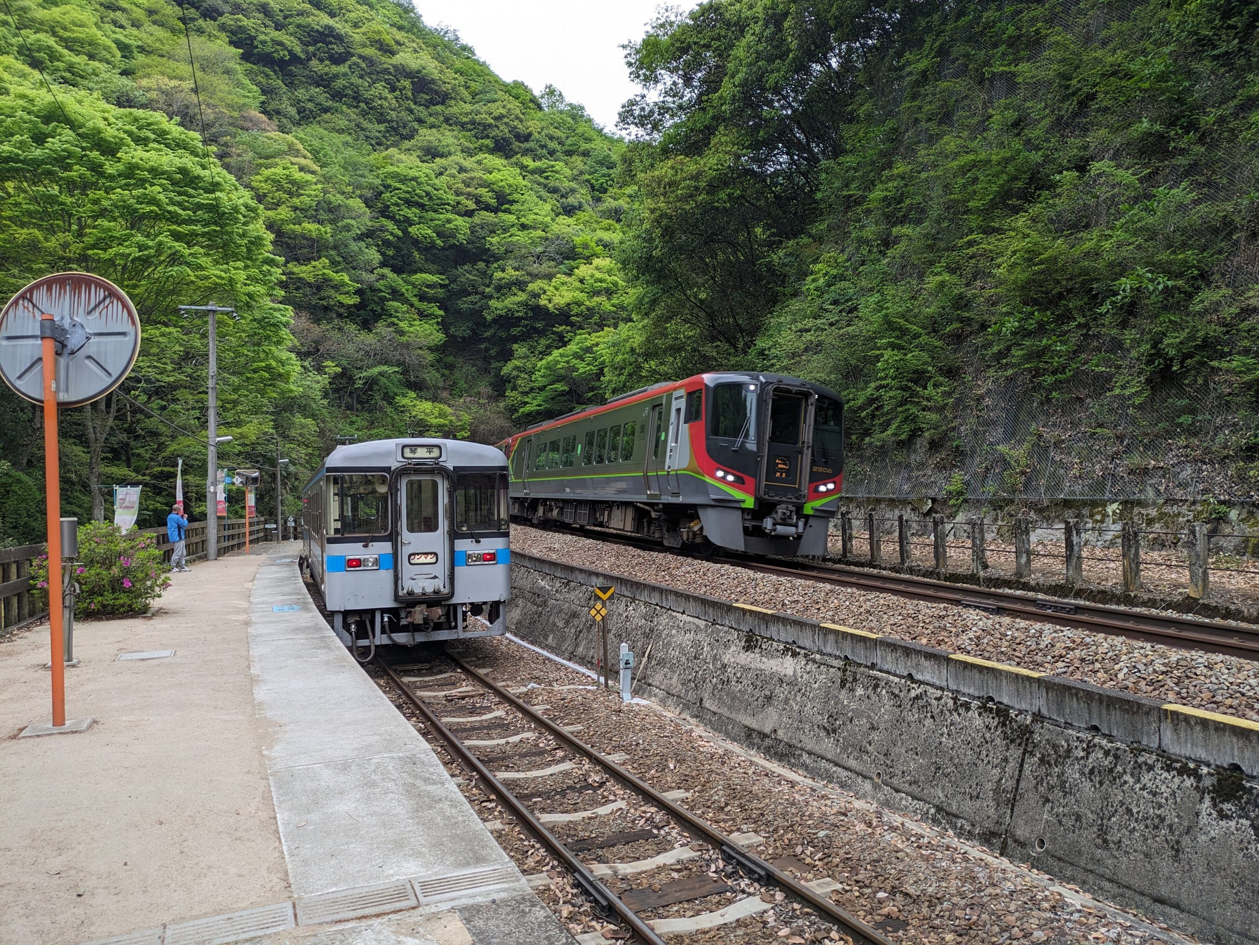
The southbound limited express came by, meaning it was time to do our switchback and continue north into the tunnel.
I arrived into Tadotsu and immediately saw a henro on the famous Shikoku 88 Temple Pilgrimage. I know two people who have done this now, a woman who taught at a Japanese language camp I attended growing up, and my high school math teacher! (He’s writing a book on it due to come out in a few months, too, and is a very good writer.)
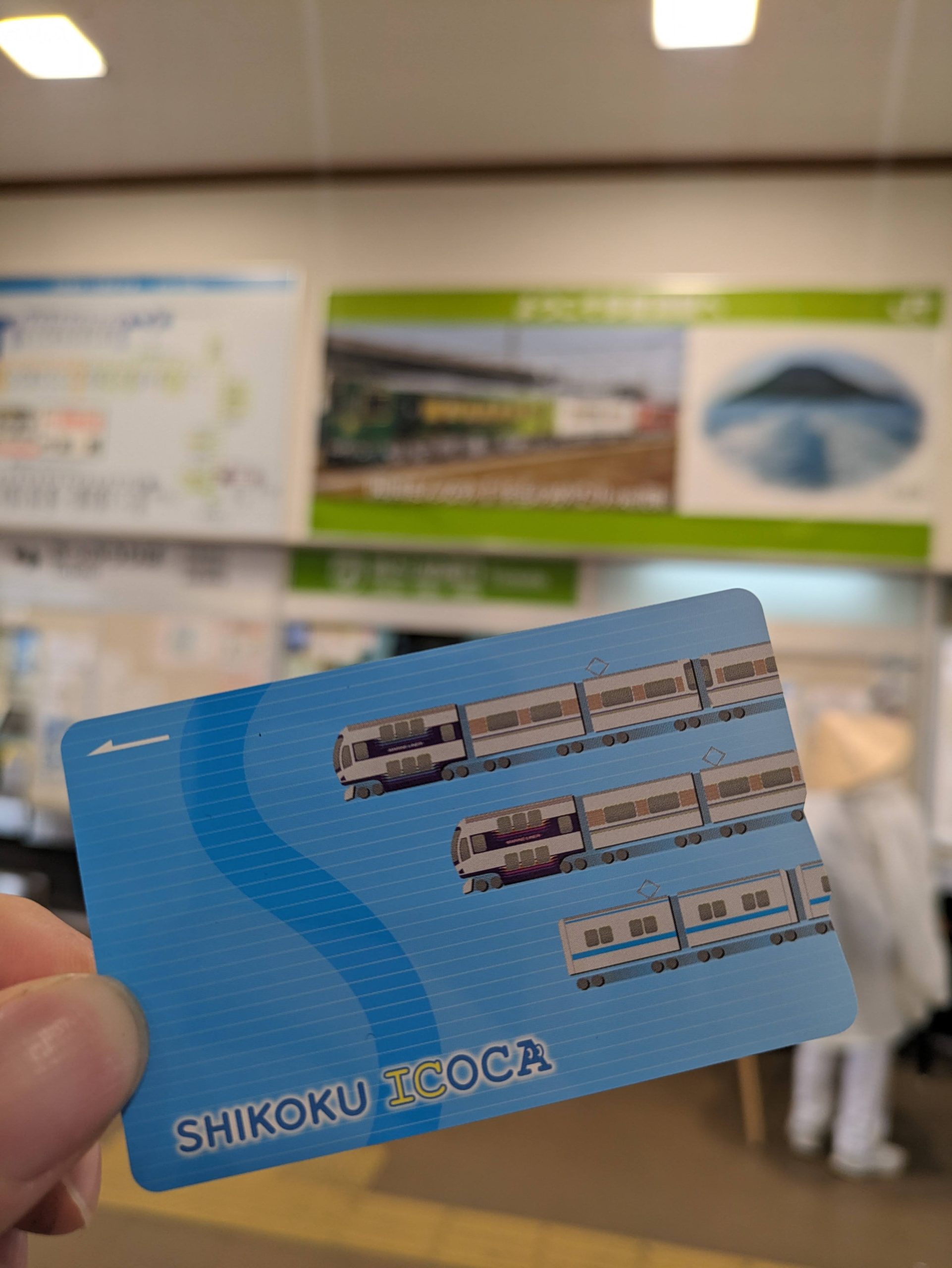
The old SHIKOKU ICOCA design was in stock, yay!!! IC card #130 obtained. When I headed back onto the platform to head back a few stations toward Kotohira, Shikoku’s beloved Anpanman train was stopped there.
Let’s do it! (Japanese loves this “let’s” construction, and I find it charming when it gets too-directly translated into English, which is a lot.)
Are you supposed to… throw away IruCa IC cards in here…? Not tickets?
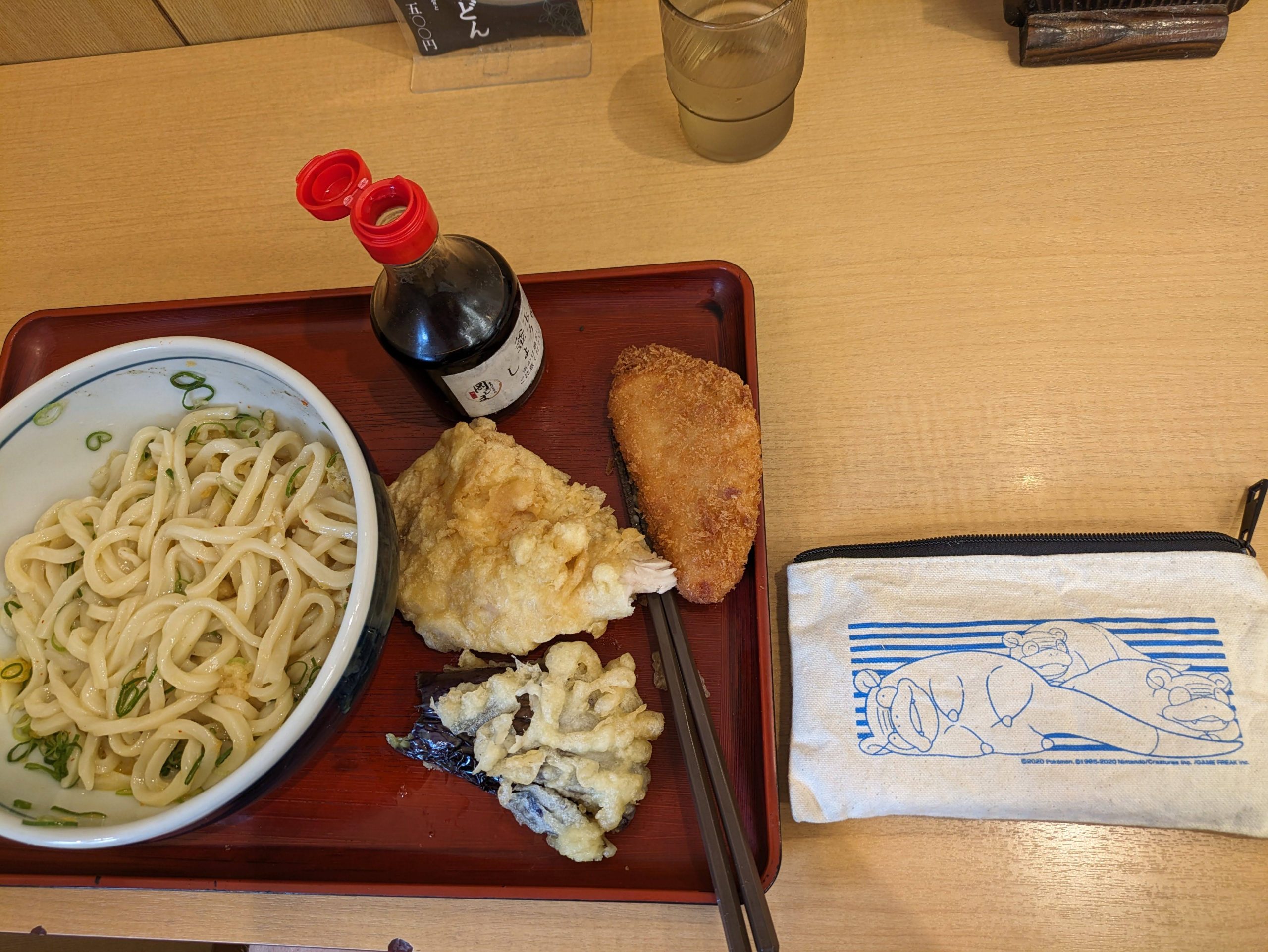
UDONNNNNN!!!!!!!!!! The best in all of Japan, in Kagawa, where sanuki udon is from – called that because “Sanuki” is the old province name for Kagawa. And of course I brought my Yadon (Slowpoke) pencil case for the photo. Yadon is Kagawa’s Ambassadorial Pokémon, by the way… for the sole reason that “yadon” sounds sort of like “udon”.

Smile Station Shikoku! From that wooden sign yesterday. There he is! :)
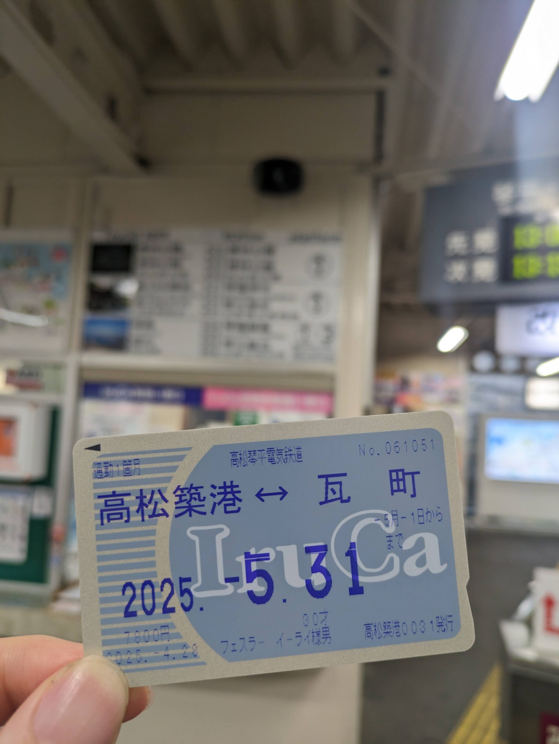
My most expensive IC card to date: an IruCa commuter pass. Or as the weird translation on their official site calls it, “IruCa Commutation Ticket”. They use different stock for these compared to regular IruCa, so I bought the cheapest one possible… which was still not cheap. A friend later suggested I could’ve them I “lost” it, then gotten it reissued on a new card, and then refunded that one, but sadly that takes 1-2 days for them to do… and I was leaving the following morning. Oh well, enjoy the money, Kotoden.
After lunch and getting all of the Kagawa IC cards I had planned on, I set out to finish riding all of Kotoden’s lines. Here was the Shido Line, which as the name implies heads out to the town of Shido (well, former town, as today it’s been combined into Sanuki City).
Advertisements in the train. Hey, that bridge looks familiar!
Kotoden has many very cute signs featuring their mascot Koto-chan. They also sell stickers of these.
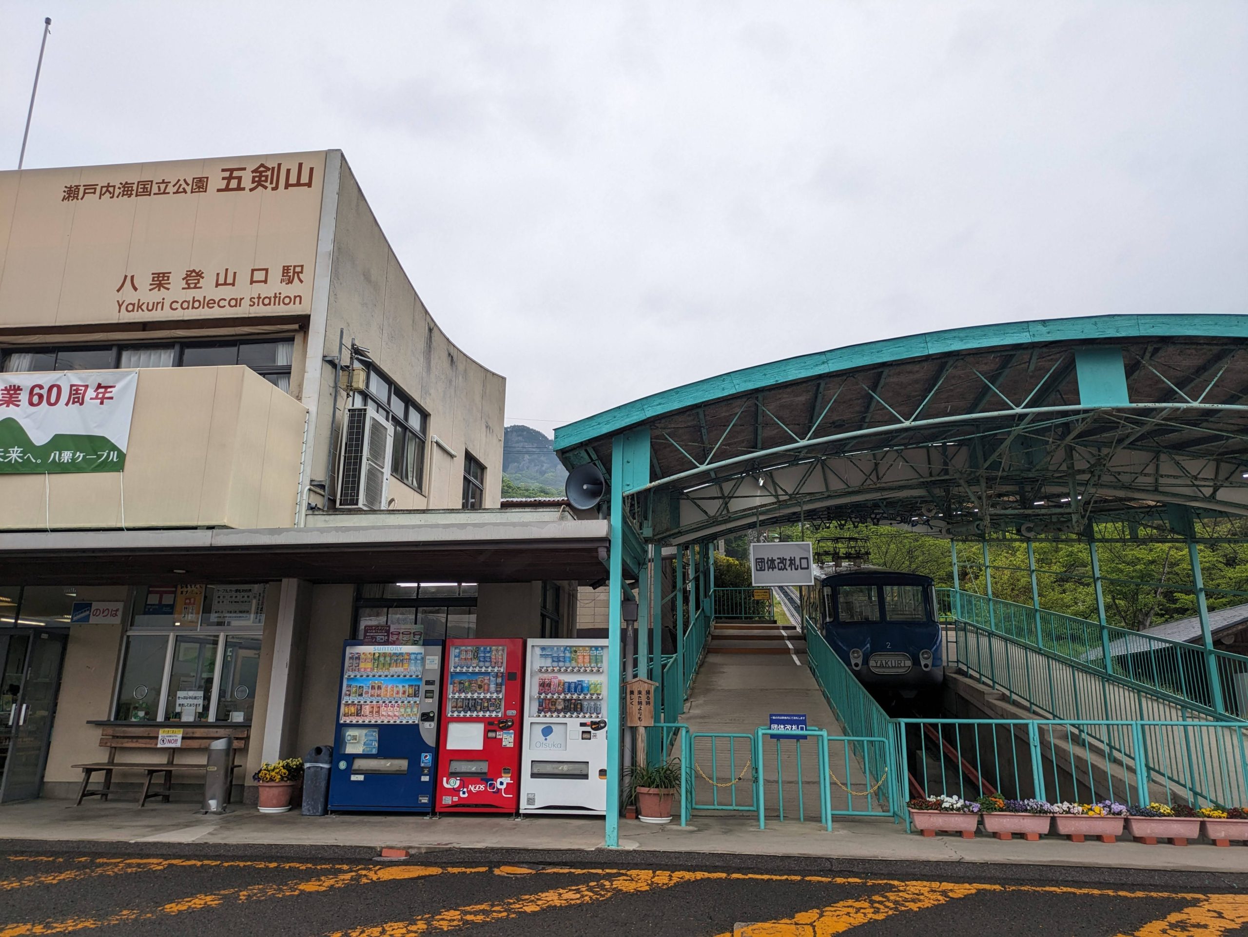
I got off at Yakuri Station and walked a half hour through a sleepy neighborhood up to a funicular that heads up a mountain. It’s informally known as Yakuri Cable, but officially, according to the Railway Bureau of the MLIT, is registered with no name! It’s run by a company simply known as “Shikoku Cable” who have no logo and only a very simple website.
A bench welcoming henro. The line opened in the 1930s as a route to get to a mountaintop temple which is #85 out of the 88 total on the pilgrimage route. Some pilgrims choose to take pubic transport and others visit them entirely on foot.
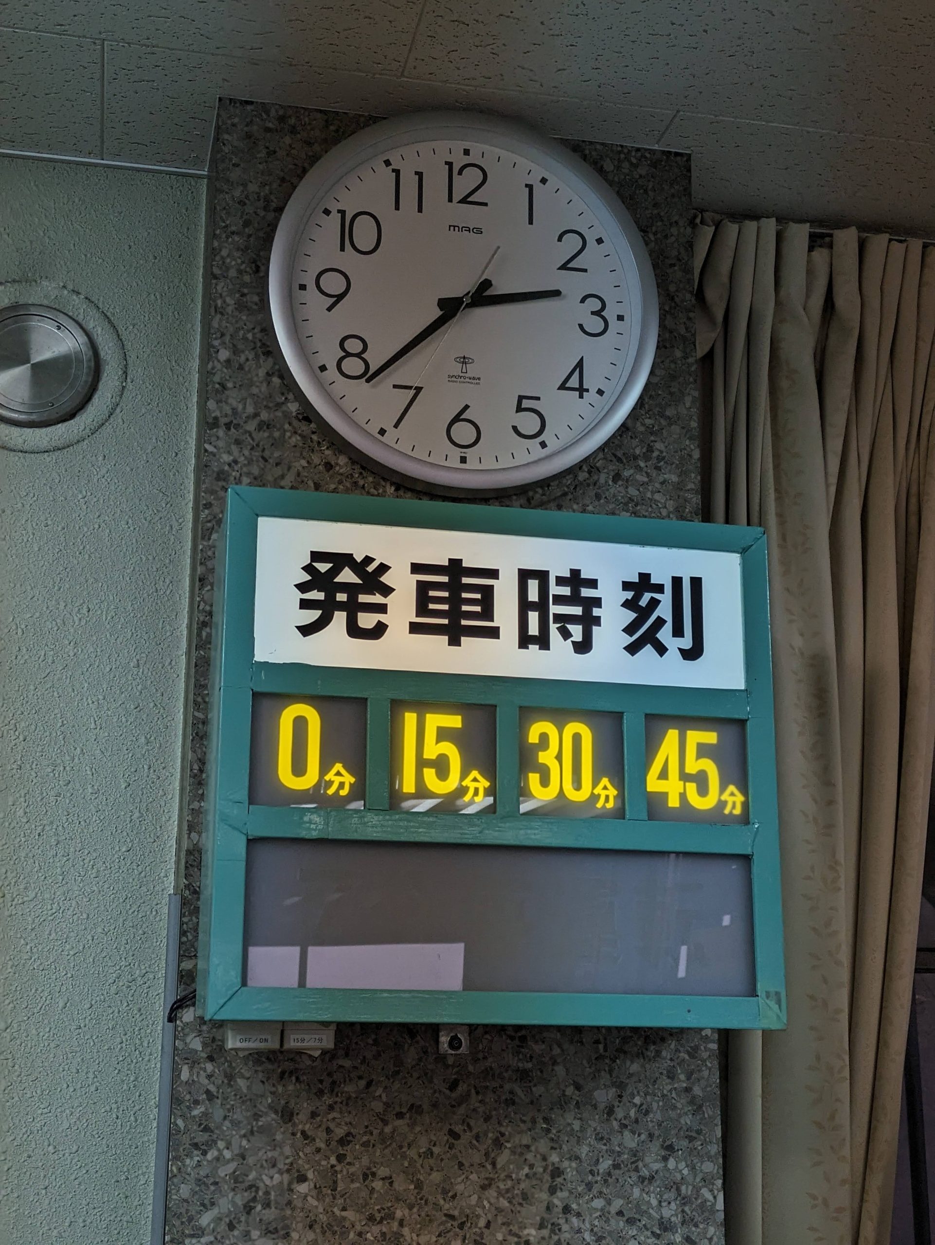
Quite the simple timetable: Every fifteen minutes from on-the-hour!
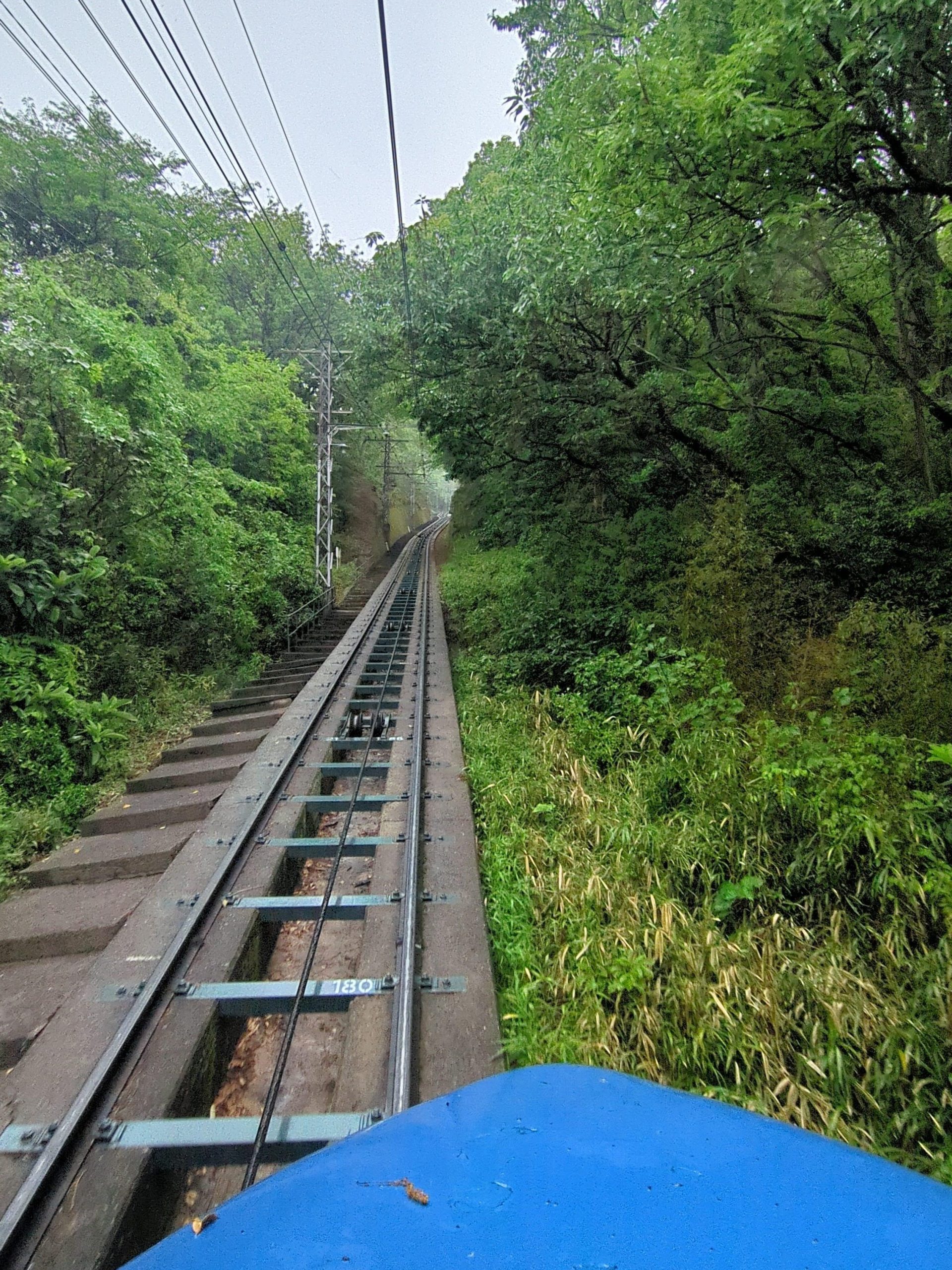
On my way up into the mountains! A very short ride, only four minutes, but super green and pretty.
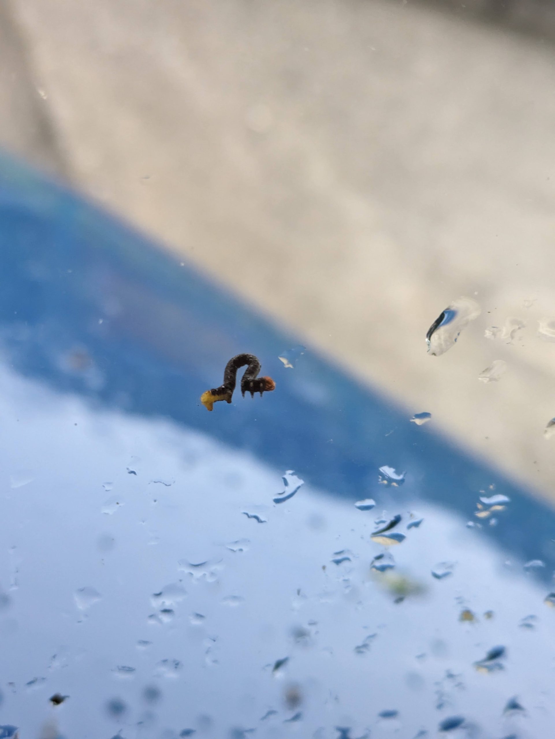
As my cable car lurched its way up the mountain, this little inchworm worked his way on a grand adventure to the other side of the windshield too.
The only other person on my cable car, this henro had a map of all the temples.
Along the slopes of Mount Goken was Yakuri-ji, a Shingon Buddhist temple founded in the year 829. It had been raining in the morning so it was a beautiful land of mist and haze all around.
There was what looks to me like a torii here. As far as I know those are Shinto, not Buddhist… But maybe it’s all mixed-up whatever was the case back in Nachi. I’m not gonna pretend I understand all the ins and outs of religious stuff.
At the base of the cable car line was this little pond, sitting tranquil after the rain under the still-cloudy skies.
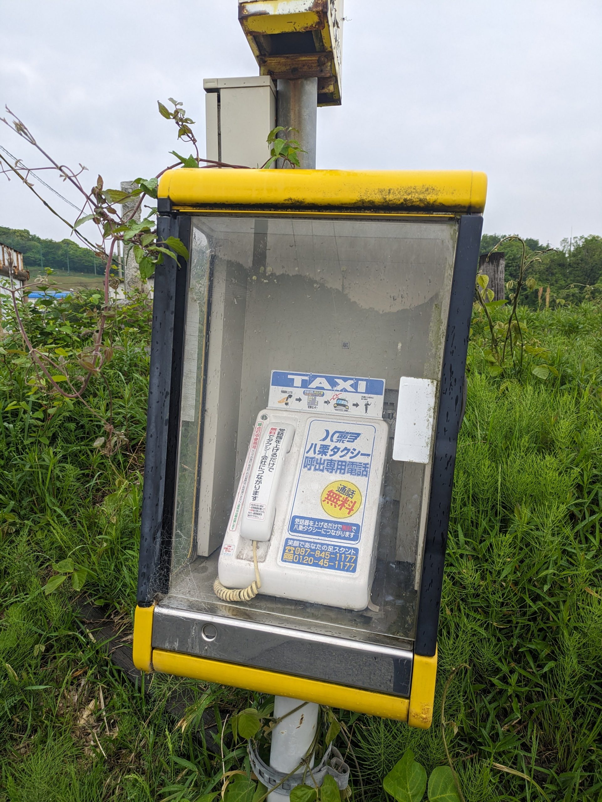
Stranded? Too tired to walk more? Good thing there’s a phonebooth that will help you call this one specific taxi company!
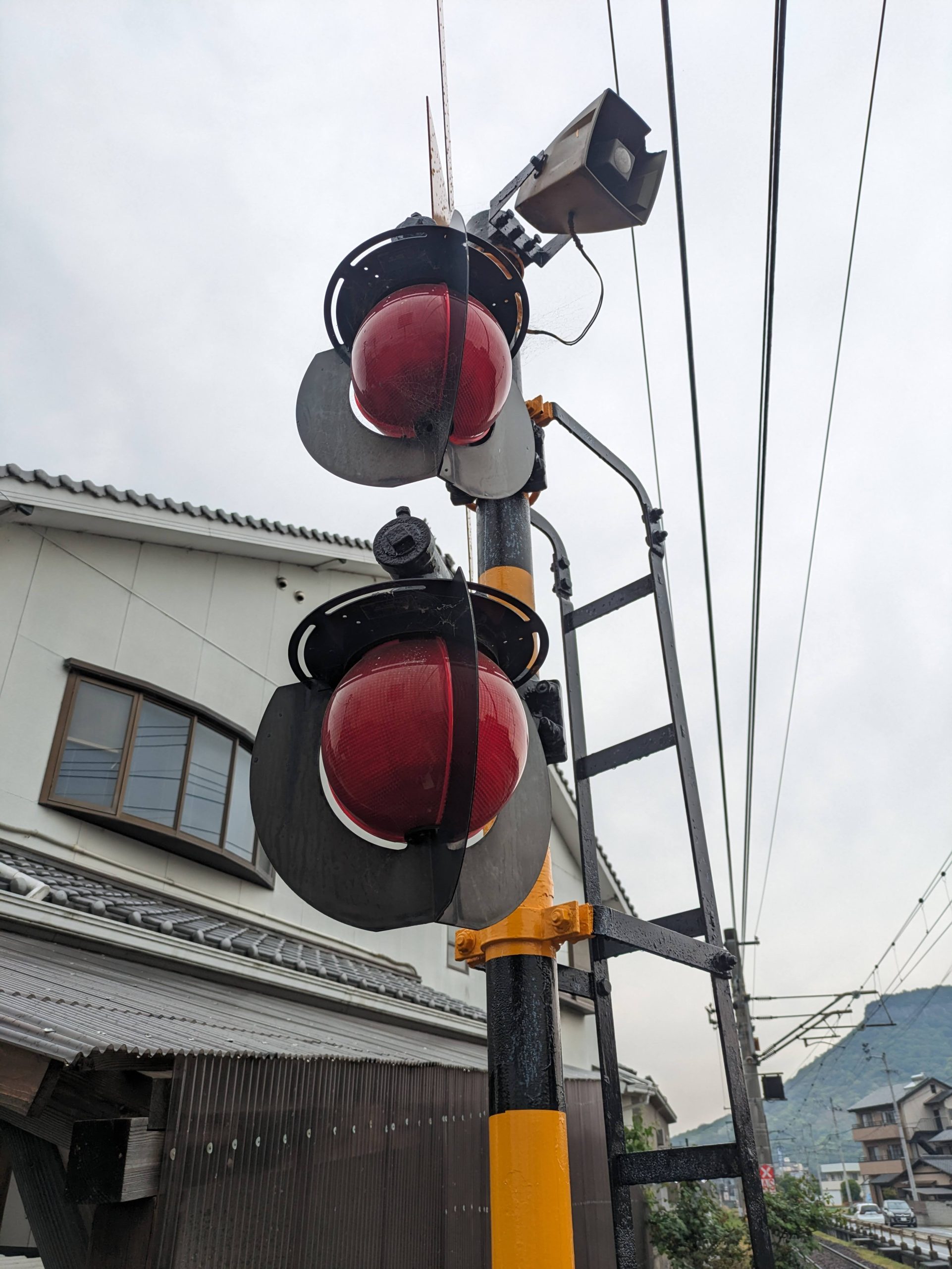
I walked past my last station down to the JR line in order to ride it to where it connects with a different one of Kotoden’s lines (the green one). Apparently some people who are into the mechanical side of train stuff don’t like these, as they’re replacing the older, flatter designs, but *I* think these orb-lights which flash when there’s a train coming look pretty cool.
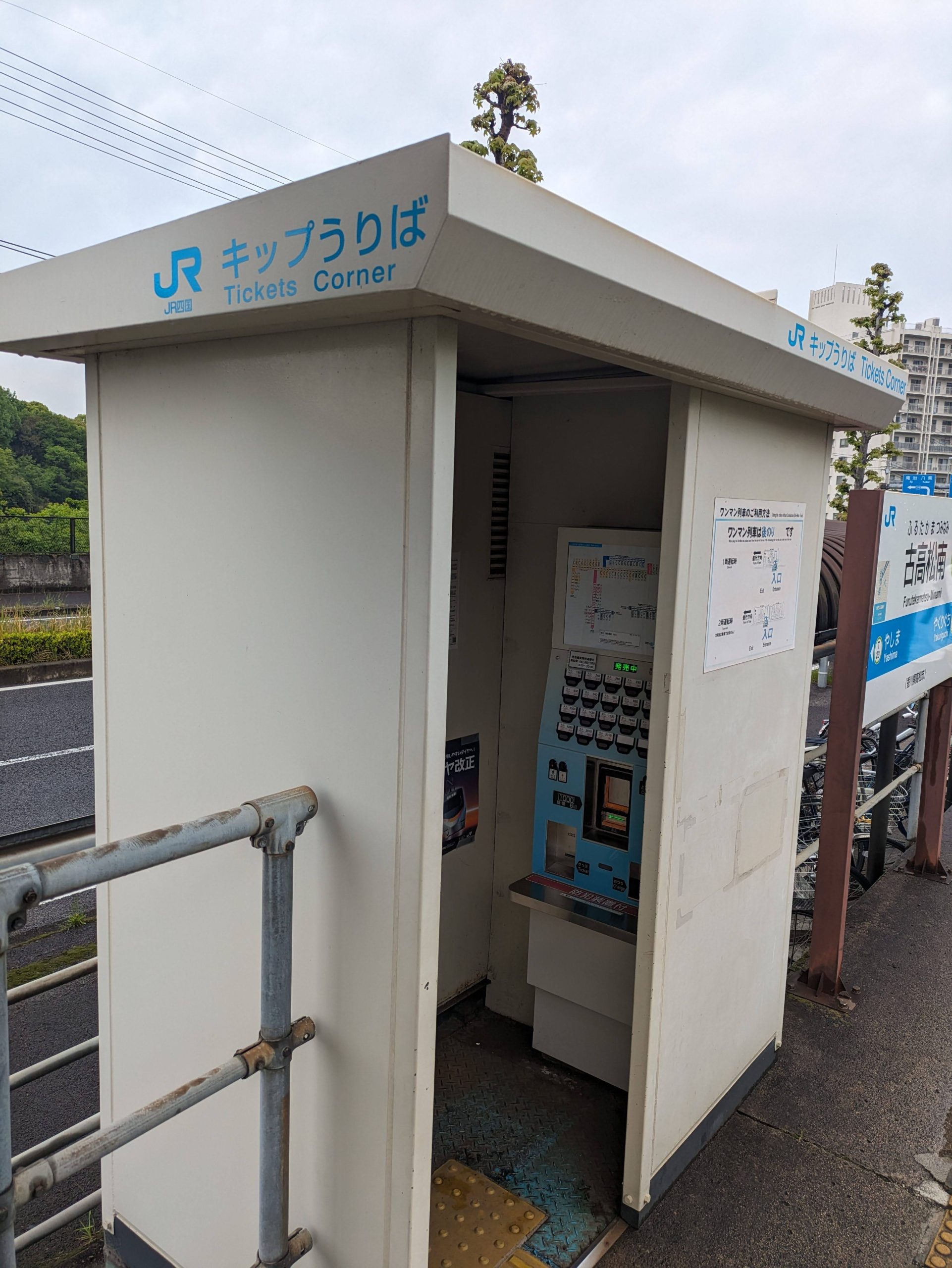
Never seen this (adorable) translation of kippu uriba before: “Ticket Corner”! (Literally, ‘ticket place’.) It’s also VERY rare to write kippu in katakana, as it appears here – my first and only time ever seeing this. It’s almost always written in hiragana as きっぷ; the kanji orthography 切符 has a different legal meaning. But here it’s written in katakana as キップ?!?! Whoa.

I was looking out the front when these very excited little boys came up and clearly wanted to see out the window, so I of course gave my seat up, since I still had a good view sitting behind the driver’s cab. I’m tall, no problem seeing over the top of heads!
The old Takamatsu Electric Tramway logo from 1912 is still here at the Nagao Station terminus. You can see the four “electric” lightning bolts around the two triangles.
The original Nagao Line was the first transit line in Takamatsu to open, dating to 1912, and today makes up one of Kotoden’s three lines. The current company is a wartime merger of three separate separate public transport companies in the area, formed in 1943, and they frequently like to reference that fact. Remember those stickers that I mentioned exist? They’re overall pretty unhinged (I mean, Kotoden has lots of very weird stuff) and make some very strange references… but one – I really had to do a lot of digging to figure this out – is referencing the dialogue and costume from the 1970s-80s manga Sangokuji, itself a retelling of the Chinese literary classic “Romance of the Three Kingdoms”…. which, yes, is meant to mirror the history of the three Takamatsu rail companies merging into one. Deep. Cuts. From Japan’s arguably most insane rail company.
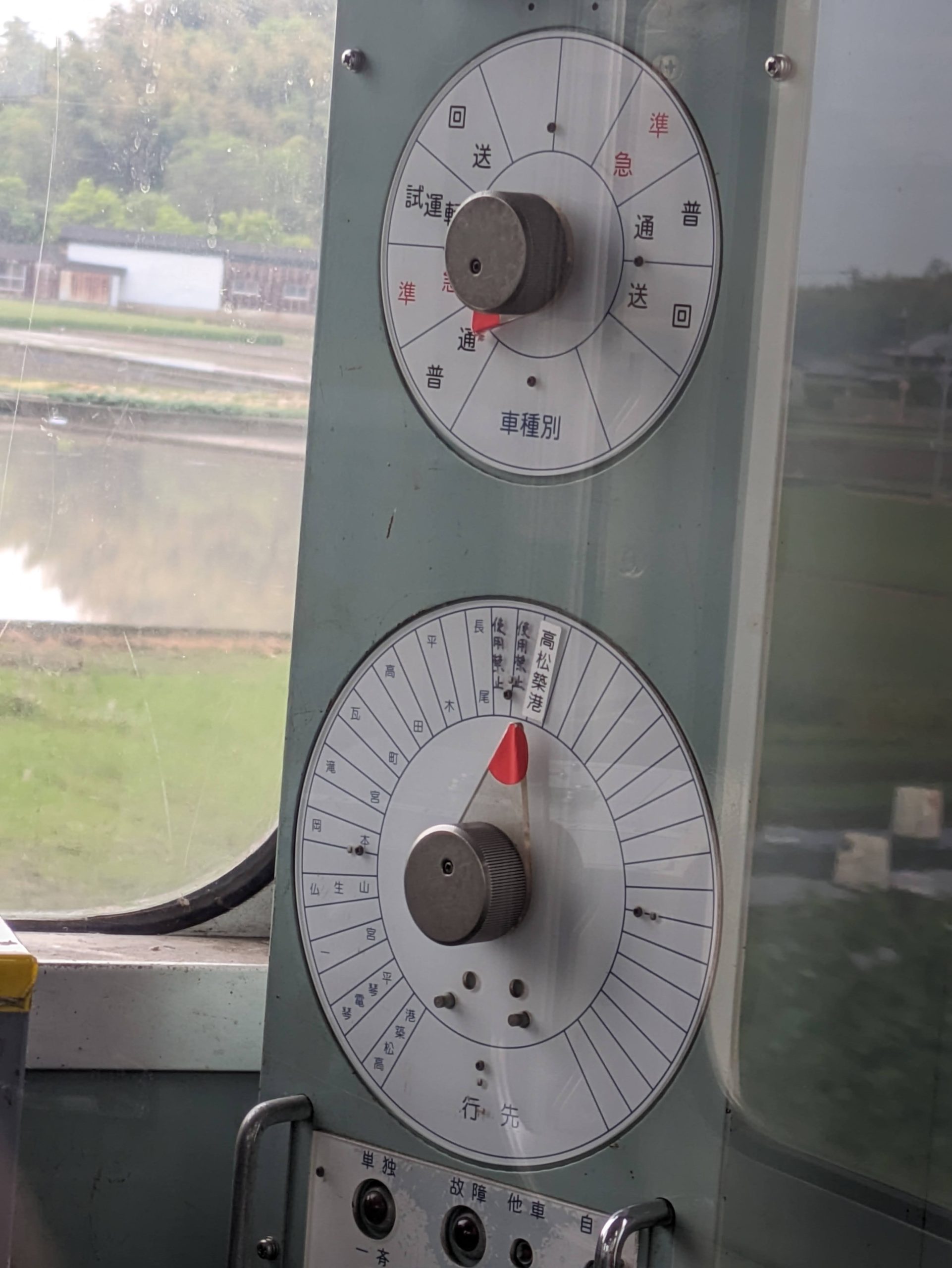
I loved these analog dials to change the destination display and service type on the outside of the train. I wonder why some have two slices for the same words?
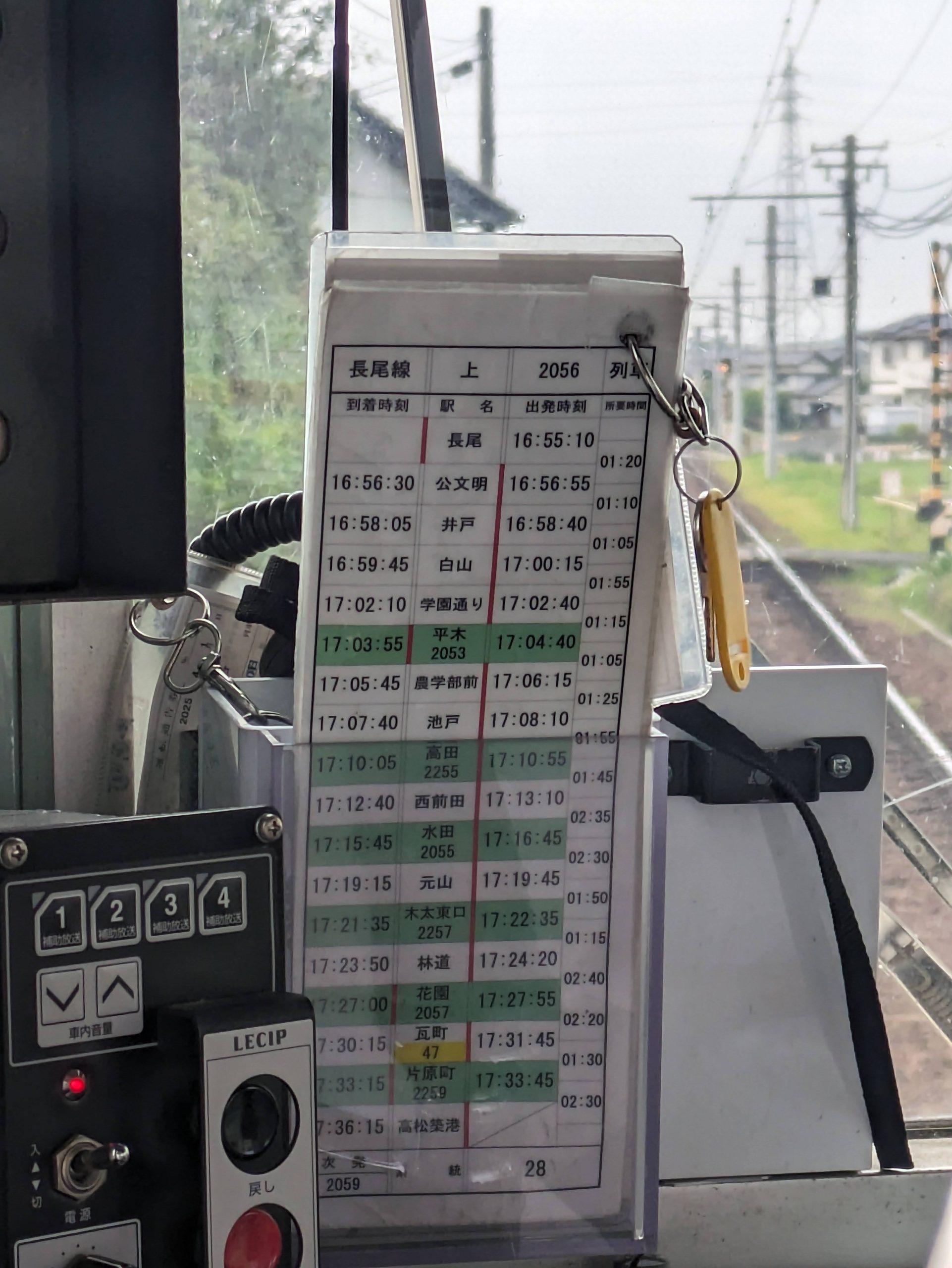
The first and only time I’ve seen SECONDS on a driver’s timetable!!!!! (I saw them again after this in Hokkaido in December 2025, but those were rounded to 15s, and these to the 5s!)
No practicing for the Olympics allowed.
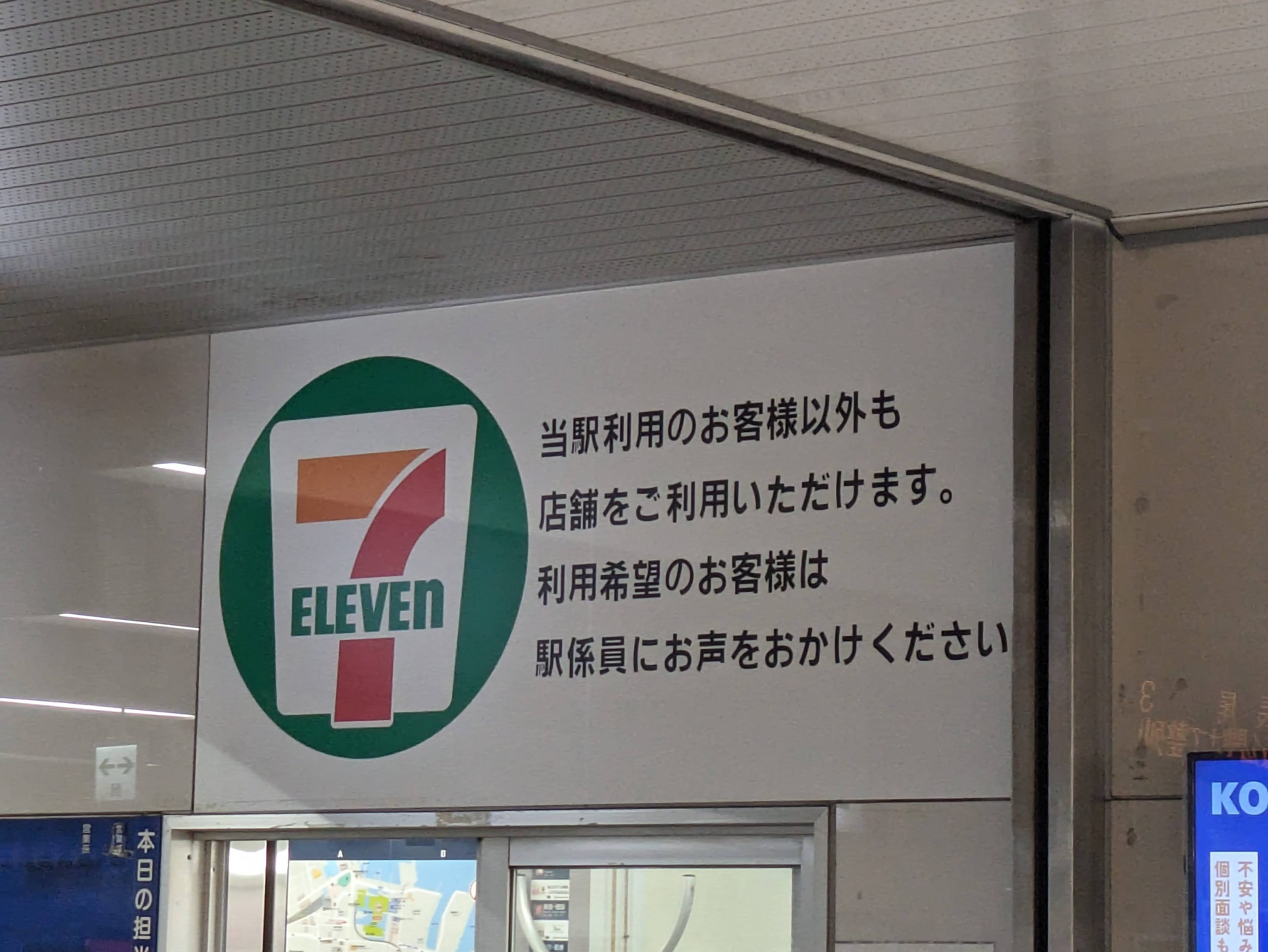
There’s a 7-Eleven inside the ticket gates, but this sign says that they’ll let you in for free to shop even if you don’t want to ride the trains. JR East could never!!!! (As of last month, Hankyu lets you do this too, though! Yay!)
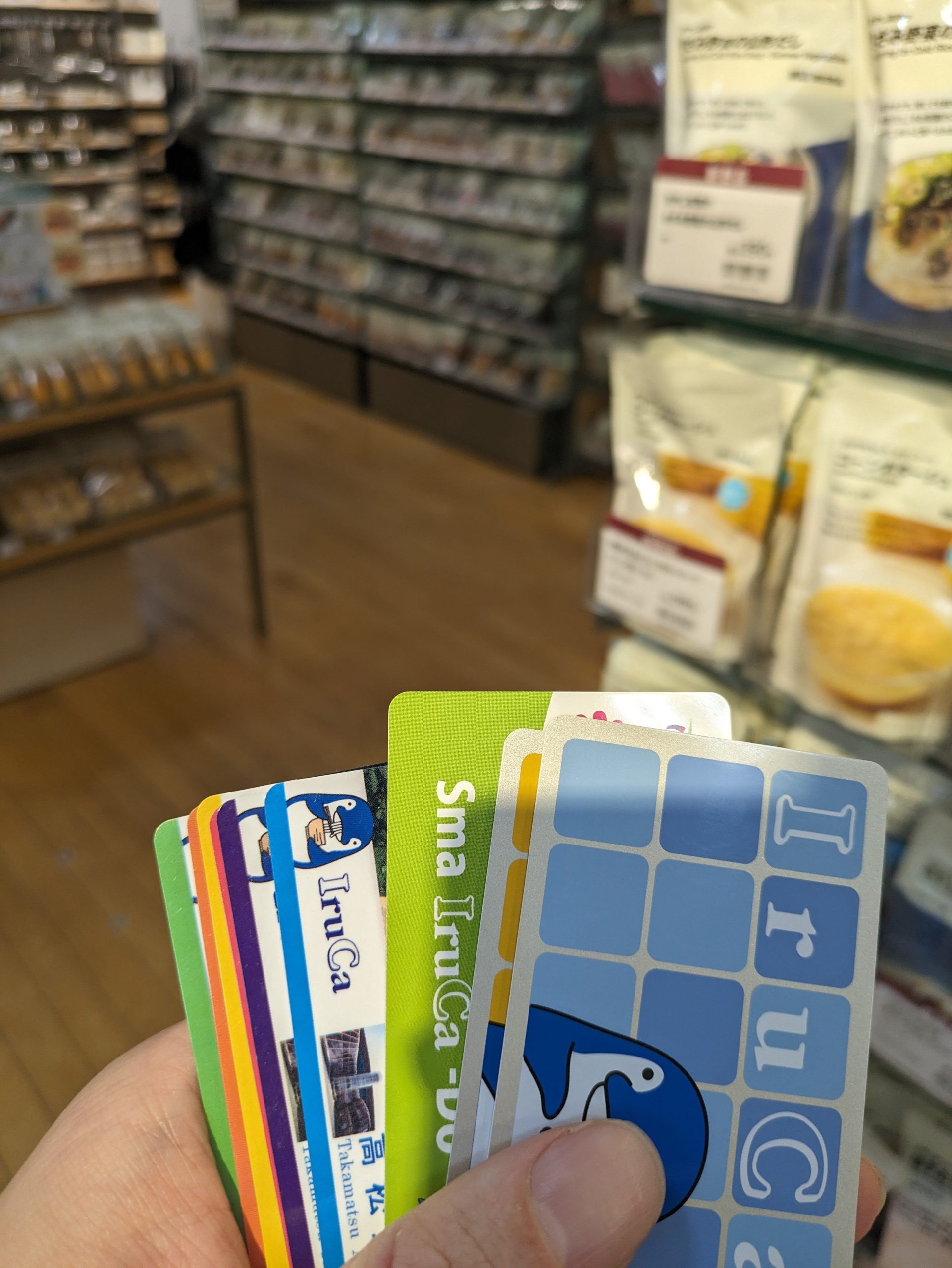
Can’t believe I’m back causing trouble at the Takamatsu Muji AGAIN………… (all my IruCa from last time that I hadn’t fully spent down, not knowing I could do split payments with them)
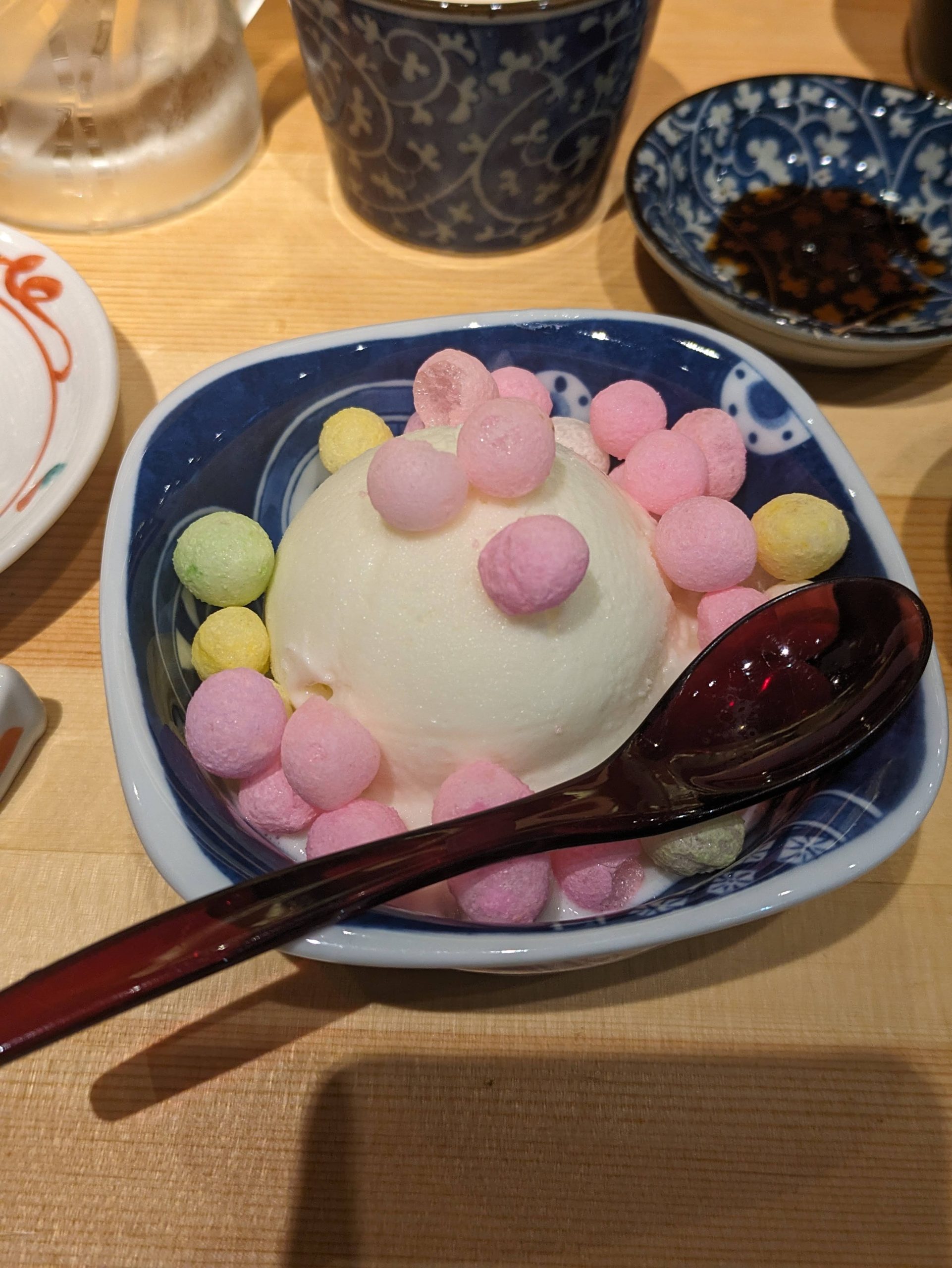
After dinner, I got served this for dessert, and got taught a new vocab word for these small, spherical, colorful candies which are popular in the prefecture: おいり oiri! But to my surprise, it was missing from Jim Breen’s JMdict/EDICT (which most people access through jisho.org), which by the way is the world’s longest-running and most comprehensive and incredible electronic dictionary project (I did a presentation on it in my lexicography class in grad school lol). So I submitted it, and now it’s in the dictionary!
Lawsuit from Robert Indiana incoming.
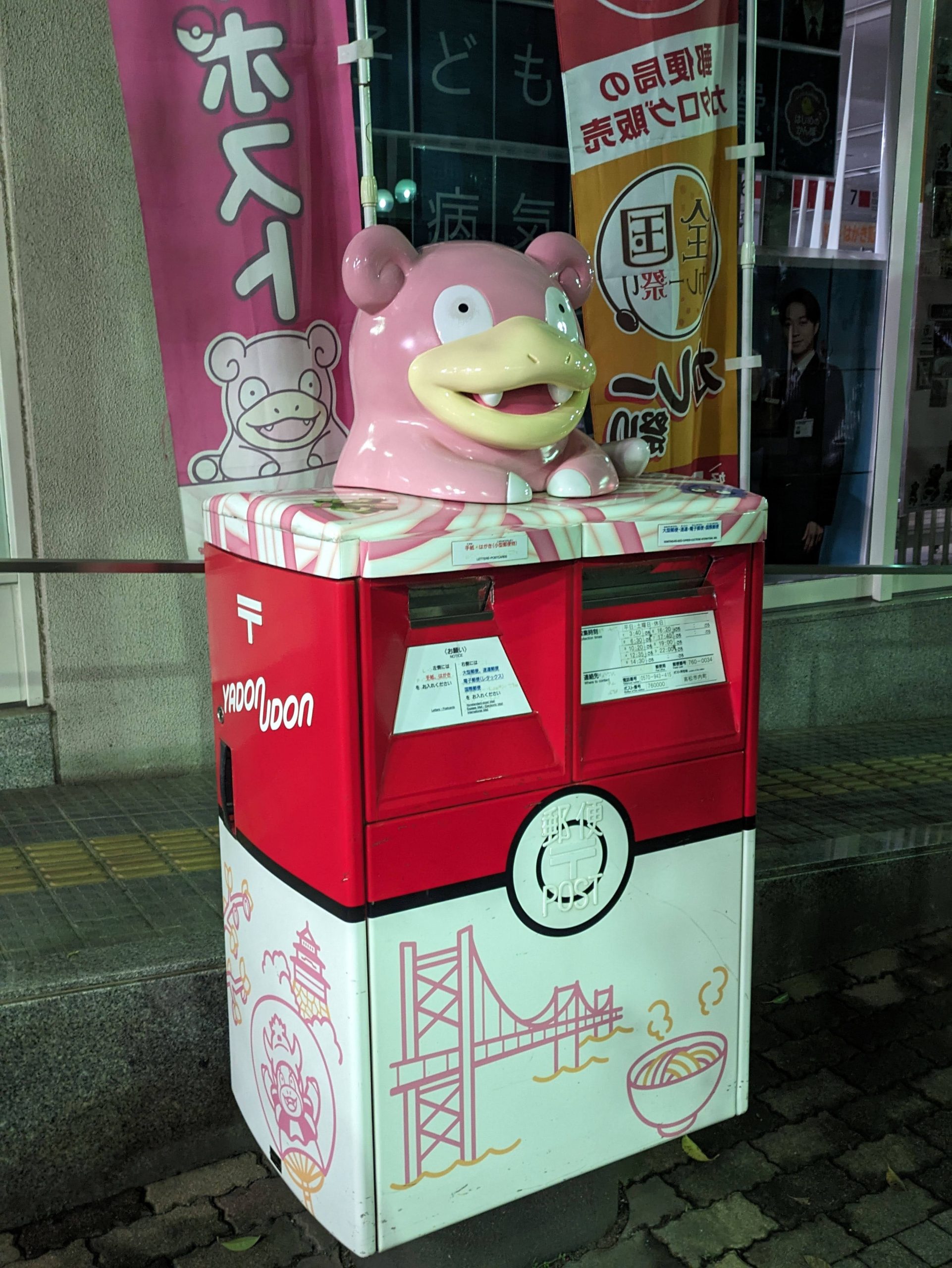
And a good night to you, Yadon-on-mailbox.
Tuesday, April 29, 2025
Today’s transit:
8:24 Takamatsu / Uzushio 5 (JR Kōtoku Line) → 9:23 Ikenotani
9:26 Ikenotani / JR Naruto Line → 9:43 Naruto
🚌 10:02 Naruto Sta. / TOKUSHIMA BUS 97 Naruto Park Line Bus → 10:26 Naruto Park
⤾ 🚌 11:25 Naruto Park / TOKUSHIMA BUS 17 Naruto Line Bus → 11:50 Naruto Sta.
12:00 Naruto / JR Tokushima Line → 12:44 Tokushima
13:30 Tokushima / JR Mugi Line → 15:42 Awa-Kainan
15:50 Awa-Kainan / Asa Coast Railway Asato Line DMV → 16:14 Umi no Eki Toyo-cho
🚌 16:31 Umi no Eki Toyo-cho / KTK Muroto-Kannoura Line Bus → 17:15 Murotosekai Geopark Center
🚌 17:18 Murotosekai Geopark Center / KTK Aki-Geopark Line Bus → 18:27 Nahari Station
The dawn of the final day. Well, not final in my trip, but final for this post. Today’s plan is just to head from the northeast of Shikoku down along the coast to the southwestern tip on Cape Muroto, including a detour to Naruto on the way (believe it) and, in the afternoon, riding the world’s first (or so they claim) dual-mode vehicle!
JR Shikoku recently started accepting on-train purchases of non-reserved seating express tickets using PayPay (one of the many QR code payment apps Japan loves). I tried it out!
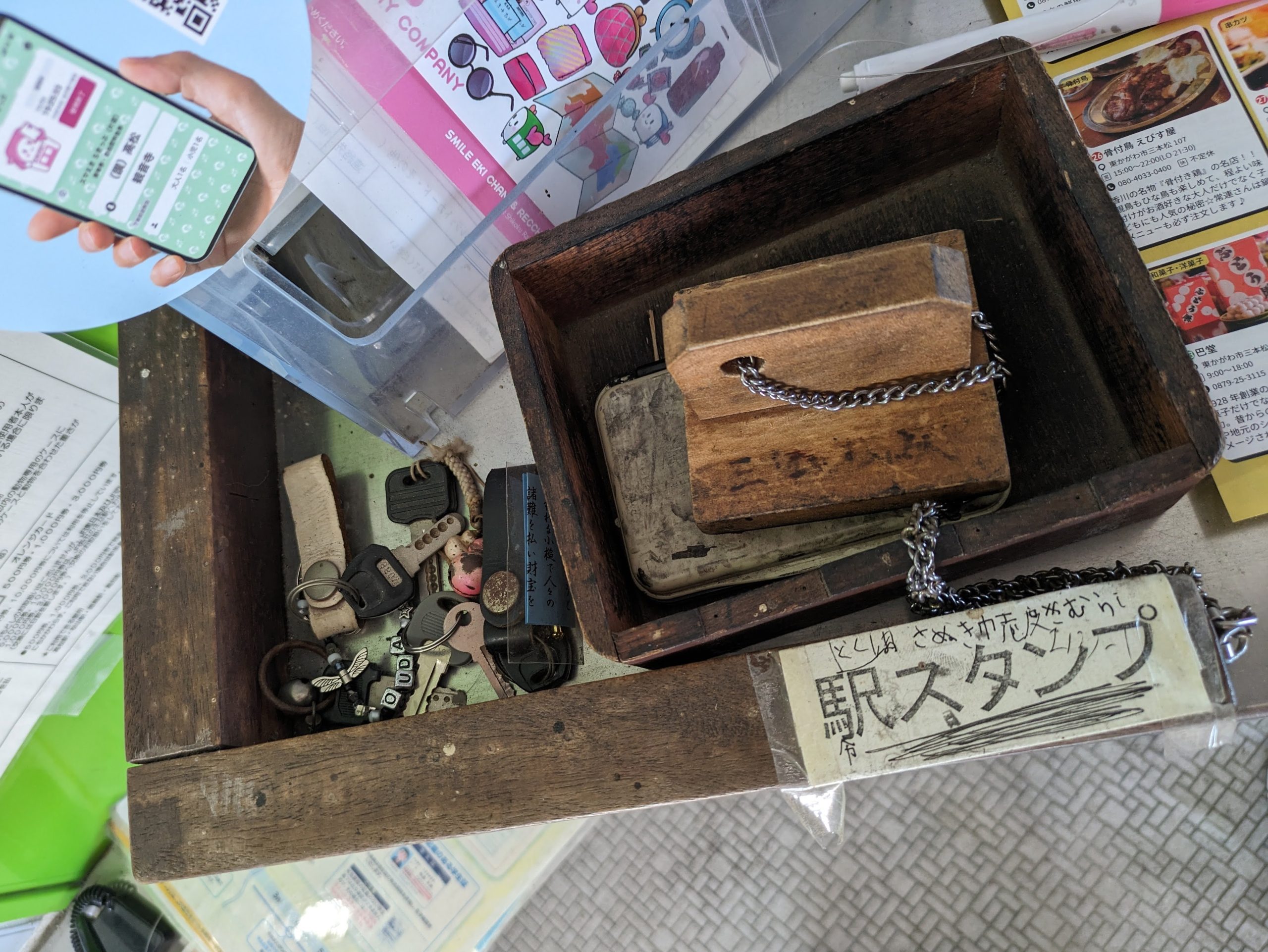
Four minutes to run out of my train and grab the eki-stamp at Sambommatsu! Lots of presumably lost-and-not-yet-found keys were floating around too…
My picture of Ikenotani Station here unfortunately isn’t centered, since I didn’t really realize it at the time, but this shows a pretty cool, rare station layout – it’s a V-shaped junction station, with two tracks on the left and two on the right… but the (unstaffed) station building is wedged in the middle between the two platforms! I was changing from the Kōtoku Line on the left to a Naruto Line train on the right.
Here, I changed from my limited express (which I was forced to take for timing) to a single-track line headed to Naruto. Naruto is a place name, referring to the strait between Shikoku and Awaji Island known for its whirlpools, and thus the name of the surrounding city too – but it became so well-known and tied to the image of the vortexes that “Naruto” started getting associated with spiral patterns in general; narutomaki fishcakes with their iconic spiral decoration are named after it, and it’s the namesake of the anime Naruto and its titular character too.
“Welcome to Naruto”, this sign on the platform read. The area was quieter and smaller than I expected – and no coin lockers at the station, so I brought my bag with me on the bus.
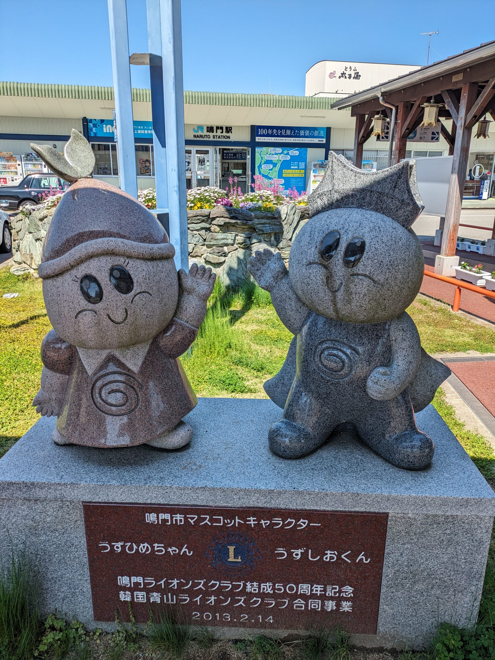
Two cute whirlpool mascots in front of the station, Uzuhime-chan and Uzushio-kun! (Roughly, “Whirlprincess Girl and Whirlpool Boy”.)
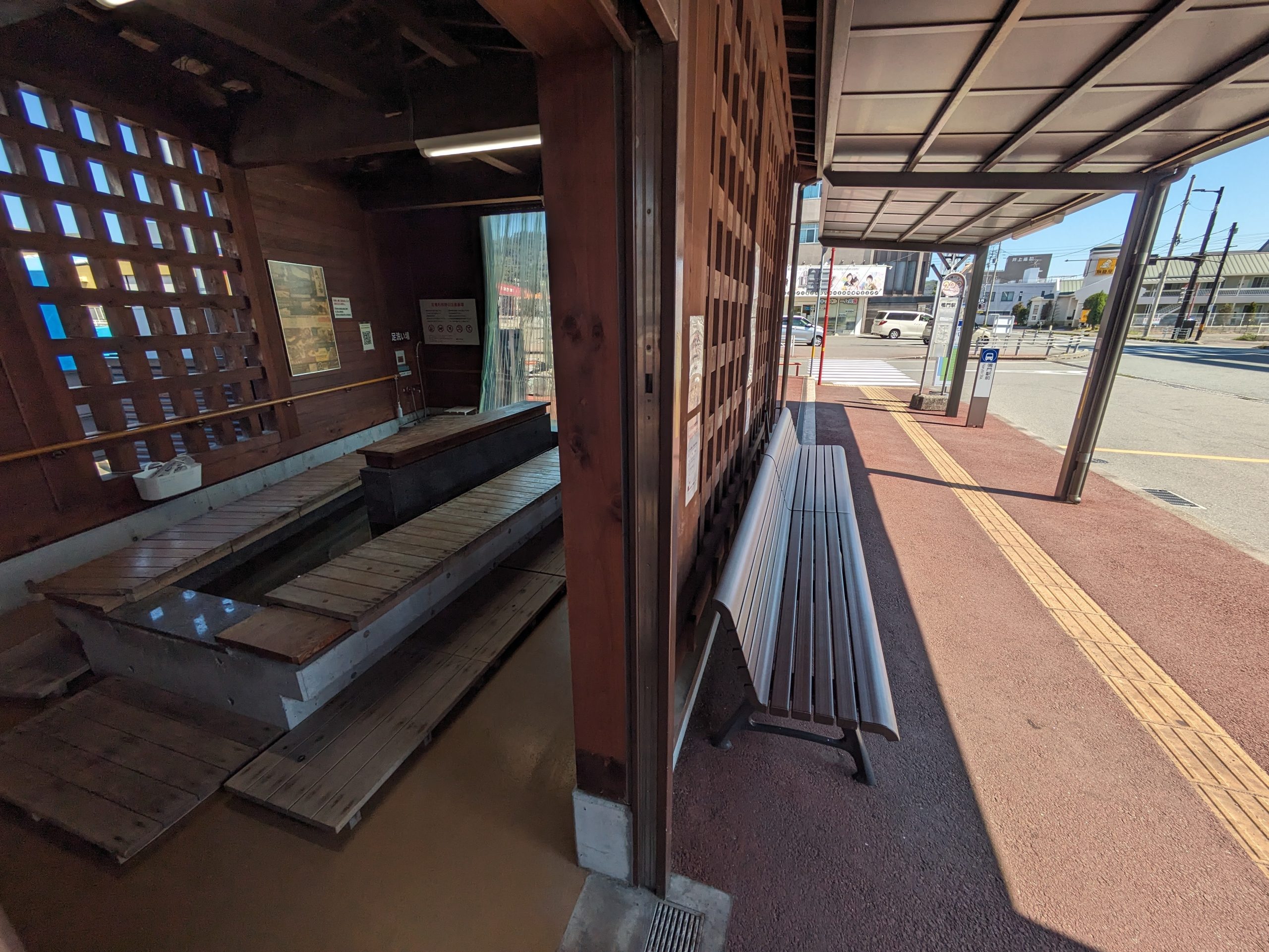
There was an ashiyu here in front of the bus stops for those waiting, but my ride came pretty quickly.
No IC card support on Tokushima buses at the time of my trip, but just last month in March 2026 they began supporting ICOCA (and thus the other Mutual Use cards too)!
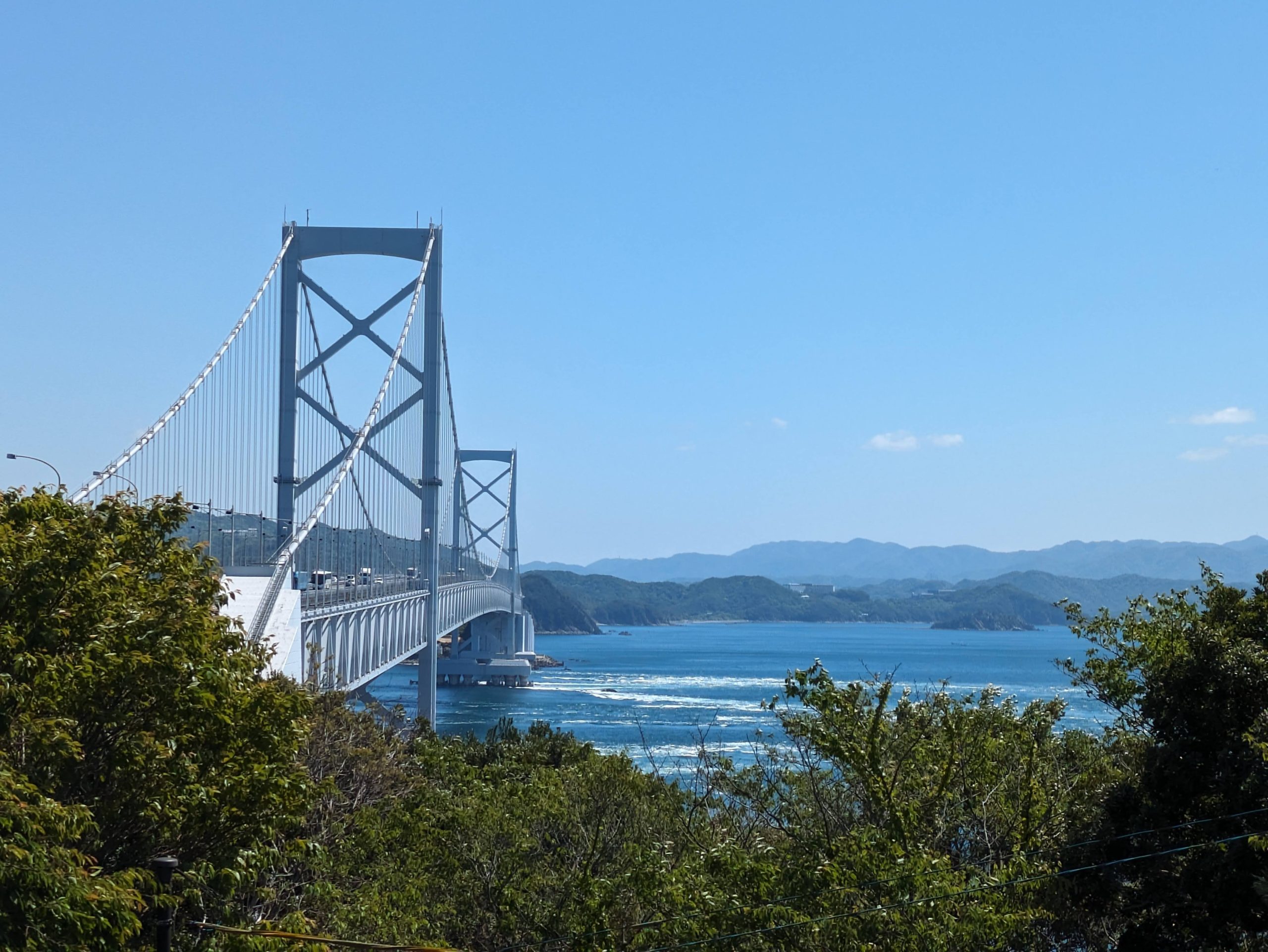
The bus book us to Naruto Park, near this observation deck view of the magnificent Onaruto Bridge.
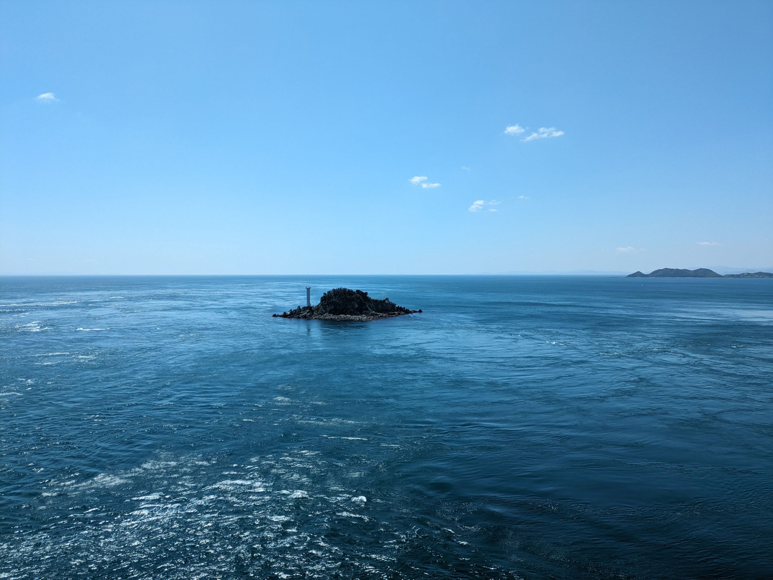
A view of the uninhabited Tobishima Island. The lighthouse on it was constructed in 1983.
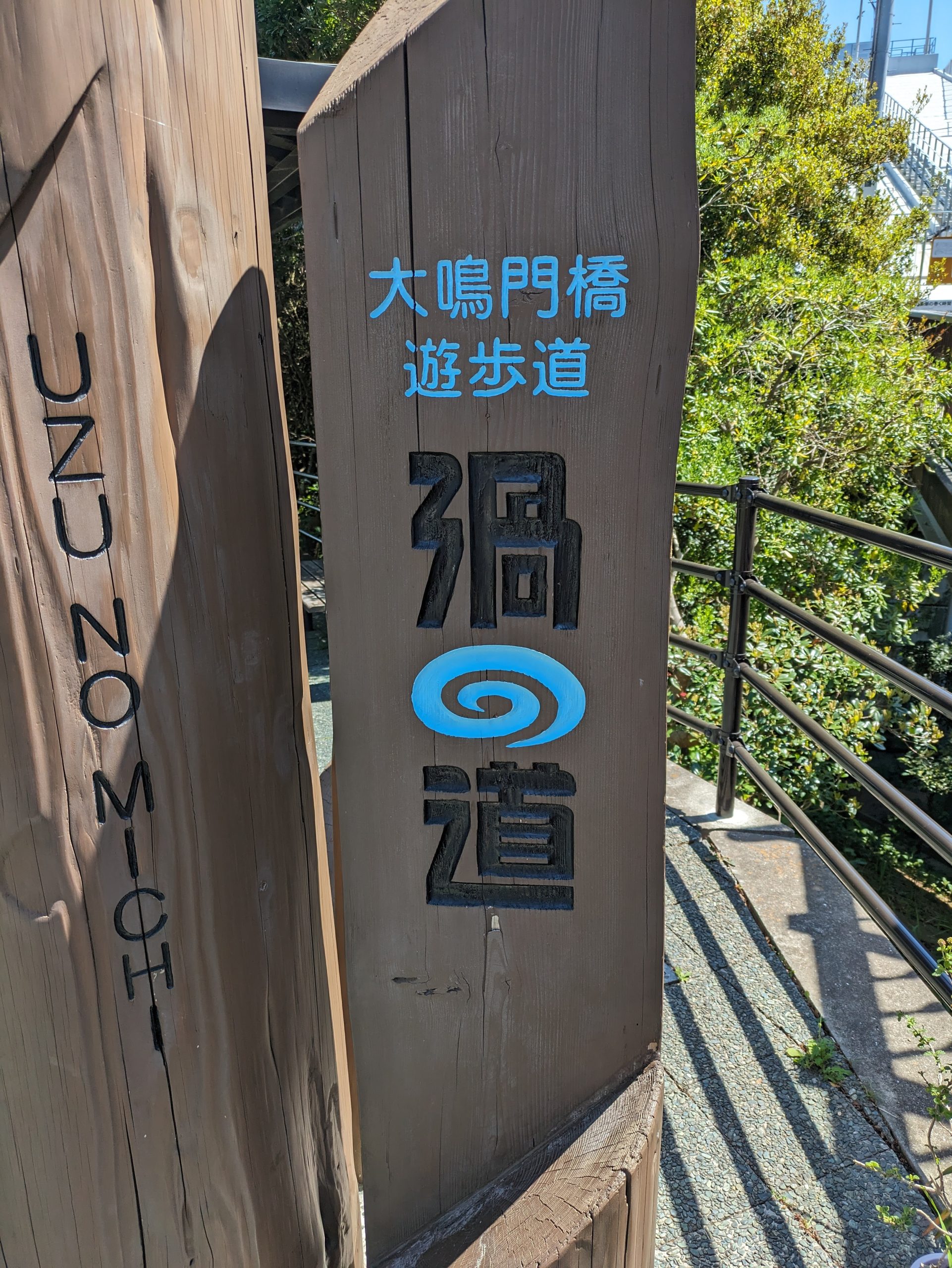
The enclosed walkway under the bridge called 渦の道 Uzu no Michi or “Whirlpool road”. They made the hiragana の stylized like a whirlpool which I LOVE.
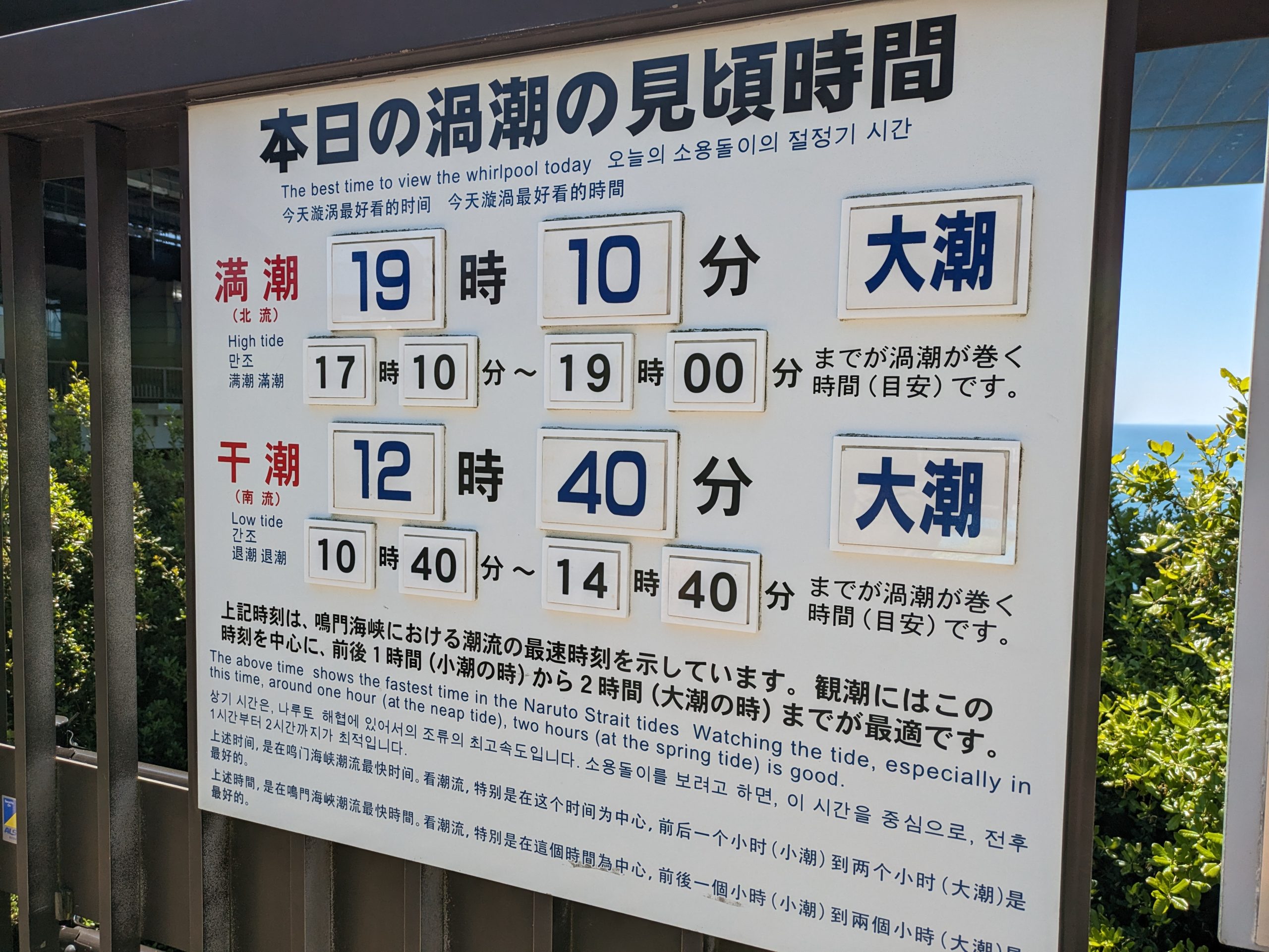
The time I had to swing by worked out pretty well, as it happened to be just at the very start of one of the two windows with max whirlpool intensity, within 1–2 hours of the daily high and low tides.
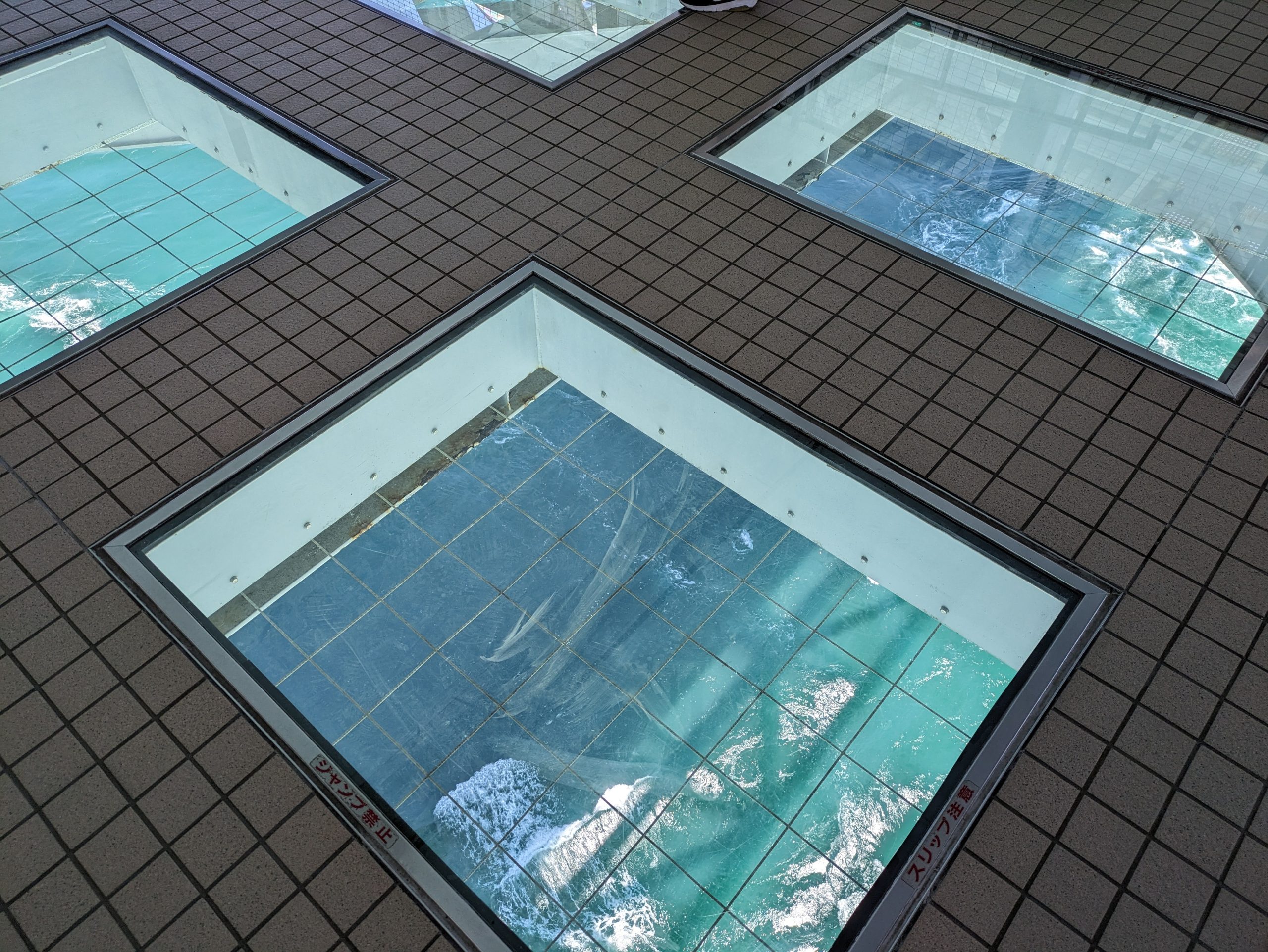
Viewing panes installed in the floor. The walkway is 45 meters above the sea, so you could get a pretty great view!
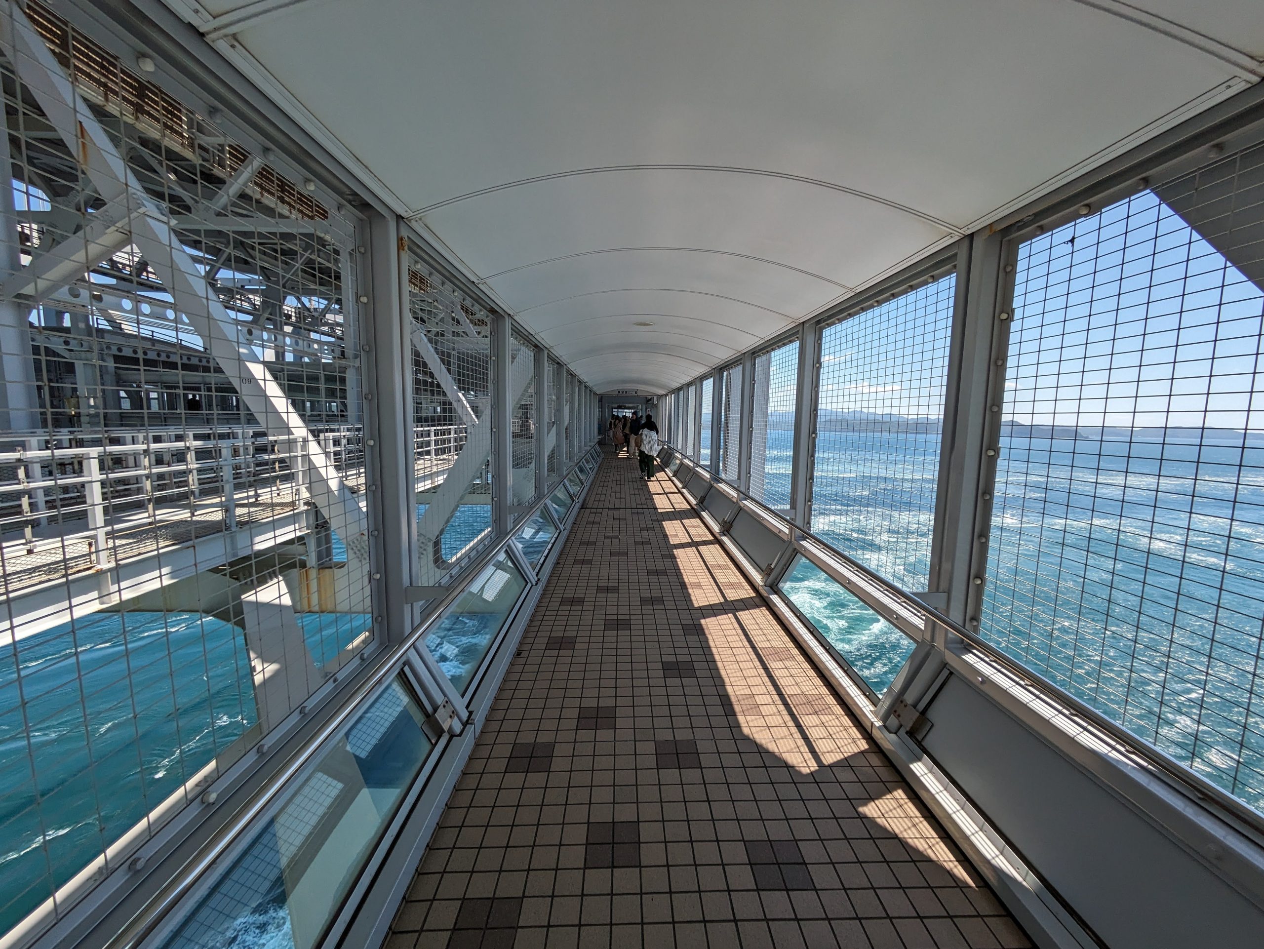
And a view of what the walkway itself looked like. The main room with the floor panes was ahead of this.
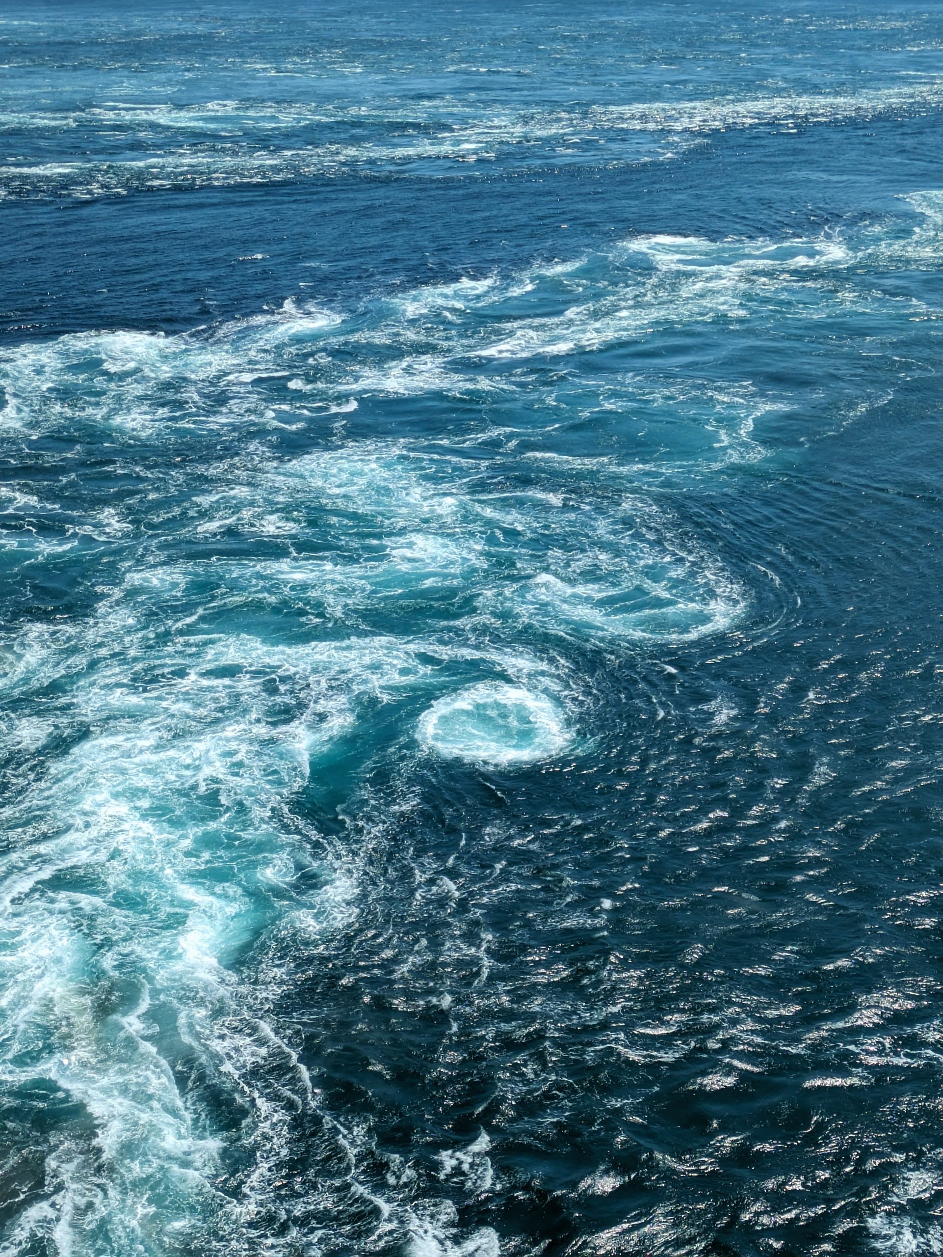
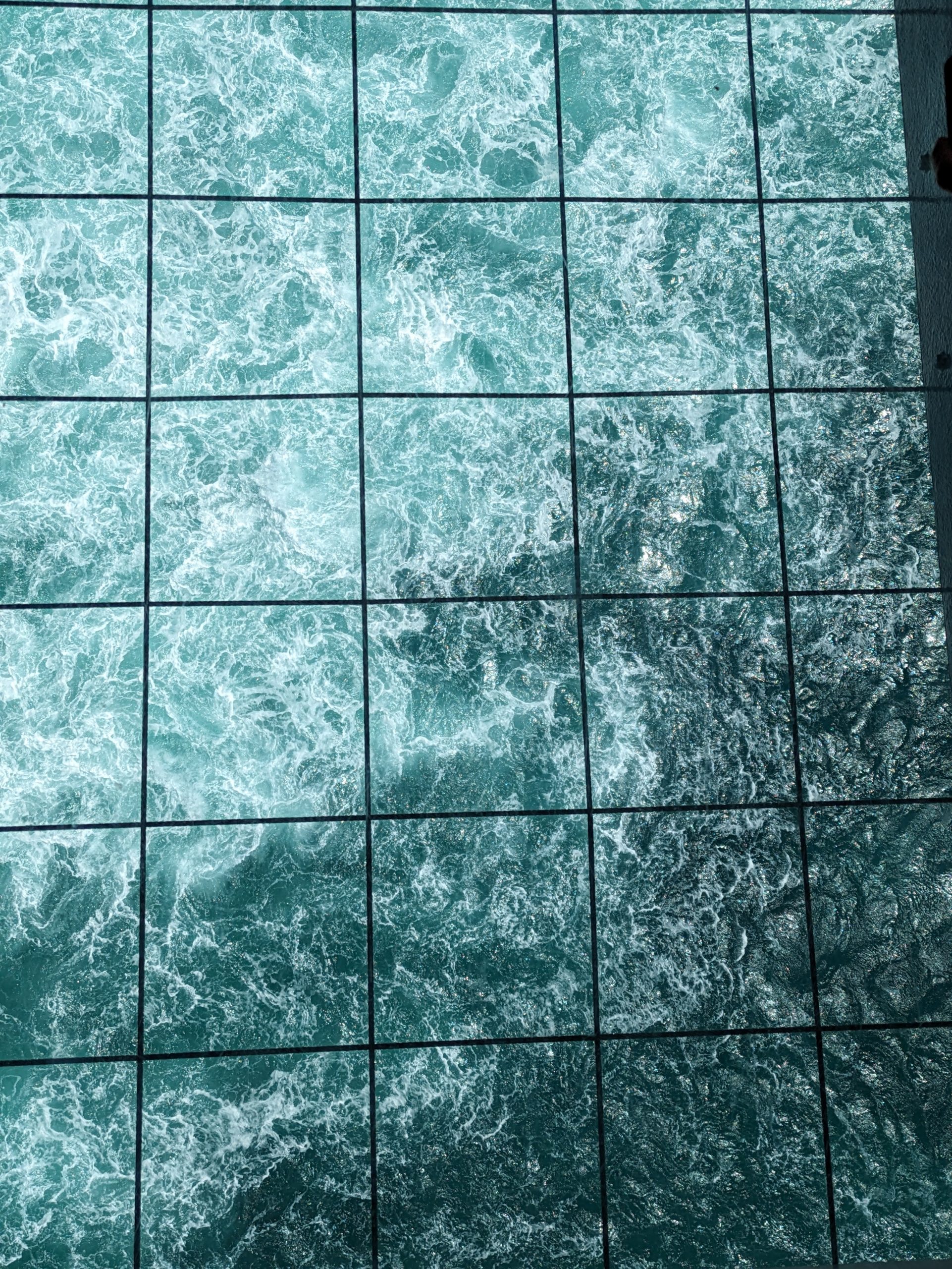
There weren’t always clearly defined spirals – lots of water rushing every which way – but I got a few pics that I thought were pretty great and showed the phenomenon well! The current in the Naruto Strait is the fastest in Japan.
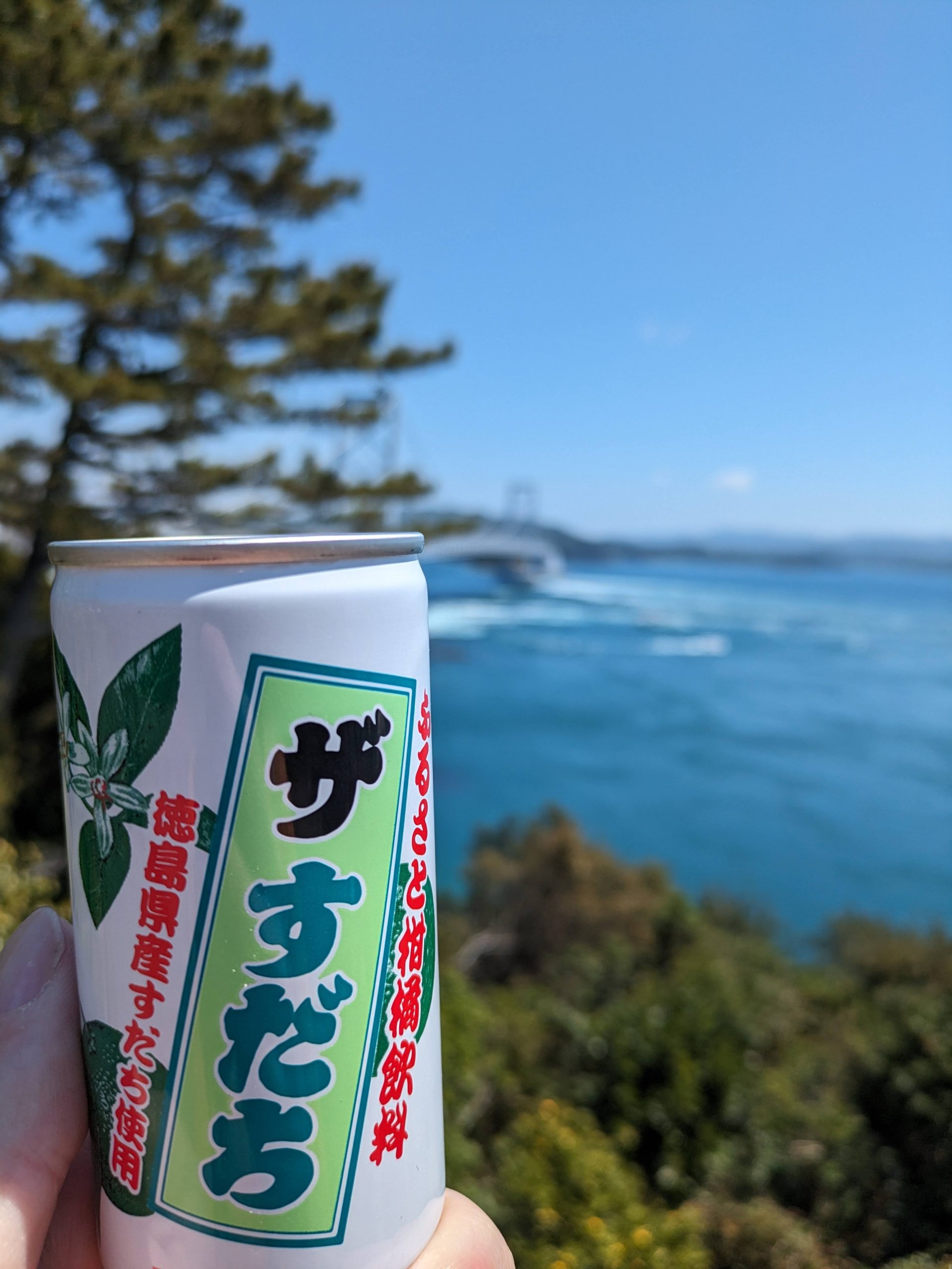
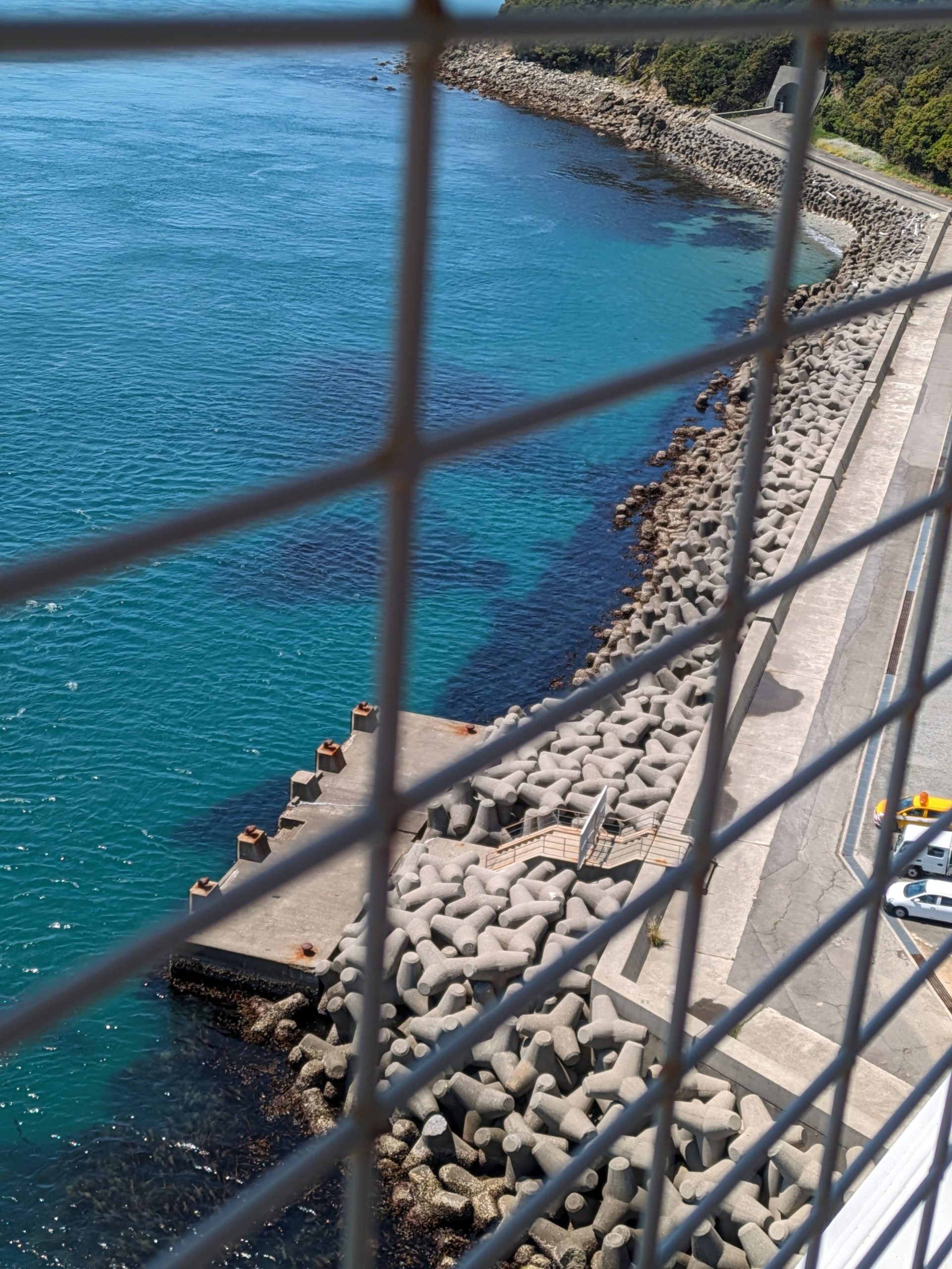
Went to a second overlook drink some “THE sudachi” juice. Also, in classic Japan fashion, tons of tetrapods along the road.
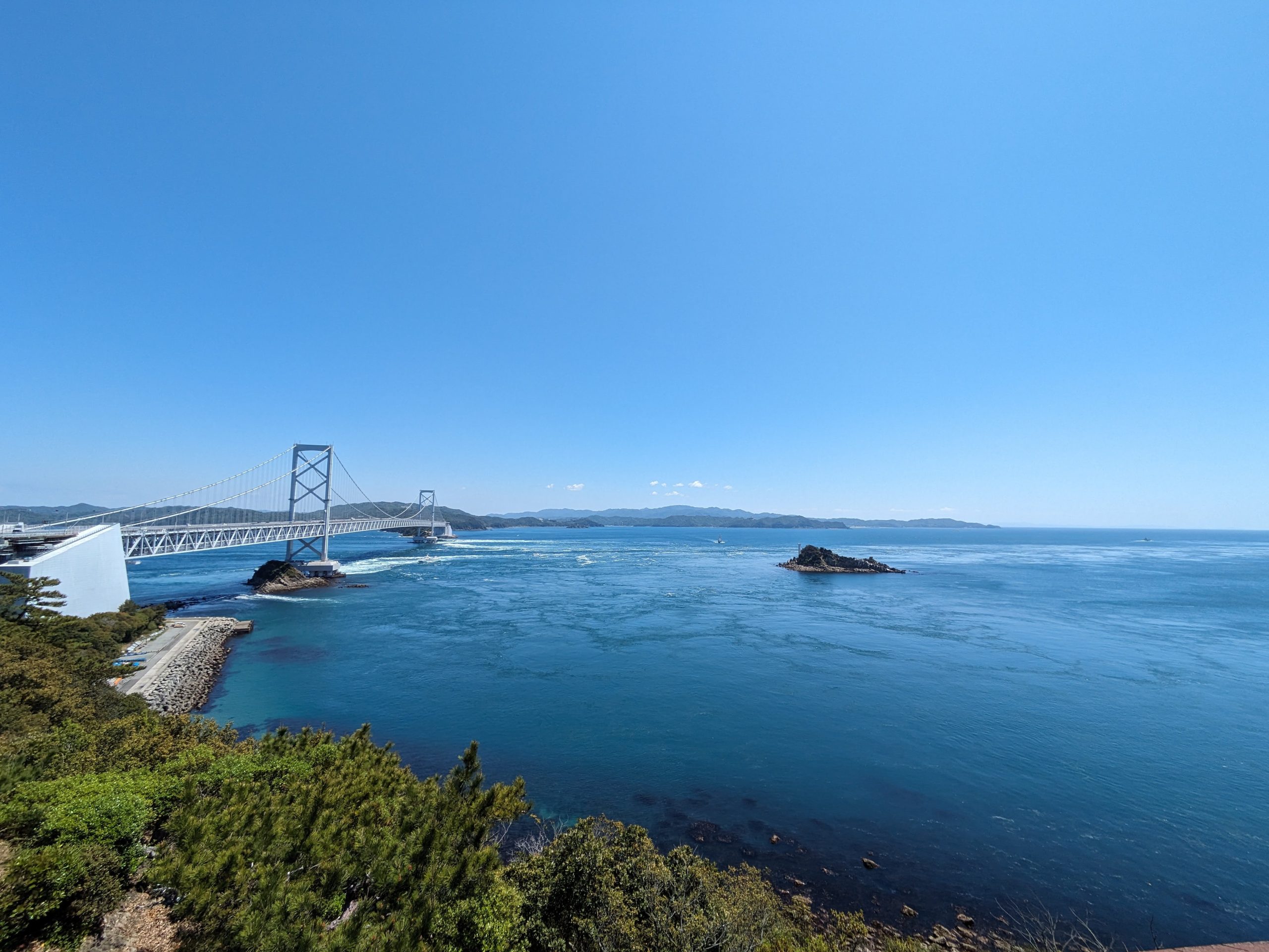
Another beautiful view of the strait from my wider-open viewpoint, taken while I wandered around to kill a bit of time before my bus back to the station, after which I continued back west and then south on my train toward Tokushima City.
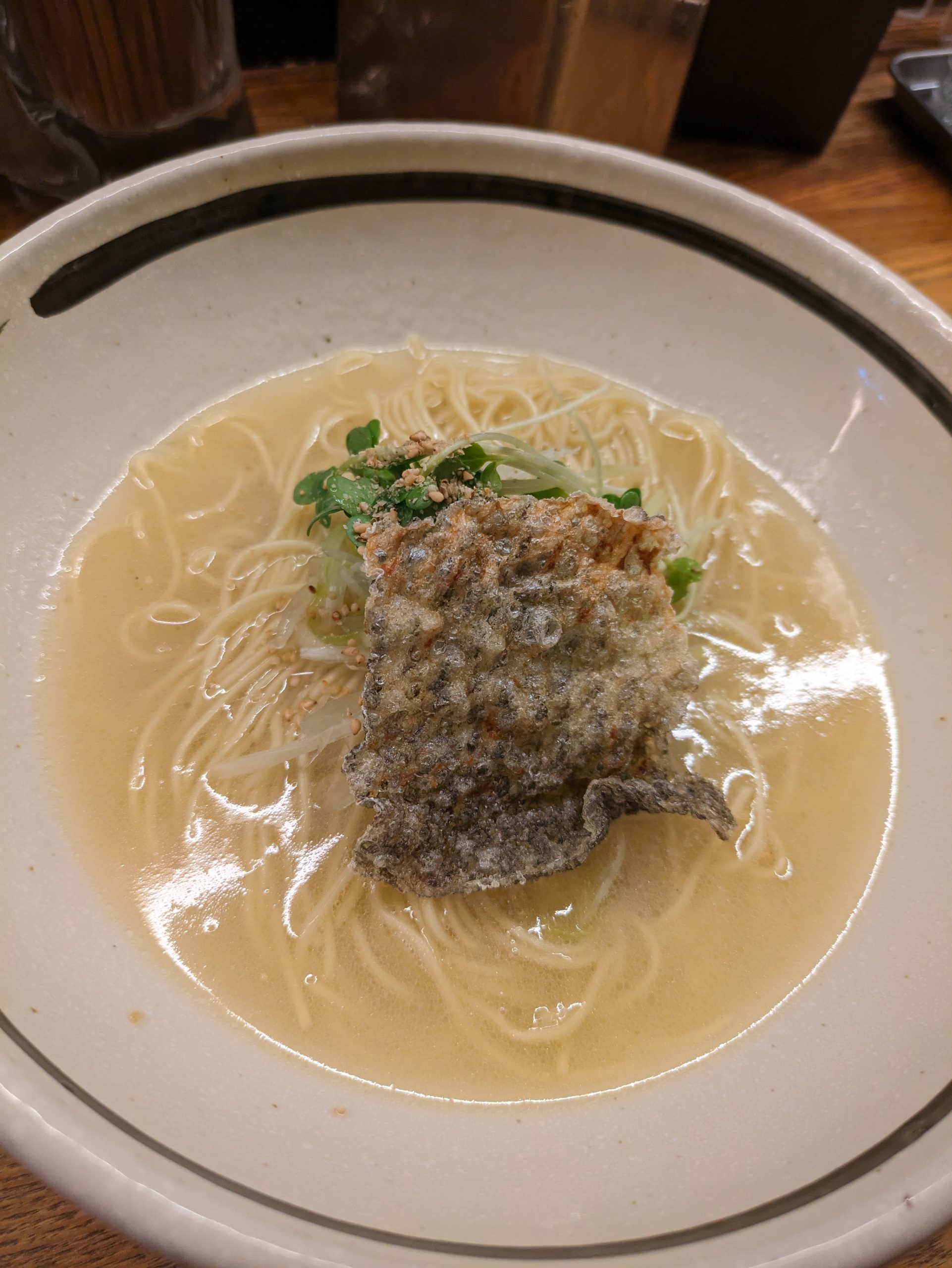
At Tokushima, I hopped out and grabbed a quick lunch – some simple sea bream salt ramen, at a skinny place tucked into a quiet side street – while I waited for my next train on the Mugi Line allll the way down to the last station, Awa-Kainan.
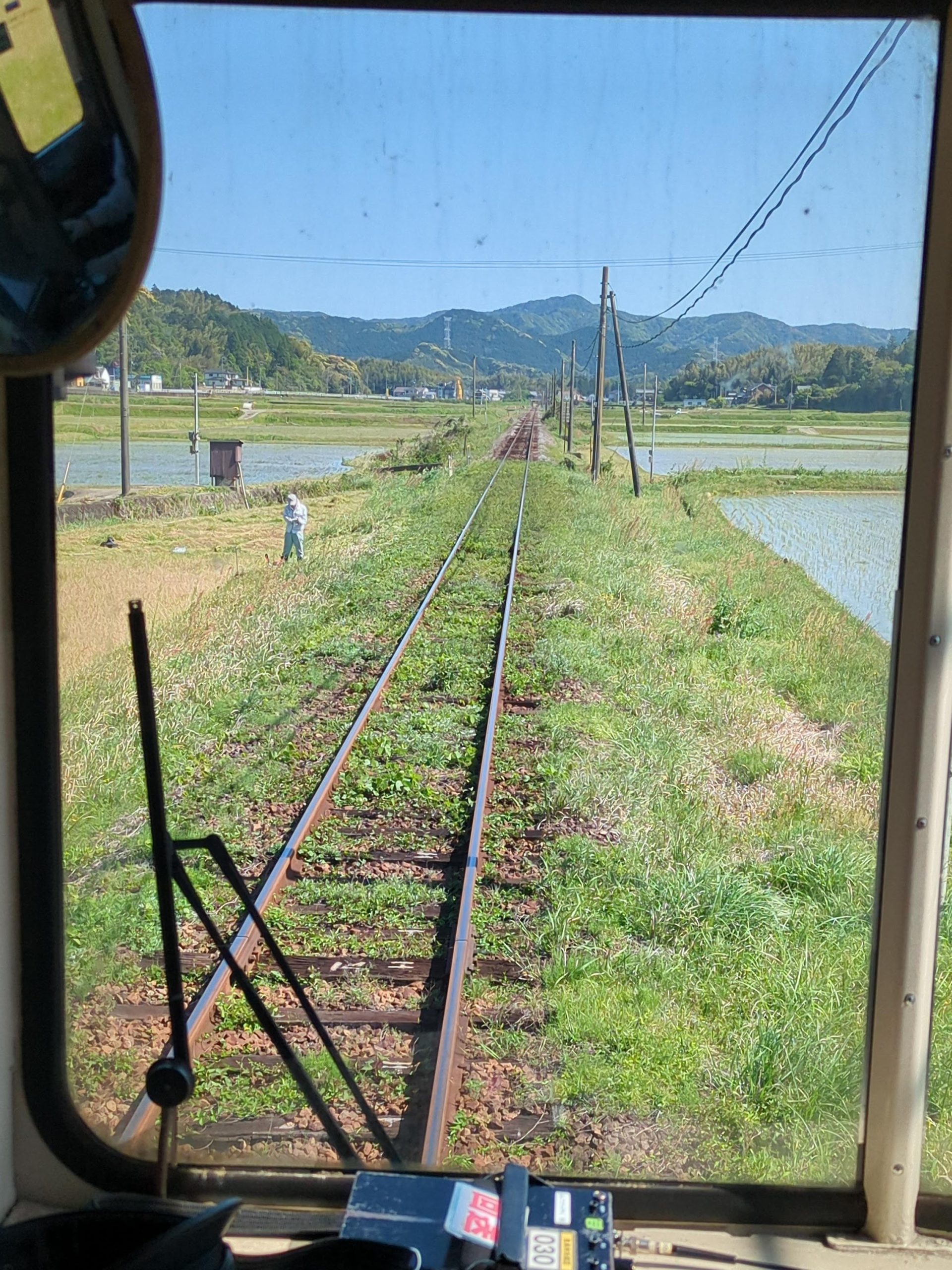
We love grassy train tracks. No fences or anything either.
The Mugi Line was one of the most rural-feeling trains I’d ever been on. Halfway into the ride, a high school boy and some giggling girls behind him approached me and asked me where I was going – he said he’d never seen any foreigner on his local train that he takes to/from school down here in this part of Tokushima, and everyone wanted to know where I was from and what I was up to. When I told him I lived in Nagoya, he asked me “Have you ever been to Tokyo? Can you tell me what it’s like?” He said he’d been once as a little kid, but didn’t remember it well, and really wanted to know what “big city life” was like. Such a different world.
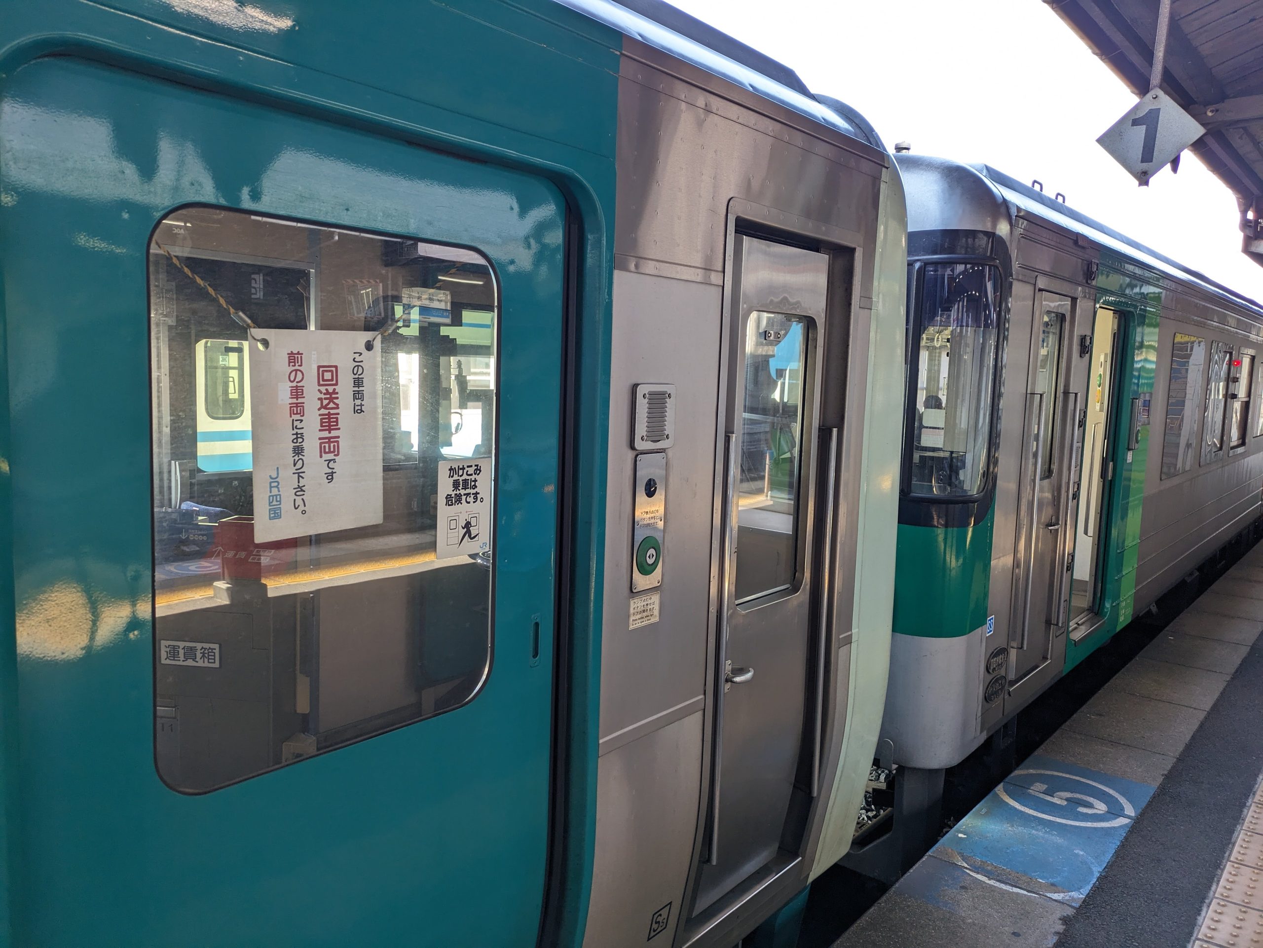
My train down toward Awa-Kainan was two cars long, but one car was roped off and out-of-use. I’ve seen this a couple times in Japan, but as of yet only (I think) in Shikoku and Hokkaido. This is done because they need to run another service upbound for part of the route, but literally don’t have the rolling stock (or sometimes even staff) there to do it. So our downbound train brought this vehicle with it, and then at Mugi Station, they took five minutes to decouple the two train cars, a new driver hopped on the back one, and drove it back up the line in the direction we had just come from.
Meanwhile, I continued south, to the section of the line with even less frequent service, passing many stations where stamps – like this one at Hanoura Station – had sadly been discontinued along with the conversion of the stations to unstaffed.
Services on this section of the line are actually so infrequent that, for the sake of the local community, JR Shikoku came up with a new solution, the first of its type in Japan: working with private bus companies to alternate service, and integrating ticketing and fares so that a ticket on the line could be used on either service – the public JR train or a bus run by the private company Tokushima Bus. Coordinating and aligning fares and schedules like this is illegal in Japan, as it’d violate the Antimonopoly Act, which prevents service providers from colluding instead of competing, so JR Shikoku had to apply for an exception from MLIT, which was granted. Now, the JR departure board shows both train and bus departure times, from two different companies.6NHK WORLD’s Japan Railway Journal talked more about this on an episode of their program titled “JR Shikoku’s Collaborative New Idea”, aired in March 2025, although it’s sadly not available to watch (publicly) online anymore as of this post. Since JR Shikoku pioneered this a few years back, JR East has started doing it on the Yamada Line in Tohoku too (which I since have ridden!)
A promotion, during a five minute stop at Mugi Station, for what was next on my agenda. Let’s do it!
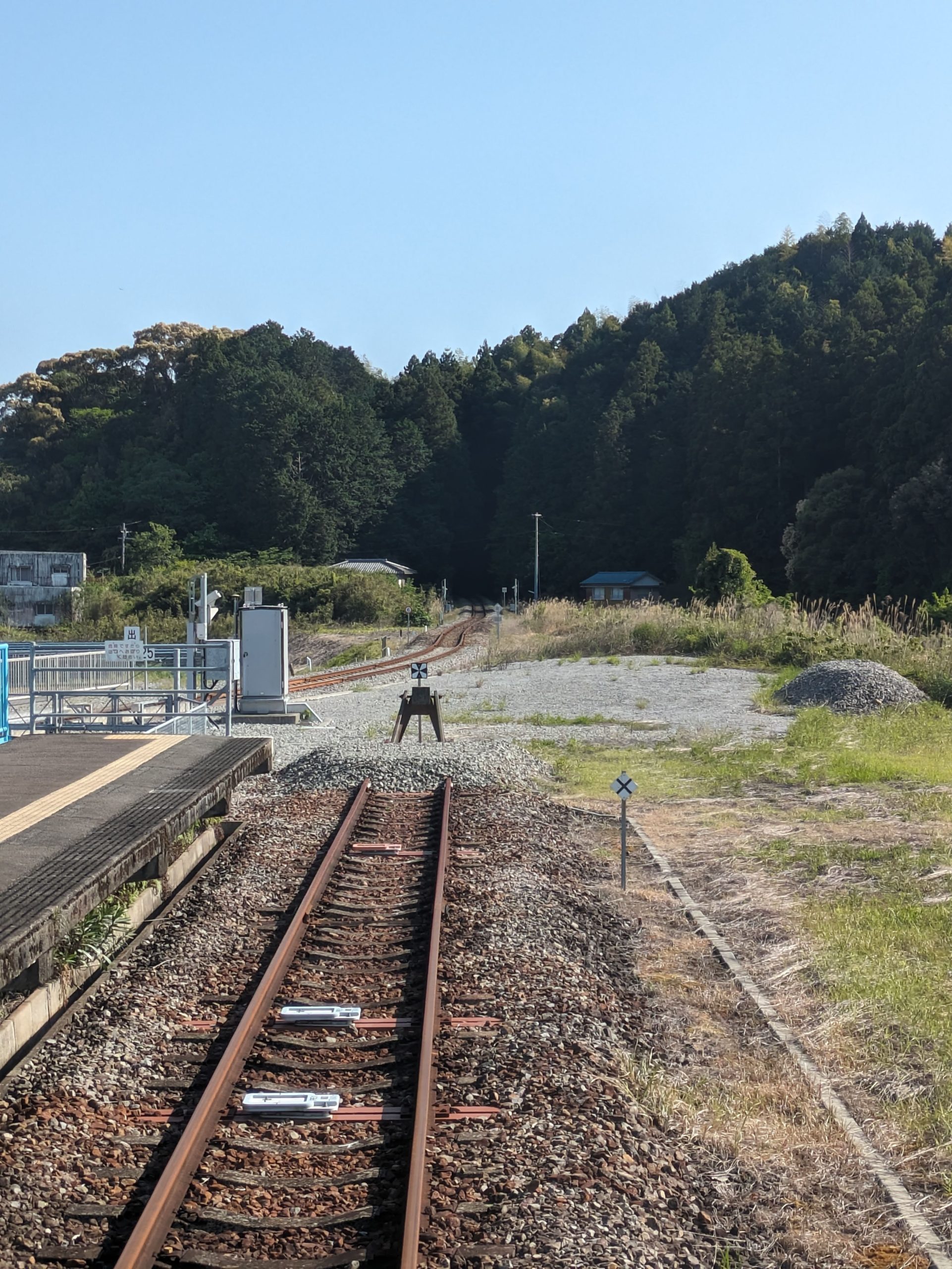
Wait… the end of the tracks? But what is that second set of tracks in the distance?
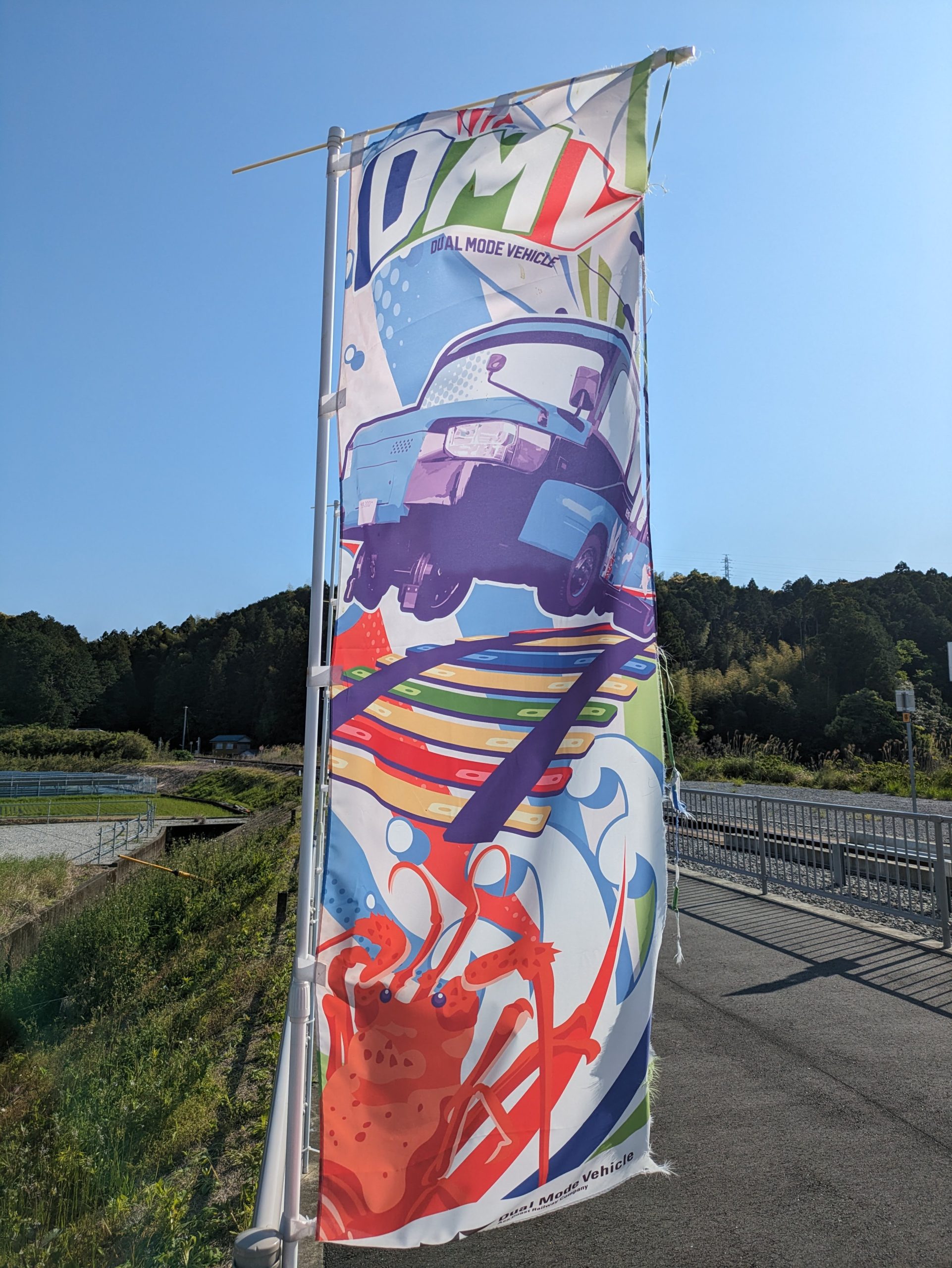
They’re for Asa Coast Railway’s dual-mode vehicles, DMVs!! They feel like buses, but are also very, very different and less bus-like than, say, the Yutorito Line guideway bus system here in Nagoya… they’re totally unique in all of Japan.
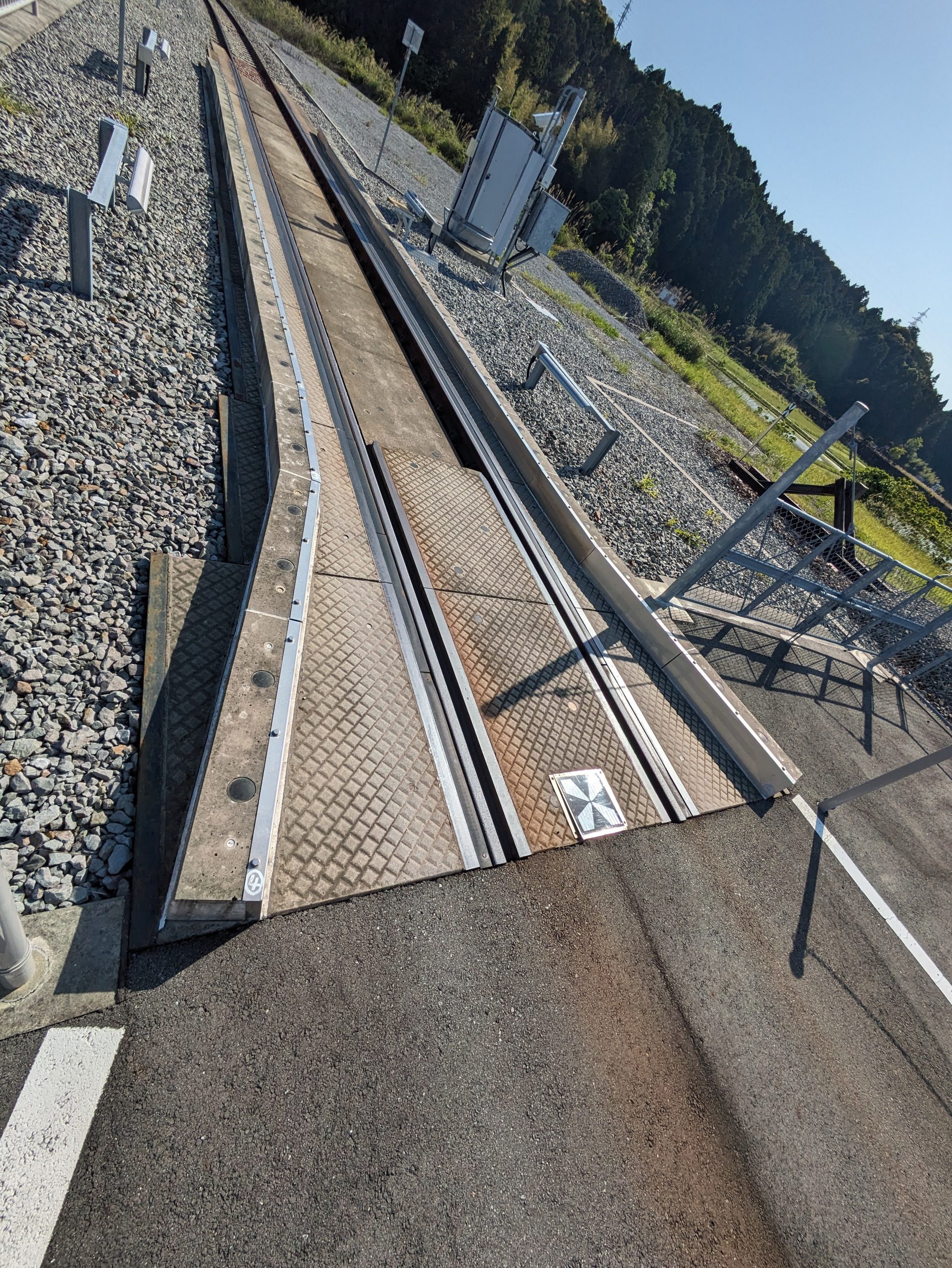
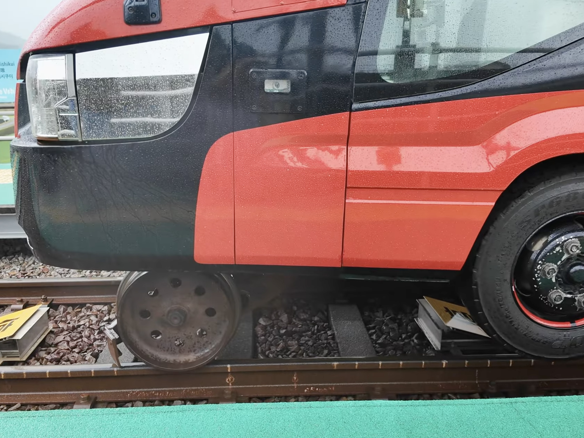
The road–rail vehicles used here – allowing service to move from the road to rail tracks, like in the photo – are just that: weird, experimental vehicles, hyper-modified Toyota Coaster minibuses which can switch wheels via a hydraulic system.
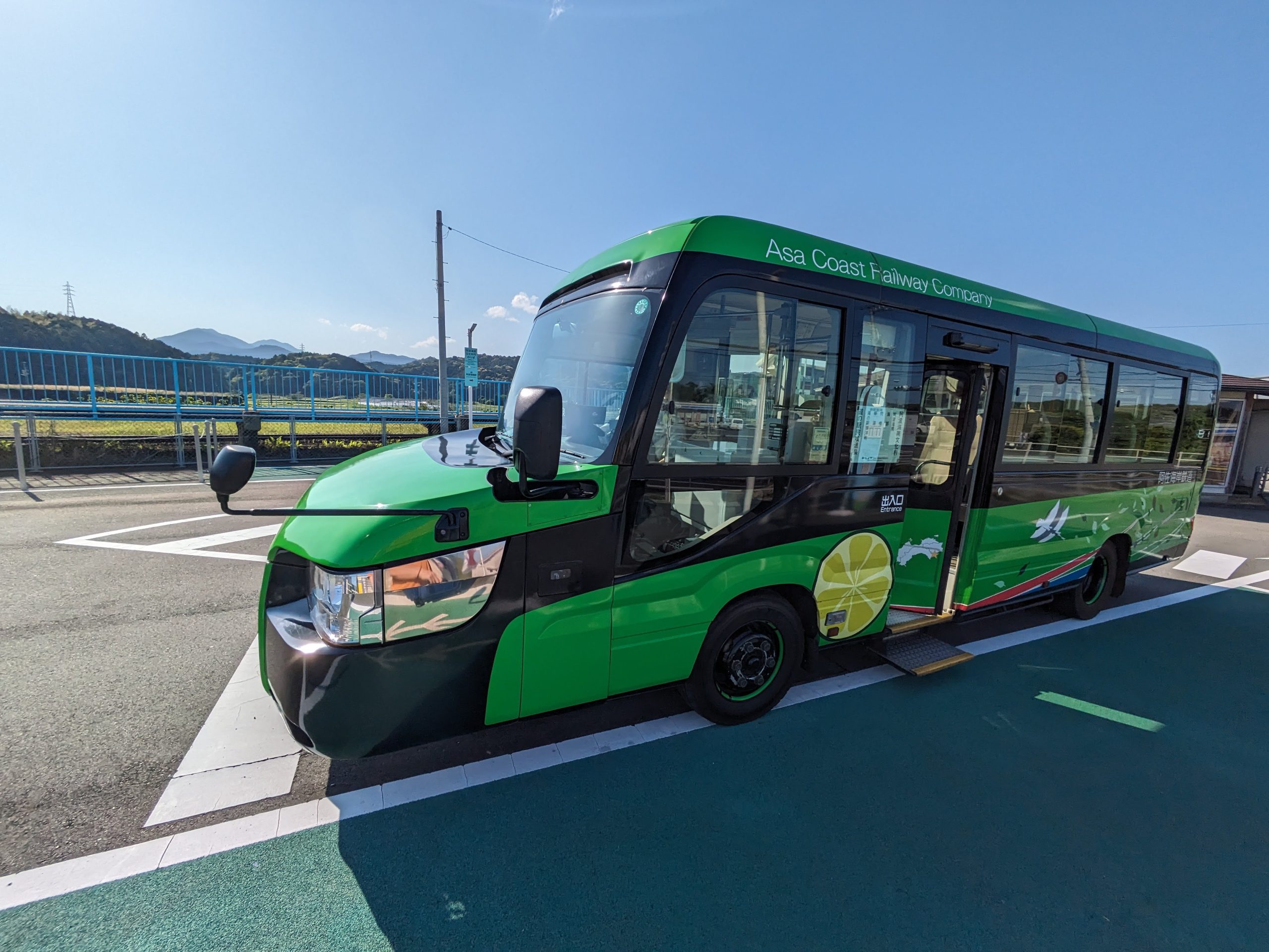
Here’s the DMV as it pulled up to me, as I waited to board, at Awa-Kainan Station. The driver asked if I had a reservation – I didn’t, which was fine, but apparently it’s best to make these, since they each only have a limited number of seats (though all 21 of them filling up feels like it’d be a rare occurrence). Prototypes for DMVs in Japan started in the 2000s, with test runs in Hokkaido, but didn’t get off the ground – ironically, in the farthest possible place away from Hokkaido, here at the southern tip of Shikoku – until 2021, at a cost of 1.6 billion yen.
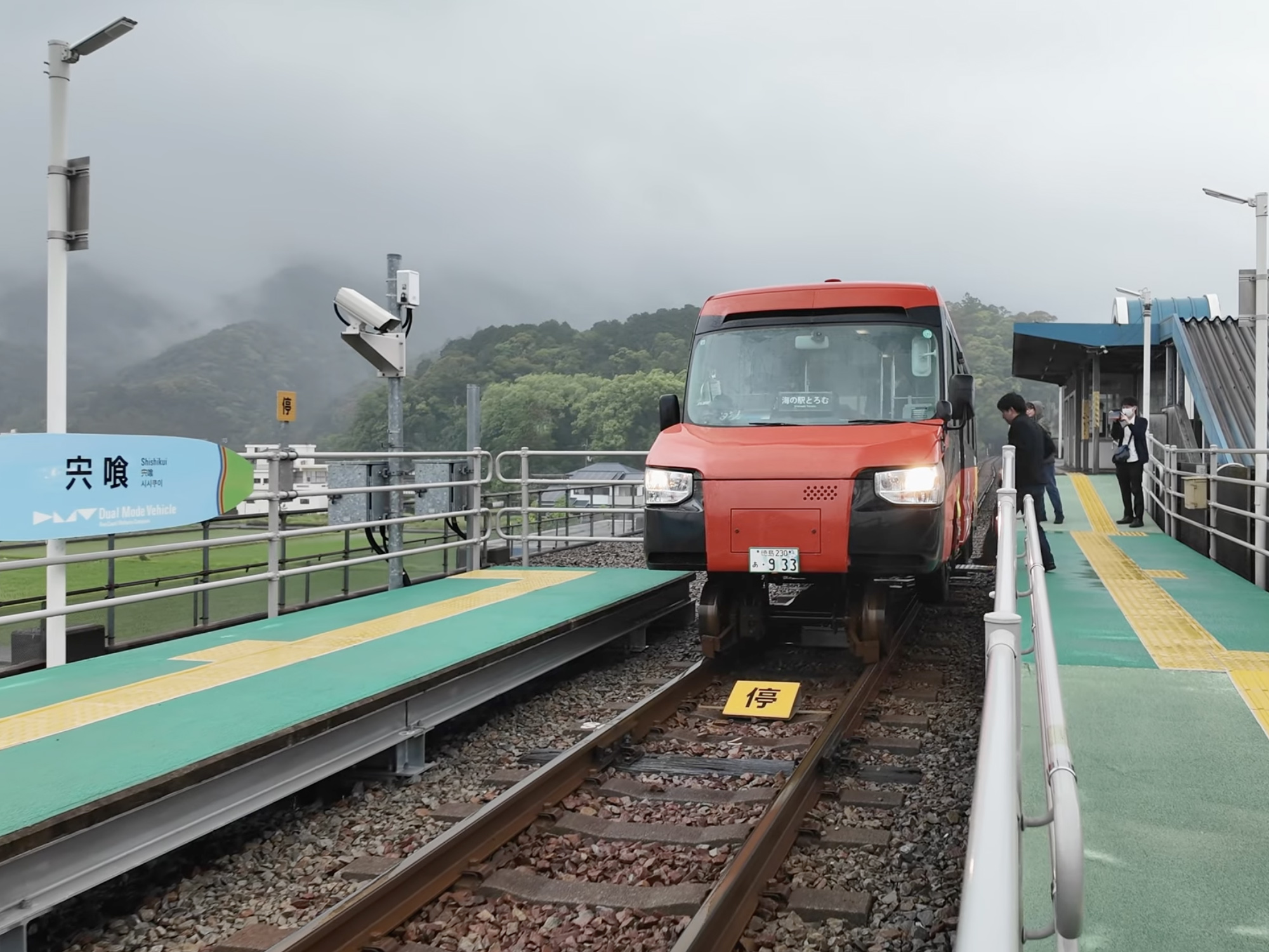
Here’s a front view of the DMV as it’s in “rail mode”. My driver was a bit grumpy, and there weren’t many passengers getting on/off adding extra time to each stop, so I (regretfully) didn’t ask to step off and take a photo of the DMV from this view – it’s sort of hard to tell if the company considers it mainly a tourist attraction (where this type of thing is more expected) or a legitimate mode of public transit for the local community (despite continuing low ridership and huge losses)…
Instead, these two photos of the red vehicle are screenshots from this video by T1D Wanderer (which is the literal only Japan train/travel-related YouTube channel I watch, much less actually consistently enjoy. Highly recommended.)
Here’s my video of the “mode change” – the steel wheels in front drop down, the body lifts up, it turns from “bus mode” into “rail mode”. The taiko music and the weird English “finish~” at the end are much beloved.
One “station” (now in bus mode) after the last rail stop was a little souvenir store, rest area, and parking lot built right on the beach, just over the border in Kochi Prefecture. Japan has a lot of thee spots, called “michi no eki” or roadside stations, but in this area they designate them “umi no eki” – a seaside station!
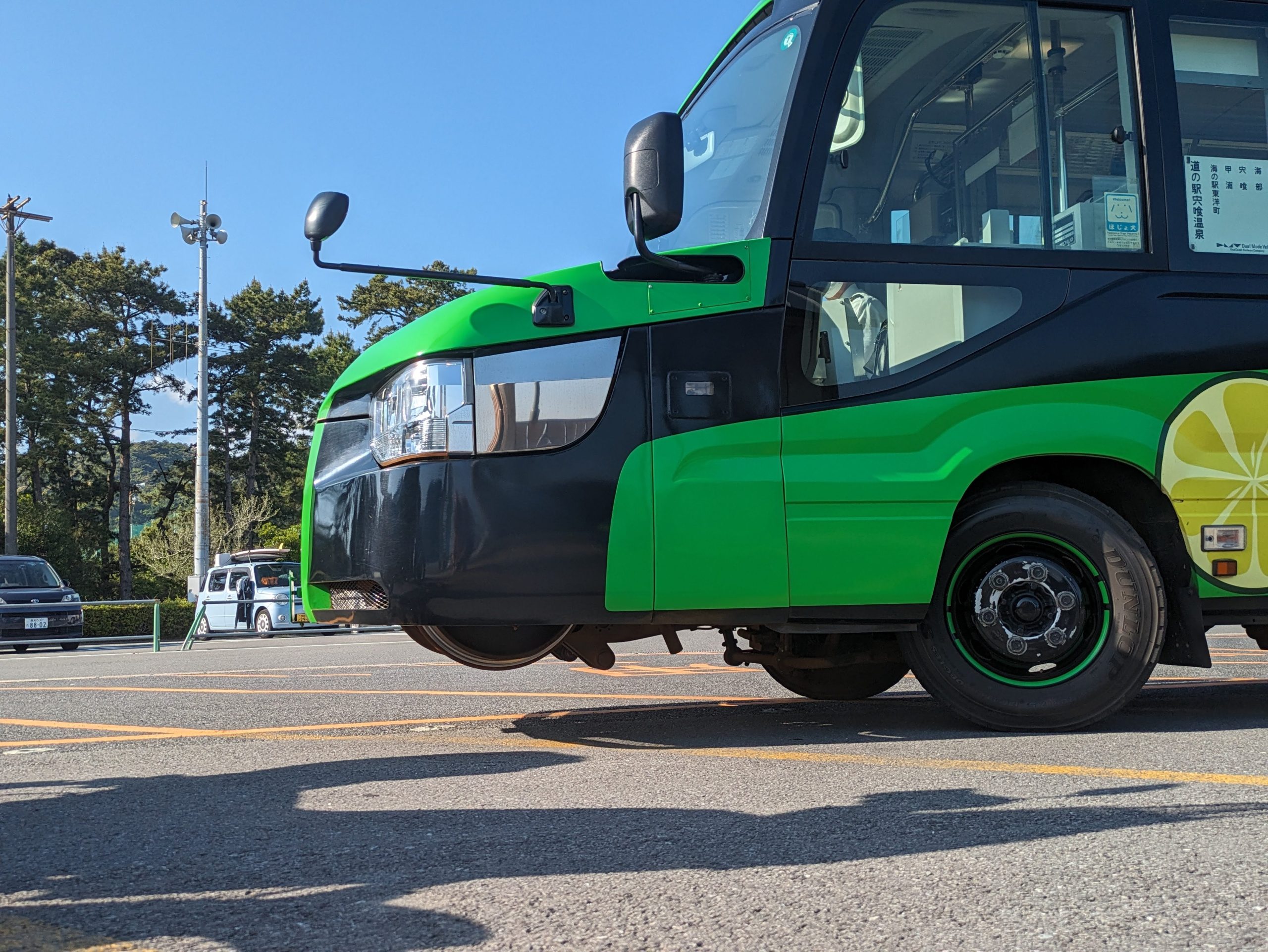
My DMV parked at Umi no Eki Toyo-cho, with its wheels tucked into the front hood just a bit visible from this angle.
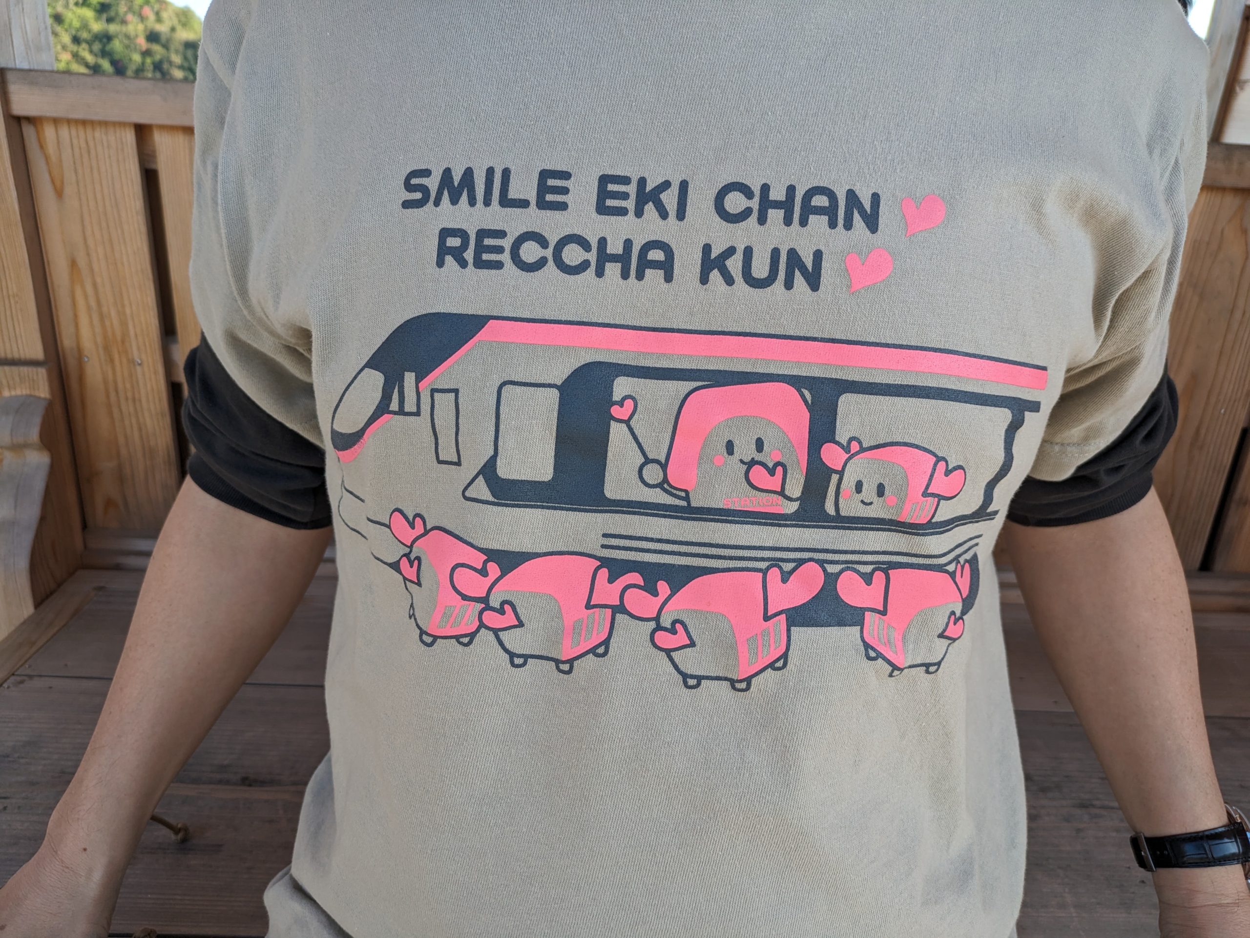
Someone outside of the seaside station had a JR Shikoku Smile Eki-chan shirt!!! :)
Benefits of me posting this late, a year after my trip: Here’s a video I was able to take at a Railway Day event in Tokyo in October 2025, of the DMV transforming! They brought it all the way from Tokushima to advertise their company and try to encourage more tourists from Tokyo to come, railfans or not. I asked if they had driven it over in bus form (hahaha) but they said they had shipped it on a barge.
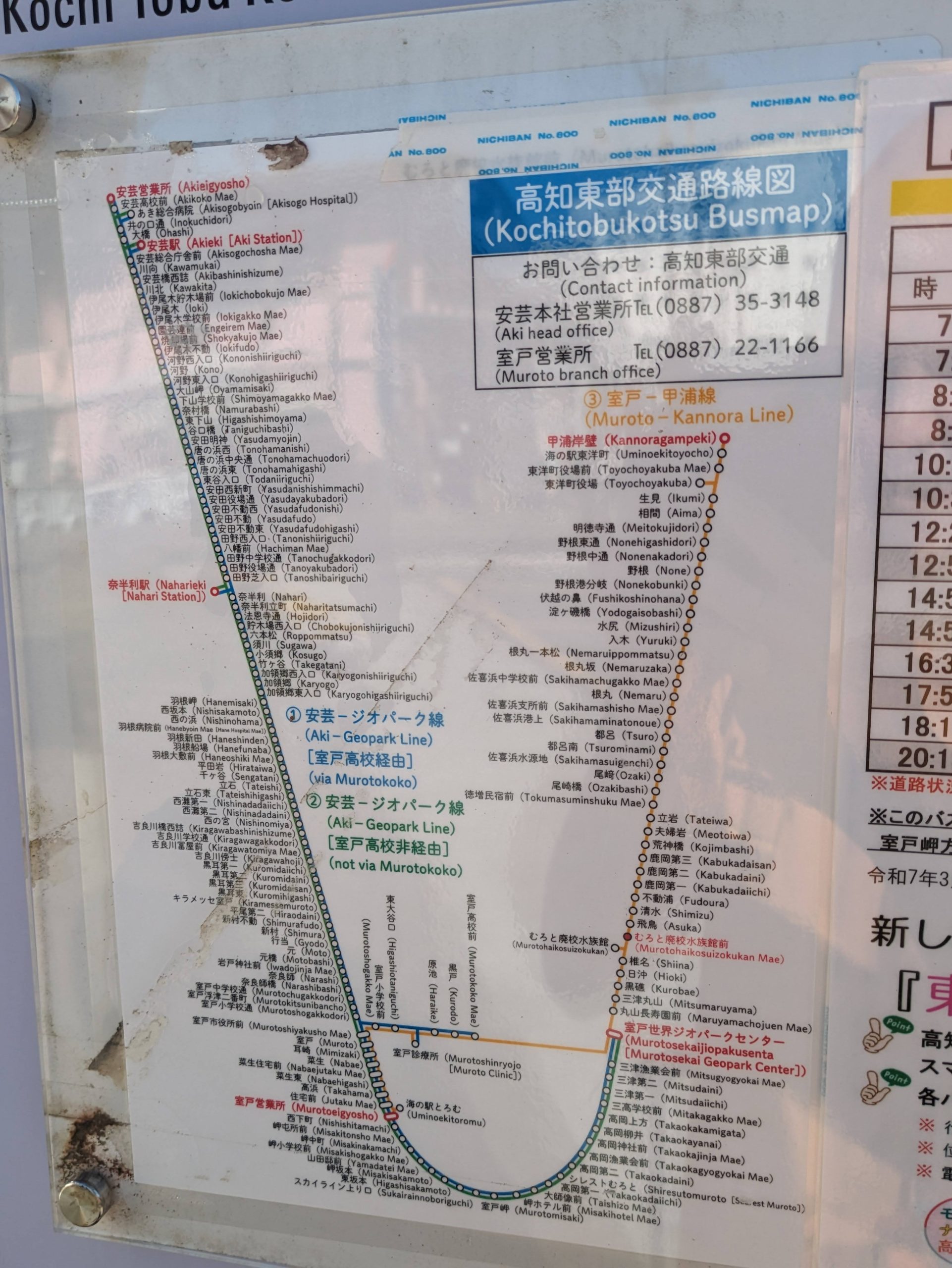
From here, I continued on a series of buses run by Kochi Tobu Kotsu, or “Kochi Southern Transportation”, which would take me in a U, clockwise along the coast to a small town called Nahari.
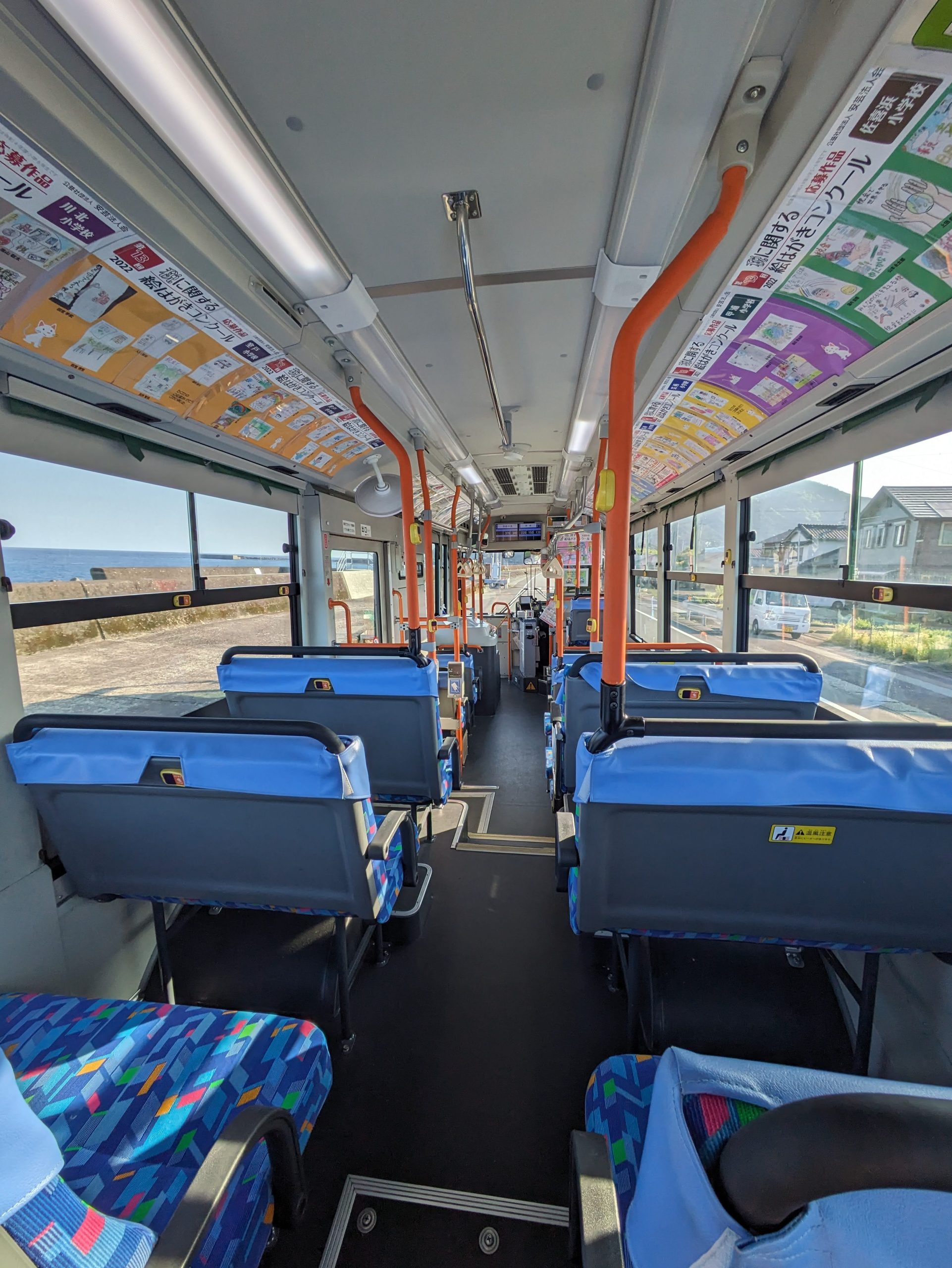
Just a normal, local bus. There were a couple other people during sections of the ride, but I was the only one who boarded at my stop, or who rode it from start to finish.
Some beautiful coastal views on this bus! It ran along the one road right next to the sea for pretty much the whole route.
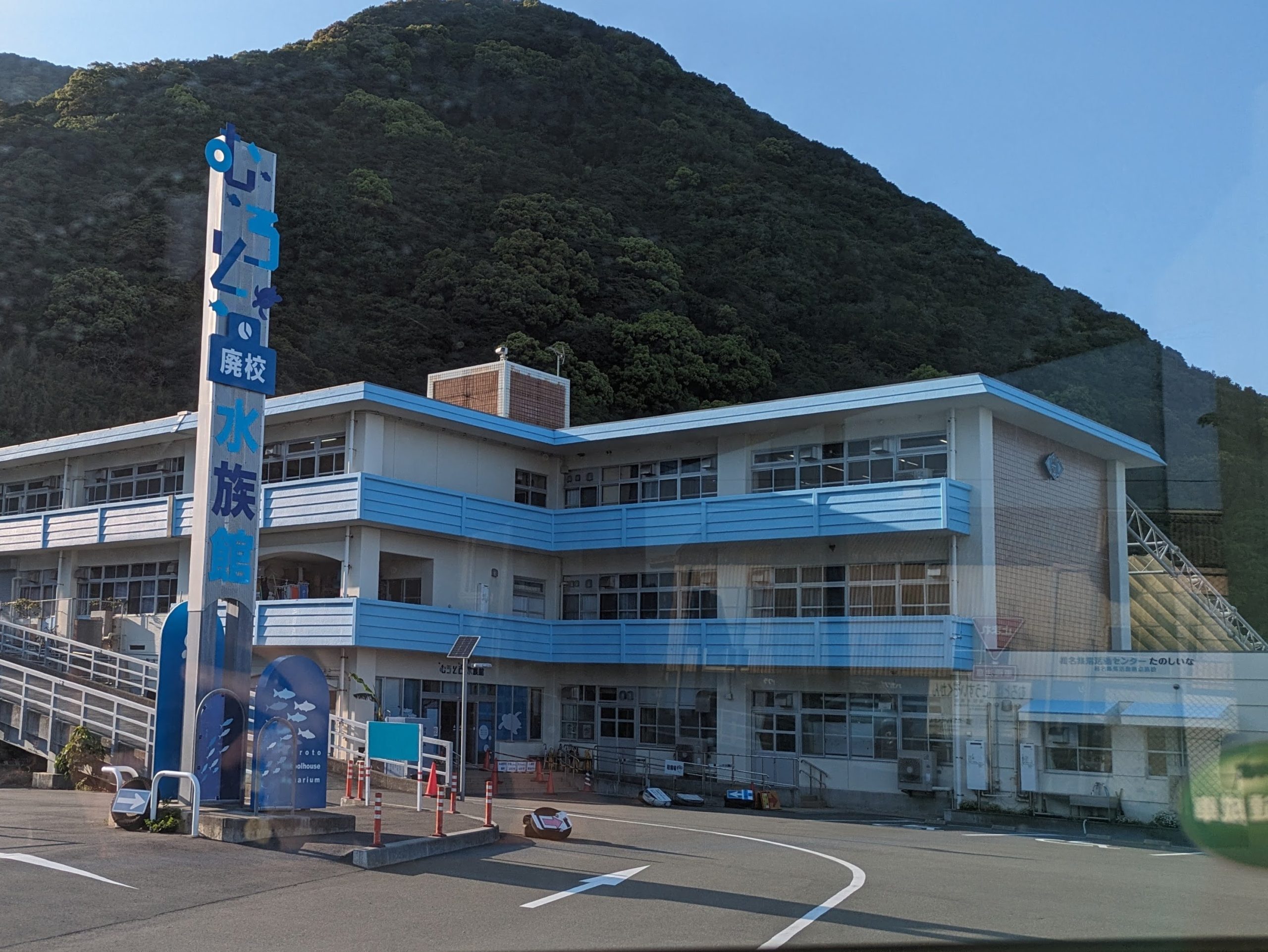
My route required one transfer, which was done here… at an elementary school that had been converted into an aquarium!
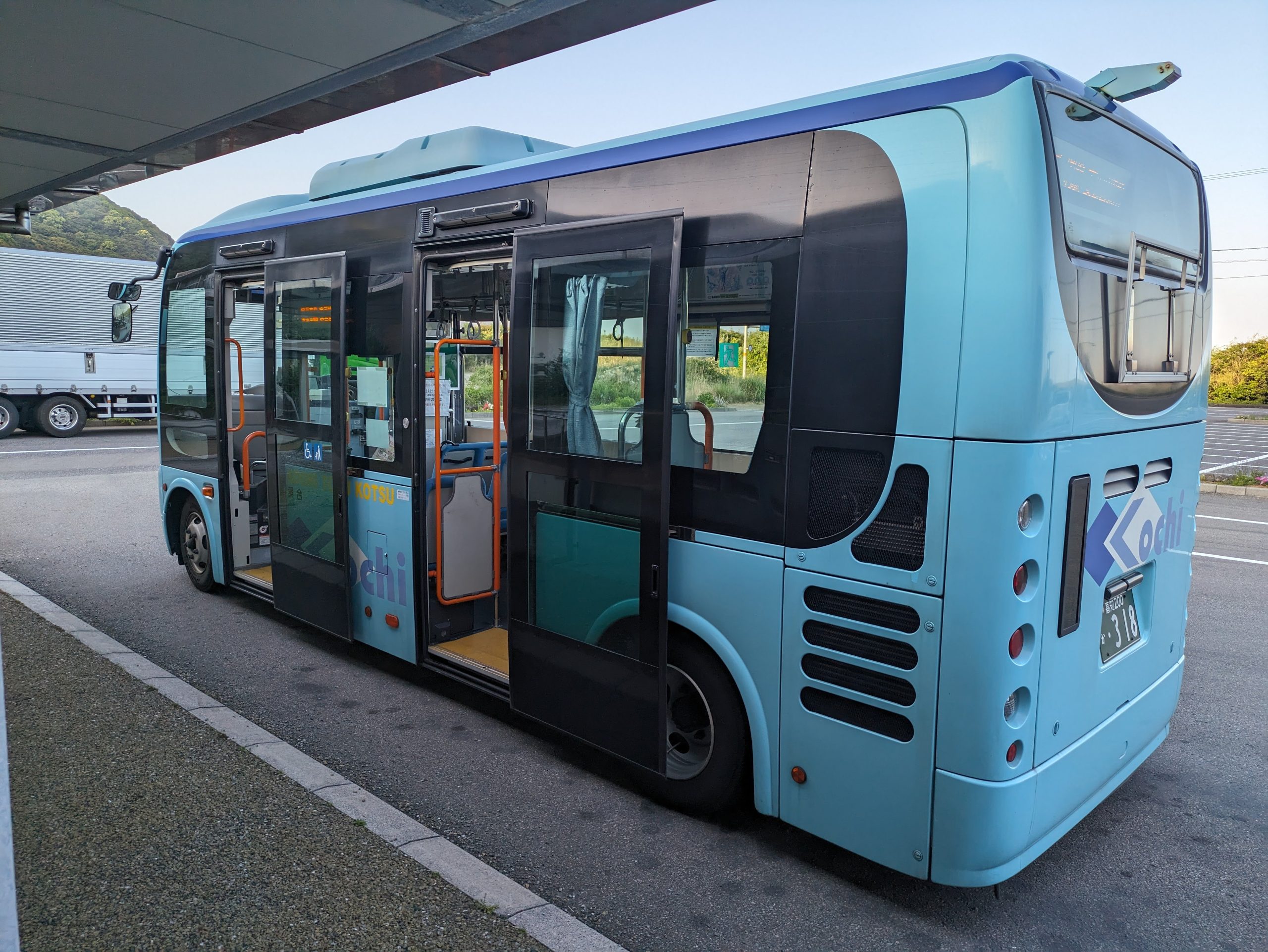
My driver hopped out of my old bus and onto this new one, even more miniature, to take me (and only me) the rest of the way. Then a new driver, at some point I guess, took over driving the original one inland, while I continued around the coast. Their official timetable (which I had to use to figure out the route, as Google Maps didn’t know about this transfer at the time) has a warning about how “we don’t guarantee transfers, if your first bus is late, the second one won’t wait!”…… but then it’s literally just the same guy driving so uhhh, in fact it does have to wait, lol.
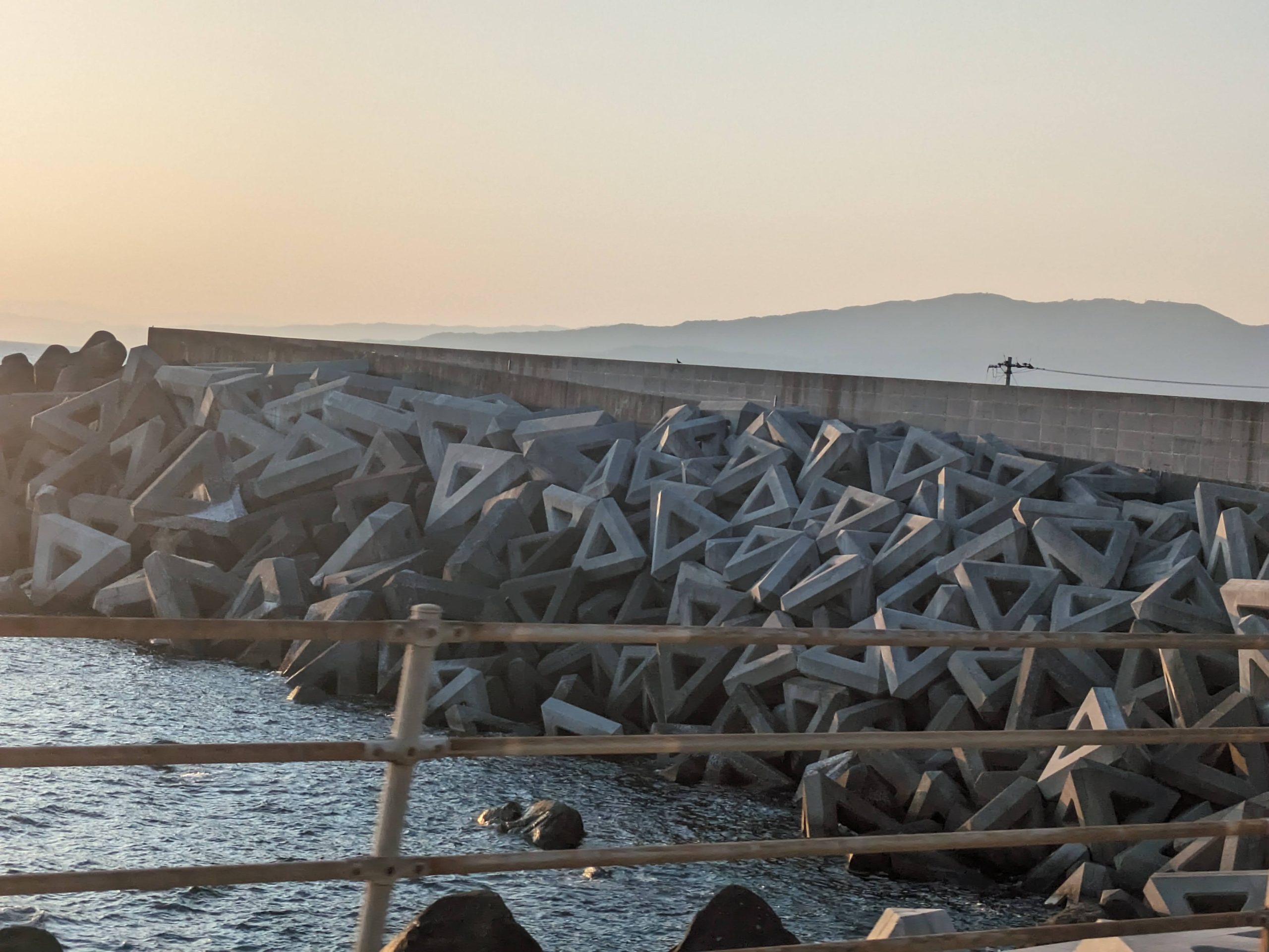
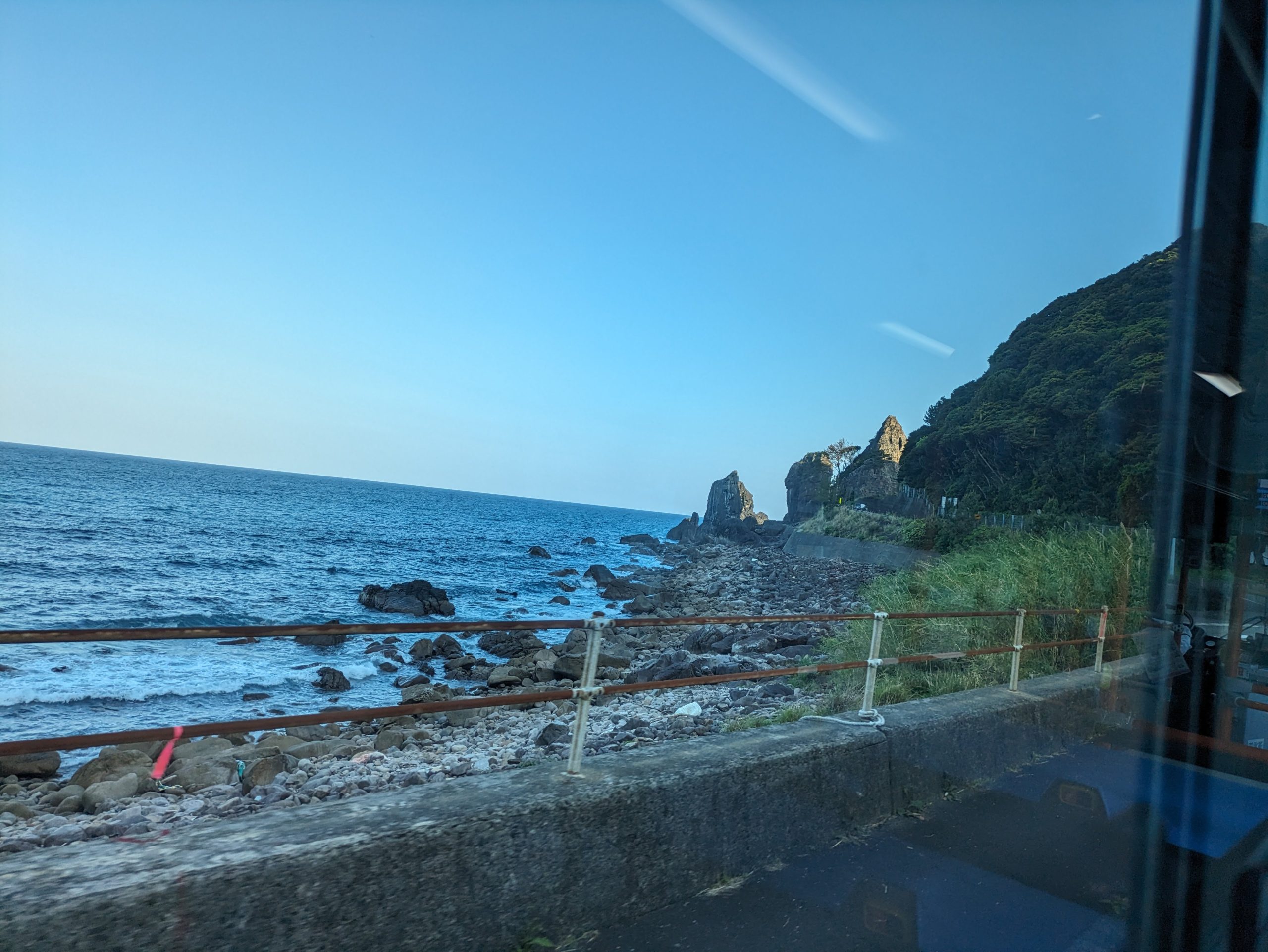
Cool triangular tetrapods as the sun began to set.
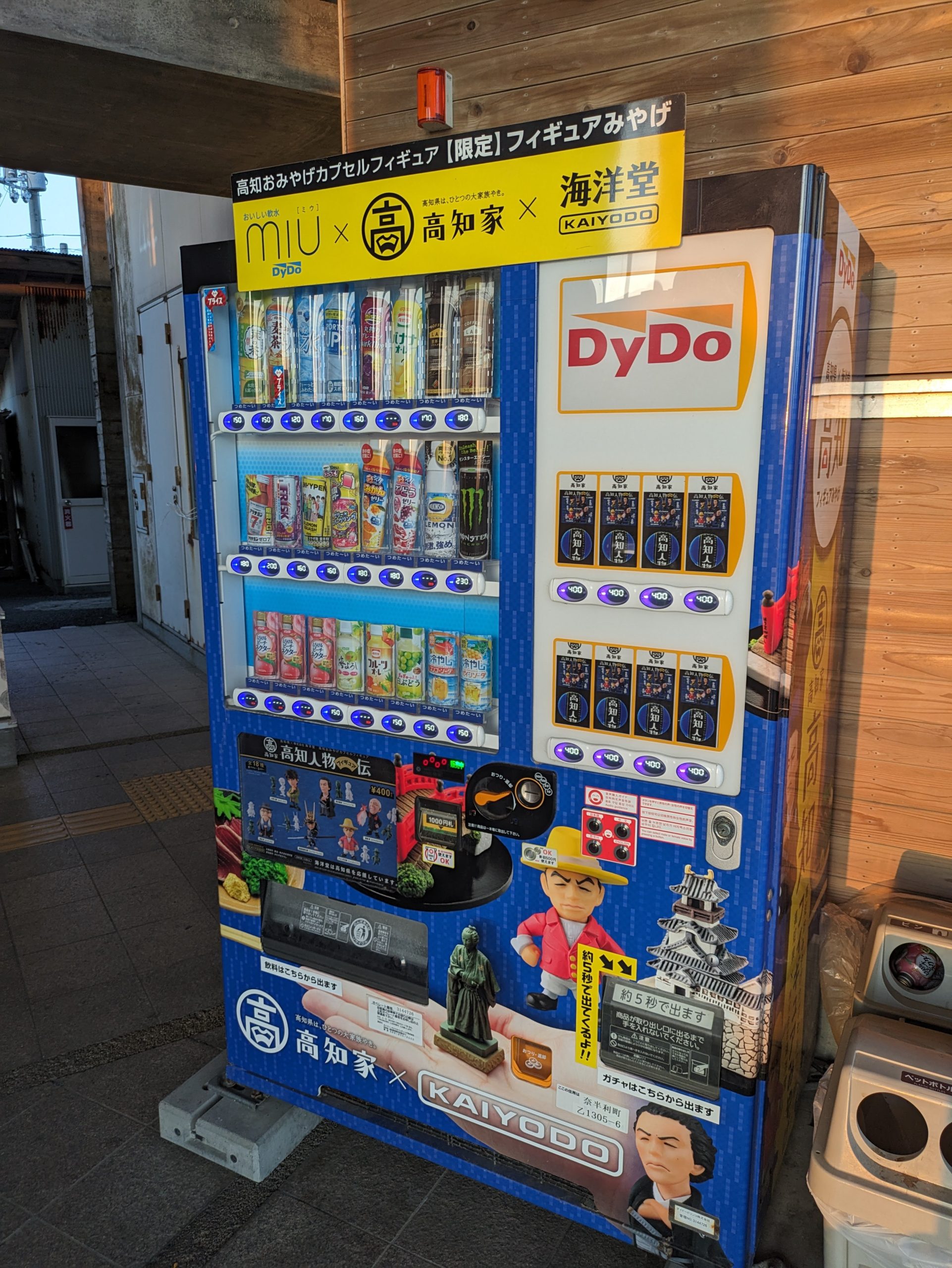
A man at the station pointed out some vending machines to me, which sold not only drinks but also figurines by the company Kaiyodo, whose founder is from Kochi. We’ll see more of their stuff in part two.
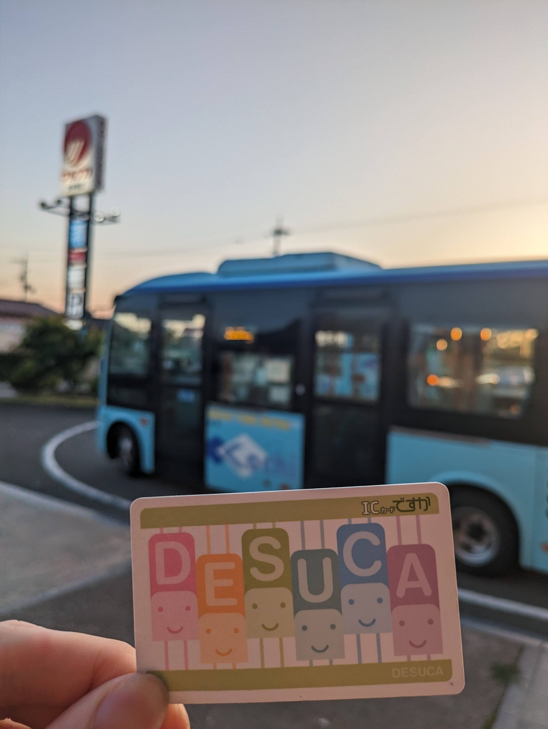
I learned, via posters in the bus, that this company also sells DESUCA… meaning I could get my very last IC card right here and now!!! But when I looked closely, it turned out that this was an old printing of the card (since no one buys them from bus drivers – he told me this was his first time selling a card) with the company’s old address on the back. They’d since moved their head office, meaning I really had one more variant I could get tomorrow!
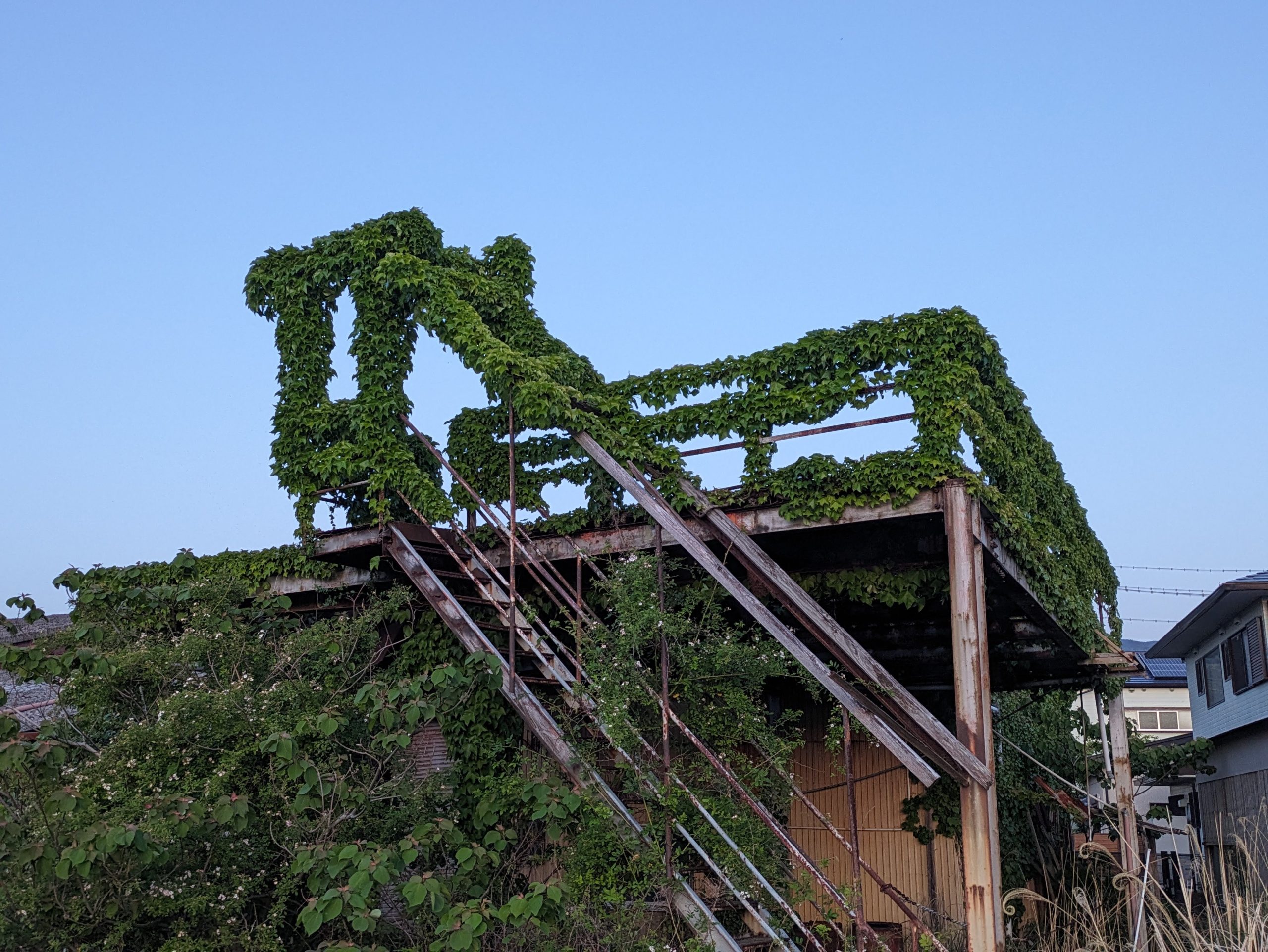
Lots of overgrown foliage and abandoned buildings here in the town of Nahari.
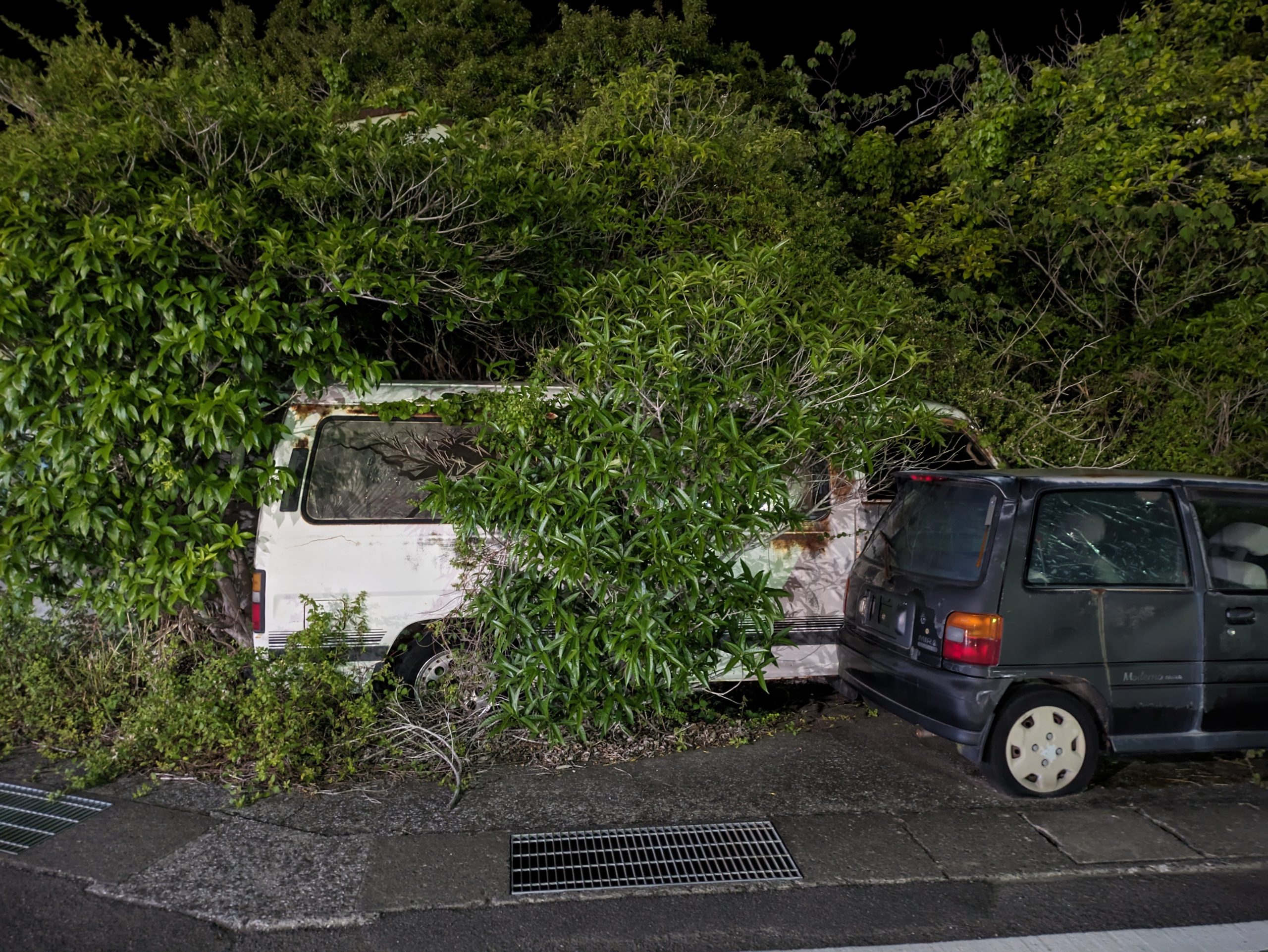
Population: 2,662. Wonder how long this car’s been here.
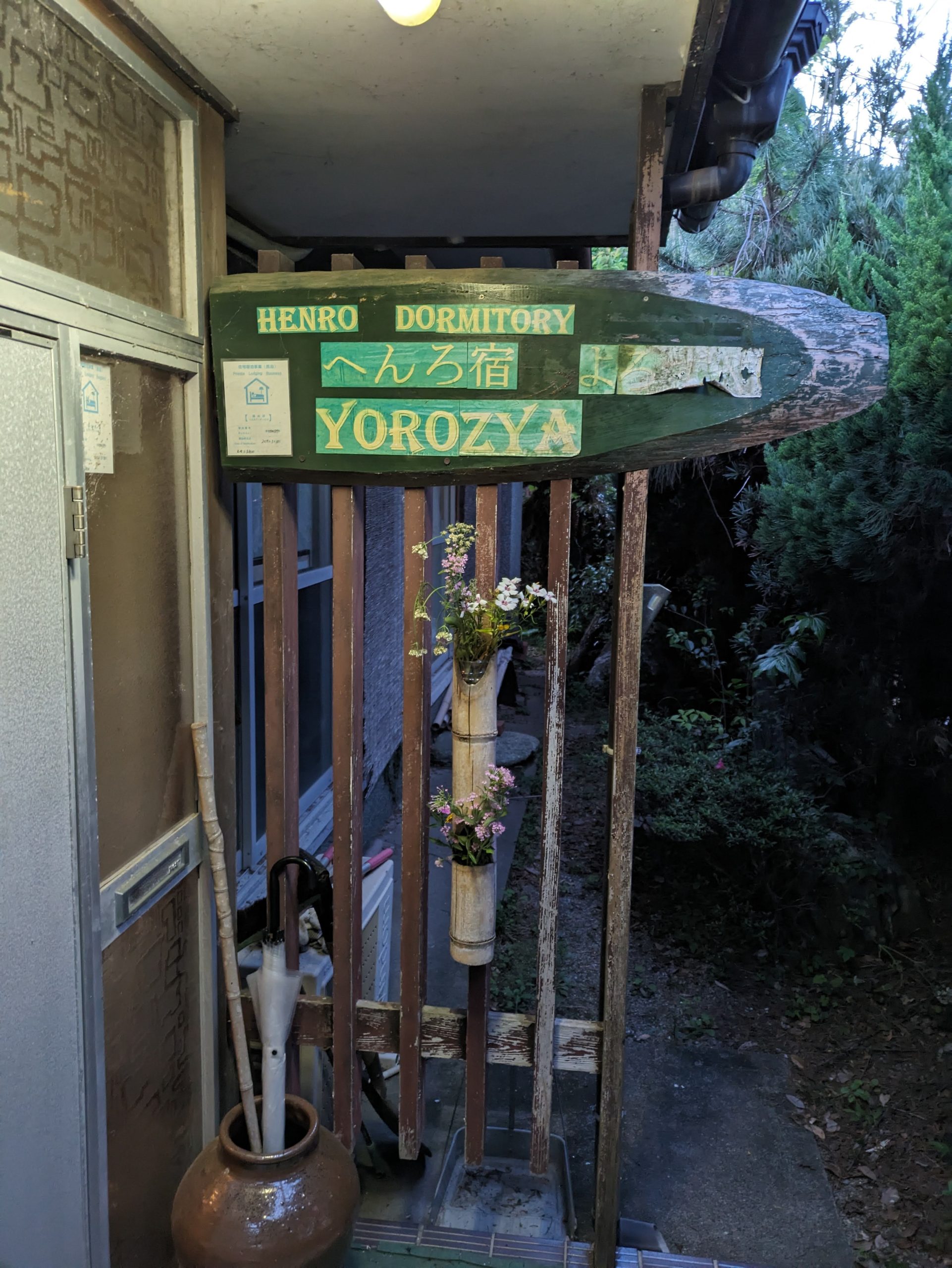
I stayed in a guesthouse meant for pilgrims as they hiked around Shikoku – the only type of accommodation that seemed to be in this area. It’s even registered on this site that helps henro find accommodations as they make their way between the 88 temples.
Dark, quiet streets. I headed to a dinner recommendation the old man who ran my guesthouse gave me on a hand-drawn map.
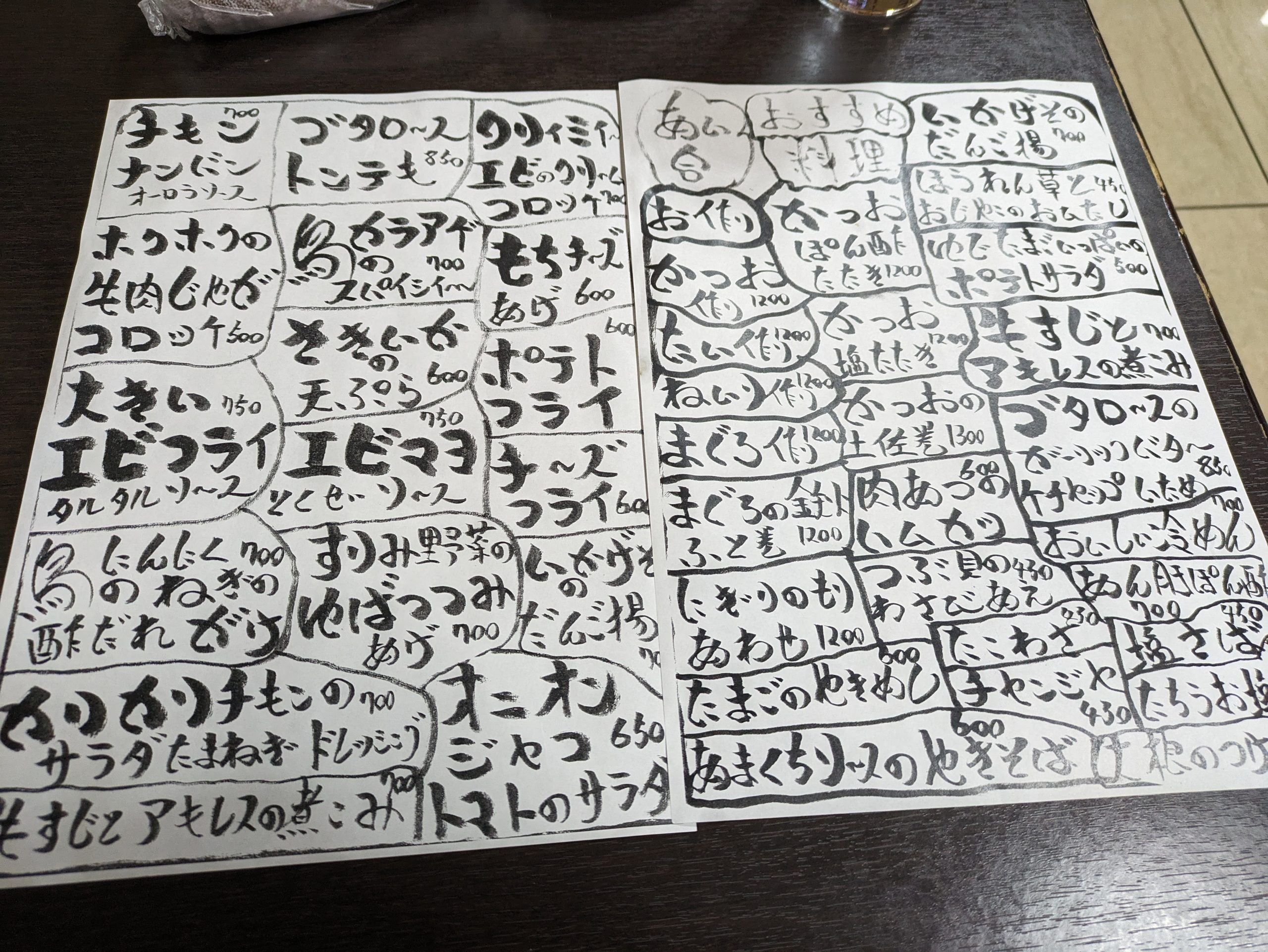
Good luck figuring out this menu, Google Translate ;)

I ordered Kochi’s most famous dish, katsuo no tataki, seared bonito (skipjack tuna). This meal right here, at this unassuming place with lights that were way too bright for the time of night or vibe of the town, and an interior decor that looked like a cafeteria, was the BEST meal I have eaten in my life.
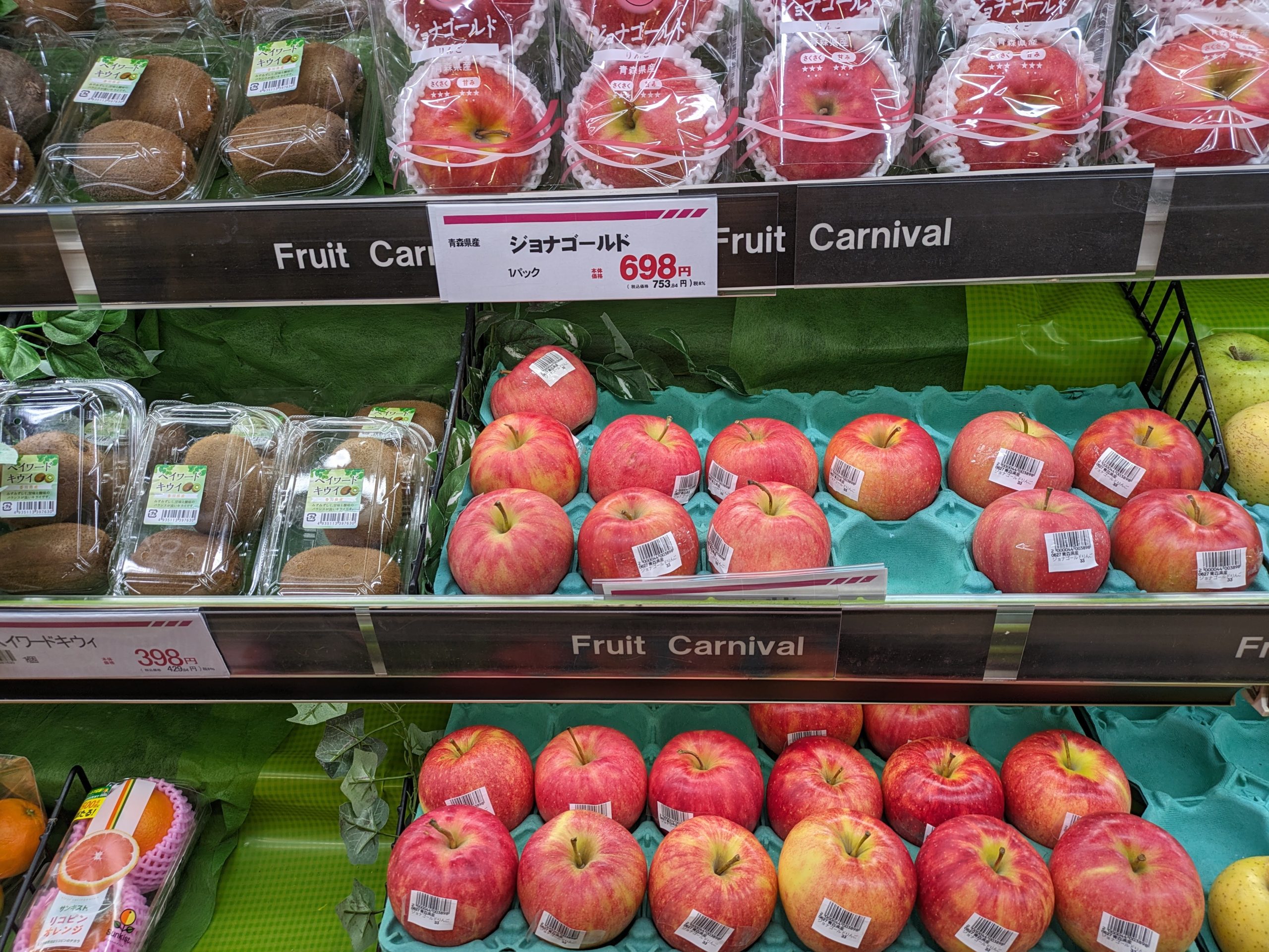
Went to the grocery store to get some snacks for tomorrow. Fruit carnival!!!!

has science gone too far
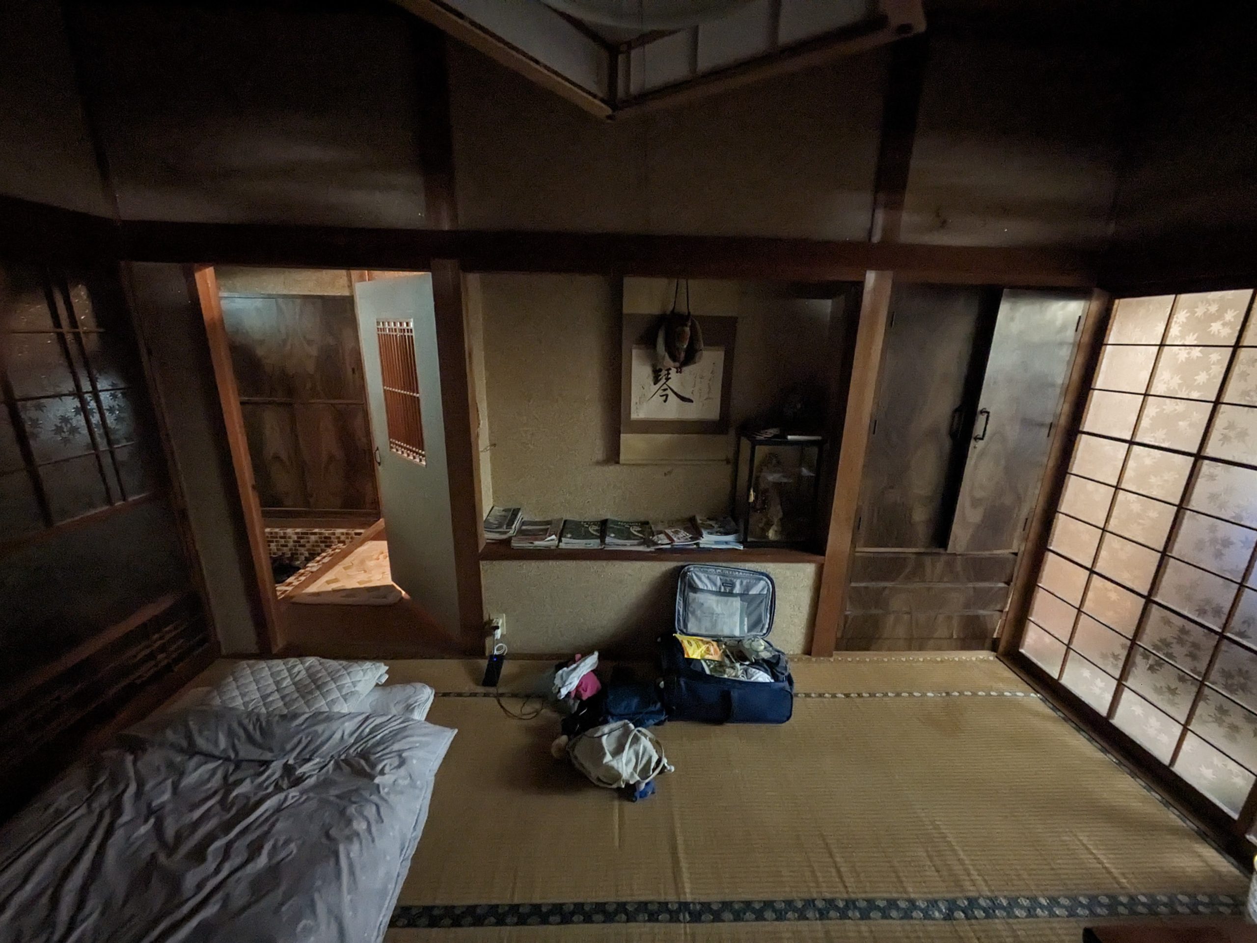
My room in the guesthouse. I like firmer beds, so futon on top of tatami are perfect for me.
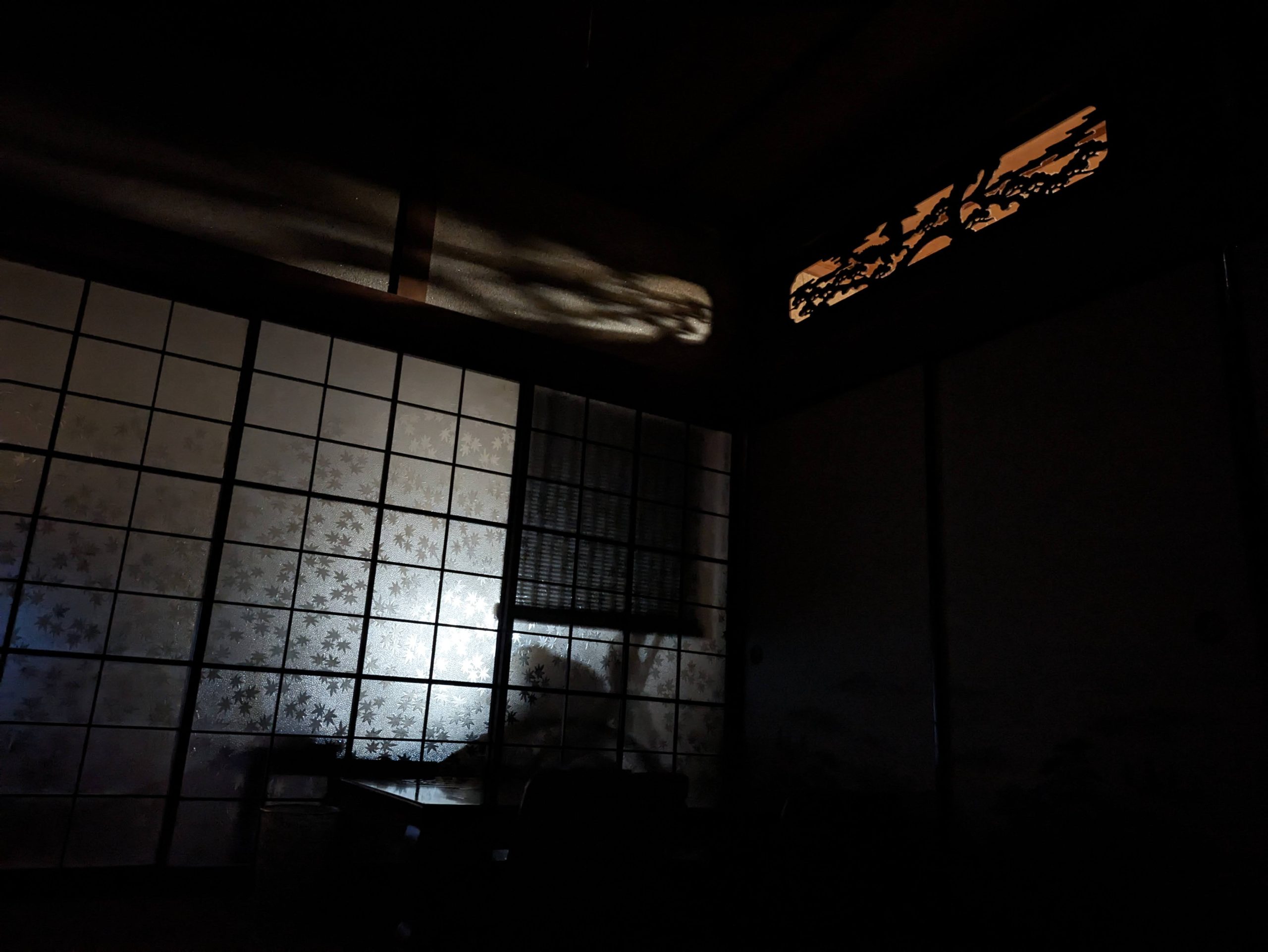
Shadows, and sleep.
Lots in store for the rest of the week. More soon.
Great write up! Had a similar experience with the station person telling me to just go under the bar at oboke station 😂 cant wait for the next part :)
Hahahaha omg really??? Amazing. Glad to know there are many of us out there who are almost-late to catching our trains at Oboke lol. I needed a bit of a break from writing and thinking about travel following my GW trip this year (last month), and I’m also traveling this weekend, but will be working on part two right after that, and hope to finish it by later this month!
Just spent a blissful hour reading this – you are living this Japan train fan’s dream!
I keep trying to plan local-train trips for when my wife and I go back (we live in the UK now), but we always end up on the 新幹線 zooming through so fast we might as well be on a plane.
We touched the opposite corner of Shikoku on our last trip (Yawatahama-Matsuyama-Imabari) on our last trip, but I was initially planning on exactly your route from Tokushima down round the coast via Muroto.
Really looking forward to part 2 of your trip!